MV Sanderling has been sold

On January 14, 2021, Sanderling was turned over to her new owner who has taken her to a marina just over the Florida/Alabama boarder on the GICW.

We will continue to update our blog with information about trawlers and cruising in trawlers from time to time. Meanwhile, you might want to subscribe to the Trawlers-and-Trawlering email list (T&T List) to ask questions or learn more about boating from some very knowledgeable and experience people. You can subscribe to T&T List by sending an email to trawlers-join@lists.trawlering.com.

After almost 25 years, the Trawlers and Trawlering list is closing. You can download the archives from the T&T List here.

Summary of 2013-2014 Cruise

Here are just a few facts summarizing our incredibly beautiful cruise around the eastern United States (sometimes referred to as the “Great Loop”). These facts reflect the cruise as we did it this trip; there are a lot of variations which will change some of these facts. We enjoy anchoring whenever we can, but we sometimes need to stay in a marina (such as when we needed groceries and there were no anchorages available, needed to rent a car to drive to another location, or left Sanderling in a marina waiting for favorable weather). As the saying goes, your mileage may vary.

We started this cruise on May 1st at our “home port” at Patrick Air Force Base, Florida. We had already traveled the east coast of the United States through New York City a number of times, and had been on the Erie Canal twice in the past; we had already cruised the Thousand Island area of the St. Lawrence River, the Rideau Waterway, the St. Lawrence River to Sorrel, the Chambly Canal and the Richelieu River, and through Lake Champlain, so our initial goal this time was to get to the beginning of the Trent-Severn Waterway at Trenton, Ontario, Canada, before the middle of June – which we did. We then spent approximately two additional months in Canada working our way through the Trent-Severn Waterway, Georgian Bay and the North Channel taking our time to enjoy the sights as they unfolded.

Weather seemed to be a huge factor throughout this cruise. Only a day and a half underway we had to stay at anchor in Daytona Beach, Florida, for two days waiting for torrential rain and wind to subside, then were able to proceed only a short distance to Marineland when it did. We delayed our arrival at Waterford to kill time while the water on the Erie Canal subsided enough to allow the canal to reopen and the backlog of boats to disperse, and then had to speed up once we were in the Erie Canal in order to get to the western slope and near Lake Oneida before more rain threatened to close the eastern portion of the canal, again. We only had a few days while in Canada when we had to wait out high winds, but there were about 8-10 days where we didn’t move because of high wind warnings. Lake Michigan upheld it’s reputation; we moved slowly down the eastern side of the lake ducking into harbors of refuge to wait out high winds and seas. All went well through the inland rivers, except our insurance provided that we could not proceed south of a certain line of latitude until the end of hurricane season (November 1st) so we could not get onto the Tennessee River heading to Chattanooga until after the magic date since it dipped below that line for a short distance before turning northward above the line; consequently we killed a couple of weeks in a marina in Clarksville and drove home for a short visit. Once we reached Mobile, Alabama, weather again had a dramatic affect on our cruising. We stayed in a marina south of Mobile for four days waiting for the wind to die down to acceptable levels so we could get across Mobile Bay. When we got to Apalachicola the weather windows for crossing the Gulf were fewer and farther between, and we wanted to see some of the Big Bend area where the water was now too low due to winter winds to allow us to enter some of the areas we wanted to see. We left Sanderling in a marina in Carrabelle for three months while we waited for decent weather to return. Bottom line: you can control a lot of things during a cruise, but not the weather!

An interesting feature of this particular cruise, and any cruise through Canadian waters, is the number of locks encountered. Here’s a rough count of the locks and other forms of vertical boat movement we encountered on this cruise:

Lifts and Locks:

  • – Dismal Swamp Canal, North Caroline/Virginia  = 2
  • – Troy, New York, Federal Lock                            = 1
  • – Erie Canal to the Oswego Canal                       = 22
  • – Oswego Canal (to Lake Ontario)                       = 7
  • – Trent-Severn Waterway – locks                         = 43
  •                                            – lifts                          = 2
  •                                            – marine railway        = 1
  • – Illinois Waterway (Lake Mich to Miss River)      = 8
  • – Mississippi River (to the Ohio River)                 = 2
  • – Ohio River (to the Cumberland River)               = 2
  • – Cumberland River (to Nashville)                        = 2
  • – Tennessee River (to Florence, Alabama)          = 2
  • – Tenn-Tombigee Waterway                                 = 10
  • – Black Warrior-Tombigbee Waterway                 = 2
  • – Okeechobee Waterway                                     = 7

                                Total Locks/Lifts                          = 101

Number and type of stops along the way:

2014 Cruise Stop and Type chart

  Fuel consumed and gallons per hour burn rate:

2014 Cruise fuel consumed


This cruise filled out our cruising map for the Great Loop. If you’re not familiar with what is commonly referred to as the “Great Loop,” here are the details from a screen shot of google earth showing actual traks from our gps (left-click on the image for a better view):

Google Earth traks-1


We’ve been working our way around the United States and Canada since 1997. Side trips have included many rivers along the east coast of the United States (St. Johns River to Sanford, Florida; James River to Richmond, Virginia; Potomac River to Washington, DC; the Cumberland River to Nashville, Tennessee; the Tennessee River to Florence, Alabama),  NYC to Maine and the Bay of Fundy, and the Florida Keys to Dry Tortugas (70 miles west of Key West).

Clearwater to Manatee Cove Marina (home)

Posted March 22, 2014

By mid-day on Thursday, March 13th the forecast was for decent weather the next day, so we made plans to get underway then. We were going to leave our car at the marina in Clearwater and return to get it after getting back home.

Friday, March 14th, we were underway at 0840 in sunny skies with the temperature a chilly 53 degrees and wind out of the east at 5-10 knots. The day grew warmer as the sun climbed higher. The water along the intracoastal south of Clearwater was clear and blue-green. By about 1330 in the afternoon we were across the shipping channel leading into Tampa Bay. We anchored for the evening at 1810 at the east side Stickney Point, about mid-way between Clearwater and Ft. Myers.

Day: 64.3SM/56.0NM – 9H30M      Trip: 4762.3NM/5472.2SM – 795H20M

Saturday, March 15th we were underway at 0735 with the temperature of 56 degrees and practically no wind. The forecast was for beautiful, warm weather for the day, then cloudy and cooler on Sunday. We knew that we would encounter a lot of weekend boaters and we weren’t disappointed. It’s amazing how inconsiderate and downright dangerous some boaters can be, particularly when the inexperienced weekenders get on the water cramming all the boating into a day or two after sitting working all week. The waterway along this stretch of the coast runs through some narrow channels and wide bodies of shallow water with narrow channels, so all the boats get funneled into a relatively small area. One extremely dangerous boater, proceeding at a high rate of speed (for the water) and throwing a large wake chose to thread his way between us and a pontoon boat full of older boaters rather than slow down and wait for a safe passage; he passed about 20 feet away from each of us, nearly capsizing the pontoon boat. We were so shocked at his actions that we didn’t have time to get the name of his boat and report his dangerous behavior to the Coast Guard. Fortunately, the pontoon boat managed to stay upright.

We then entered the Ft. Myers area late in the afternoon when all the boaters in the area were returning after a day in the sun drinking and playing in the water. It was an incredible process threading through a long, narrow channel leading eastward from San Carlos Bay into Ft. Myers/Cape Coral and the Caloosahatchee River leading to Lake Okeechobee. The entire channel and river is a slow speed, no wake area, but everyone is heading home, are tired, and want to get to their destination as soon as possible. There were literally hundreds of boats of all shapes and sizes in an easterly parade. By the time we passed Cape Coral the parade had thinned out with only a few larger boats continuing up the river. We anchored in a wide area of the Caloosahatchee River just upstream of Negro Head in six feet of water. The full moon rose early in the evening and provided a bright light on the water throughout the night.

Day: 75.6SM/65.8NM – 10H55M       Trip: 4828.1NM/5547.8SM – 806H15M

The forecast for Sunday, March 6, indicated that the weather was going to deteriorate during the day bringing 20-25 MPH winds, possible rain and cooler weather. We decided to proceed a short distance up the river through the Franklin Lock and try to get a slip at the Franklin Marina and Park, operated by the Army Corps of Engineers. Our Golden Age Pass would get us a discounted price of $12.00 per night for a slip with electricity and water – just the place to spend a blustery day or two. Judy contacted the park and there were slips available, so upon exiting the Franklin Lock we proceeded into the park marina to our assigned slip. What a beautiful place. Operated mainly for RVers, they have eight slips available, several of which will accommodate a boat the size of Sanderling.

Day: 19.6SM/17.1NM – 3H30M     Trip: 4845.2NM/5567.4SM – 809H45M

Due to conditions on Lake Okeechobee (known for it’s rough water) forecast for Monday and into Tuesday, we decided to stay at the Marina and Park at Franklin Lock for another day, then to depart on Tuesday to go to the west side of Lake Okeechobee, giving the lake a little extra time to settle down for a decent passage. Consequently, we spent the day on Monday, March 17th at the park; Judy worked on various things dealing with her legal nurse consulting business and I reading.

On Tuesday, March 18th, we departed the park at 0830 and continued up the Caloosahatchee River and through the Ortona Lock. At Moore Haven Lock we tied bow and stern to two dolphins after passing through the lock. We were now on the “lake” side of the river and locks and dams leading to the lake. The next day would take us a short distance southerly around the rim of the lake (protected from the lake itself by land) and then out into the lake for the 22 mile crossing.

Day: 42.9SM/37.3NM – 6H30M   Trip: 4891.5NM/5620.7SM – 816H15M

Wednesday, March 19th and we were underway at 0715. The wind was calm and the temperature 55 degrees with the promise of sunshine for most of the day. A good day for crossing the lake. We worked our way through what is essentially a canal around the rim of Lake Okeechobee for a few miles, then turned eastward at Clewiston (the Clewiston Lock is not on the rim route, but is used only when proceeding away from the lake into the town of Clewiston). We turned into the channel that crosses the lake and immediately were greeted by wind out of the northeast at about 10-15 MPH – not enough to cause us to abandon our crossing, but nonetheless enough to make the crossing a bit “lumpy.” The autopilot was able to steer us in a good straight line to keep us in the narrow channel in the shallow lake, and at 1225 we motored through the Port Mayaca Lock on the eastern side of the lake. No lock opening was required, as the lake level was high enough that both lock doors were open and we could simply pass through into the St. Lucie Canal on the eastern side of the lock. In all the hundreds of locks we have been through in the past several years, this is the only time that we didn’t have to “lock” through – that is, tie up to the lock wall in the chamber while the water was raised or lowered. We continued down the St. Lucie Canal, Locked through the St. Lucie Lock and into the St. Lucie River. We anchored for the night in Stuart, Florida, off Britt Point at 1725.

Day: 70.2SM/61.1NM – 10H10M   Trip: 4952.6NM/5690.9SM – 826H25M

Thursday, March 20th brought an overcast day but the temperature was a balmy 67 degrees and wind was negligible. We were underway at 0710, motoring back out into the river, through the old road bridge and then the railroad bridge, and a few miles later into the Atlantic Intracoastal Waterway at mile 990. Home was less than ninety miles away. It was the first time in almost 10 1/2 months since we were in the Indian River Lagoon. We turned northward through Ft. Pierce, Vero Beach, past Sebastian Inlet, and anchored just south of the Melbourne Causeway for the night at 1755.

Day: 77.7SM/67.6NM – 10H45M    Trip: 5020.3NM/5768.6SM – 837H10M

The next morning, Friday, March 21, 2014, we were underway at 0750 even though we had a very short distance to complete our circumnavigation of the east coast (the “Great Loop”). When we turned into the Banana River and passed through Mathers Bridge we were almost home; we also encountered dozens of rowers, both male and female, in all sorts of water craft, including eights, fours, quads, paddle boards, and kneeling boards (not sure if that’s the correct name). They must have been from one of the local high schools judging from their ages. We turned into the channel leading to the Manatee Cove Marina, then entered the marina area and tied to the fuel/pumpout dock before heading to our assigned temporary slip. While we were gone many of the old docks were removed and new docks constructed in their place necessitating moving boats around the marina to avoid the construction areas. Just before we returned one dock had been completed by the contractor and all the boats from “our” dock had been moved temporarily to slips on the newly completed dock.

After a friend gave Bob a ride home (with our two cats) to retrieve a car, we offloaded most of the things we needed to remove from the boat right away while we were at the fuel dock which enabled us to back the car close to the boat so we wouldn’t have to carry things as far as we would have to were we in a slip. We then proceeded to our assigned temporary slip only to discover that the new slip was too narrow (by about 8 inches) for Sanderling’s beam. We slowly backed out into the fairway and contacted the marina office. Mark, the new manager, came up with another empty slip and when we nosed into that slip we had about a foot to spare. Friends on the dock helped catch us and hold us in position while we got lines, fenders and fenderboard in place.

WE WERE HOME!

Day: 11.9SM/10.4NM – 1H40M  Trip: 5030.6NM/5780.5SM – 838H50M

Since Chicago we had traveled 3,127SM (well over half of the total mileage). We had traveled 593SM from Mobile, Alabama (I had estimated 600 miles from Mobile).

Total fuel consumed: TBD


Carrabelle Florida . . . around the Big Bend

Thursday, March 13, 2014

Just as we had hoped (and had been forecast), by early afternoon on Friday (March 7) the wind had subsided to the point where we felt confident that we could depart Carrabelle and have a good 3-4 day weather window to make it around the Big Bend to Tarpon Springs. Everything on Sanderling was in order, and we cast off lines (it took about half an hour to get all the lines secured) and were underway down the Carrabelle River at 1415. We cut the corner of the channel after departing the river in order to save a few miles, then headed east in the deep water toward Alligator Point. A barrier island provided some additional shelter from the 1-2 foot waves that were still on the Gulf. By the time we reached the area where we intended to anchor the waves had died down to less than one foot; we spent a quiet night anchored in about eight feet of water about 1/2 mile off the spit of land that is named Alligator Point on the chart. Interestingly, there were a few houses on the narrow peninsula and a restaurant with unsecured WiFi which we could access with our ubiquiti  WiFi antenna from Island Times so we were able to download our email and check the weather-related web sites to confirm that we’d have good weather while continuing our trip around the Big Bend.

Day: 18.5SM/16.1NM – 2H45M              Trip 4520.8NM – 758H15M

On Saturday (March 8) we had the anchor up and were underway at 0640, just before sunrise. The wind was less than 5 MPH and the water surface was about as calm as it gets without being a “mirror” surface. We had an easy day cruise to Steinhatchee. The channel from the Gulf to Good Times Motel and Marina was no less than 8.5 feet in depth with the tide about 1.5 feet at the time we transited. When we got to the marina we called them on the phone (they didn’t seem to be interested in using the VHF radio) and suddenly four guys appeared on the dock to help take our lines. We got tied up and chatted with the volunteer dock hands from the bar for awhile – they were interested in what we were doing there and in Sanderilng – obviously they don’t see many boats and boaters like us since the majority of boaters doing this section of Florida do not stop at any of the Big Bend towns but rather head straight across the 180 miles from Apalachicola or Carrabelle to either Tarpon Springs or Clearwater. We ate dinner in the tiki bar (every marina in Florida has a tiki bar) and returned to Sanderlng and read while listening to loud music shared by a Hatteras sports-fishing boat and karaoke from the tiki hut bar.

Day: 68.8SM/59.9NM – 9H10M    –   Trip: 4850.7NM/5263.5SM – 767H25M

On Sunday (March 9) with the change to daylight savings time we were underway just after sunrise in order to see better with the topside plastic windows slightly glazed after trying to remove most of the heavy dew from the night. Even at 0745 there were a lot of small fishing boats heading out for early morning fishing on the Gulf and low tide there was still plenty of water for us in the long channel leading to the Gulf. Again, the water was about as calm as it could get with waves less than one foot. We headed essentially south after coming back into the Gulf and set a series of courses to just south of Seahorse Key (about 3-4 miles southwest of Cedar Key. We crossed the northern end of the Seahorse Reef and anchored on the southern side in about 15 feet of water about a mile from Seahorse Key and the entrance to the Main Ship channel heading into Cedar key. Since it was almost a 5 mile trip into Cedar Key and because the wind was so calm, we elected to simply anchor out in the Gulf rather than traveling and additional five miles in to Cedar Key where we’d have to anchor anyway and then another five miles back out to rejoin our route down to Tarpon Springs from Steinhatchee. At the time we anchored the wind was from the northwest at less than 6 MPH and the waves were less than one foot.

Day: 62.5SM/54.4NM – 8H05M    Trip: 4635.1NM/5326.0SM – 775H30M

On Monday, March 10th we were underway just about sunrise and headed basically south to the entrance to Tarpon Springs, about 65 miles away. Again, the water was calm and although we had some 1 foot waves on the port beam for about 15 miles (caused a little rocking), when we turned slightly to the SSE the waves were quartering and we had a nice, quiet ride again. We entered the channel into Tarpon Springs and decided we might as well continue further south to an anchorage we identified near Dunedin since we still had a lot of daylight remaining in the day; we also decided to go into a marina in Clearwater the next day (rather than stopping at Tarpon Springs) for another land-trip back home so I could attend a chorus rehearsal Tuesday evening. We pulled into an anchorage between two spoil islands just off the marked channel and joined about six sailboats that were already at anchor. We had a very calm, restful evening at anchor.

Day: 78.3SM/68.1NM – 9H30M       Trip: 4703.2NM/5404.3SM – 785H00M

Tuesday morning (March 11th) we slept in since we only had about 3 miles to go to get to the marina where we had reservations for a few days (Clearwater Harbor Marina – mainside). The weather is forecast to become very windy starting Tuesday evening and Bob wanted to get to a chorus rehearsal (only a month to go to the Brevard Community Chorus’s production of Carmina Burana), and we wanted to restage our car from Carrabelle to Clearwater so it would be closer to home when the time came to get it after we got Sanderling home. We pulled into the marina and had lines to the dock at 1035. By 1230 we were in a rental car from Enterprise and heading home to Merritt Island. Bob attended the chorus rehearsal while Judy worked from her home computer that evening.

Day: 3.6SM/3.1NM – 00H50M    Trip: 4706.4NM/5407.9SN – 785H50M

On Wednesday, March 12th, we left home about 0740 in our rental car and headed to Carrabelle, Florida. At Carrabelle Bob got our car and followed Judy back to Clearwater. We arrived back in Clearwater about 2000, fed the cats (who had remained aboard Sanderlng during our absence) and walked a few blocks up the hill from the marina to have a late evening meal of pizza (at Tony’s – very good, a nice place and close to the marina). With high gusting winds forecast for Thursday we’ll be here for at least another day; depending on Friday’s forecast we hope to get underway and start down the west coast of Florida to Ft. Myers and the Okeechobee Waterway across the state to Stuart, then home!

Thursday, March 6, 2014

We’ve been watching the weather forecast and the tides since returning home in early December, waiting for a good time to cruise through the Florida’s Big Bend. By mid-February the northerly winds had receeded to some extent and the water levels in the northeast corner of the Gulf of Mexico were returning to near normal. Daylight was getting longer. Temperatures were . . . well, generally rising. Storm fronts kept sweeping across the US dumping snow throughout the midwest and stirring up the Gulf every week or so.

We had returned to Sanderling in early January and again in early February to ensure that all was well, and Bob changed the oil and equalized the batteries on one visit.

In late February it seemed like there would be a window developing around the 8th or 9th of March, if the storms would just stay away from the Gulf. By March 2nd the forecast had started to be consistently good for the second weekend in March, so we made our preparations to get to Carrabelle in anticipation of a departure on Friday or Saturday (March 7th or 8th). We loaded up the car with the few things we needed to bring back to Sanderling (including the cats) and drove to Carrabelle on Wednesday. Since Sanderling had sat for three months without being underway, there were quite a few things we wanted to do to ensure that she was still her reliable self, fill the 20# propane tank and water tanks, check out the engine and generator, run the windlass and bow thruster, check the running, anchor and deck lights, make sure the electronics were still playing nicely together, etc.

Currently there are some 20 plus knot winds on the Gulf just south of Carrabelle, but they’re predicted to die down on Friday. Although we can hardly feel a breeze here on the river in Carrabelle, we wouldn’t want to go anywhere today because those winds are stirring up the waves. Everything should calm down starting early Friday morning, and by early afternoon the wind and waves should become manageable enough for us to depart and proceed about 10 miles to the east where we can anchor in the lee of the shore (wind is predicted to be about 10 knots from the north by 1600) while the wind continues to abate. By Saturday morning the wind is predicted to be in the 5 knot range! Even if we decide we can’t depart Friday afternoon we’ll be able to leave the marina on Saturday morning. We hope to make the Friday departure – it will take us an hour or so just to remove all the lines that are holding us in position against the cross-current in the river.

No matter which day we depart Carrabelle, we’ll be in Steinhatchee on Saturday by late afternoon. From there we have a good weather forecast for the next two days, so we should get from Steinhatchee to Crystal River and then to Tarpon Springs without difficulty.

More later!


Mobile, Alabama to . . . Home. Not so fast, Sanderling!

Posted December 8, 2013

The weather cooperated and we were able to leave Dog River Marina on the west side of Mobile Bay about 0900 on Thanksgiving Day. We waited to depart to give the wind on the bay a chance to die down a little more and make our crossing easier. Three other faster boats left at the same time and by the time we had traveled the roughly 24 miles down and across the bay they were well out of radio range. We entered the Gulf Coast Intracoastal Waterway at 1235 at mile 120 (that is, 120 miles east of Harvey Lock at New Orleans). The crossing was fairly calm with a southerly wind creating small waves of 1-2 feet.

Thanksgiving Day anchorage

Thanksgiving Day anchorage

Sanderling Thanksgiving 2013 (3)After passing through Gulf Shores, Alabama and past several large marinas, we anchored for the night in a beautiful small bay (Ingram Bayou) at mile 164.0. There were already several boats anchored when we arrived and two more entered after our arrival. There was plenty of room for all of us and we enjoyed our Thanksgiving dinner of turkey breast, blender potato puree, green beans, sweet potato casserole and cranberries. We had a quiet, peaceful night.

Day: 44.7SM/ 38.9NM – 5H50M            Trip: 4313.4NM/4956.5SM – 724H50M


 Friday, November 29, 2013 – Ingram Bayou – mile 164.0

We were underway at 0635 with the sun barely peaking over the horizon. Another boat was leaving at the same time and we journeyed together for a short way until we slowly pulled away from them. At 0750 we entered Florida waters on the Gulf Intracoastal Waterway. As we continued eastward we passed numerous homes and condos with the Gulf beaches on our starboard side not more than 1/2 mile away most of the time.

Although we had several options for anchorages toward the end of the day, we wanted to inspect the free town docks at Ft. Walton Beach Landing, which would put us within walking distance of a West Marina store and a Florida West Coast chart book which we needed (we apparently forgot to take our existing chart book with us when we left home in May). The docks have been newly renovated or perhaps even replaced, and although they provided no water or electricity they were adjacent to a beautiful town park and within walking distance of numerous restaurants and a Publix grocery store. We took one of the outside slips in 6.5 feet of water, called the number provided on the dock to get permission to stay overnight, then walked about a mile to West Marine where they were holding the chart book for us. On the return hike we stopped at Publix for several items including ice cream!

Day: 59.9SM/52.1NM – 8H05M   Trip: 4365.6NM/5016.3SM – 732H55M

Strange tower - revolving restaurant? Not!

Strange tower – revolving restaurant? Not!

On Saturday, November 30th we were underway as the sun came over the horizon and transited lengthy Choctahatchee Bay, near where Judy lived when she was stationed at Eglin AFB. We passed a very unusual tower near the beach which we learned, thanks to Wiki, was a prototype of a Secure Boarder Initiative monitoring tower. Here’s what Wiki has to say:

The 98-foot high tower is a key element of the mobile component of the SBInet system. It provides the relocatable version of the platform for SBInet’s main sensing capability that will deliver the ability to detect and identify entries into the U.S. when they occur (who they are, how many, etc.); allowing the Border Patrol to effectively and efficiently respond to the entry and resolve the situation with appropriate law enforcement. The tower houses cameras and radars, wireless data access points, communications and computer equipment, and a tower security system to prevent tampering with its operations.

We passed through Panama City and anchored in Parker Bayou – a beautiful, well-protected bayou (I understand that term refers to a body of water, such as a creek or small river, that is a tributary of a larger body of water) with a few homes on its shoreline.

Day: 71.7SM/62.4NM – 9H15M   Trip: 4428.0NM/5088.0SM – 742H10M

Sand banks of one of the rivers along the Gulf ICW

Sand banks of one of the rivers along the Gulf ICW

We were underway with the sun again at 0630 on Sunday, December 1, 2013. We passed through East Bay, Wetappo Creek, Lake Wimico and the Apalachicola River. At 1123 that day we crossed back into the Eastern Time Zone – it was interesting to reflect that we had been in the Central Time Zone since crossing Lake Michigan to Chicago in September. In the Apalachicola River we saw two golden eagles attacking a small group of cormorants on the water surface, but they were too far away to tell if the eagles got their dinner.

We arrived in Apalachicola, Florida with the expectation of spending one night at the Municipal Dock, but it turned out to be way to shallow. Fortunately for us, the bottom was mud and although we stirred up a lot when we came alongside the pier, the depth was only slightly over four feet and our tide tables showed that the water would recede another foot before starting it’s one-day cycle back up to high water (called a “diurnal” cycle – as opposed to a “semi-diurnal” cycle which has two high tides and two low tides daily – see Wiki at http://en.wikipedia.org/wiki/Tide). We slowly moved away from the dock and went to the Apalachicola Marina just north of the Maritime Museum with the intent of staying one night and moving on to Carrabelle the next day (about 26 miles away by water). Carrabelle would be our jumping off point for our trip directly across the Big Bend to Tarpon Springs, or the start of our short-hops through the Big Bend with several stops prior to getting to Tarpon Springs. The direct route was totally weather-dependent; the short-hops were water depth dependent.

Day: 58.6SM/51.0NM – 9H35M    Trip: 4479.0NM/5146.6SM

The next morning (Monday, December 2nd) found us debating whether we would continue with our plan to make several stops through the Big Bend area, cut directly across 180 statute miles to Tarpon Springs, or wait for several months. The decision was helped along by the fact that the weather was not going to be particularly conducive to a peaceful crossing of the 180 mile route, the fact that the predominant weather had driven water away from the Big Bend area making the water depths lower than charted, the fact that daylight was getting too short for even 70 mile cruises, and the fact there was an inexpensive and well-rated marina in Carrabelle, only 26 miles away. It was also apparent that we would not get home in time for Christmas at the current rate of advance even if we cut directly across from Carrabelle to Tarpon Springs.

The choice was made to put the cruise on hold for a few months to give the negatives a chance to clear up. We’d get Sanderling to Carrabelle which was a little closer to home and leave the boat there until we were ready to resume our cruise in the spring.

Consequently, we rented a car at the local airport and packed it with our two cats and as much other gear as it would hold and drove to Merritt Island on Tuesday. Judy then drove back to Orlando on Tuesday night to attend a meeting of her Florida Legal Nurse Consulting organization, then we returned to Apalachicola with my car (plus the rental) which we dropped off at the marina in Carrabelle along the way (about a 5.5 hour drive from home). Judy returned the rental car that afternoon, and on Thursday we departed by boat for Carrabelle.

We were underway for Carrabelle at 0930 on Thursday, December 5th, 2013. Although the wind was blowing 10-15 knots from the south (making the direct crossing to Tarpon Springs rather rough), the waves inside Apalachicola Bay and St. Georgs Sound on the way to Carrabelle were only 1-2 feet at the most. We arrived at the C-Quarters Marina in Carrabelle, got Sanderling situation in a slip and started packing my car for the trip back to Merritt Island.

Day: 29.6SM/25.8NM – 3H45M    Trip: 4504.7NM/5176.2SM – 755H30M

We drove home on Friday, unloaded the car, and started the process of transitioning to our home. Lot of things to do: remove hurricane shutters around the pool enclosure and back of the house, take the outdoor furniture back onto the lanai, move two kayaks and other outdoor items from the garage to the pool area, etc. We’re already part way there with all the shutters removed and put in their storage area behind the house. In another few days all will be back to “normal” at home.

We plan to return to Sanderling every few weeks to check on her lines and make a few repairs. We also still have some canned and boxed food onboard which will need to be brought home.

We hope to be back on the water cruising in March and will continue our blog at that point.


Florence to Mobile, Alabama

Written and posted November 27, 2013

We’re now sitting in Mobile, Alabama, at Dog River Marina, having arrived on Sunday, November 24th. We’ve been waiting for high winds and waves on Mobile Bay to subside before continuing the 18 or so miles down the bay and into the Alabama Canal heading east. Tomorrow, Thanksgiving day, may be the day we get out of here and closer to home!

Restored Chris Craft Commander in the Aberdeen Lock at mile 358

Restored Chris Craft Commander in the Aberdeen Lock at mile 358

Four boats left Aberdeen Marina at 0630, Monday, November 18th and a few minutes later were in the Aberdeen Lock and then on our way. One of the boats was a beautifully restored Chris Craft Commander. Here she is in the Aberdeen Lock.


A few hours later we transited the Stennis Lock and by mid-afternoon had the anchor down in a large body of water at Pickensville, mile 308.1. The night was calm but cold and we ran the generator for a few hours in the evening to warm the boat up before going to bed with the electric blanket!

Day: 51.8SM/45.1NM – 7H35M  Trip: 3988.8NM/4583.4SM – 676H10M

The next day, Tuesday, November 19th, we transited the Bevill Lock and five hours later the Heflin Lock. We anchored for the night in the ox-bow immediately below the Heflin Lock and it provided a good shelter from the wind that picked up a little during the night.

Day: 43.2SM/37.6NM – 6H25M    Trip: 4026.4NM/4626.6SM – 682H35M

The current from the dam spillway was about 2 MPH the next morning when we awoke and got underway at 0735, Wednesday, November 20th..There was a thin layer of fog on the water as the temperature had dropped to about 36 degrees overnight and the water was still relatively warm.

White chalk cliffs at Eppes, Alabama

White chalk cliffs at Eppes, Alabama

We passed several sections of spectacular white cliffs along the riverbanks.These at Epes, Alabama, consist of chalk deposited about the same time as the White Cliffs of Dover (England).


White chalk cliffs at Eppes, Alabama

White chalk cliffs at Eppes, Alabama

White chalk cliffs at Eppes, Alabama

White chalk cliffs at Eppes, Alabama


By 1405 we were tied to a dock at Kingfisher Marina at Demopolis, Alabama, mile 217. We used the provided golf cart to drive from our dock to the marina office about a mile away to register and pay for the night, and later in the day drove to an on-site restaurant where I sampled shrimp and fried grits – a little different from the standard shrimp and grits that I’ve gotten in other places.

Day: 49.8SM/43.3NM – 6H30M   Trip: 4069.8NM/689H05M

Our next day underway, Thursday, November 21st, was a day of animal sightings! The photos tell it all.

2013 Cruise-2013-11-21-07-33-04-

Coyote


Bobcats (we think)

Bobcats (we think)


2013 Cruise-2013-11-21-09-44-39-

Kingfisher


Bald Eagle

Bald Eagle


2013 Cruise-2013-11-21-14-20-50-

Alligator


2013 Cruise-2013-11-21-15-04-26-

White egret


2013 Cruise-2013-11-21-15-50-24-

Domestic short hair (Ernie)


2013 Cruise-2013-11-22-11-20-49-


We stopped for the night at Bashi Creek, mile 145.0.

Day: 71.2SM/62.0NM – 9H00M    Trip: 4131.7NM/4747.6SM – 698H05M

Friday, November 22, 2013 was our special day – our 10th wedding anniversary – so we wanted to stop somewhere that we could celebrate in grand style, and Bobby’s Fish Camp seemed to fit the bill (furthermore, it was the only game in town). So after getting underway from Bashi Creek at 0815 we arrived at Bobby’s about noon.

2013 Cruise-2013-11-22-14-00-00 from phone


We took the furthest upstream position on the relatively short dock so subsequent arrivals could obtain fuel at the fuel pump, if they wished. Since we arrived so early we had plenty of time to look around and take pictures before getting dressed for our special evening.

2013 Cruise-2013-11-22-12-20-52-


Bob and Judy at Bobby's Fish Camp

Bob and Judy at Bobby’s Fish Camp


2013 Cruise-2013-11-22-18-00-00 from phone

Catfish, hush puppies and french fries in an elegant setting


What a great celebration!


Day: 26.2SM/22.8NM – 3H40M      Trip: 4154.5NM/4778.8SM – 701H45M

On Saturday, 23 November, we got an early start so we could get to our anchorage of choice before sunset. We were off the dock at 0620 and through our last lock, Coffeeville Lock, by 0705 and on our way. We wound our way through numerous horseshoe bends (I’d classify them as omega-bends) traveling 4-5 river miles in order to make 1 or 2 miles to the good toward the south. The AIS came in extremely handy in identifying tows before we could see them.

2013 Cruise-2013-11-23-12-20-59-

Here’s how an approaching tow appears on our chart plotter displaying information received from the connected AIS. An audible alarm also sounds when the other vessel is within a certain distance, but because of the numerous omega bends the alarm sounded frequently when the tow was two bends ahead of us but pointing in our direction. We eventually shut off the audible alarm and relied on the visual display to keep us appraised of approaching tows.

By 1500 we had entered the Alabama Rive Cut-Off where we found the water depth to be at least 12 feet all the way to where we anchored about 1/2 mile in from the river. Because the cut-off was narrow, we used a stern anchor to keep the stern from swinging us cross-stream. There was also a slight current which helped keep Sanderling aligned with the stream’s banks.

Day: 69,0SM/60.0NM – 8H45M   Trip: 4214.6NM/4842.8SM – 710H30M

Sunday, November 24th was clear and sunny and a balmy 41F. We were up and away at 0750 anticipating that we would get to Mobile, Alabama, and the 6 miles down the Mobile Bay as the wind was laying down and before sunset. We entered the Mobile River (the junction of the Alabama River and the Black Warrior River) and shortly were passing through the extremely busy port of Mobile. There were tows, tugs, barges and ships everywhere, some stationary and others moving their cargoes. We were constantly watching the water ahead of us and the chart plotter, determine which boats we needed to watch out for and which ones were not going to be a problem.

2013 Cruise-2013-11-24-14-32-17- 2013 Cruise-2013-11-24-14-18-38- 2013 Cruise-2013-11-24-14-10-02- 2013 Cruise-2013-11-24-13-56-17-


After we departed the Mobile River we entered the expansive Mobile Bay. The water got noticeably rougher from the northerly wind and the tide rushing upriver, and we were in the ship channel which heads south and into the Gulf of Mexico. We tied to the fuel dock at Dog River Marine on the west side of Mobile Bay at 1620, took on 194 gallons of diesel fuel and pumped out the port-side holding tank, then at 1700 moved to the transient dock where the two boats that we had met at Aberdeen Marina were located.

Day: 68.9SM/    NM  – 6H30M   Trip:

Although we had originally considered getting across Mobile Bay and into the Alabama Canal on Monday morning before the wind picked up (according to the forecast) we changed our minds on Monday morning and decided to stay and wait out the forecasted high winds and cold temperatures at a cozy marina with dockside electricity and a courtesy van which we could use to go to restaurants and shopping.

Here we still sit on Wednesday. We’re hoping the Bay is calm enough by mid-morning tomorrow (Thanksgiving Day) that we can get across without too much trouble and into the Alabama Canal heading east to Carrabelle and hopefully warmer weather. The front has just about passed, and the bay forecast for tomorrow looks promising with winds of only 10-15 MPH and wave height at 1 foot (rather than 2 feet today). We’ll see!

Written November 17, 2013

We departed Florence, Alabama, on November 14th, which just happened to be Judy’s birthday! Before departing the marina we moved to the pumpout dock and pumped out our forward holding tank (Ava, the marina owner, had left the cabinet unlocked so we could get to the necessary equipment early in the morning). As much as we hated to leave this nice area (the marina and the surrounding towns) we needed to get heading south to warmer weather. We finished pumping out the holding tank and were underway at 0820.

White pelicans on the Tennessee River

White pelicans on the Tennessee River

It wasn’t much later on our way down the Tennessee River that we encountered huge flocks of white pelicans, much larger numbers than anything we’d seen before. The water and when they took flight, the sky, was literally white.

White pelicans on the Tennessee River

White pelicans on the Tennessee River


The birds seemed to be everywhere in the area of the nature preserve at Seven Mile Island (actually a string of islands partially submerged). Small numbers were exhibiting the unique fishing behavior we’d read about and observed before, even when they were in large groups like this.

2013 Cruise-2013-11-14-14-05-42-

Goats on goat island


Eagle on the Tenn-Tom

Eagle on the Tenn-Tom

2013 Cruise-2013-11-15-09-23-22-

Baffled spillway from creek into the Tenn-Tom

2013 Cruise-2013-11-16-07-50-16-

Judy tending the line attached to a floating bollard in one of the locks

2013 Cruise-2013-11-16-07-53-10-

One of the floating bollards with pins for taking lines for two different heights

2013 Cruise-2013-11-16-08-45-52-

A different type of floating bollard

2013 Cruise-2013-11-16-11-30-28-

Great blue heron preparing to hunt fish trapped in the upstream lock door braces

2013 Cruise-2013-11-16-11-48-38-

Loading station for barges at the Weyerhauser paper plant

2013 Cruise-2013-11-16-14-40-38-

One of the locks looking upstream before the gate closes


By mid-day we reached the junction of the Tennessee River and Yellow Creek, the northern end of the Tenn-Tombigbee Waterway. We hung a left in front of some beautiful homes then past a rather large marina resort (nothing but big boats, thank you) and a few miles further anchored at Goat Island – appropriately named.

Day: 44,9SM/39.1NM – 5H50M

Trip: 3864.9NM/4441.0SM – 653H45M

The Tenn-Tombigbee Waterway is another combination of land cuts (canals) and rivers. Created by the Army Corps of Engineers, it opened in 1985 as a means of shortening the distance between the inland rivers and the Gulf of Mexico. The amount of dirt moved to create the “ditch” in the northern part of the waterway exceeded the amount of earth moved to create the Panama Canal!  The upper waterway, from mile 443 to mile 417, is a 24-mile stretch known as the Divide Cut – basically a man-made canal lined with rocks.

On Friday, November 15th, we were underway a 0755 heading through the Divide Cut (The Ditch) and to an anchorage just before our first lock. We reached Cotton Springs and anchored in a quiet cove by a boat shed belonging (we think) to the Bay Springs Visitors Center.

Day: 34.8SM/30.3NM – 4H55M

Trip: 4475.8SM/3895.2NM – 658H40M

Judy and I have a well-established routine for entering and departing locks. When we contact the lock we determine whether there are any restrictions as to which side is available. We prefer to tie on our starboard side, since the stern of the boat moves to starboard when the transmission is put in reverse to slow us down. Judy has the fenders and line or lines all set on the appropriate side (sometimes both sides if there are a lot of locks coming up or if we know we’ll be in small locks with several boats). When we enter the lock (after getting the green light) we will discuss where we’re going to tie along the lock chamber wall, then I head toward that point and get the boat as close to the wall and tie-off point as I can, Judy has the first line in her hand with the end tied to a cleat, and as bow gets close to the tie-off point she loops the line and walks back aft as I bring the boat to a stop. In these locks, as well as all of the inland river locks we’ve encountered, we use a single line at the mid-ship cleat with large orange ball-fenders fastened about half way forward and half way aft to keep the boat from hitting the lock wall. The tie-off point is a floating bollard that rises and falls with the water level. (Locks in other locations have several different kinds of tie-off points including vertical pipes and loose lines.) Then we just wait for the water level to go up or down (in this case we’re locking down). Once we get the signal that we can depart the lock Judy removed the line from the tie-off point and I use the bow thruster to move the bow away from the lock wall. When the bow is angled out sufficiently I put the boat in gear with about 5 degrees of rudder to push the stern out from the wall, and we’re off agin!

Saturday, November 16th would be our “locking” day! We were underway at 0655 and entered the Whitten Lock at 0740. This is one of the tallest locks in the United States – 84 feet. By the end of the day we had locked through six locks and dropped a total of 234 feet. When we exited the Amory Lock at 1455 we still had 13 miles to go to get to an anchorage or a marina just before the next lock. Fortunately, the further south we go the later sunset becomes, so we made it into a small marina exactly as the sunset and we were able to follow the small private markers without having to use a search light. We’re going to stay the day on Sunday due to high winds and rain in the forecast. We’ll enjoy a day with shore-side electricity and heat from our two heat pumps at Aberdeen Marina, immediately upstream of the Aberdeen Lock at mile 358.

Day: 55.8SM/48.6NM – 9H55M    Trip: 3943.7NM/4531.6SM – 668H35M

Clarksville to Chattanooga

Written November 13, 2013 – Florence, Alabama

Judy has driven to Kansas and back, her mother’s pacemaker was replaced and her mother is doing extremely well. Only problem – while driving through Arkansas about dusk a deer decided to broadside the car Judy was driving, resulting in enough damage to the vehicle that it needed to be replaced; unfortunately, the nearest Enterprise Rental Agency was closed for the night and the only one open was 150 miles away at the airport at Memphis – so she stayed in a resort hotel for the night and took possession of a different vehicle mid-morning on Monday. Had a lot of helpful folks providing advice and comfort along the way, including a local policeman who went out to search for a deer along the roadway (nothing to be seen) and then escorted Judy to the hotel. She arrived back in Florence on Monday afternoon.

In the meantime, I had talked with some boaters who had just returned from Chattanooga who said that the fall foliage had passed its peak. The temp for the next several days was going to be in the 20s at night and 40s during the day with wind gusting to 30 MPH, which makes for some really cold cruising and miserable anchoring out without a constant source of heat. We are also trying to get home before Christmas – only a month and a half away! So . . . .

The decision has been made not to continue upstream to Chattanooga. We’ll tour Chattanooga on another trip by car (we still want to get to Memphis for the Elvis and blues experience). We stayed in this nice marina in Florence through today and tonight (November 13th) and will depart tomorrow morning to head back downstream and join us with the Tenn-Tombigbee Waterway at mile 215 and head toward Mobile, Alabama, and hopefully warmer weather (although even southern Alabama and Florida are experiencing low temperatures, just not as low as here in upper Alabama at 450 feet of elevation).

Today, while Judy worked on some of her consulting cases, I toured the W.C. Handy Home and Museum and the Alabama Music Hall of Fame – both fascinating places and worth the visit if you’re in the area. Although I was slightly familiar with W.C. Handy’s music (St. Louis Blues, for one) I was not aware of how extensive his compositions were and how much he contributed to the music industry beyond being considered “The Father of the Blues.” I was also not aware of the connection between this area, Muscle Shoals (the documentary just hit the movie theaters) and the rest of the country-western, blues, jazz and recording industry. There are still some major recording studios in this area, particularly in Muscle Shoals.

So . . . Mobile, here we come!

Before leaving, here are a few pictures of some of the local sights.

Delta Mariner - the ship that took out the bridge on the lower Tennessee River in 2012

Delta Mariner – the ship that took out the bridge on the lower Tennessee River in 2012


W.C. Handy's piano at the W.C. Handy House and Museum

W.C. Handy’s piano at the W.C. Handy House and Museum


W.C. Handy's trumpet

W.C. Handy’s trumpet


Display about SUN Recording Studio at Muscle Shoals at the Alabama Music Hall of Fame

Display about SUN Recording Studio at Muscle Shoals at the Alabama Music Hall of Fame


Written November 9, 2013 – Florence, Alabama

The last blog entry had us anchored behind Diamond Island a short distance below the Pickwick Lock and Dam on November 1st. As we departed the next morning (Saturday, November 2nd) a tow came upriver and passed the island. We knew we had a race on our hands to get to Pickwick Lock and Dam before the tow or we would have to wait several hours while the tow locked through ahead of us. The tow was about 1.5 miles ahead of us as we came back out into the main river channel, but with a little extra rpms we managed to pass it several miles before the lock; the lock was open for us when we arrived and we locked right through into Pickwick Lake. We had arranged to meet friends Lynn and Wayne (Bones) for a day, so after getting our slip at the Pickwick Landing State Park Marina (mile 208) we called them and a short time later they arrived to take us to their farm for the day. Wayne and Lynn lived aboard their large Marine Trader for a number of years, cruising the waterways and being pirates, until they swallowed the anchor and bought a 20 acre farm in the area that they refer to as the “wet confluence of Mississippi, Alabama and Tennessee.” Now they are really into the concept of sustainable farming as described in the book “Omnivore’s Dilemma” a few years ago.

Wayne, Judy and goats

Wayne, Judy and goats

We had a most enjoyable day with them riding around their farm and meeting the donkeys, goats, chickens, and catfish, seeing their extensive garden, and talking about farming and boating. We had a great dinner with their very own vegetables and chicken, and talked into the evening about boating, pirates, farming and such things. We returned to Sanderling on Sunday morning and readied everything for our departure the next day. It was great seeing them again. Sunday evening a park ranger gave us a ride into the small town nearby where we had some great pulled barbeque pork at a small mom and pop restaurant; after dinner, the same ranger came back and returned us to the marina! The next morning (Monday) we walked to the Park’s Inn for breakfast – what a beautiful location overlooking Pickwick Lake.

We were underway on November 4th at 1055 and heading upstream on the Tennessee. It was cold and windy, but the waves on the broad expanses of the lake weren’t bad and we made good time, turning into our chosen anchorage at Ross Branch (mile 229.8) and anchoring at 1415. The little anchorage was very well protected from the southerly wind, and we enjoyed a peaceful night.

Day: 23.0SM/20.0NM – 3H20M     Trip: 3802.4NM/4369.2SM – 643H35M

On Tuesday, November 5th we were underway at 0825. The Tennessee started to narrow down a bit but continued it’s serpentine route through the beautiful Tennessee countryside.

Great Blue Heron fishing

Great Blue Heron fishing

Tennessee River

Tennessee River

The trees are putting on their fall colors, but because the day was overcast the colors were subdued and not as brilliant as we would have liked. However, it was obvious that we’d continue to have some colorful landscapes for a few weeks as we continued upstream to Chattanooga. The lack of sunshine also made for a chilly day and we welcomed the sun from time to time as it broke through an opening in the overcast and warmed our topside steering area, at least temporarily. We arrived at Florence Harbor Marina at 1255 and tied starboard side to the long transient dock in this nicely protected harbor surrounded by a beautiful park.

Florence Harbor Marina

Florence Harbor Marina

There are several large boat launching ramps in the basin as well as a fuel dock and a number of covered floating docks for fairly large boats. We were offered the option of a covered slip (max height was 24 feet) or the uncovered transient dock – we chose the uncovered transient dock so we could get some sunshine when the clouds departed!

Day: 26.9SM/23.4NM – 4H30M   Trip: 3825.8NM/4396.1SM – 648H05M

We ate dinner the first night at the River Bottom Grille at the marina – it was great! On Wednesday Judy got her rental car from Enterprise and we did some major shopping at Publix (one of our favorite store chains) since we don’t know how easy it will be to shop once we get to Chattanooga.

Frank Lloyd Wright usonian home

Rosenbaum usonian home by Frank Lloyd Wright

Rosenbaum house interior

Rosenbaum house interior

We also toured the Frank Lloyd Wright usonian home built by the son of a wealthy theater owner and his wife in the late 1940s.


We had chili and corn bread for dinner and Judy got underway for Kansas at 0430 on Thursday. It took her just about 12 hours to drive to Wichita where she is going to be with her mother while she has her pacemaker replaced. I’m staying behind to take care of the cats and work on a few little projects on Sanderlng (equalize batteries, change oil in the generator, update this blog, etc).

Written November 3, 2013 – Pickwick Marina

While we were in Florida we learned that Judy would be making another trip to Kansas in early November to be with her mother while she (Mom) was having her pacemaker’s battery replaced. Because of her age it would require an overnight stay in the hospital. Consequently we had to come up with a location where we could put the boat (and the cats and me) in a marina somewhere on the Tennessee River while Judy rented a car to drive to Kansas.

We returned to Clarksville (from our home in Florida) on Thursday, October 24th, reprovisioned, turned in the rental car and readied Sanderlng for getting underway on Friday, and departed the Clarksville Marina on Saturday morning, October 26th.

With the river’s current giving us a little “push” we made good 61 miles by 1740 that afternoon and anchored in Terrapin Creek as the sun was going down, where we raised the radar mast (with anchor light) before it got dark. Our trip down river was delayed about an hour when we were hailed by two young men (turned out they were stationed at Fort Campbell) in a john boat who’s motor had stopped working. We turned around and towed them back up river to a boat launch ramp where they were then going to walk further upstream to a boat ramp where they had left their truck and boat trailer earlier in the day. We were happy to give them a tow, but it did cause us a bit of concern about whether we would be able to get to our hoped-for anchorage before dark. The only slight difficulty we encountered was due to the low water level (about 4.5 feet below “normal” pool) – the entrance to the creek (more like a small bay) was very shallow and we dragged our keel through mud for a short distance when entering. Fortunately, the lake level did not drop any further during the night, so we were able to exit without difficulty.

Day: 65.4SM/56.9NM – 8H40M          Trip: 35907NM/4125.9SN – 606H50M

Sunday morning (October 27th) we were underway at 0845, entered the Barkley Canal (connects the Cumberland Rive (Lake Barkley) and the Tennessee River (Kentucky Lake) at 1310 and were heading up the Tennessee River. It was a bright, sunny day and there were a number of pleasure vessels (and a few tows) out enjoying the day on Kentucky Lake. We anchored for the night at 1510 in Ewes Bay, a small, isolated bay just off Higgins Bay. Judy commented that it was the nicest anchorage we’d been in since Georgian Bay. There was no sign of civilization anywhere around (except for a few fishing boats) and birds careening overhead. We had been told by a passing trawler that there was a family of coyotes living in the area that we might hear at night – we didn’t!

Day: 46.0SM/40.0NM – 6H25M      Trip: 3630.7NM/4171.9SM – 613H15M

We were underway again at 0845 on Monday, October 28th, and another beautiful day – light wind, sunny, and temps in the low 70s. We were still in Kentucky Lake, which runs essentially from mile 30 to mile 208 (Pickwick Lock and Dam) on the Kentucky River. The waterway was wide and deep and we encountered only a few tows during the day. Since we had decided to stay at Florence, Alabama, while Judy drives to Kansas, we were in no hurry, so stopped early at another spectacular anchorage, Clay Bay, at 1120, only 17 miles for the day.

This “embayment” (a small bay between hills) was rather long and was the stopping place for a number of white pelicans as well as hosting an eagle nest in the trees on the south bank. Throughout the remainder of the day we watched as the white pelicans engaged in their unusual fishing behavior along the northern shore opposite Sanderling. Unlike brown pelicans which are so common along the east coast of the US and dive into the water beak-first to get their intended prey, the white pelicans heard schools of small fish from the surface, then strike their necks and beaks downward into the water to grab their prey. The technique seemed to be quite successful as the birds frequently tipped their heads back to swallow after letting the water drain out of their “mouths.”

Day: 17.8SM/15.5NJ – 2H35M          Trip: 3646.2NM/4189.7SM – 615H50M

On Tuesday, October 19th, we were underway at 0915 and anchored for the night at 1625 in Birdsong Creek, this time not an embayment but a meandering, shallow river running along he northern side of a wildlife preserve.

Birdsong Creek and fishermen

Birdsong Creek and fishermen

From the charts/maps it was difficult to tell the water depths in advance, but our cruising guide indicated that by following the private markers we would be able to get a distance away from the river and into a good area. We slowly followed the small red and green markers through water that at a few spots was only 6 feet deep, but eventually came to a nice wide area of 9 foot water with a few homes on one side where we anchored for the night.

Day: 50.1SM/            – 7H10M       Trip:

We departed Birdsong Creek and continued upstream on Wednesday, looking for marinas where we could buy diesel. There was no urgency, but we wanted to fill our tanks as we had cruised about 125 hours since we last obtained fuel and our fuel gauges were reading about 1/2 which in reality means the tanks are about 1/4 full (a little less than 100 gallons). Our cruising guide indicated that we would pass several marinas, so Judy began calling them only to learn that they were closed on Mondays, Tuesdays and Wednesdays this time of year! She finally contacted the Clifton Marina and learned that they were open and that their fuel price was comparable to other marinas ($4.19/gallon), and told them that we would be in later in the afternoon. Shortly after that conversation we decided to simply spend the night in that marina, so Judy called them back and got a reservation. Later in the day when checking the next day’s weather forecast we learned that high winds and rain were predicted, so we decided to extend our stay through Thursday as there were no good, protected anchorages beyond the Clifton area until well after the Pickwick Lock and Dam which were too far for us to make that day.

As we rounded the hairpin turn and headed toward Clifton and the marina we heard another boat calling the marina to confirm that they were about to arrive and had a reservation for the night. We saw them approaching as we entered the marina’s entrance; then we tied up at the fuel dock and they entered and tied up on the long transient dock and pulled forward so we can reposition ourselves behind them after fueling. We took 220 gallons of fuel (we never purposely fill the tanks to capacity to avoid spilling diesel fuel out the air vents) and backed out and onto the transient dock. In the meantime we met Linda and Pete on Carina while fueling and they provided a wealth of information about the Tennessee River.

Day: 55.9SM/      – 8H225M   Trip:

Thursday was just as forecast – winds reading 40MPH and heavy rain off and on throughout the day. Thursday evening the rain slacked off but the wind increased in intensity and lasted well into the late evening. We were glad that we had decided to stay in this well protected marina during the passing of the storm front.

From Clifton Marina we cruised 6 hours upriver against a current of about 1.5 to 2 MPH and anchored behind Diamond Island. We had a lot of difficulty getting the anchor to hold in a hard-pan riverbed that had been swept clear of any mud and soft clay by the 2-3MPH current through the area. After several tries we got the anchor to catch in about 16 feet of water, and after backing down to 1000 RPM (we usually back to 1200RPM) we called it good enough, let out 175 feet of chain (at one pound per foot plus the 55 pound anchor) and set two anchor alarms. We didn’t budge the entire night although the water level dropped about three feet during the night.

Day: 36.6SM/           – 6H00M


Cumberland River to Nashville, Tennessee

Monday, October 14, 2013 – Back in Merritt Island for a short visit

Keeping a sharp lookout

Keeping a sharp lookout

We departed Clarksville and Sanderling a week ago today, as soon as Judy was able to get the rental car from Enterprise and we were able to load our bags and cats. The drive back home was relatively easy – just 13 hours underway including pit stops. The cats did well as you can see from this photo.


We’ve decided that we are definitely going to go up the Tennessee River as far as Chattanooga at mile 464 before returning to the junction with the TomBigBee Waterway at mile 215 of the Tennessee River. That will add another 500 miles to the trip home but we probably will never be in this area by boat again so wanted to enjoy as much of the rivers as we could and still get home before Christmas!

Sunday, October 6, 2013 Clarksville, Tennessee

We departed Nashville Friday morning (October 4th) after four great days in Nashville (more about that later). We anchored for the night a few miles above Cheatham Lock and Dam in the Harpeth River (where we anchored the nights of the 28th and 29th of September). The next morning (October 5th) we called the lock by phone prior to raising the anchor to ask when they could lock us through if we could be there in about 40 to 50 minutes and were told to come on down and they’d be ready for us. We did and they were! We went right into the open lock chamber and were on our way downstream about 15 minutes later after having been lowered 26 feet.

We’re now in a great marina in Clarksville, Tennessee (the same town we stayed in the night of September 27th). We are in a floating, covered slip and have it for a month. Why, you might ask? We’re renting a car from Enterprise (just down the street) and are driving overland back to Florida and home for a couple of weeks while we take care of doctor and dentist appointments, Judy terminates her leave of absence by working a couple of days at her hospital in Sebastian, and we sort through all the mail that has accumulated in the past five plus months! Despite their pleas to the contrary, we’re going to subject Khepera and Ernie to the 14 hour road trip (times two) so they can have a brief respite from the boating life and knock back the patio’s enole population that has undoubtedly flourished in their absence. We’ll depart tomorrow morning as soon as Enterprise can get us set with a vehicle, and 14 hours later we should pull into our driveway. We’ll return to resume our boating adventure near the end of the month. We still have over a thousand miles of water travel remaining on our trip back to Merritt Island, more if we decide to cruise up the Tennessee River to Chattanooga.

Nashville – The Home of Country Music / The Country Music Capital of the World

We just spent four interesting days in Nashville, Tennessee, about 160 miles upstream from Green Turtle Bay  I have a totally different understanding and appreciation for “country” music having been there.

IMG_20131001_182720_055

Outside the Grand Ole Opry building

IMG_20131002_122458_801

The renovated Post Office building now contains art exhibits and a children’s art appreciation center

We attended the Grand Ole Opry the first night, and the major sights in the downtown area dealing with country music and its history. At night we did some bar-hopping to listen to local groups ply their version of country and rock music to standing room only crowds in relatively small venues with amplified music so loud that at times it was impossible to tell if anyone was singing or if there were just instruments making all the noise! Even the Grand Ole Oprey seems to have hired some over-amplified-sound-dead tech to run their sound boards; except for the few groups/songs that were acoustic, everything was amplified beyond belief, sometimes reaching the near pain thresh-hold. Nevertheless, it was interesting and entertaining.

IMG_20130930_205003_603

Andy T and Nick Nixon

Stacy Mitchard

Stacy Mitchard

One overamplified spot we liked and returned to several times was Bourbon Street Blues and Boogie Bar in an area called Printer’s Alley (several blocks off Broadway, the happenin’ street). We saw two great groups perform there, both with musicians with national reputations who put on great shows with recognizable music – some rock but mostly blues (one of my favorite genres). The names of the performers and their groups we enjoyed were Stacy Mitchard and Andy T & Nick Nickson – check them out on YouTube.

Here’s a photo of another place on Printer’s Alley (Judy, Gary, and Jann):

This could be really bad karioke

This could be really bad karaoke

Also had some of the best ribs and barbeque we’ve ever experienced at Jack’s – a little hole in the wall with the ordering line going out the door and onto the street at eight at night!

Even if you’re not a country music fan, don’t pass up a chance to visit Nashville.

Monday September 30, 2013 Nashville, Tennessee

My ole dog died in the bed of my pickup truck, and my woman left me for the guitar player! We’re in Nashville, the country music capital of the world!

We arrived in Nashville at the municipal docks yesterday a few minutes after noon. We will be here for four night (thru Thursday) taking in the sights and sounds of this interesting city. Tonight we have tickets to the Grand Ole Oprey (no longer in the original theater downtown, but now owned by Gaylord Enterprises).

The trip up the Cumberland River has been interesting with beautiful landscapes around every bend (and there seem to be a lot of bends on this river). We started at Green Turtle Bay Marina at Lake Barkley this past Wednesday morning and anchored for the night on a little bay off Barkley lake at mile 39.9. The next night (Thursday the 26th of September) we ran about 49.1 miles to Hickman Creek and anchored in another small bay with no houses, only a few fishermen, and on Friday September 27th cruised to Clarksville, Tennessee, about 38.5 miles further upstream at mile 126.0. There we stayed at the town dock and ate at Kelly’s (old fashioned hamburgers for dinner, an omelet with everything for breakfast). We also toured the Customs House and Post Office Museum (interesting place).

IMG_20130928_100434_337

A night heron and a great blue heron watching for fish at a lock and dam

A night heron and a great blue heron watching for fish at a lock and dam

In the lock with a light tow

In the lock with a light tow

The light tow exited the upper gate, picked up the barges that had been pulled through earlier, and became a "tow" again.

The light tow exited the upper gate, picked up the barges that had been pulled through earlier, and became a “tow” again.

We stayed in Clarksville until almost noon in order to walk around town, visit the farmers market and tour the museum, then headed to the next anchorage at Harpeth River, above Cheatham Lock and Dam. When we got to the dam (with our “buddy boat) we were told that there would be about a six hour delay while two tows were locked through. Our buddy boat attempted to anchor below the dam but couldn’t get their anchor to hold, while we were in the process of looking for a place to anchor closer to shore in what appeared to be a shelf of shallower water. A few minutes later the lockmaster contacted us on VHF to let us know that he would lock us through with a light tow (tug only, no barges) when the tug locked up to pick up his tow of 12 barges which had already been locked up and pulled out the top side by another tug on the upstream side. The light tow took the forward most position in the lock, and we took the first pins on either side of the downstream side of the lock so we were as far away from the light tow as possible in the lock. When the water was fully raised and the upstream doors opened, the light tow attached itself to the end of the waiting barges and started pushing upstream; we waited until the tow had fully cleared the upstream side of the lock and then proceeded upstream ourselves. We still got to our Harpeth River anchorage by 1745 and anchored about a mile upstream just below some limestone cliffs that were at least 100 feet high – a beautiful spot.

Tie A Knot anchored on the Harpeth River

Tie A Knot anchored on the Harpeth River

The next morning (September 29th) we lowered the dinghy and the four of us took a short ride further up the Harpeth River (said by some to be one of the most beautiful rivers in Tennessee). Our buddy boaters departed that day to go to an anchorage about 13 miles upstream so they could get to the town dock at Nashville (where we both had reservations) early in hopes of getting a spot farthest away from the bridge that spans the river above the dock. We stayed in the river anchorage that day and departed early the following morning for Nashville. When we got to Nashville about noon our friends were already at the dock (farthest spot) and there was a good spot for us ahead of them with one boat in between.

The Nashville town dock is located at the foot of Broadway, the happeningest street in town! Fortunately, we were several blocks from the loudest part of the scene so we were able to sleep at night, except for the commuter train that pulled into the commuter rail station just up the ramp from the dock at 0700 every morning!

Wednesday, September 25, 2013

We’re really behind events but it has been a busy couple of weeks. I’ll try to find the time to bring the earlier posts up to date. We have completed the Illinois River, took a road trip to Mt. Pleasant, Iowa (Bob’s home town), completed the Mississippi River to the Ohio, the Ohio to the Cumberland, and the Cumberland River through Barkley Lock onto Lake Barkley. We’ve been at Green Turtle Bay Resort/Marina for the past two nights, and today will head out with some friends in another trawler to head up the Cumberland River to Nashville. We have reservations at the town docks in Nashville for four nights starting Monday – couldn’t get in earlier due to a football game on Sunday when the docks are full.

Tonight we’ll get about 9 miles away from Green Turtle Bay Resort and anchor, then slowly proceed up the Cumberland, anchoring whenever we can, and arrive there on Monday to tour the Country-Western Music Capitol of the World!

More later!

Illinois, Mississippi and Ohio Rivers

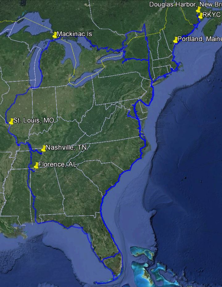
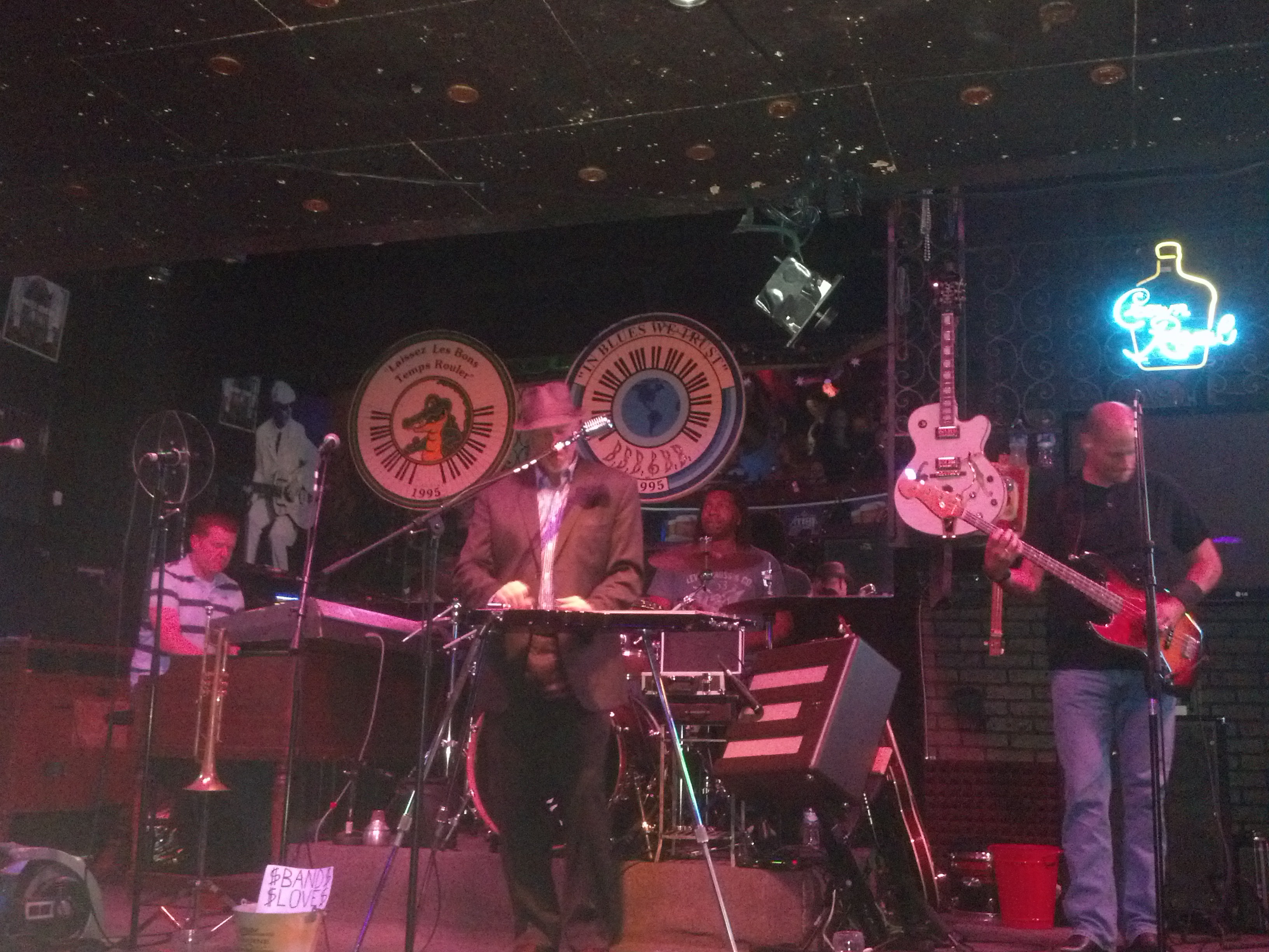
This is a bit late, but I’ll get it in sequence. I now have some time to catch up and throw in some photos we took while transiting these inland rivers.

The wind on Lake Michigan cooperated for once and we were able to move from Muskegon (where Bob stayed with Sanderling and the cats while Judy flew to Kansas for her mother’s 92nd birthday celebration) to Holland (Michigan, that is) to St. Joseph, and then across the bottom of Lake Michigan to Chicago.

2013 Cruise-2013-09-07-16-20-56-

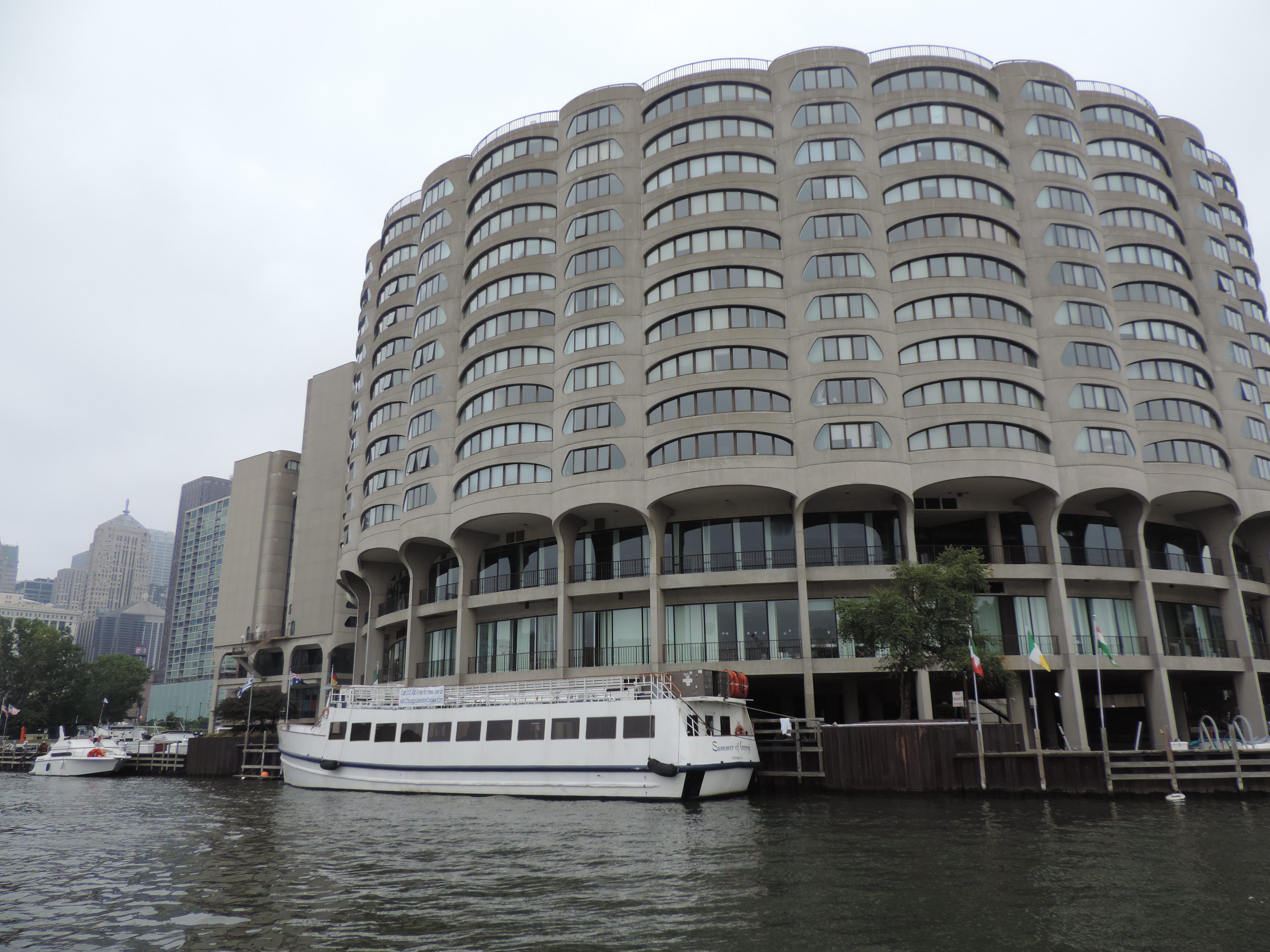
Chicago skyline from Lake Michigan

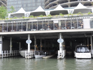
This is our view of the Chicago skyline as we approached on Saturday, September 7th about mid-afternoon. We arranged for a mooring in Monroe Harbor, which is dead center in the photo. Our mooring was located directly in front of Buckingham Fountain in Grant Park. We were meeting Caroline and Melissa for dinner in the evening, and since we both have visited Chicago a number of times we were not going to stay longer than one night there – we wanted to get on with the inland rivers! We took the launch to the marina office where we registered and met up with Caroline and Melissa. We walked to Miller’s Pub for dinner, then into the nearby Millennium Park where we enjoyed seeing “The Bean” (not it’s official name) and listening to the Chicago Lyric Opera perform various arias on the nearby stage. By the time we returned to Sanderling on her mooring the wind had shifted to the east and waves were blowing in the entrance to the mooring field through the breakwater, directly at Sanderling. It was a fitful night – even the cats were hunkered down!

Sunday morning we had to lower the radar mast in order to get below the 17 foot minimum clearance on the Chicago Sanitary Canal route through downtown Chicago, but the waves were still tossing us about and there was no way we could lower the mast (it weights about 150 pounds and we use a 4-part rope fall to assist) under those conditions. A helpful launch driver who happened by suggested that we pull further into the harbor to a free pumpout dock and while there pumping out our holding tanks we could lower the mast and be on our way. It worked our perfected; while Judy took care of the holding tanks and gave them a thorough rinsing, Bob rigged the gin-pole and rope fall, then the two of us lowered the mast into the mast/boom crutch and we were off to our next adventure – transiting downtown Chicago into the inland rivers.

2013 Cruise-2013-09-08-11-22-10-

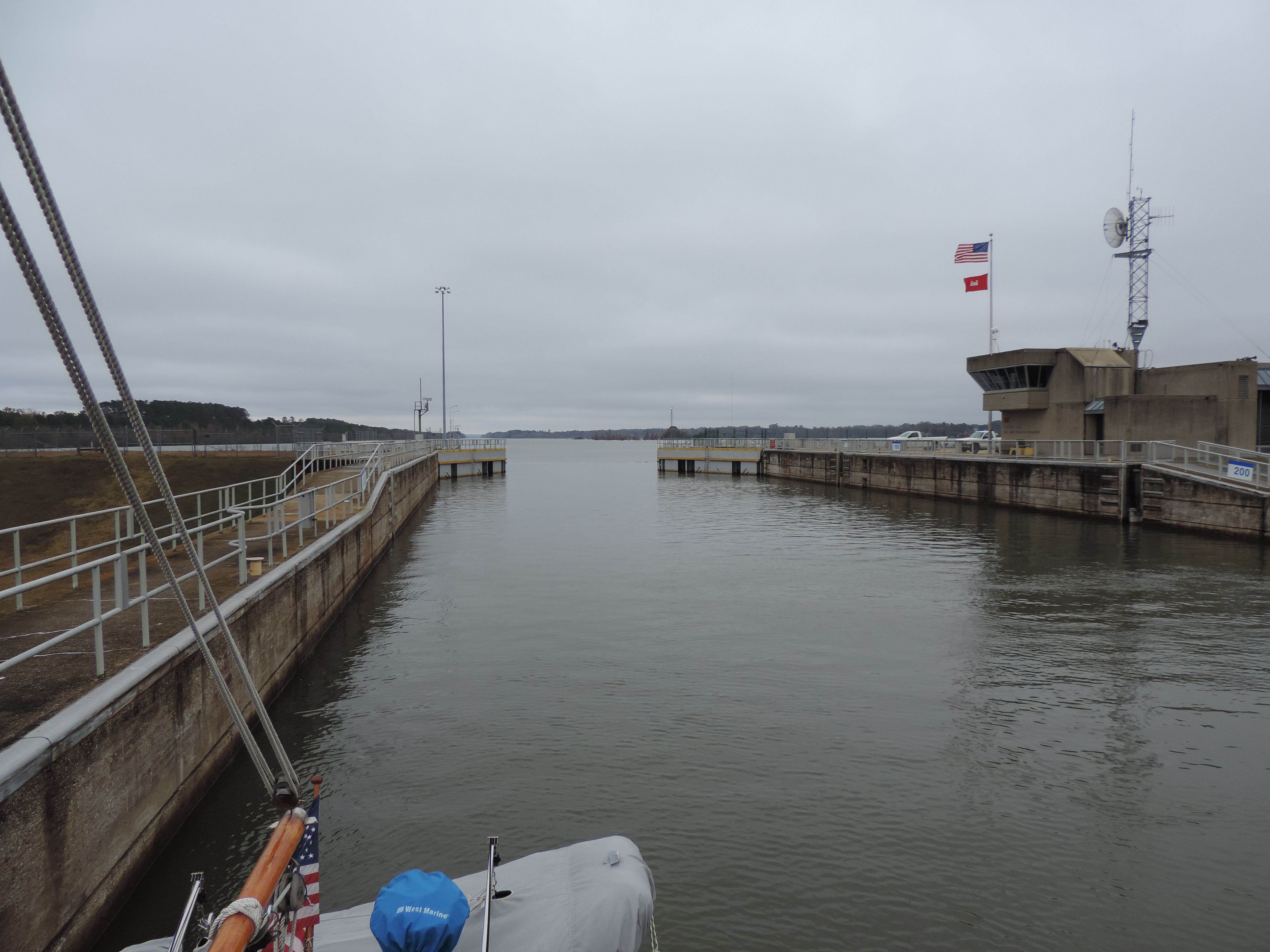
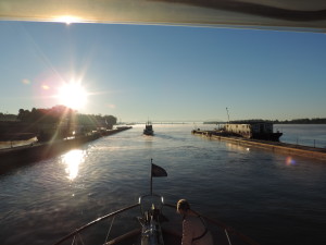
Waiting for the Chicago Lock

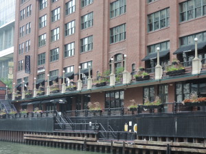
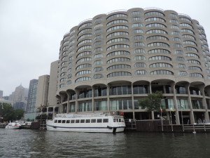
The photo shows the Chicago skyline in the high fog on Sunday morning (September 9th) as we were waiting for the Chicago Lock to lock us down a few feet into the Chicago Sanitary Canal. Once in the canal we passed right through downtown Chicago and across all the well-known streets that we had walked on earlier visits, including Michigan Avenue and through the heart of the “Miracle Mile.” Quite a thrill to see the windy city from that perspective.

This is how it looked shortly after entering the canal. The second bridge in the photo is the Michigan Avenue DuSable Bridge. Tour boats abounded throughout this stretch, as well as water taxis and private boats out for a Sunday morning cruise.2013 Cruise-2013-09-08-11-44-52-

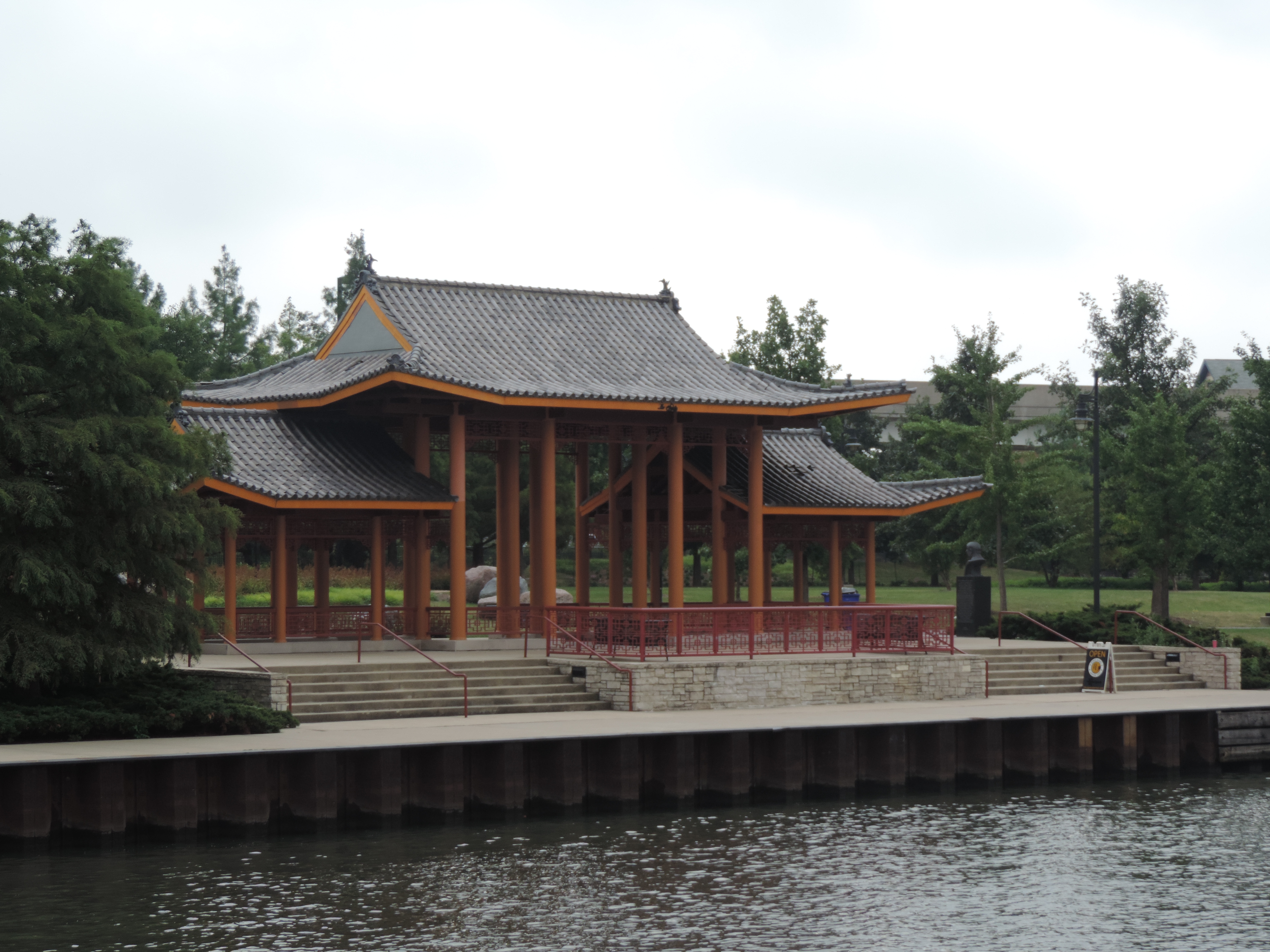
 Other photos of Chicago via the Canal:

2013 Cruise-2013-09-08-11-51-46- 2013 Cruise-2013-09-08-11-53-15-


2013 Cruise-2013-09-08-12-09-52-

2013 Cruise-2013-09-08-12-18-27-

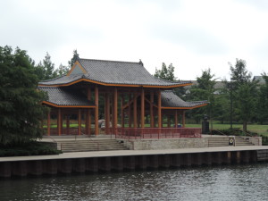
Ping Tom Memorial Park pagoda


2013 Cruise-2013-09-08-12-22-26-

Amtrak Railway Bridge – the last impediment to transiting the Chicago Sanitary Canal

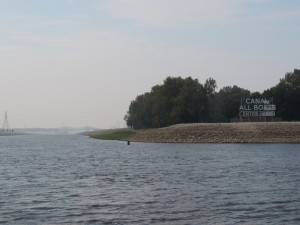
Once through downtown Chicago with the minimum bridge clearance of 17 feet, there is one last impediment to a hastle-free transit: the Amtrak railway bridge with a clearance of less than 10 feet (on a good day). If the bridge is down (as it is in the above photo) one must call by phone some mysterious place and ask that the bridge be raised. We called twice with no results; we called the bridge via VHF radio with no results. On the third phone call the bridge was raised and we went our merry, if delayed, way. Shortly after this bridge the Chicago Sanitary Canal joins forces with the Cal-Sag Canal (higher clearances for boats that cannot get lower than 17 feet) and enters the Illinois River.

 Later in the afternoon we went through2013 Cruise-2013-09-09-12-28-08- 
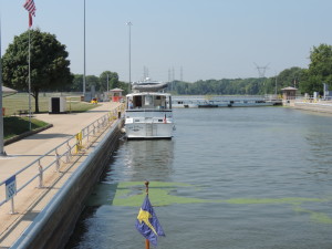
our first lock on the Illinois River at Lockport with another pleasure trawler which had transited the Chicago area via the Cal-Sag Canal, Tie A Knot with Jann and Gary aboard. Unbeknownst to us at the time, we were going to be traveling companions for the next month. We both tied to the outside of the lower lock wall bullnose for the night.


Day: 40.1SM/34.9NM – 6H25M         Trip: 2782.4NM/3197.1SM – 481H05M

For the next six days we cruised down the Illinois River, transiting the remaining six locks and dams along the way.

Lock/Dam Name Location River Miles
Above Mississippi
Pool Level
(above sea level)
Geo Coordinates
T.J. O’Brien L&D Chicago 326 577 feet (176 m) 41°39′7.45″N 87°34′1.24″W
Lockport L&D Lockport 291 577 feet (176 m) 41°34′8.61″N 88°4′39.29″W
Brandon Road L&D Joliet 286 539 feet (164 m) 41°30′12.12″N 88°6′11.04″W
Dresden Island L&D Morris 271 505 feet (154 m) 41°23′52.66″N 88°16′56.42″W
Marseille L&D Marseilles 245 483 feet (147 m) 41°19′39.77″N 88°45′4.5″W
Starved Rock L&D North Utica 231 458 feet (140 m) 41°19′27.93″N 88°59′10.82″W
Peoria L&D Peoria 157 440 feet (134 m) 40°37′54.84″N 89°37′29.52″W
La Grange L&D Beardstown 80 430 feet (131 m) 39°56′21.21″N 90°32′0.69″W

Most inland rivers are numbered in statute miles starting at their mouth; there are a few exceptions which we’ll encounter later. On the Illinois the mouth of the river is at Grafton, Illinois, a few miles upstream from St. Louis, Missouri. The Illinois River and waterway (includes the Chicago Sanitary Canal and the Cal-Sag Canal) drops from 578 feet at Lake Michigan to 419 feet (above mean sea level) at Grafton.  The locks and dams make it possible for commercial tow traffic to use the river to transport goods and makes it possible for us pleasure boaters to access the remaining inland rivers and circumnavigate the eastern United States in what has become known as the “Great Loop.”

Tow on the Illinois River - 3 wide and 5 long

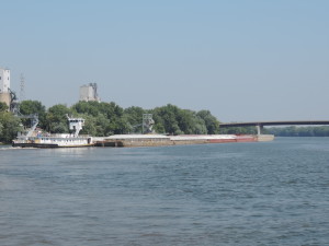
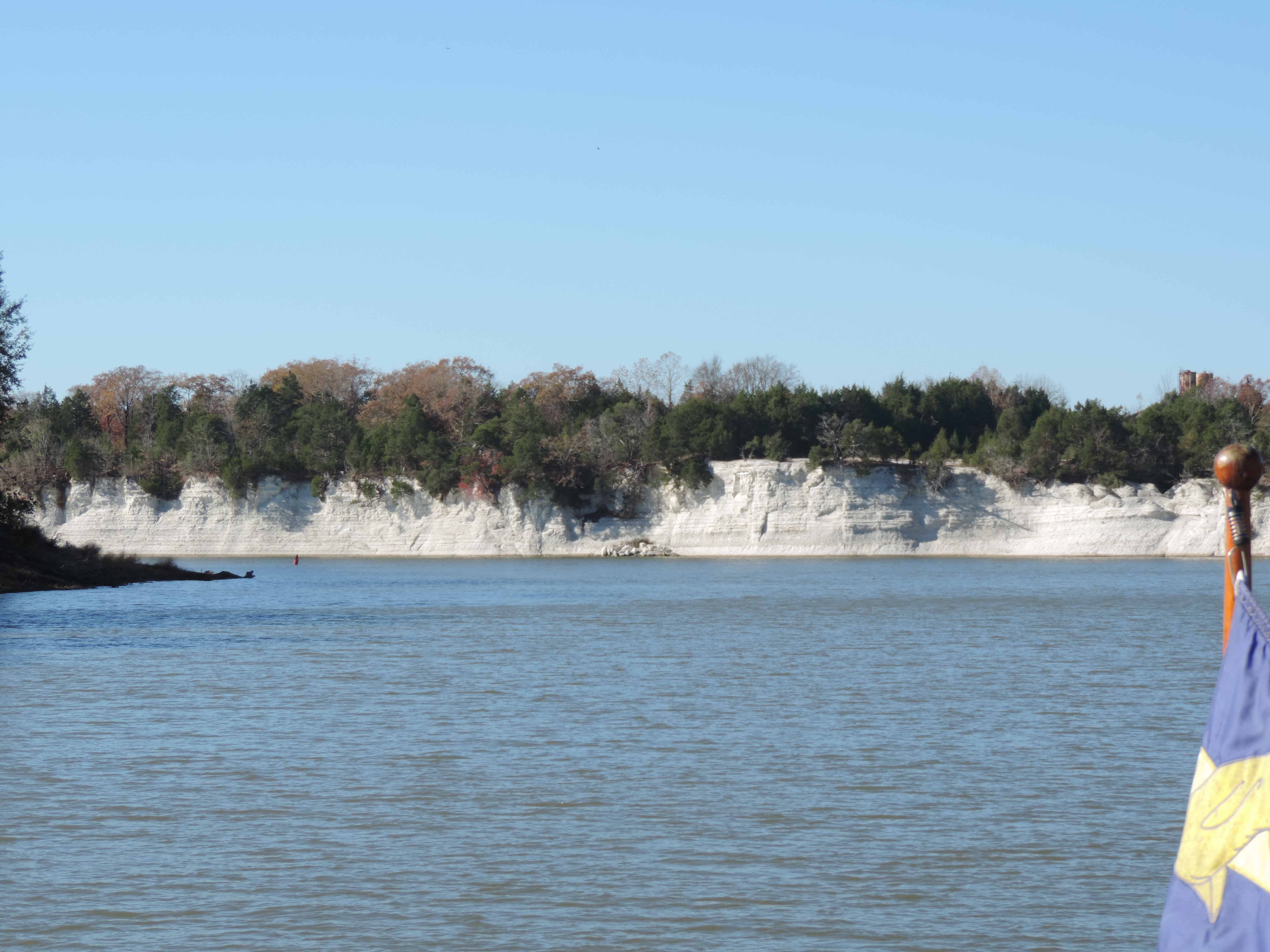
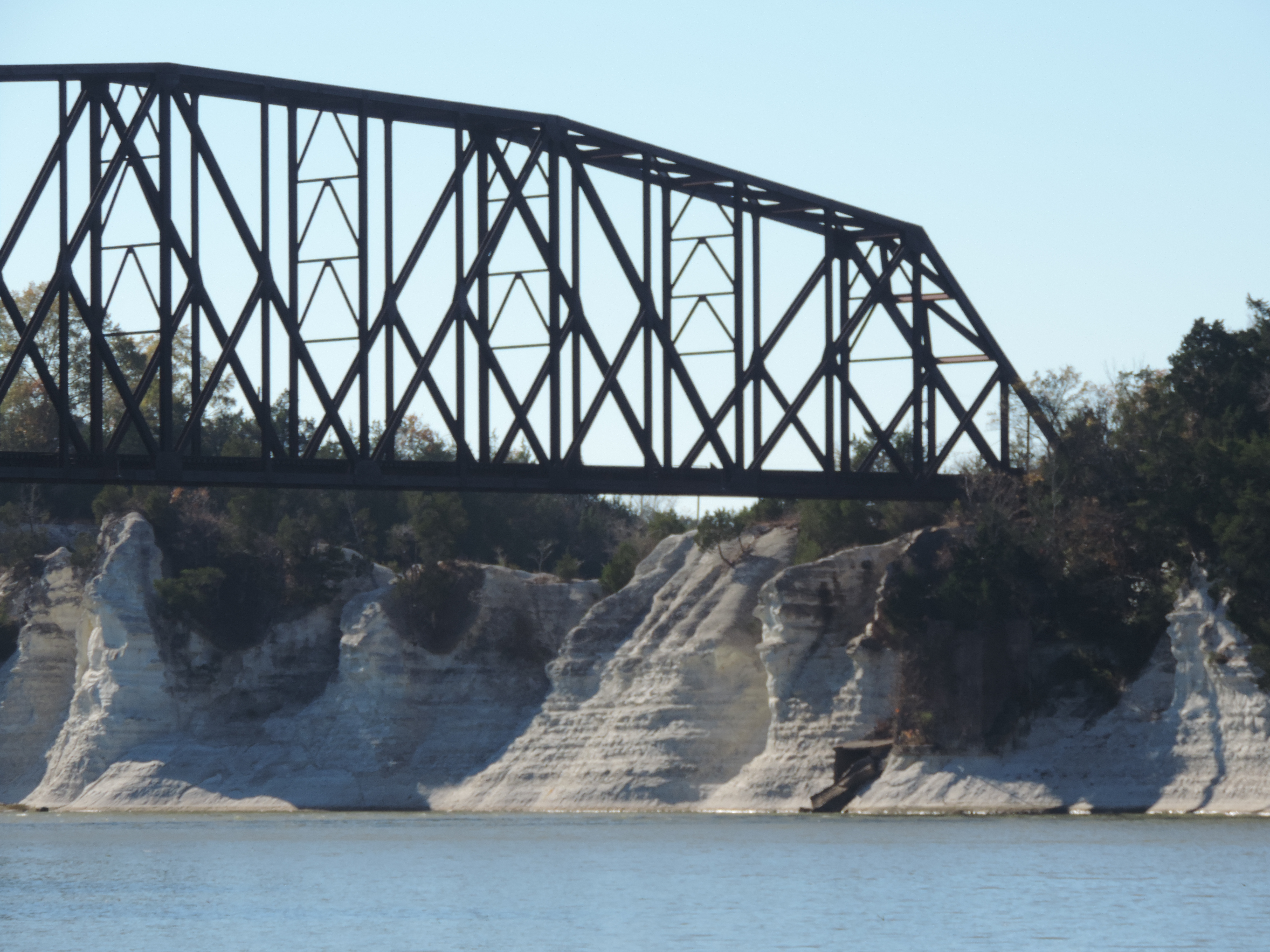
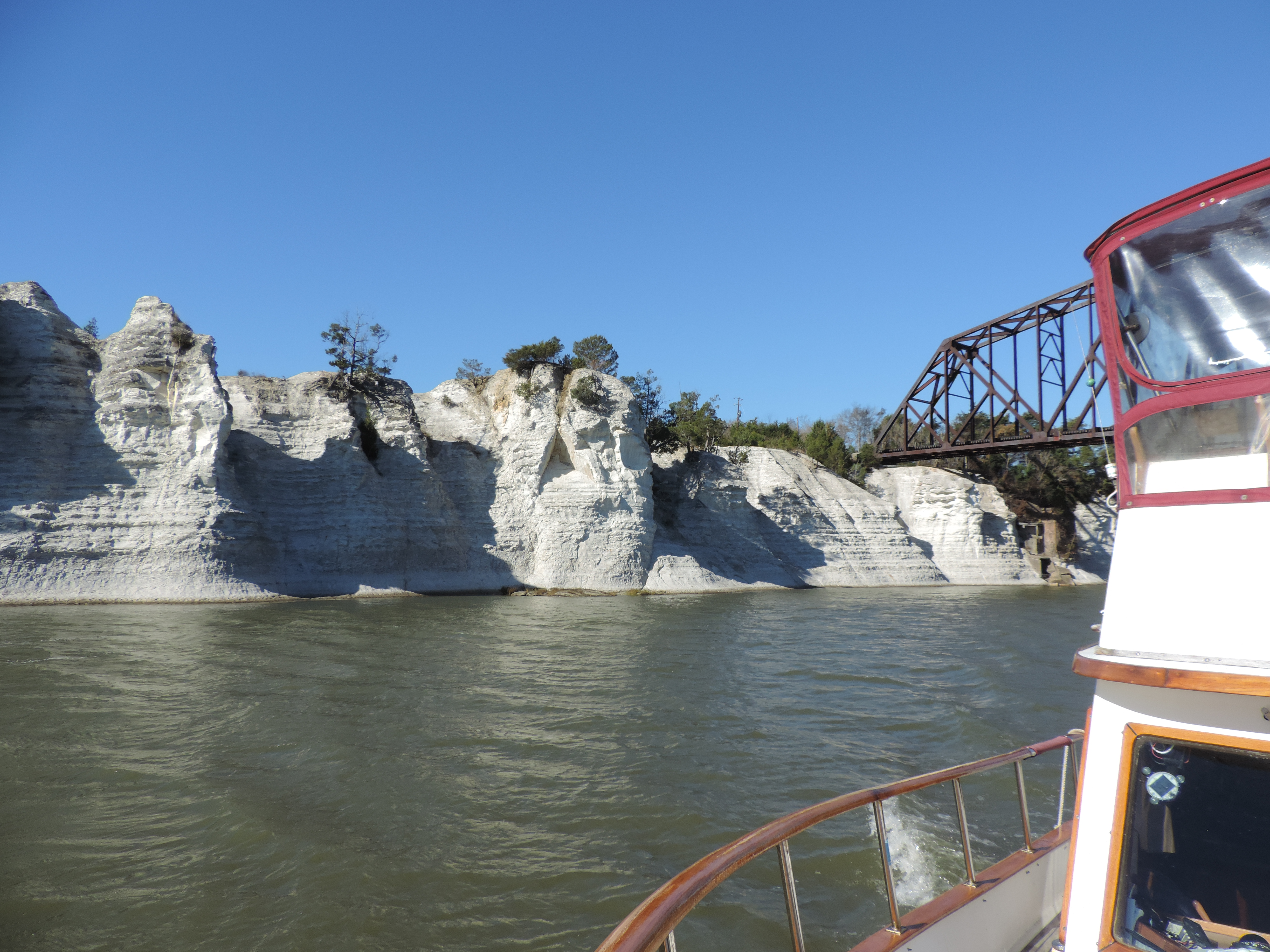
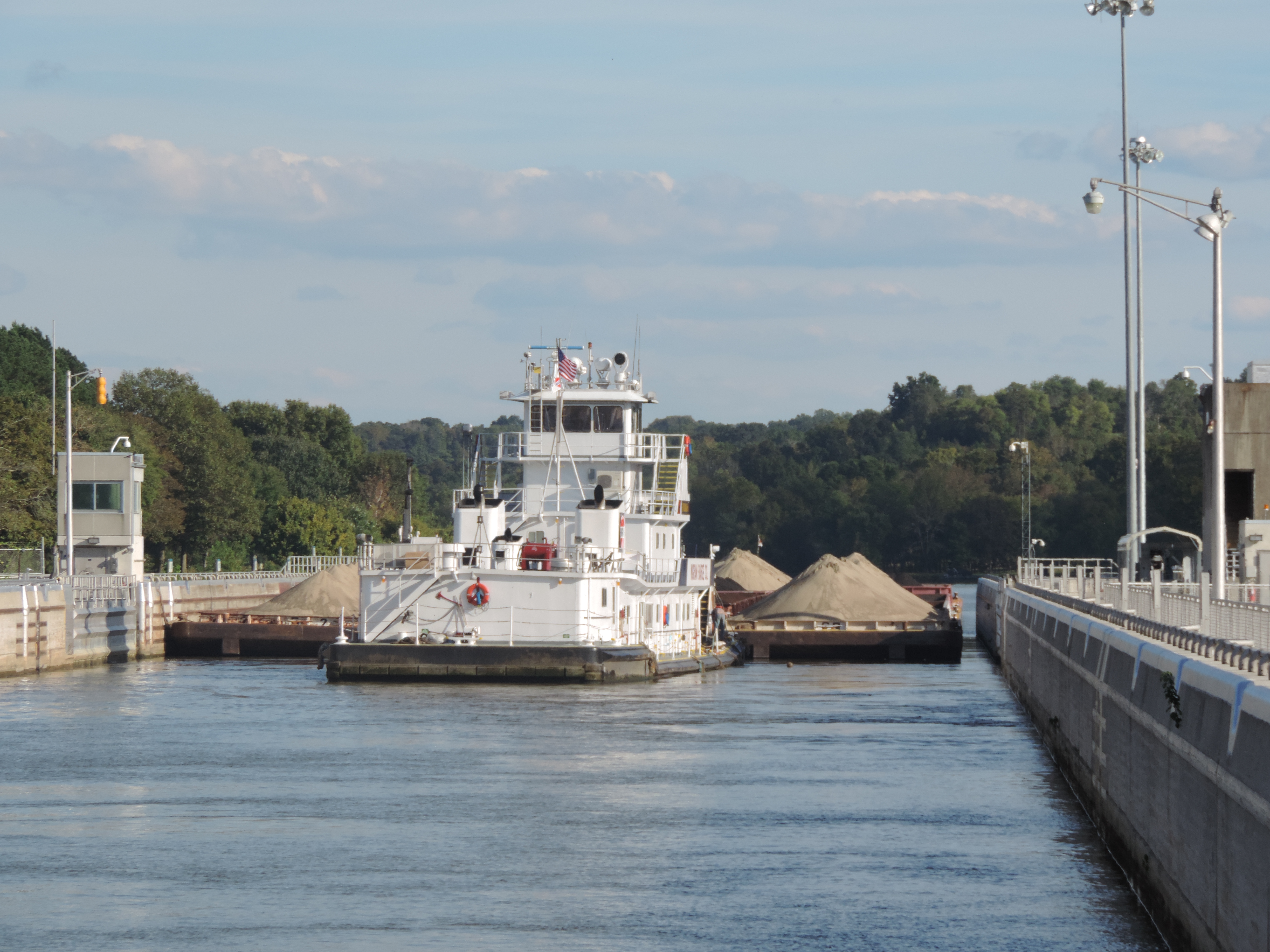
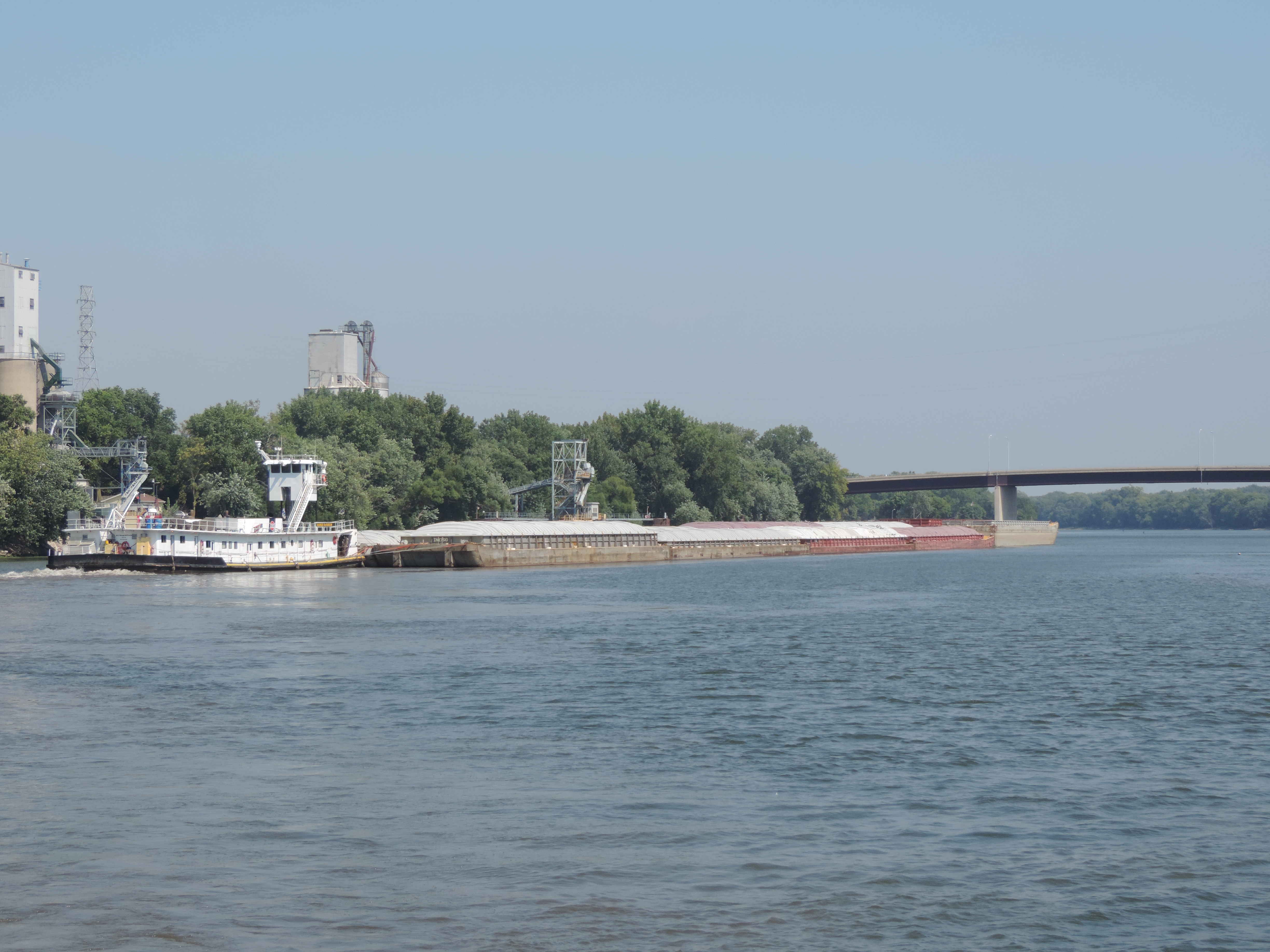
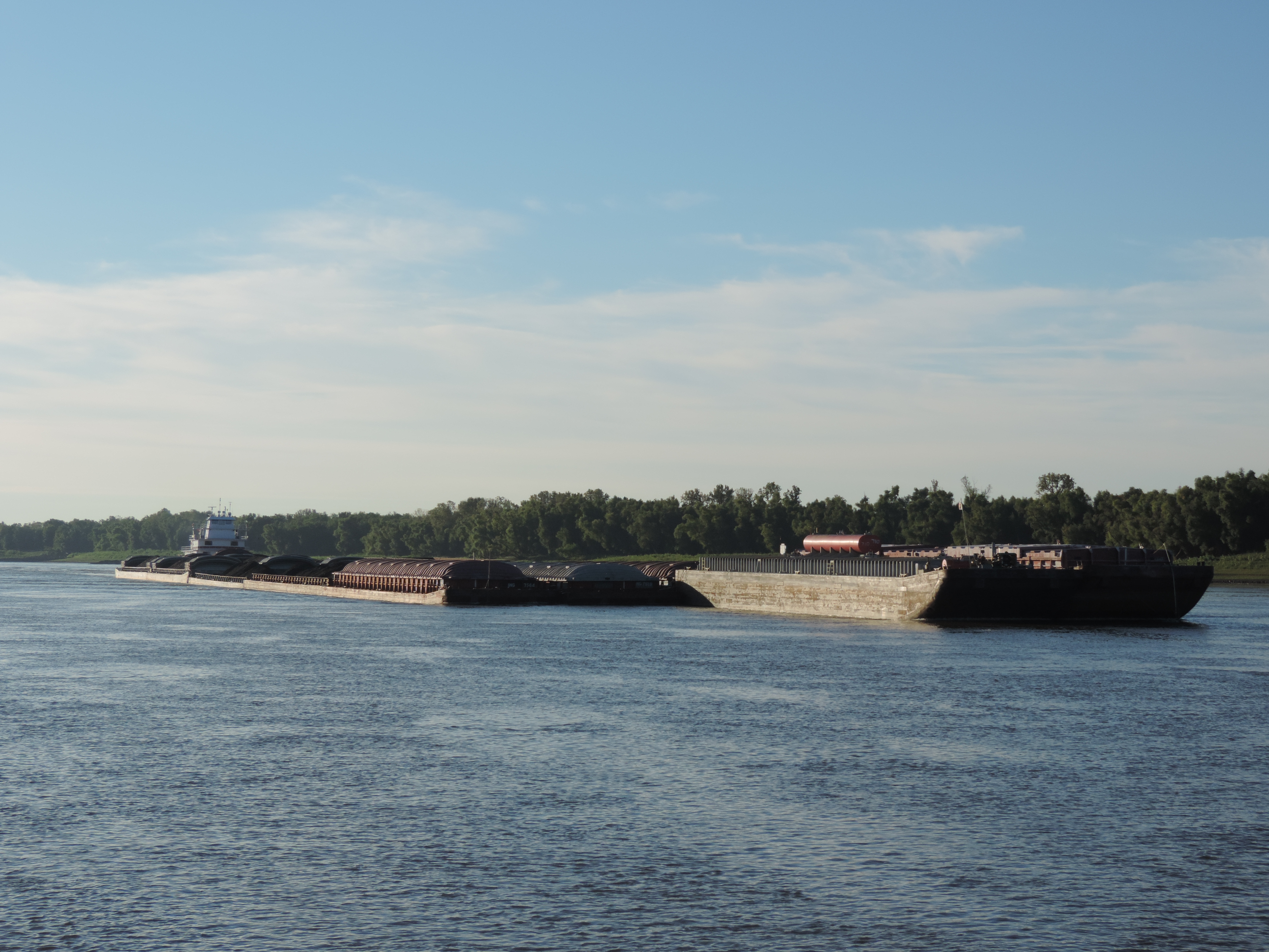
Tow on the Illinois River – 3 wide and 5 long

After Lockport, we stopped for the night at Ottawa (mile 239) on a free town dock and stayed there for two nights during some very hot weather so we could take advantage of free electricity for our air conditioners; at Hamm’s “marina” near Rome (mile 178), Illinois; at Tall Timbers Marina at Havana, Illinois (mile 120); at Buckhorn Island (mile 46.1), and at Mortland Island near the small town of Hardin, Illinois (mile 18.7).

The two night stop at Ottawa provided an opportunity to do a little food shopping and eat out, to say nothing of being able to run our generators for two days while the heat soared into the 90s – all at no cost! We ate out with Jann and Gary and found Ben & Jerry’s ice cream at the local grocery store.

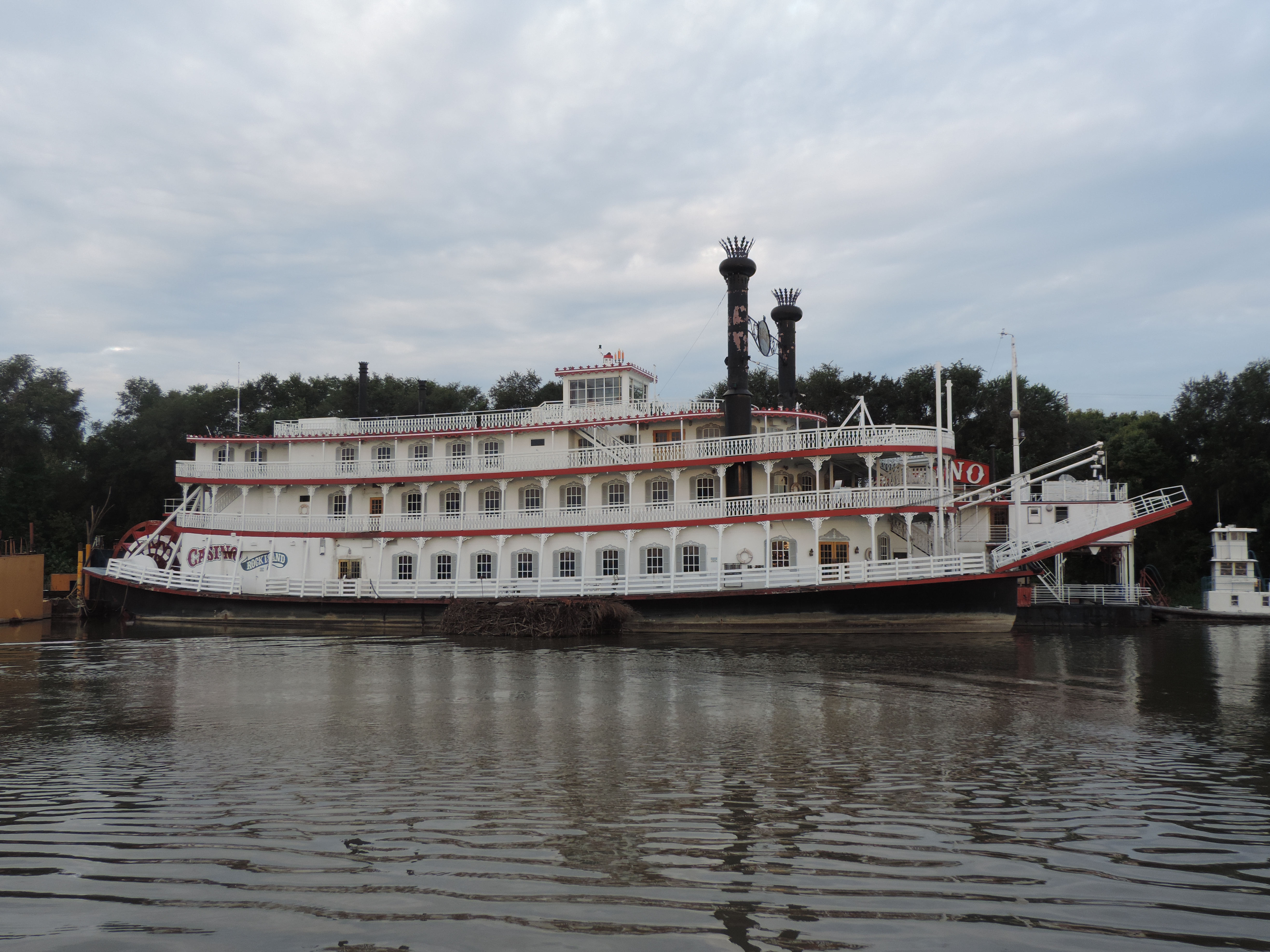
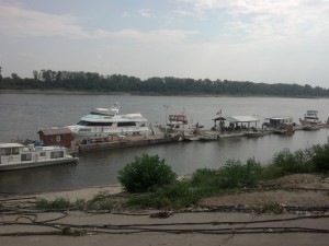
Of all the places we stopped along the Illinois River, Hamms “marina” was the most interesting, by far. It obviously was a very active marina at one time, and the owner operated several tugs along the river. Now it has become a storage for “marina queens” – boats that are seldom used and appear to have all of their better days2013 Cruise-2013-09-12-07-10-02- behind them – of all shapes, sizes and lineages. There is even an old riverboat being stored for the time the owner wants it back. The owner is a congenial fellow who was happy to collect our $1.00 per foot overnight fee in return for which he offered a spider filled dock, an electrical hookup that worked all the time we were there, and water (if one were brave enough to actually drink it from the ancient and stagnant lines). Nonetheless, it was an interesting place to spend the night.

The river level was down several feet from the time that some of our cruising guides was written, so the entrance to Tall Timbers Marina was barely passable for us with our four-foot draft. Tie A Knot (at 4.5 foot draft) decided not to plow through the entrance mud, and anchored for the night above a tow staging area just upstream from the marina. While there we were impressed with the cleanliness of the marina and the attentiveness of the husband and wife owners. All the docks and small buildings in the marina were floating so they were able to reopen shortly after the spring floods. The marina also had the cleanest Port-A-Lets we have ever seen – just like walking into a head in an upscale marina!

2013 Cruise-2013-09-12-07-14-11-
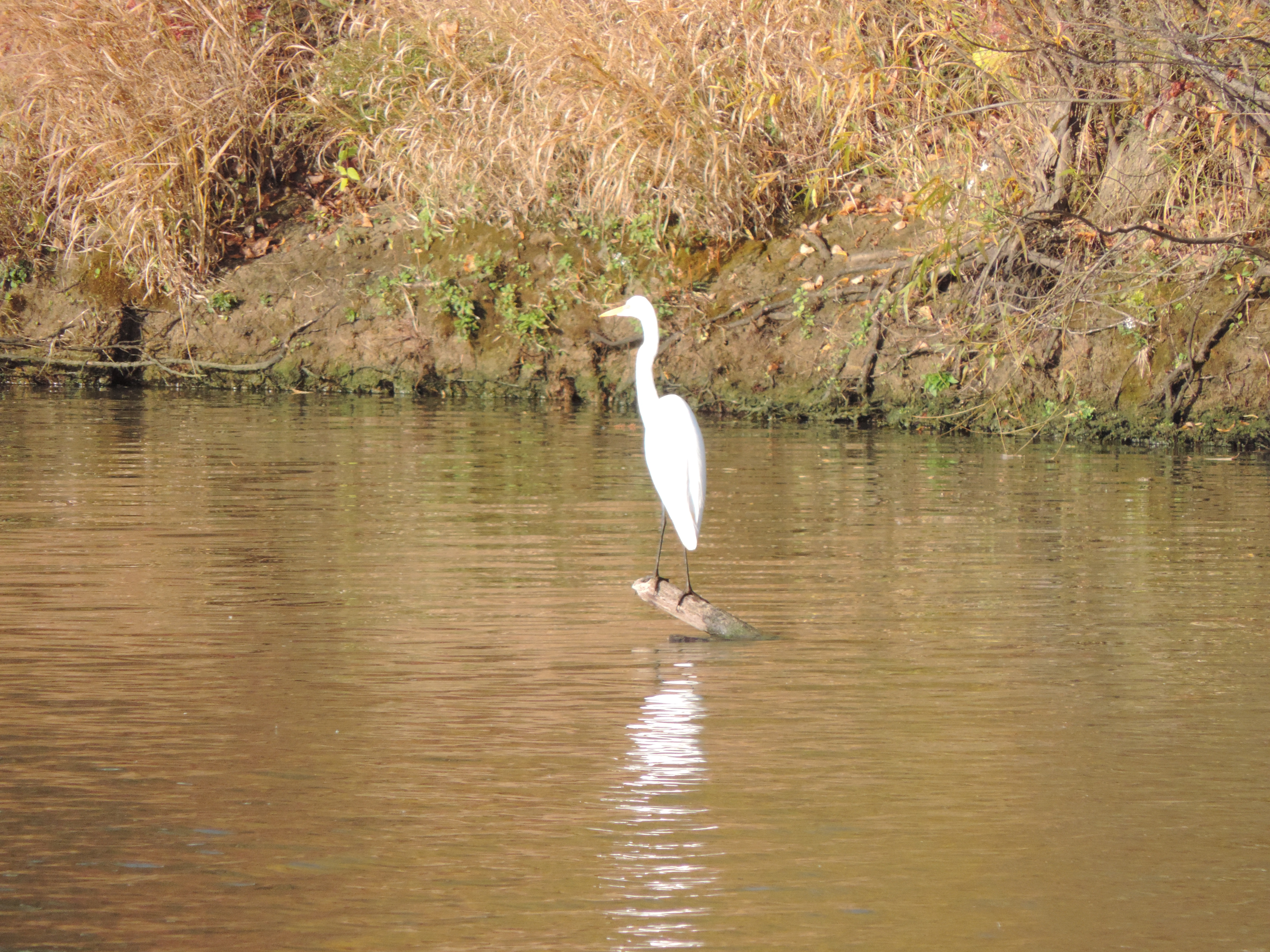
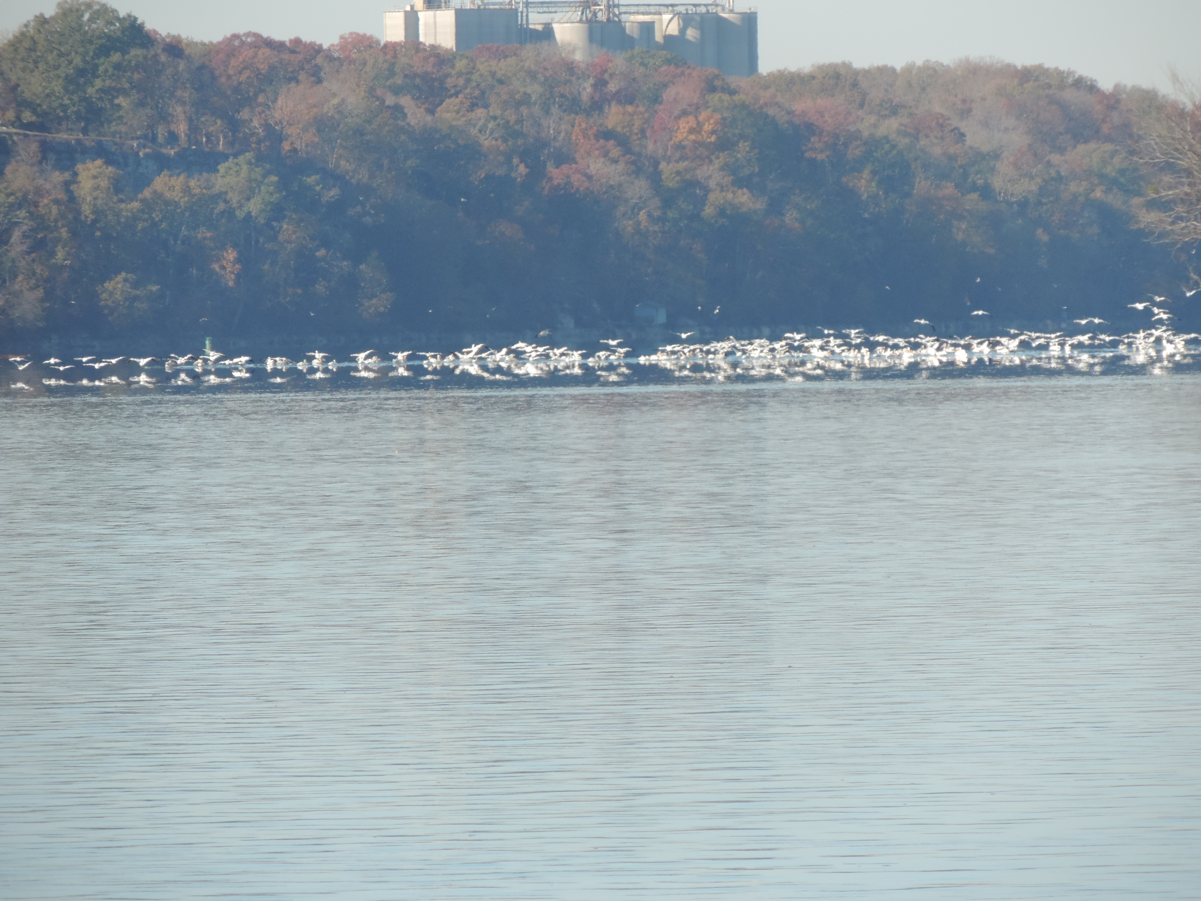
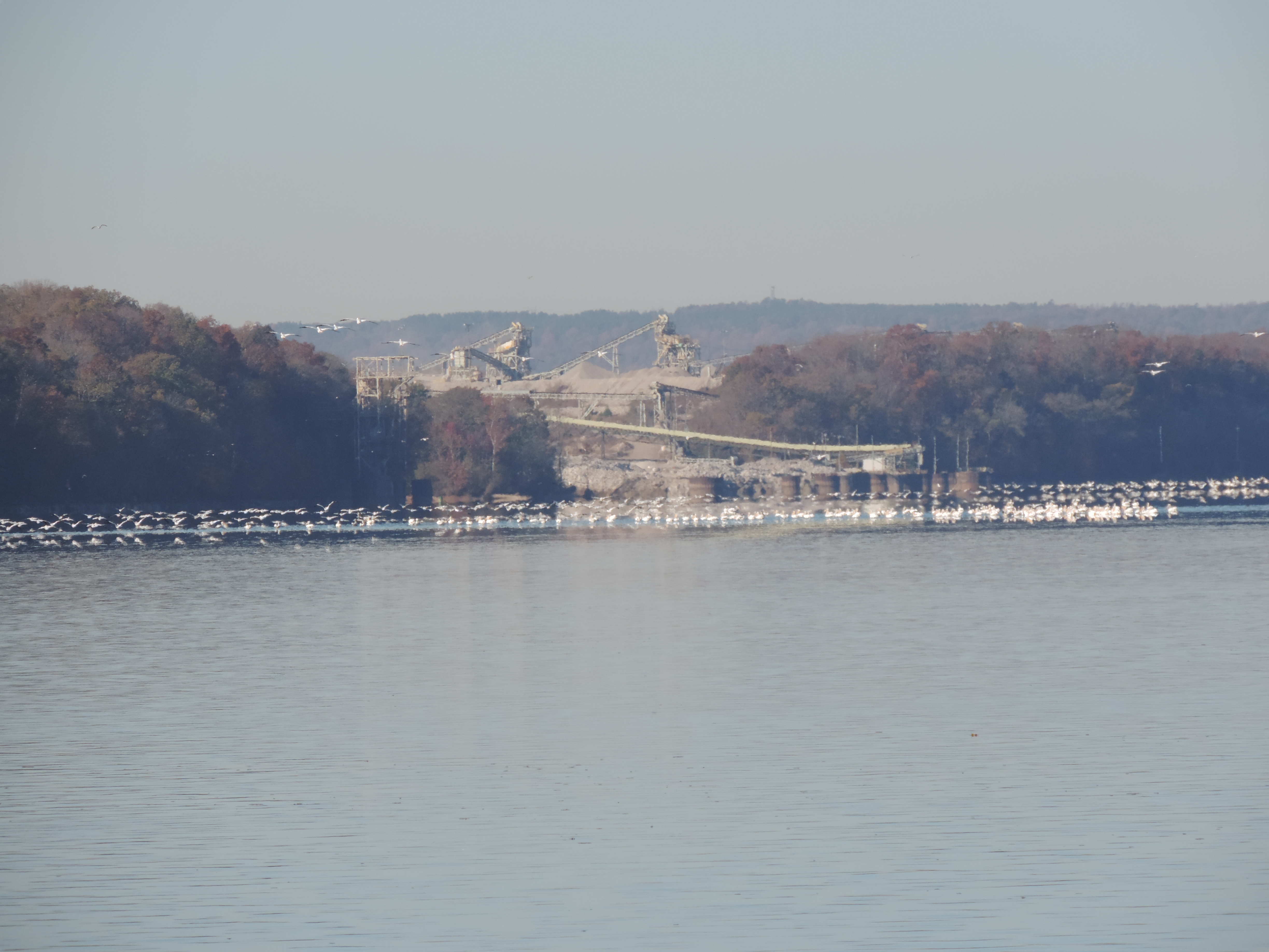
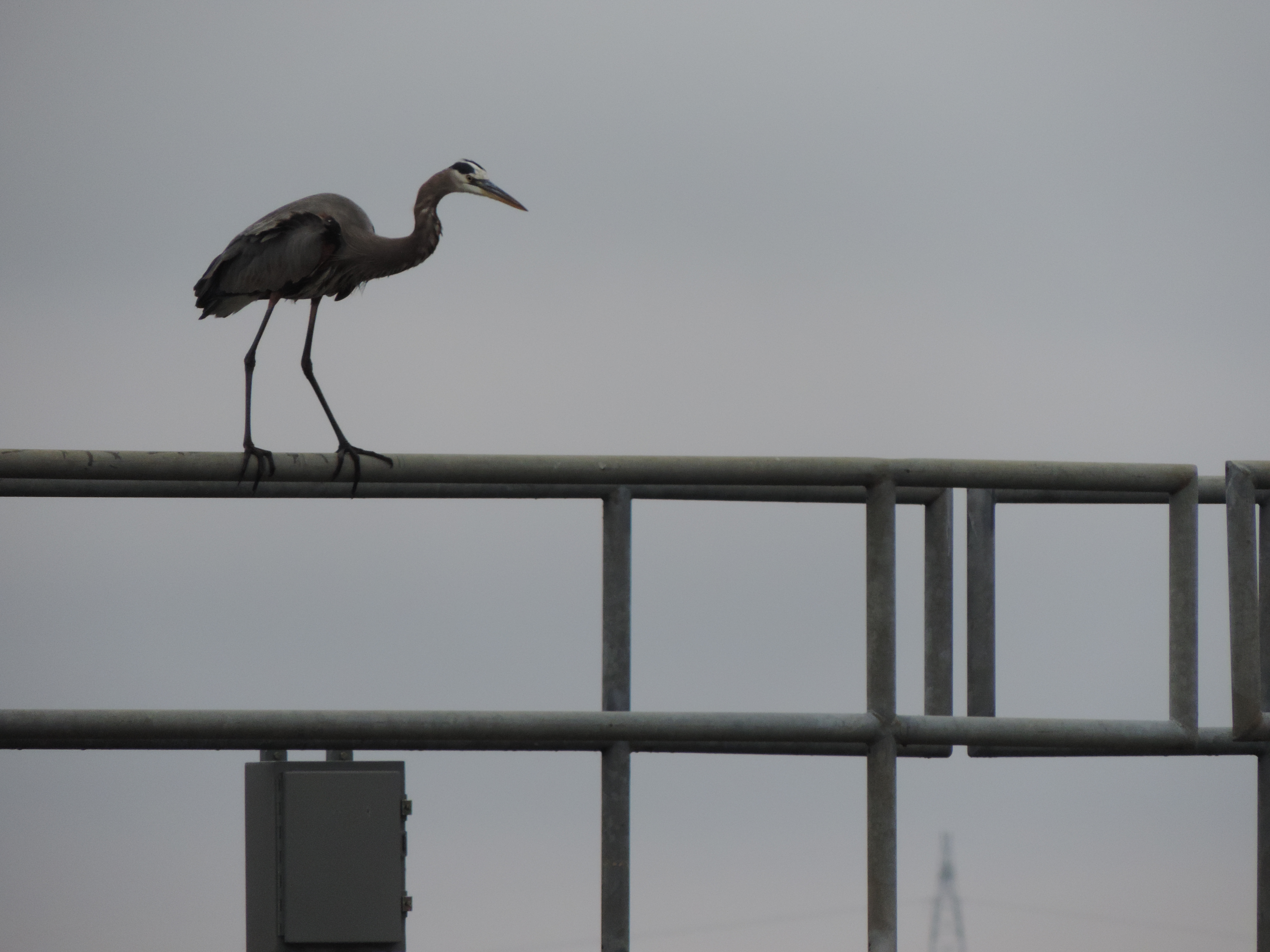
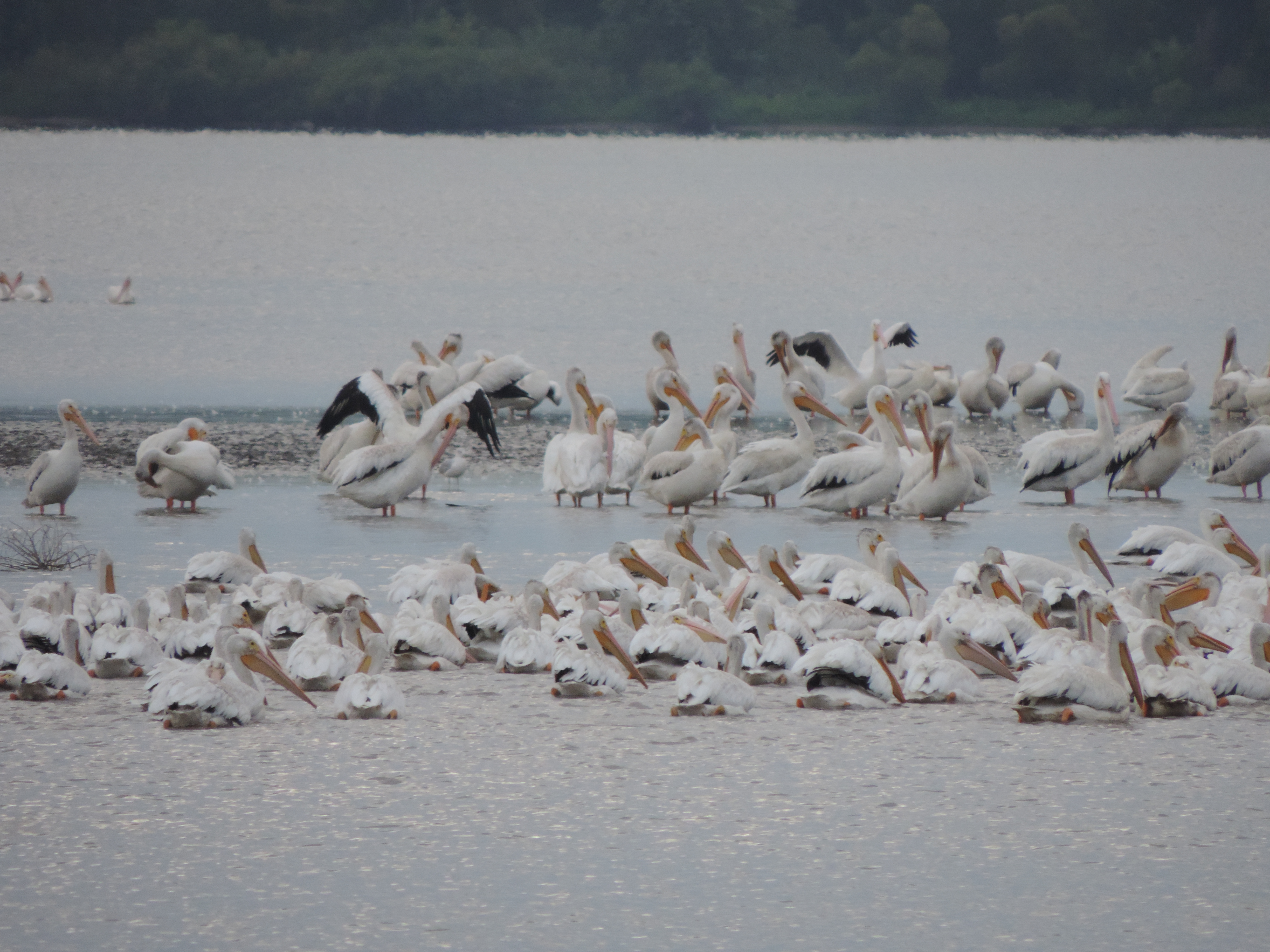
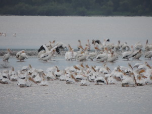
One of the things that surprised us while on the Illinois River was the abundance of white pelicans – something we’d never even seen in Florida. At first we thought they were egrets, but it soon became apparent that the clouds of birds soaring overhead were white pelicans; undoubtedly we were in the mid-western flyway and they were heading to warmer climes ahead of the approaching winter snow.

2013 Cruise-2013-09-13-10-26-58-
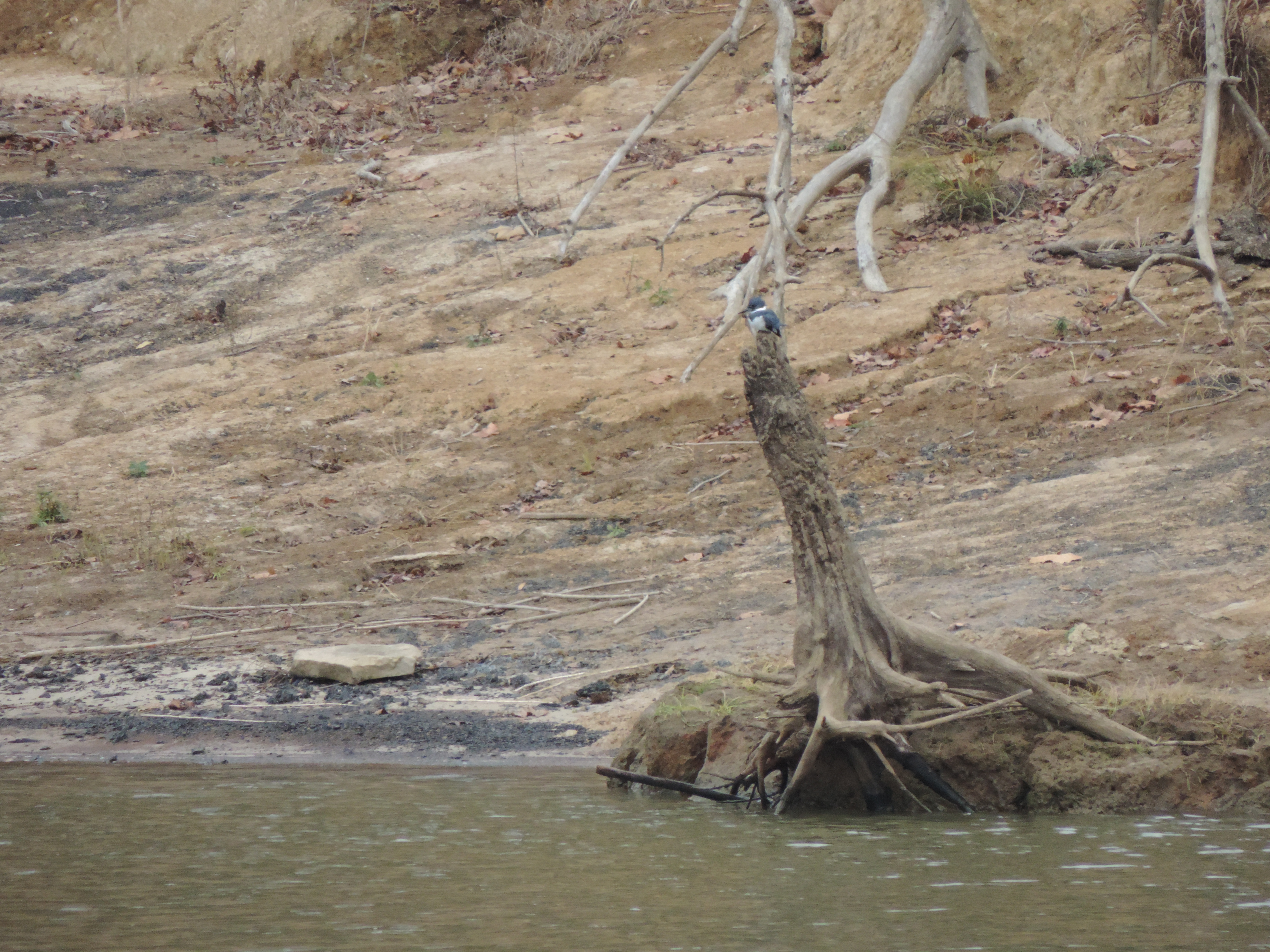
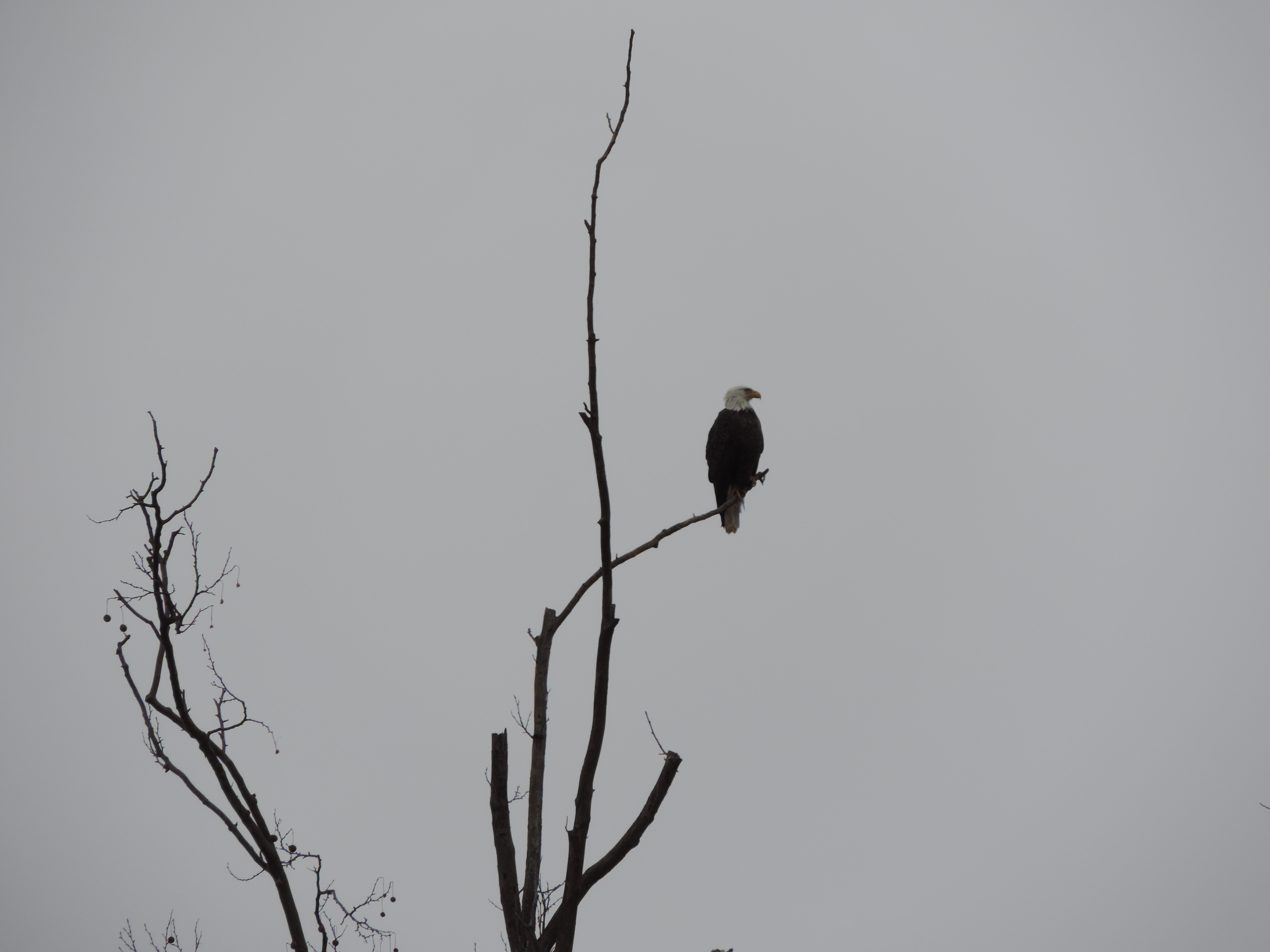
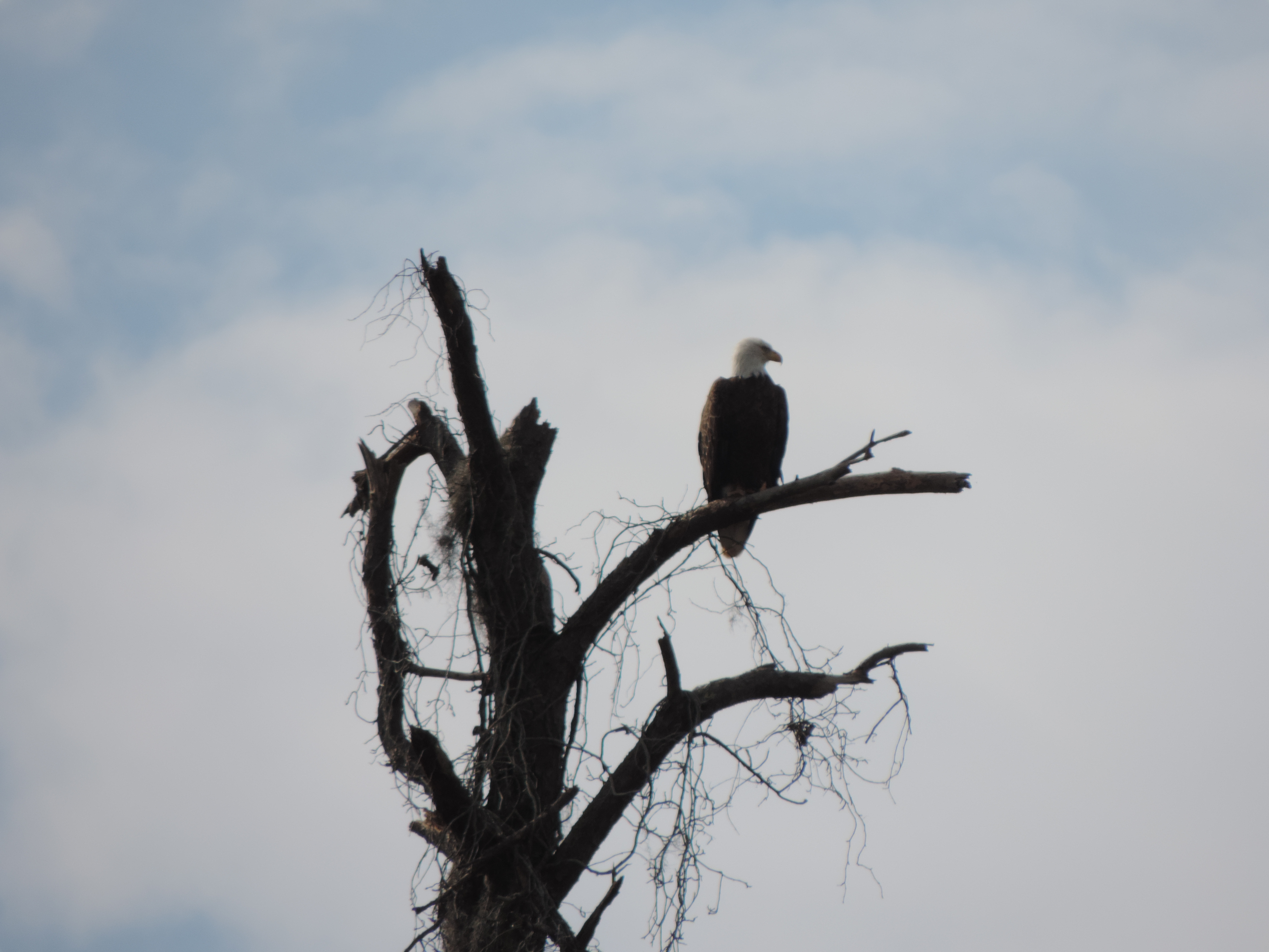
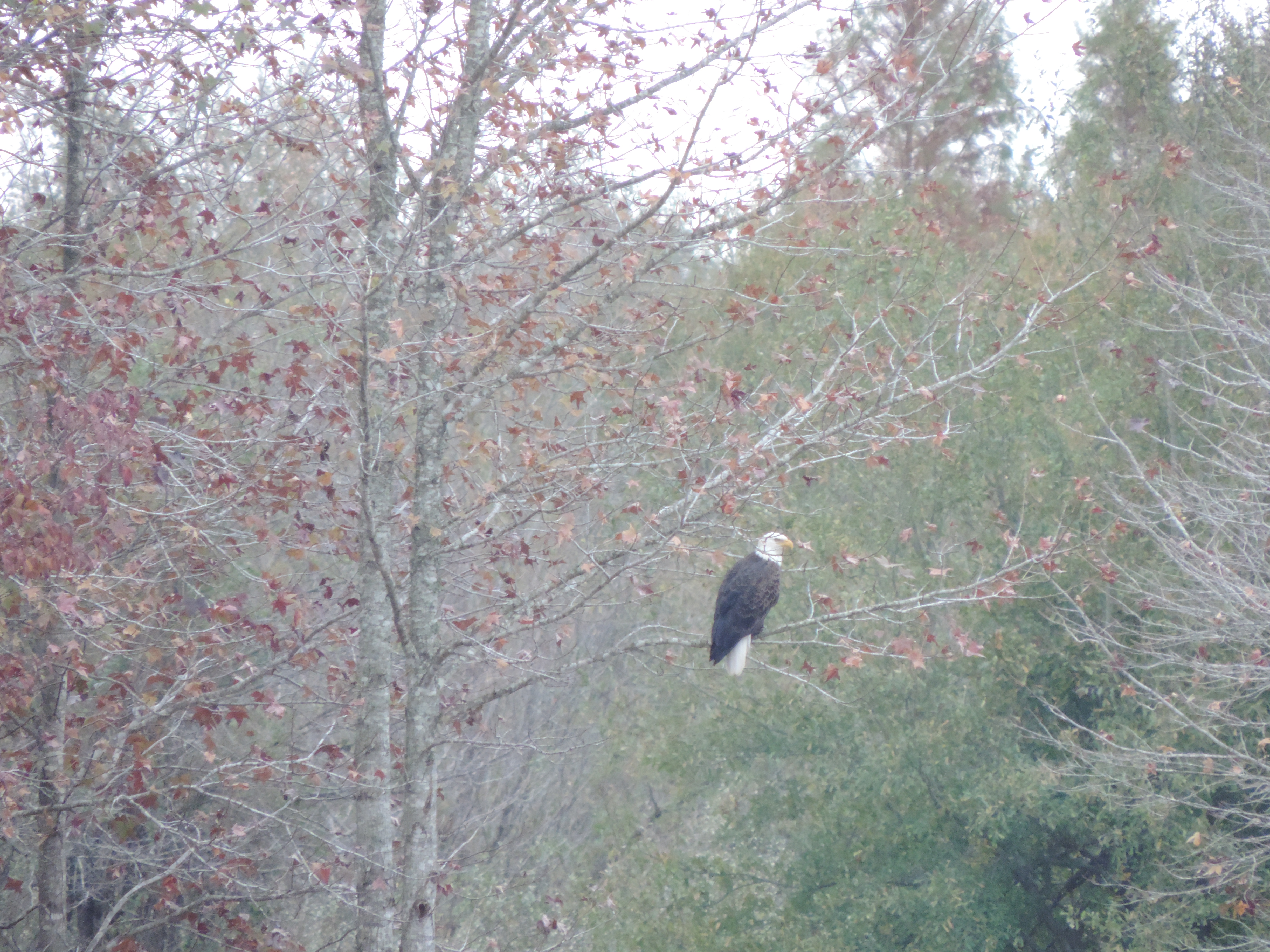
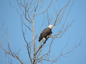
And eagles – we saw several along the river. 2013 Cruise-2013-09-13-08-09-53-
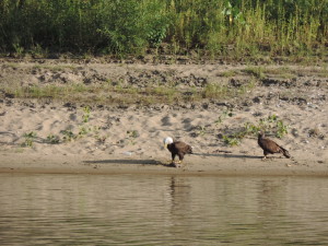
The bald eagle in the tree appeared to be alone, but the eagles eating a dead fish (undoubtedly one of the Asian carp) included an immature bald eagle waiting its turn at the table!


2013 Cruise-2013-09-14-07-26-08-

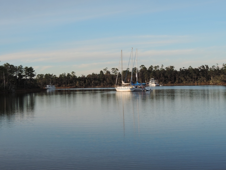
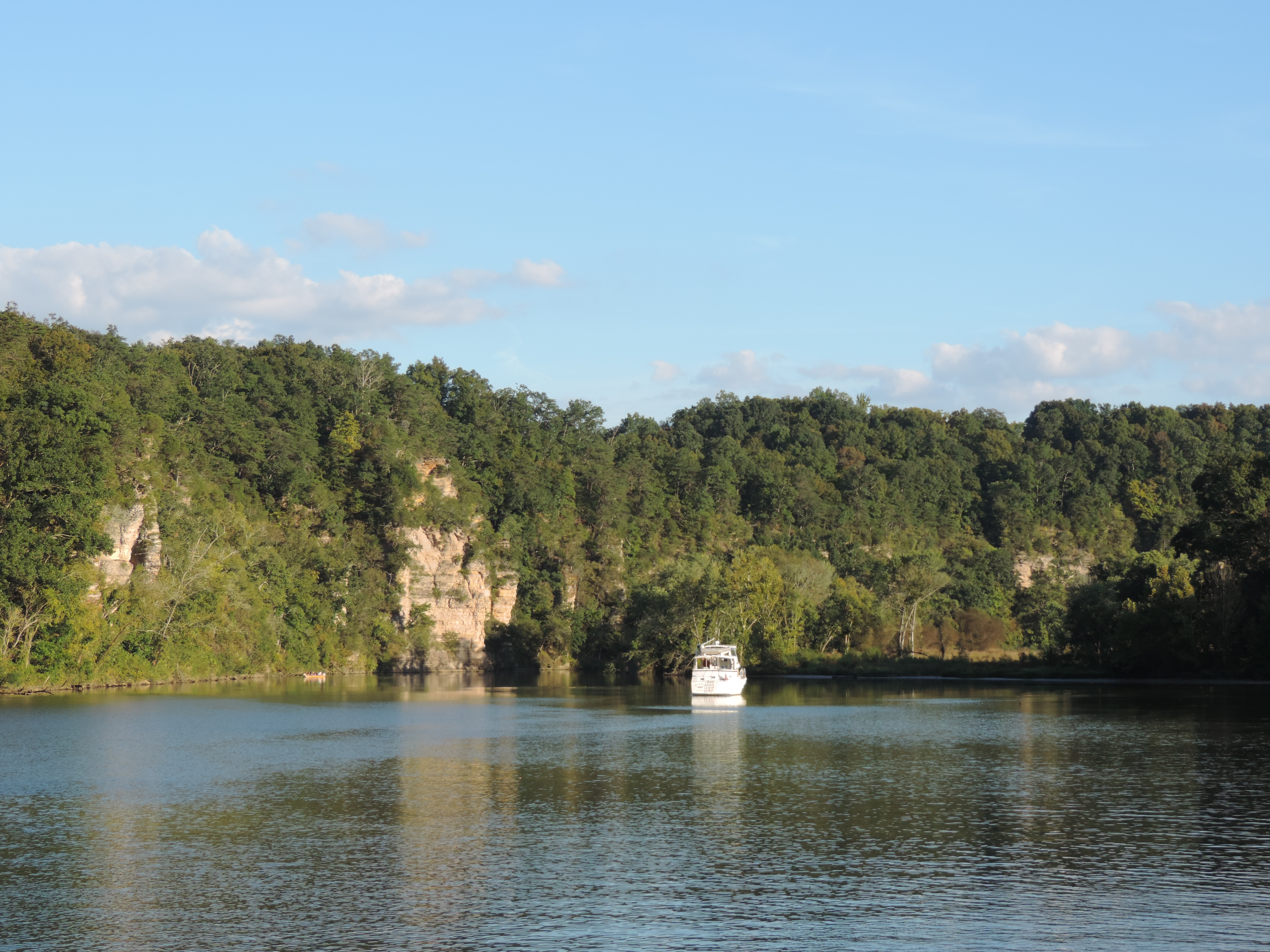
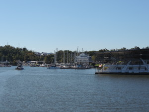
We shared many beautiful anchorages with Tie A Knot. Here’s a photo of Tie A Knot in the early morning at Buckhorn Island.


On Sunday, September 15th, we departed Mortland Island at 0825 and a few hours later entered the Mississippi River at Grafton (Illinois River mile 0; Mississippi River mile 219) and turned UPSTREAM to get to a marina at St. Charles, Missouri, where we planned to spend a few days. Both boats needed to resupply before departing for the roughly 200 miles of the Mississippi River we’d be traveling, and we (Bob and Judy) were going to rent a car and drive to Bob’s home town, Mt. Pleasant, Iowa, so Judy could see the growing metropolis and meet some of his friends. We are now at mile 221 of the Upper Mississippi – that is 221 miles from where the Ohio River joins the Mississippi at Cairo, Illinois. The Mississippi River above Cairo is called the Upper Mississippi; the river below Cairo is the Lower Mississippi and the two segments are numbered separately – the numbering of the Lower Mississippi starts at the Gulf of Mexico.

Day: 25.6SM/22.3NM – 3H40M   Trip: 3044.1NM/3497.9SM – 522H35M

Monday, September 16, 2013 – Road trip to Mt. Pleasant, Iowa

We arranged to get an Enterprise rental car as early as possible on Monday morning after getting to the Port Charles Harbor Marina at St. Charles, Missouri, the day before, along with Tie A Knot and crew. We were finally underway by car about 1030 after being picked up at the marina and taken to the closest Enterprise office about 20 miles away. We had our overnight bags with us so immediately headed north on the Avenue of the Saints (linking St. Louis and Minneapolis/St. Paul and going right through Bob’s hometown of Mt. Pleasant, Iowa).

After arriving in Mt. Pleasant we did a quick tour of all the interesting sites of significance in Bob’s formative years (took about an hour) including the house where he lived until he left for law school and the Iowa Wesleyan College campus then got a room in a local motel, changed clothes, and headed to Burlington, Iowa (on the Mississippi) to have dinner with one of Bob’s high school and college buddies and his wife, Arnie and Lois Sperfslage. Bob hadn’t seen them in a number of years so there was a lot to catch up on before and during dinner. We had a very enjoyable evening with Arnie and Lois, seeing their lovely home and the additions that Arnie had built and getting ice cream for desert at a mom and pop ice cream store near their home after dinner on the waterfront at Big Muddy’s!

The next morning we visited with Bob’s broker, met with the attorneys who bought Bob’s father’s law firm, drove through the Midwest Old Settler’s and Thresher’s park and drove to Oakland Mills to get a fried pork tenderloin at Butch’s River Rock Cafe. From there we continued east to rejoin the Avenue of the Saints and get back to Sanderling.

Throughout the visit Bob regaled Judy with many humorous tales of growing up in (and leaving) small town Iowa. (Bob isn’t sure that Judy would confirm this characterization.)

On the way back to Sanderling we stopped at a small grocery store and bought a few groceries that would get us down the Upper Mississippi, through the short stretch of the Ohio, and into the Cumberland River.

On Wednesday, September 18, 2013, we took on 200 gallons of diesel fuel, pumped out the holding tanks, and were on our way down the Mighty Mississippi at 1110. We knew we were only going a few miles to Alton, Illinois, so didn’t try to get an early start. Two and a half hours later we were at the Alton Marina, just upstream of the first lock and dam we would be transiting on the Mississippi. Along the way we passed and met several large tows, but they were nothing in size to the ones we would be seeing the next day.

This information is from Wikipedia:

Above St. Louis on the Upper Mississippi River and on other rivers such as the Illinois, Ohio, Arkansas, Tennessee and Cumberland, boats can handle only up to 15 barges due the size of lock chambers. These boats tend to be limited to 5,000 horsepower (3,728 kW).

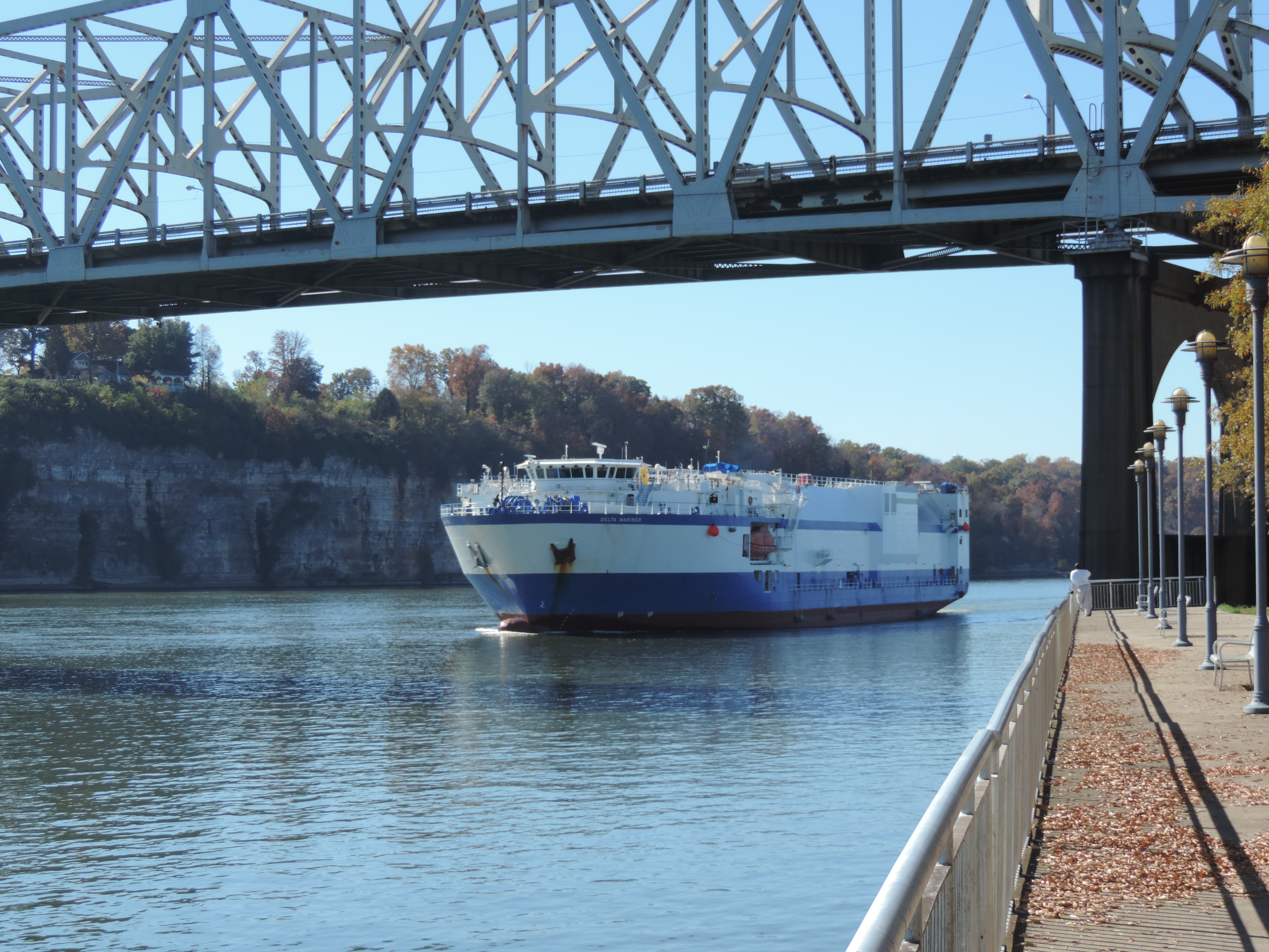
South of the Chain of Rocks Lock across from St. Louis on the Mississippi River, the river is open with no locks or impediments other than channel size and depth. Larger boats can run this segment of the river with the maximum tow size of 42 barges southbound and 40+ northbound. A typical River tow might be 35 to 42 barges, each about 200 feet (61 m) long by 35 feet (11 m) wide, configured in a rectangular shape 6 to 7 barges long and 5 to 6 barges wide, depending on the number of barges in tow. The whole tow, excluding the towboat, can easily be over 1,200 feet (370 m) long and 200 feet (61 m) wide, covering over 6 acres (2.4 ha) and holding thousands of tons of cargo. [The towboats pushing these large tows can be as much as 200 feet long and 56 feet wide with up to 11,100 horsepower (8,277 kW).]

The Alton Marina is a large, floating marina, with everything built on floating docks anchored to shore to rise with the periodic flooding of the Mississippi (at least a couple of times a year). Even the pool and store were part of the floating structure. All the slips except a few for transient boaters (like us) were covered. It’s quite a place.

Bob changed the engine oil and filters after the engine room had cooled down a bit after our arrival (something that he does every 250-275 hours of engine run-time). Later in the afternoon we attended a “loopers briefing” conducted by the America’s Great Loop Cruisers Association harbor hosts for Alton, Bob and Patty Mitchell. Their up-to-date information on the Mississippi and Ohio Rivers provided good information to assist us for the next 250 miles of our trip. They then drove all of us attending the briefing (about 12 people) to Mac’s Time-Out Lounge for dinner. Lots of fun.

Day: 21SM/18.3NM – 2H40M  Trip: 3062.4NM/3518.9SM – 525H15M

2013 Cruise-2013-09-19-08-47-23-
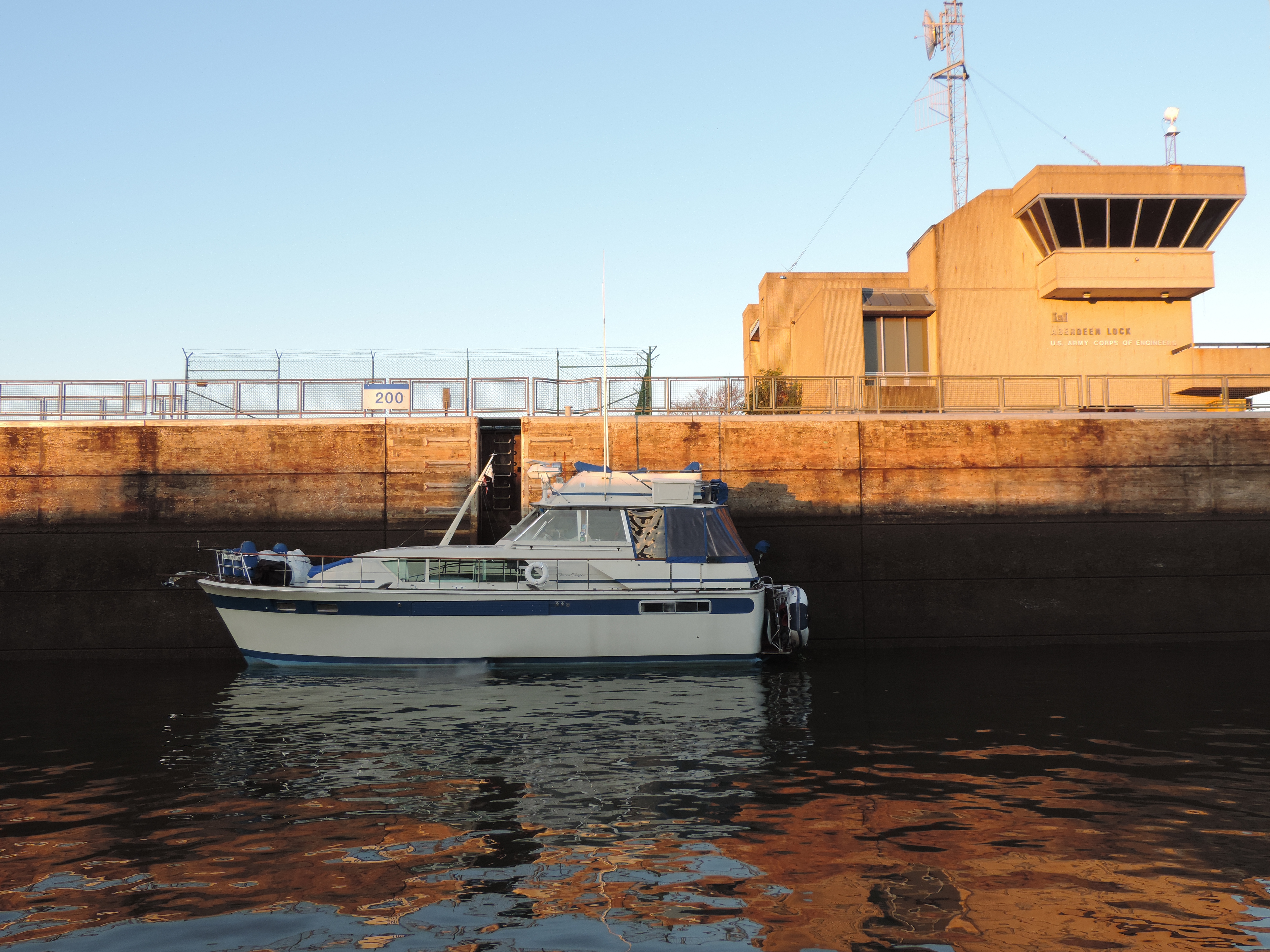
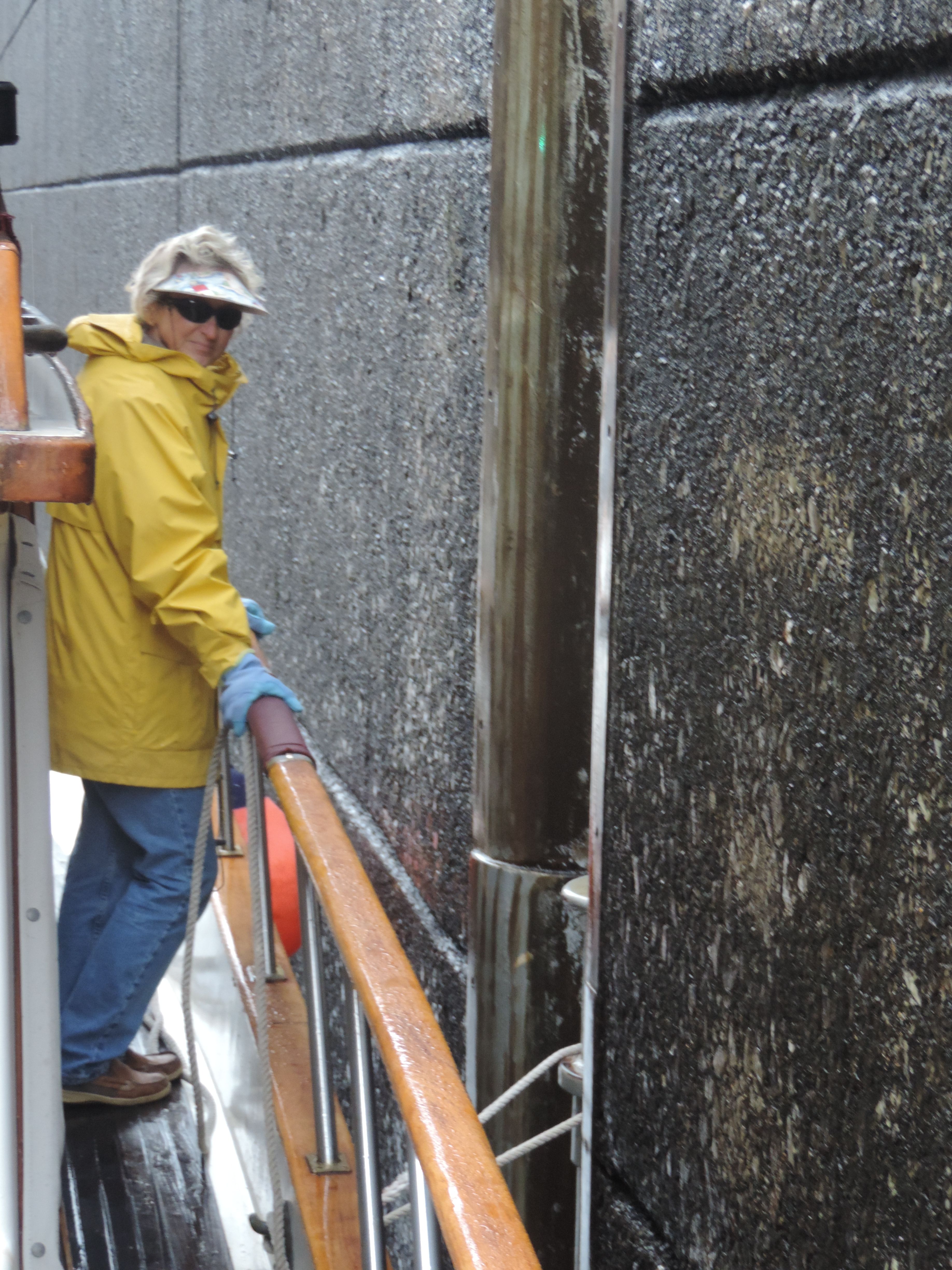
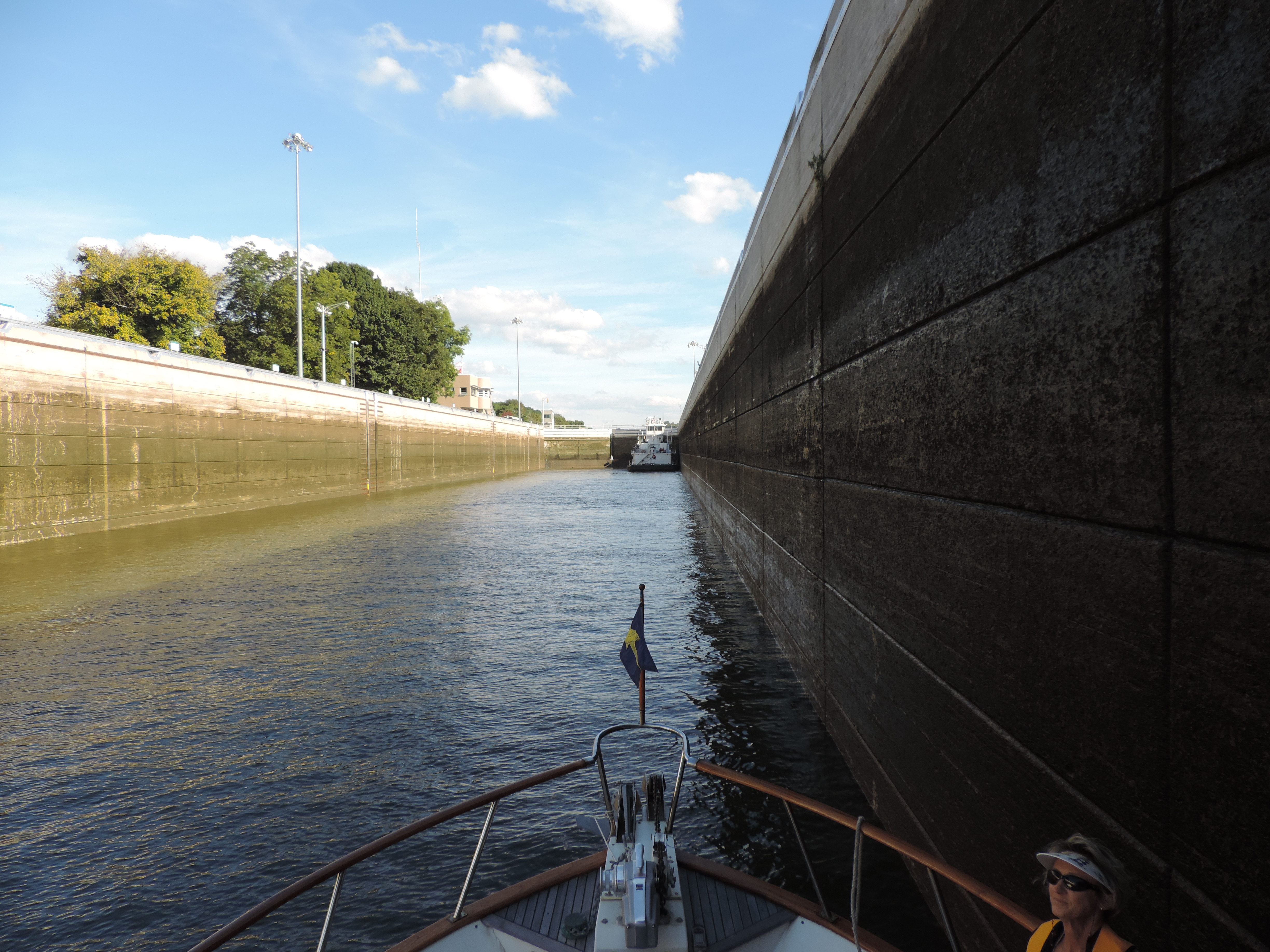
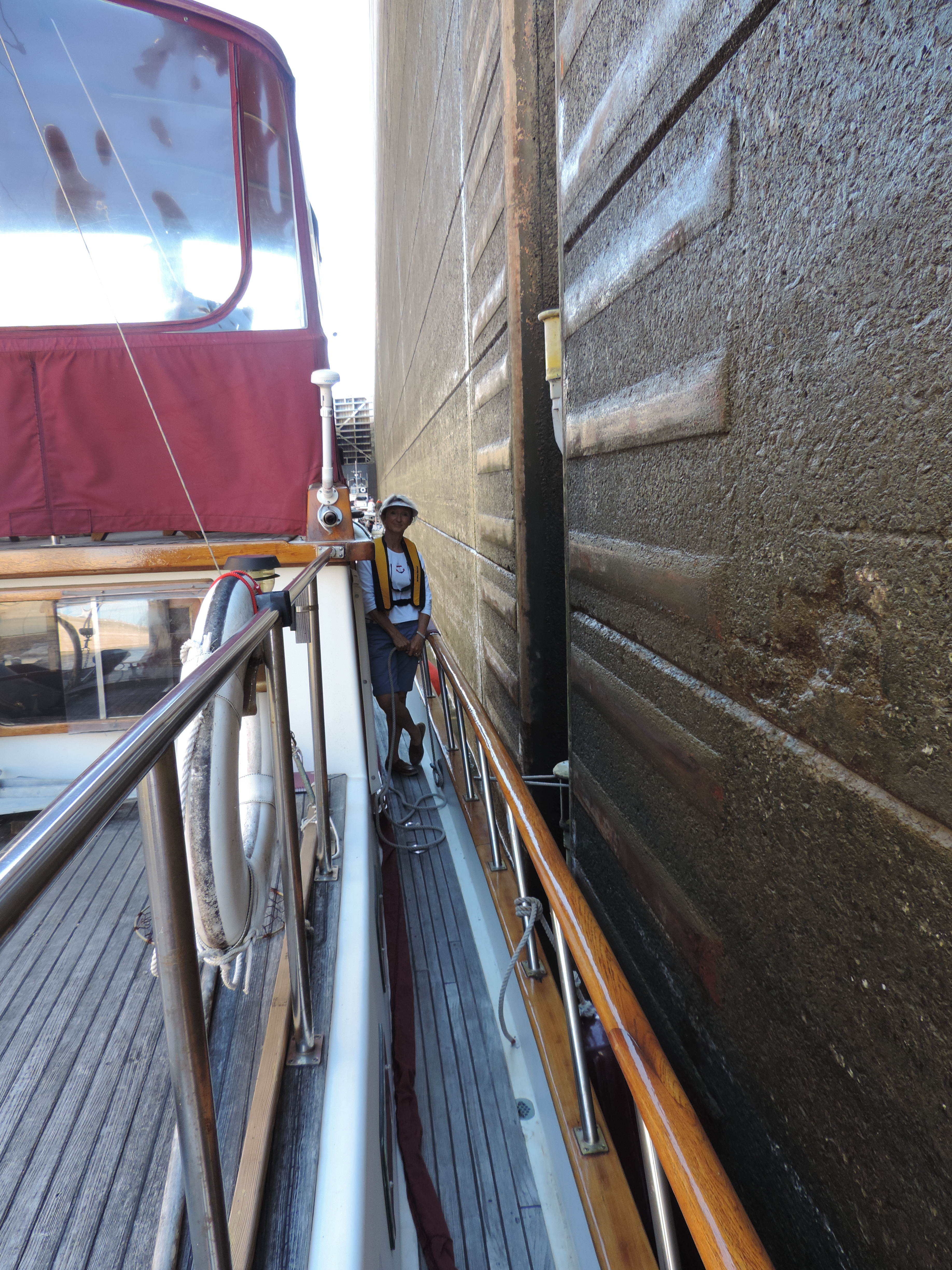
Shortly after departing the Alton Marina on Thursday, September 19, 2013, we passed through our first Mississippi River lock at mile 200, the Melvin Price Locks and Dam – it was substantially larger than the locks we had encountered on the Illinois River, at least it seemed so. It had two separate chambers, one large (the newer chamber) and one smaller (essentially the original chamber). We called the lockmaster before departing the marina and were told that the main (big) lock would be waiting for us when we arrived, and it was. We went right in and took a floating bollard about half-way down the starboard side of the chamber. The floating bollards make locking through easy for us and requires only one line at the mid-ship hawse cleated at one end to Sanderling and then single-looped around the bollard. As the water in the lock rises or lowers, the bollard floats up or down with the water level. Large round ball fenders near Sanderling’s bow and stern keep the boat from scraping the lock walls. We were the only boat in this huge lock; locking through these locks operated by the Army Corps of Engineers costs us nothing. Thank you, taxpayers!

2013 Cruise-2013-09-19-09-37-37-This lock was the northern end of a man-made canal which bypasses the confluence of the Missouri River with the Mississippi and some shallow rapids in that area.

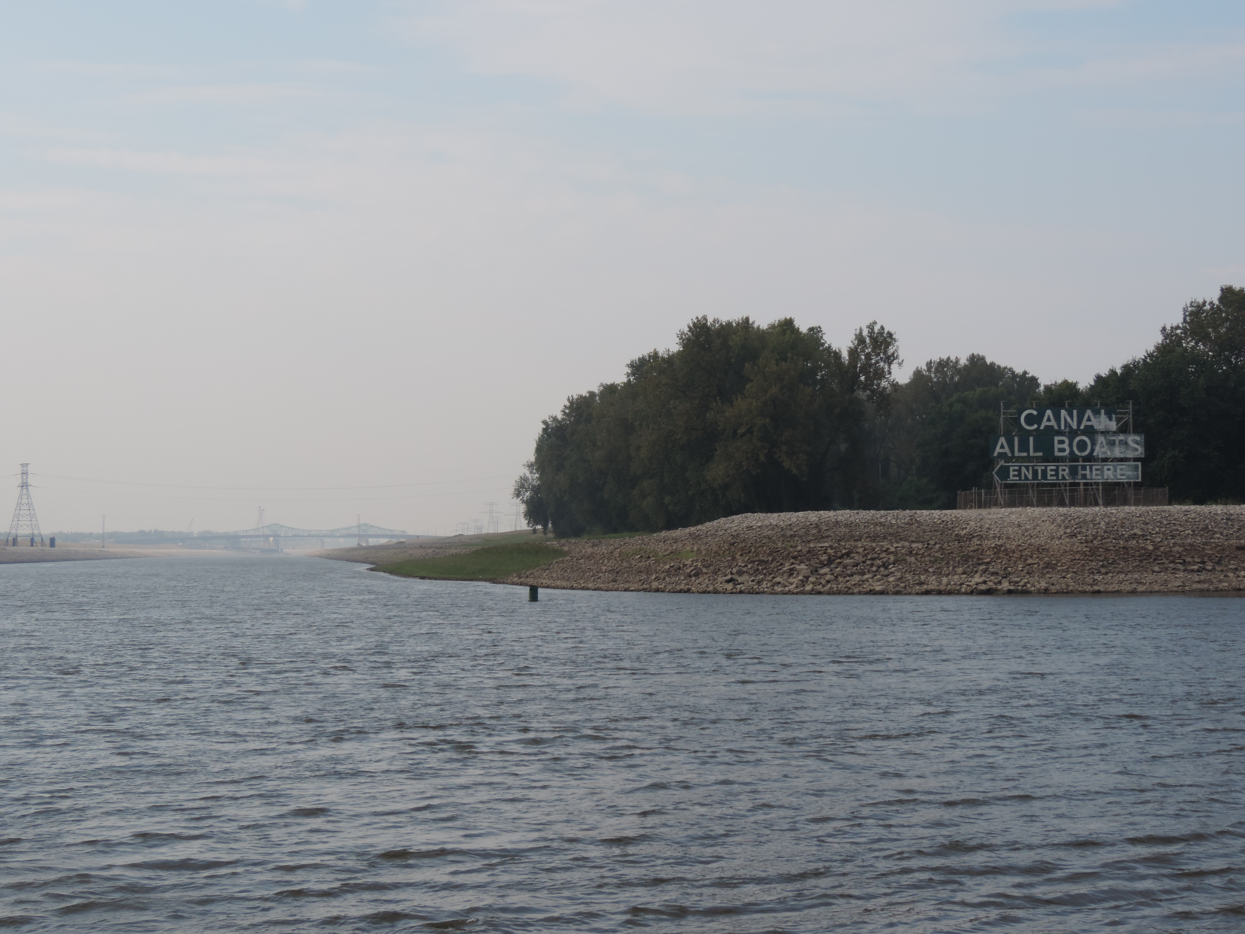
The next lock was only 10 miles further downstream, the Chain of Rocks Lock and Dam, near Granite City, Illinois. This lock is the end of a man-made canal and is the last lock and dam on the Mississippi River when southbound.

2013 Cruise-2013-09-19-11-38-18-
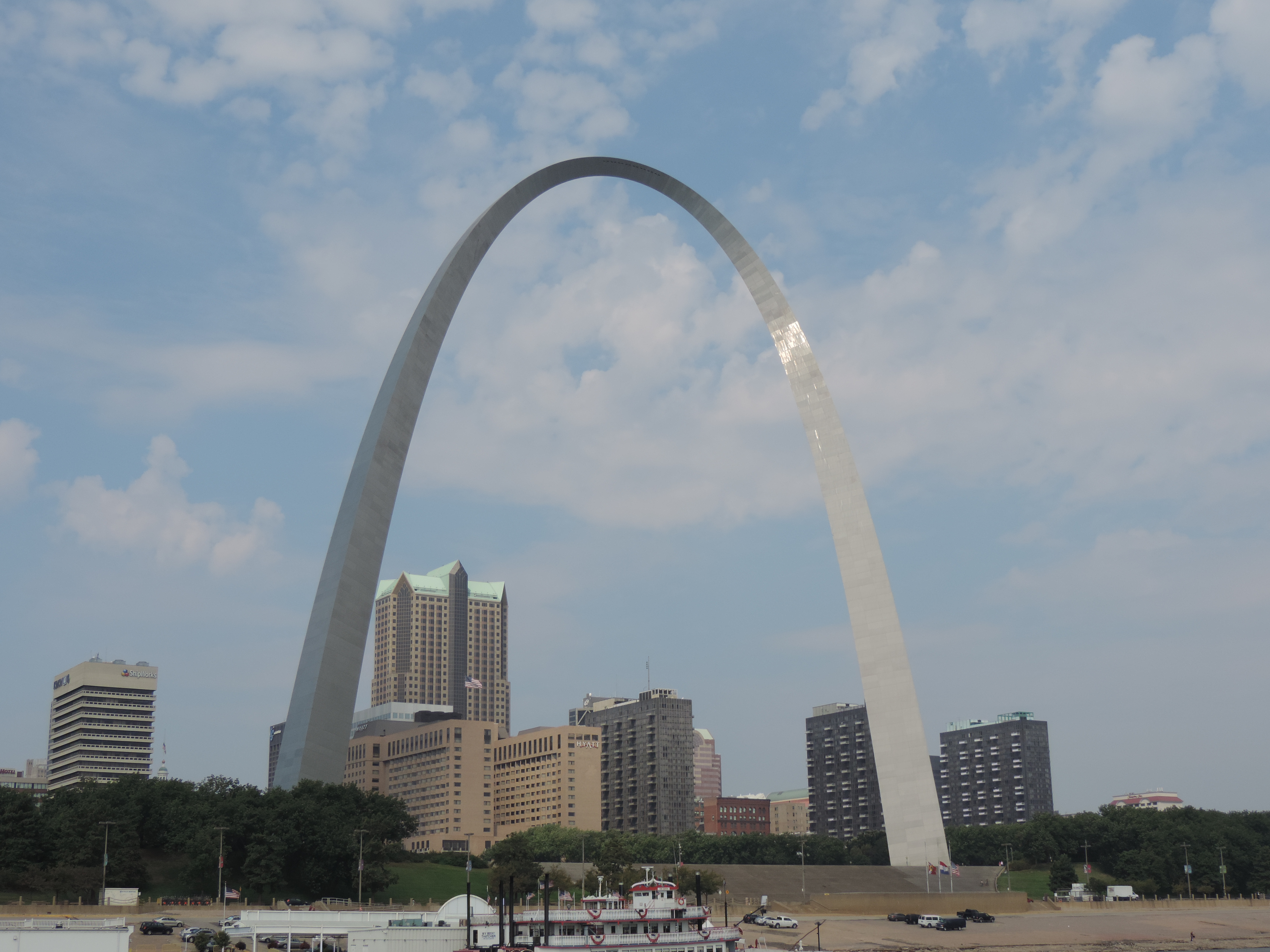
As we passed St. Louis we started encountering staging areas for the large tows that are put together to transit the remainder of the Mississippi to New Orleans. We were constantly on the lookout for small towboats moving one or two barges into position and joining them together to create the huge tows that we would be seeing on this part of the river.

2013 Cruise-2013-09-21-07-49-05-


2013 Cruise-2013-09-21-15-21-07-
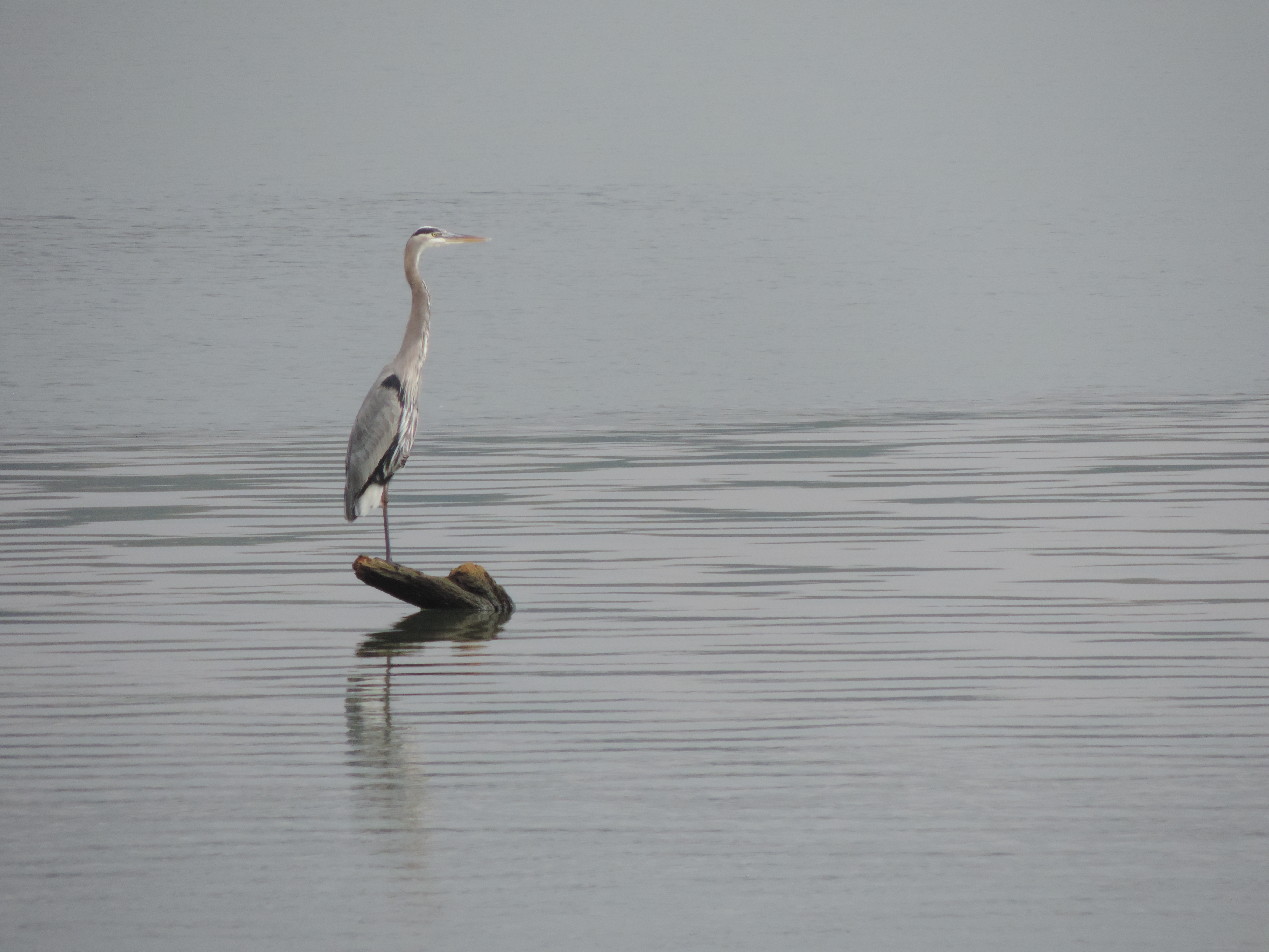
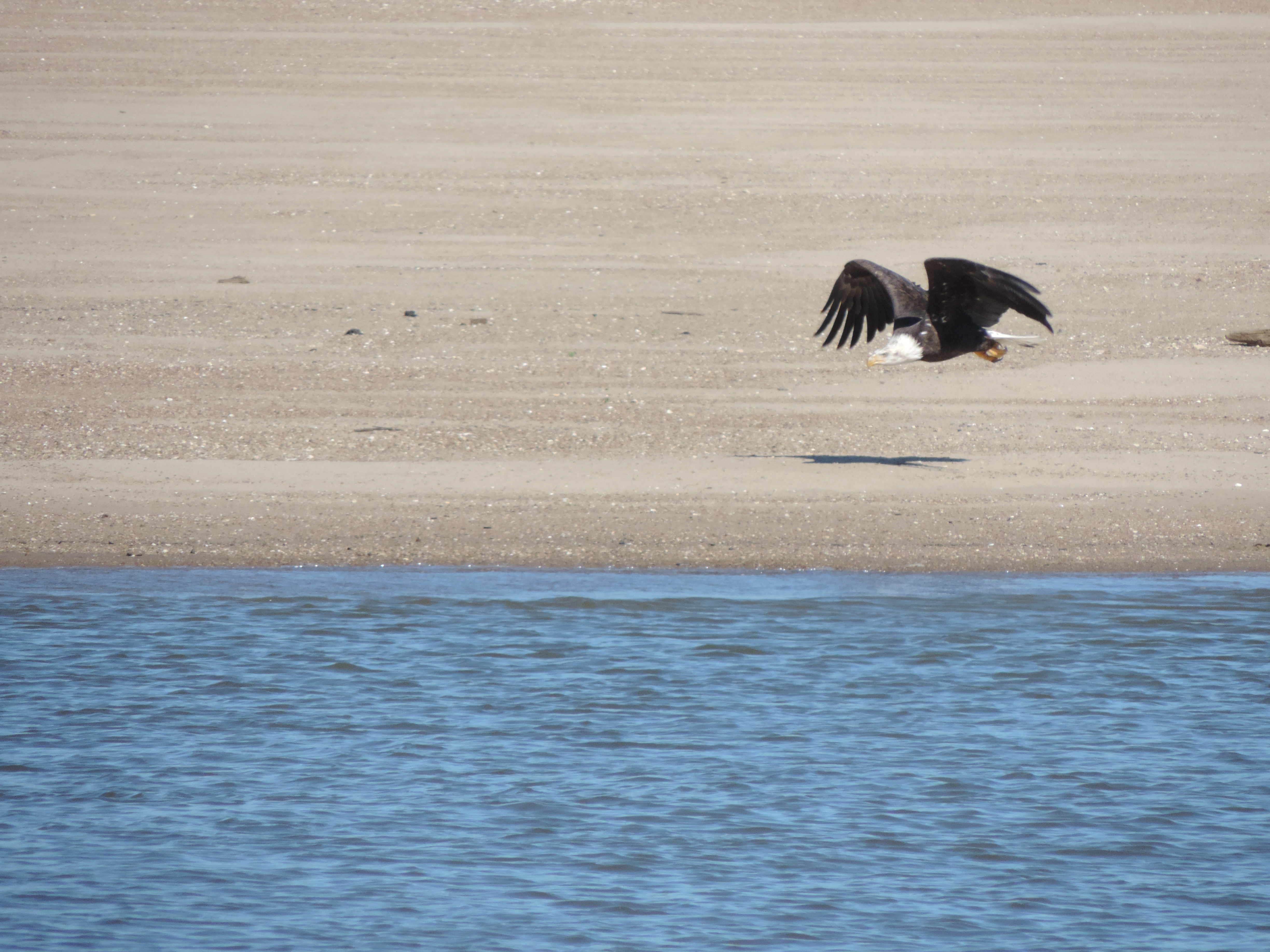
Further downstream we saw several eagles at separate locations; this one flying along a sandy area probably looking for some “found” lunch!
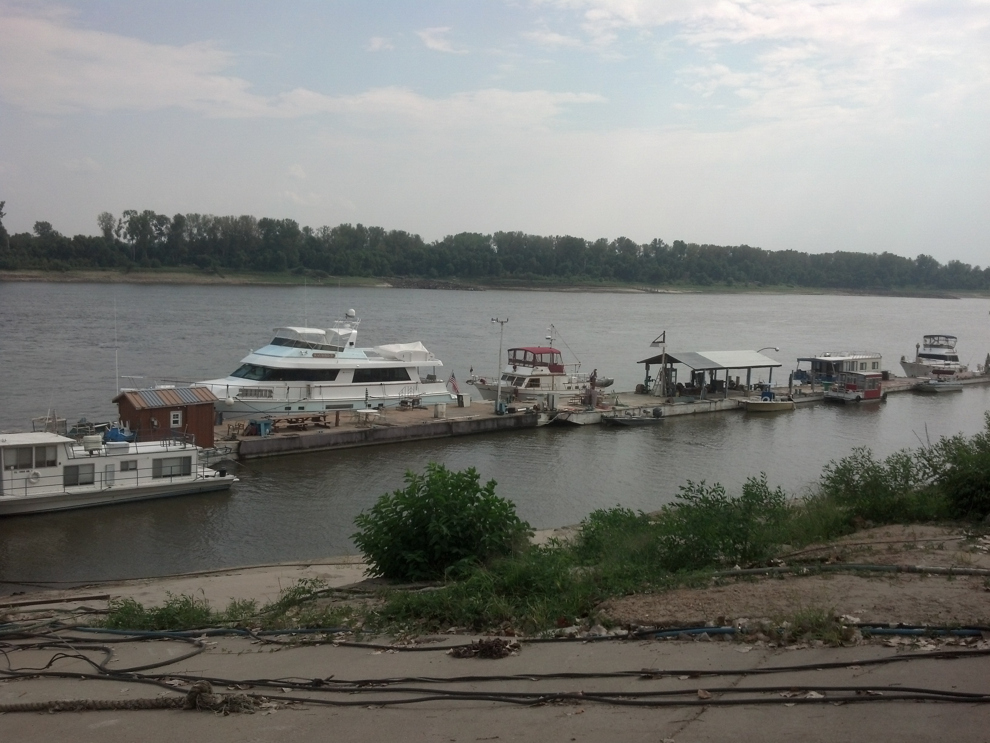


Hoppies dock

Hoppies dock

We stopped for the day at Hoppies, a well-known and must-experience stop south of St. Louis at mile 158. Hoppies consists of some old barges anchored along the RDB (Right Descending Bank) at the town of Kimmswick, Missouri. Not much to look at, but it’s the only game in town for the next 158 miles of the Mississippi River and a place that sells both diesel and gasoline fuel for boats needing to top off. Electricity and water are available, but no heads or showers. We walked into town for lunch and then joined other boaters spending the night to listen to Fern’s briefing about things we should know for the rest of our transit of the Mississippi and Ohio Rivers. Fern has been boating on the Mississippi for years and has a lot of good advice for us newcomers. One of her tid-bits that we put to good use was to always meet a tow on a straight-away or inside of the curve on the river to avoid their very strong and long-lasting prop wash when upbound; never take the outside of a tow on a curve.

One of the things you soon learn on any confined body of water is that it is important to contact the tow captain to arrange a passing well in advance of actually overtaking or meeting. This becomes even more important on the narrow stretch of the inland rivers where the tows are very restricted in their ability to maneuver and the channels are sometimes barely wide enough for them to swing their sterns to make the turn. More than once on the Mississippi we waited for a tow to come around a bend in the channel before proceeding through the bend ourselves. The tow captains have their own language to arrange meeting and passing situations with other boats. The Inland Rules provide that the primary means of arranging a meeting/passing is by VHF radio and in the alternative to sound your horn to alert the other boat of your intentions (one whistle to indicate you intend to pass on your port side and two whistles to indicate you intend to pass on your starboard side – this is at least the easy-to-understand interpretation of the rules even though it isn’t the exact language of the rules themselves). On the rivers the tow captains have incorporated the horn signals into the language used on the VHF. So they talk of a one whistle pass and a two whistle pass. Anyone boating on the inland rivers had best understand what it means: it’s not about sides of a boat – it’s about the maneuver, and it’s not my one-whistle side or my two-whistle side, or your one-whistle side or your two-whistle side. If you initiate the VHF call and want to indicate your intention to pass or meet the other boat on YOUR PORT SIDE, then you would refer to a one-whistle pass; this is true whether you’re passing or meeting the other boat. The corollary is also true: if the caller intends to meet or pass the other boat on the caller’s starboard side, then the caller would indicate a two-whistle pass. Of course, the clearest and simplest was to arrange a passing/meeting is simply to indicate in plain English that you would like to pas the other boat on it’s port or starboard side. Tow captains understand, either way, and the whole idea is to leave no doubt in either mind so there is no danger of a collision. With our AIS system, the tow captains frequently contact us in advance to arrange a meeting (they seldom pass us as even at our slow speeds we are generally going faster than the tows).

Day: 46.5SM/40.5 NM – 5H30M   Trip: 3102.9NM/3565.4SM – 530H45M

We departed Hoppies dock  at 0730 on Friday, September 20, 2013 heading a short distance to Kaskaskia Lock where we hoped to be able to tie to the river side of the bull nose on the downstream side of the lock. This lock is not a lock on the Mississippi River, but rather on a river that joins the Mississippi at mile 117. When we arrived about 1150 we were in luck – no other boaters had arrived so we took the first position along the wall. It had started to rain by the time we arrived and continued to rain throughout the afternoon, so we were happy to be off the river and cozy in our warm, dry boat. There were no amenities here, just a place to tie up that was out of the way. Later in the day a sailboat came in and tied up behind us.

2013 Cruise-2013-09-20-12-03-14-Shortly after we arrived a tow locked down from the Kaskaskia River and made an interesting maneuver. The tow was two barges wide and 3 barges long. It exited the lock on the opposite side from us (the wall was low so we could see the whole thing), the towboat unfastened from the barges while the barges were still moving slightly downstream toward the Mississippi (about 1/2 mile away), 2013 Cruise-2013-09-20-12-13-04-
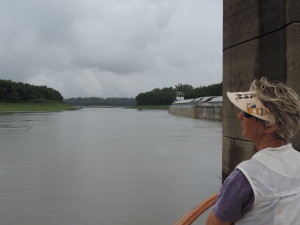
passed the barges, turned around, and reattached itself to the formerly forward end of the string of barges. After a large tow passed the mouth of the river in the Mississippi, it backed out into the Mississippi, turned and proceeded upstream. A crew member who was on the forward edge of the tow told us that this was the only way the towboat cold get the tow turned to head upstream in the Mississippi. If the tow proceeded to push the barges into the Mississippi the current would sweep the leading end downstream and the towboat could never get the two turned around 180 degrees to head upstream. By backing into the Mississippi the two captain could back downstream with the current and by the time it cleared the side river the entire tow wold be headed upstream. Pretty darned clever! The whole turn-around maneuver took all of about 10 minutes including unleashing and refastening the towboat.

Day: 42.1SM/36.6NM – 4H20M    Trip: 3139.5NM/3607SM – 535H05M

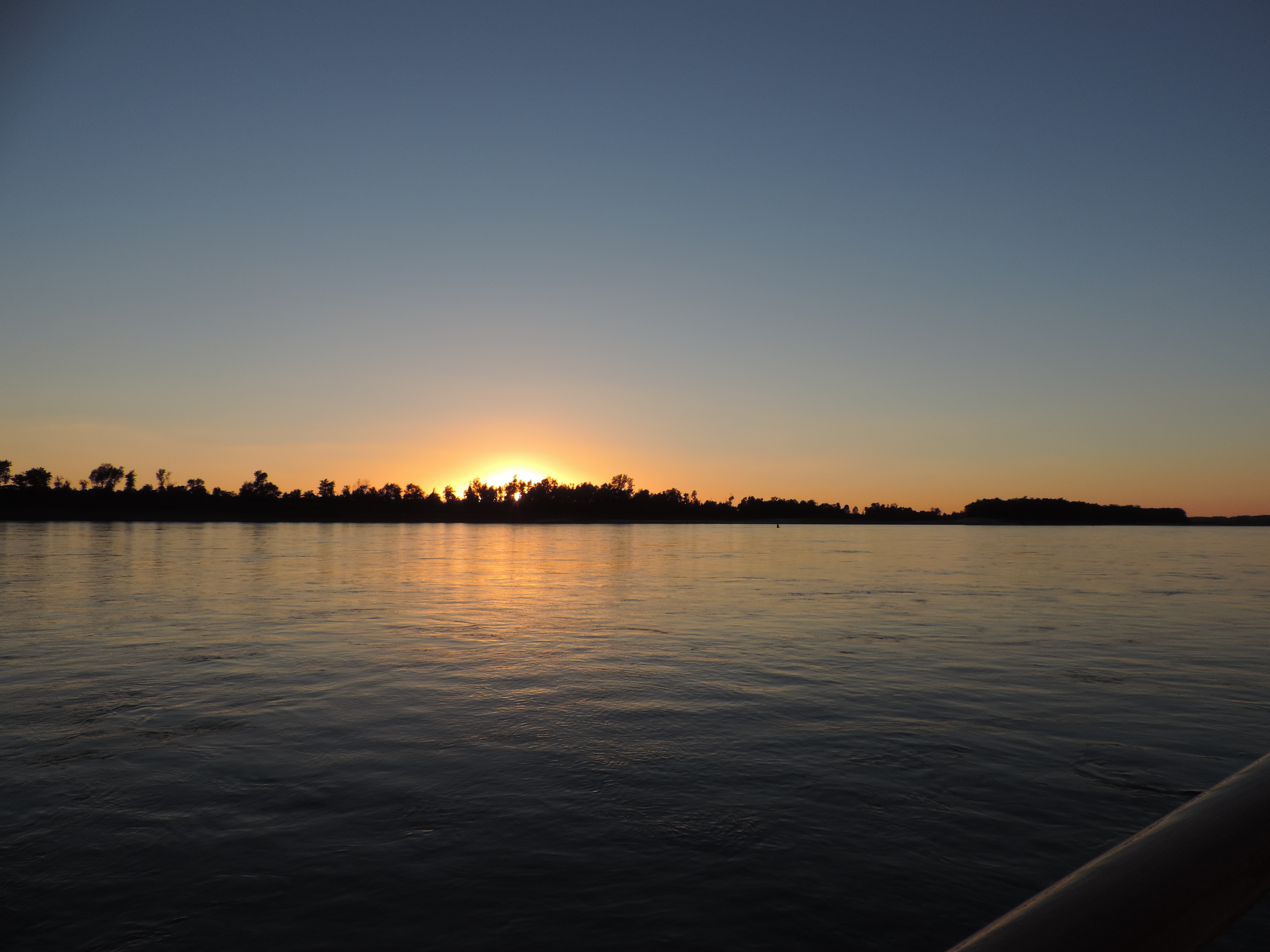
The next length of the Mississippi would be the longest and provide the fewest opportunities to find a good anchorage (there would be no marinas or docks until we were in the Ohio River). Consequently, we set out as soon as we could see to safely navigate, about 0645 on September 21, 2013. The rain had stopped and it was going to be a clear and sunny day. We were hoping to find an anchorage behind one of the many wing dams which have been constructed by the Army Corps of Engineers to help mother nature control the flow of current in the rivers, but the unintended (who knows) consequences are that the formerly deep water downstream of the wing dams have silted in and the lower water level of the river when we passed through eliminated most of the anchorages discussed in the cruising guides. We passed up several potential anchorages at around mile 40-45 but that was too early in the day and would have resulted in a long day the next day when we would be going upstream on the Ohio River where there were even fewer anchorages. By late afternoon we started checking anchorages which had formerly been good for boats our size at around mile 20, but all were silted in and too shallow. We were running out of time so turned back upstream and proceeded against the 2.5 MPH current to an extensive shallow area at about mile 24.5 on the inside of a sharp curve in the river about 200 yards off the main channel on the LDB (Left Descending Bank). We looked at several places there behind wing dams (and out of the current) but they, too, were silted in and unavailable. At 1730 ended up anchoring in the river in about 9 feet of water with good holding in sand. Even if the river 2013 Cruise-2013-09-21-18-45-35-level dropped a few feet overnight we would still have enough depth to get back into the main channel. We checked with a passing tow captain to confirm that we would be out of the way of all river traffic; the only thing we had to be concerned about was “run-away” barges – barges that had broken loose from tows and were drifting downstream on their own with the current. After we had anchored Bob measured the current – it was flying past at 3 MPH – we let out 150 feet of chain (at 1 pound per foot) to keep us steady during the night. Throughout the night we were awakened from time to time by the sound of tows backing down and accelerating their huge diesel engines to maneuver the sharp bend in the river. We did have a nice sunset that evening!

Day: 104.0SM/90.5NM – 11H00M   Trip: 3230.0NM/3711.5SM – 546H05M

Sunday, September 22, 2013 – Into the Ohio River

We had the anchor up (and 150 feet of chain) and were underway at 0650. We hoped to get to Lock 52 at mile 939 on the Ohio River before nightfall. The  fast current of the Mississippi River pushed us along at over 9 MPH and by 1015 we were departing the Mississippi River and turning into the Ohio River at mile 981 (mile 0 of the Upper Mississippi River) at Cairo, Illinois. The character of the water changed almost immediately from a relatively narrow and turbulent body of water on the Upper Mississippi to a broad and fairly calm body of water on the Ohio River. The tow traffic picked up considerably, however, as the lower Ohio River is a major staging area for tows transitioning between the Ohio and the Mississippi. Many small towboats were moving barges around to break up large tows for their trip up the Ohio, or addition additional barges to tows heading down the Mississippi.

2013 Cruise-2013-09-22-12-03-36-

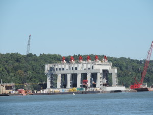
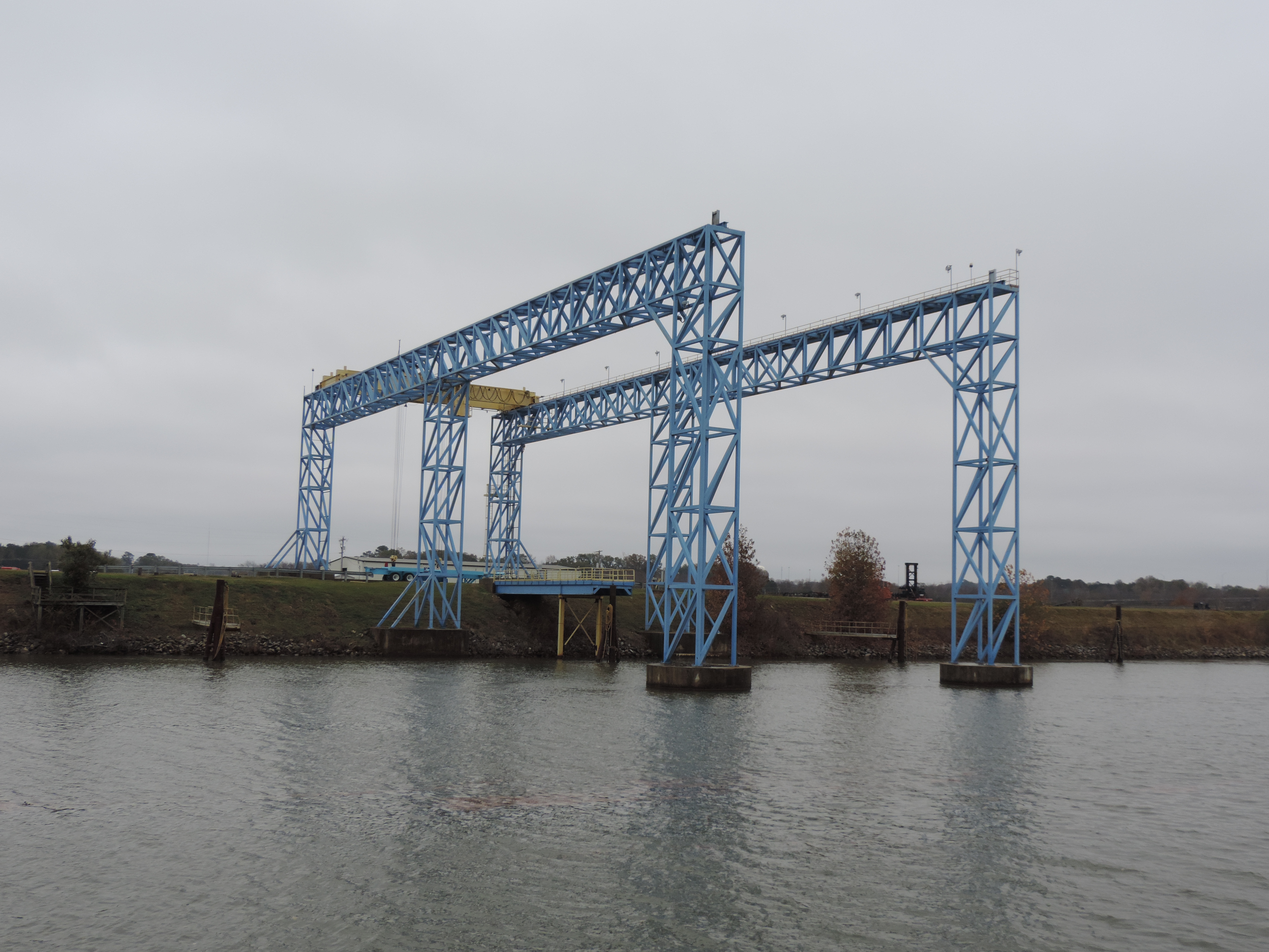
Dam modules already in place

2013 Cruise-2013-09-22-12-03-15-

Locks apparently completed and in place

2013 Cruise-2013-09-22-12-00-39-

Construction site for dam modules

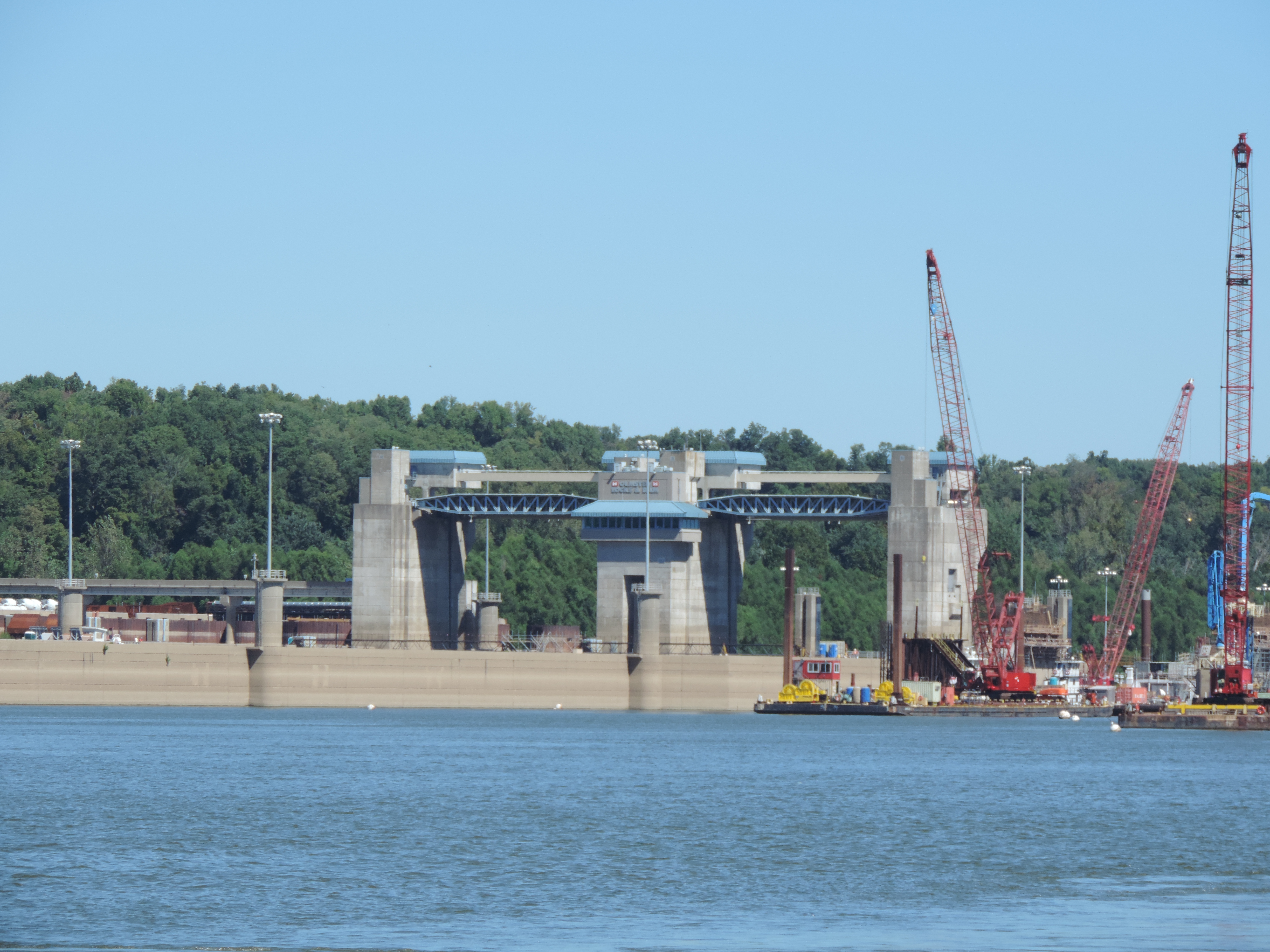
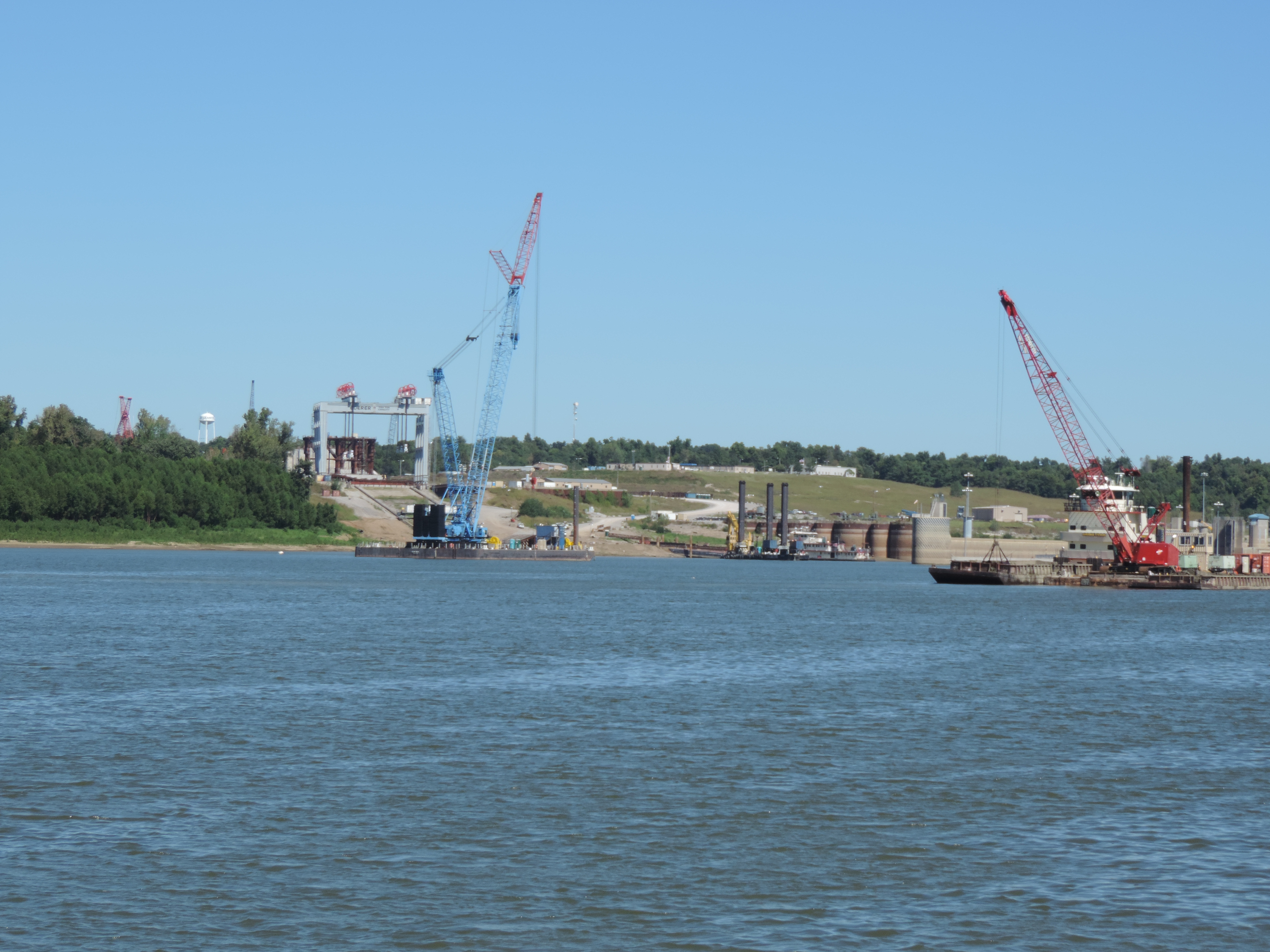
We soon passed a major Army Corps of Engineers Construction site for the Olmstead Locks and Dam at mile 964 that is projected to cost (with over-runs) upwards of a BILLION dollars. This single dam will replace existing dams number 52 and 53. Some people we met who were involved in the operation of other dams referred to it as a major boondoggle and a pit of corruption and payoffs; some even questioned whether it would be completed at all.

There was an incredible amount of construction traffic connected with the project – land-based vehicles as well as towboats large and small.

The lock structure appears to be completed and the dam itself is being constructed in modules fabricated ashore than placed into position in the prepared riverbed. The technique was developed in Europe where it has been used successfully in a number of projects, but has never been used before in the United States.


2013 Cruise-2013-09-22-12-45-47-
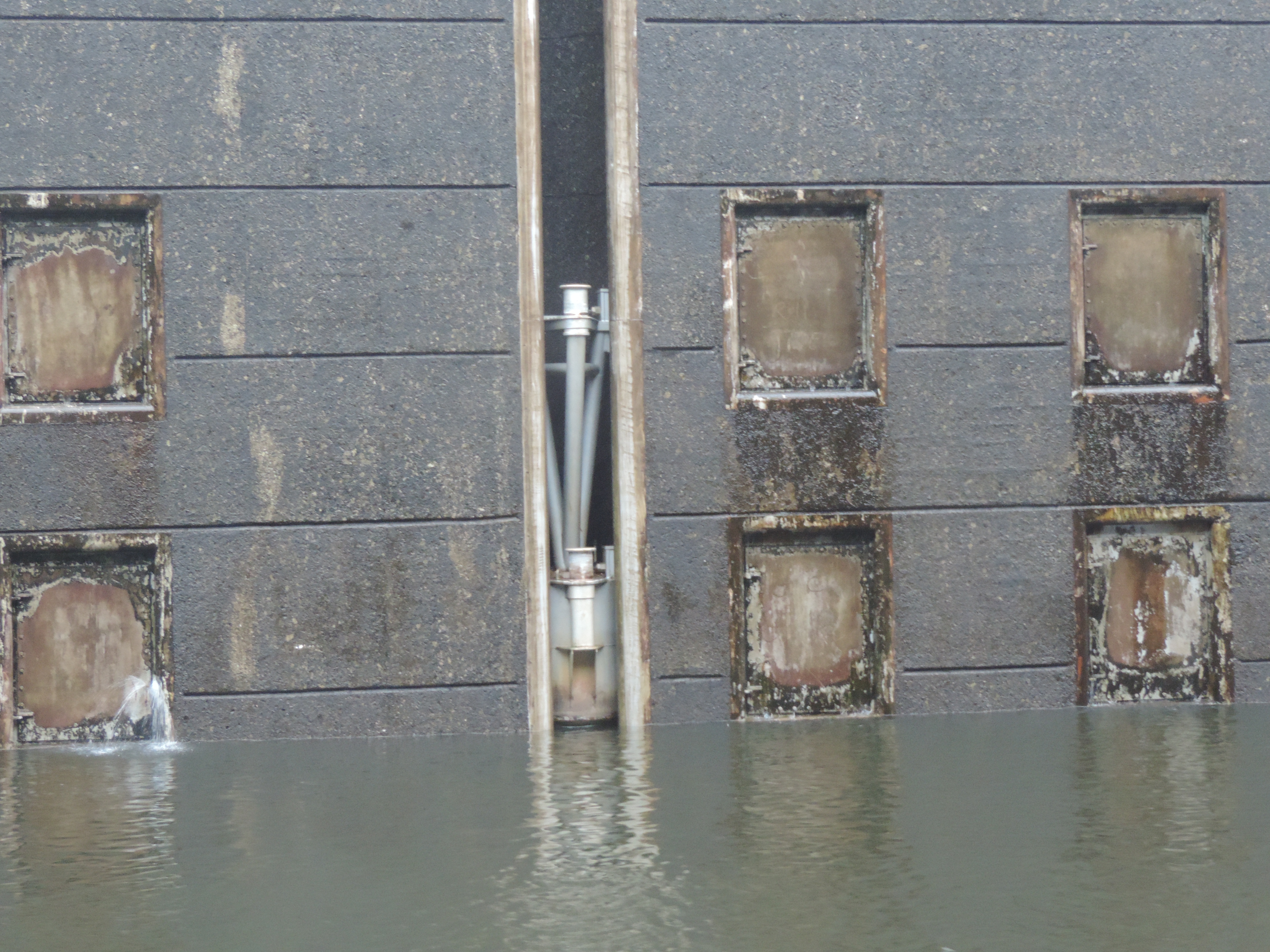
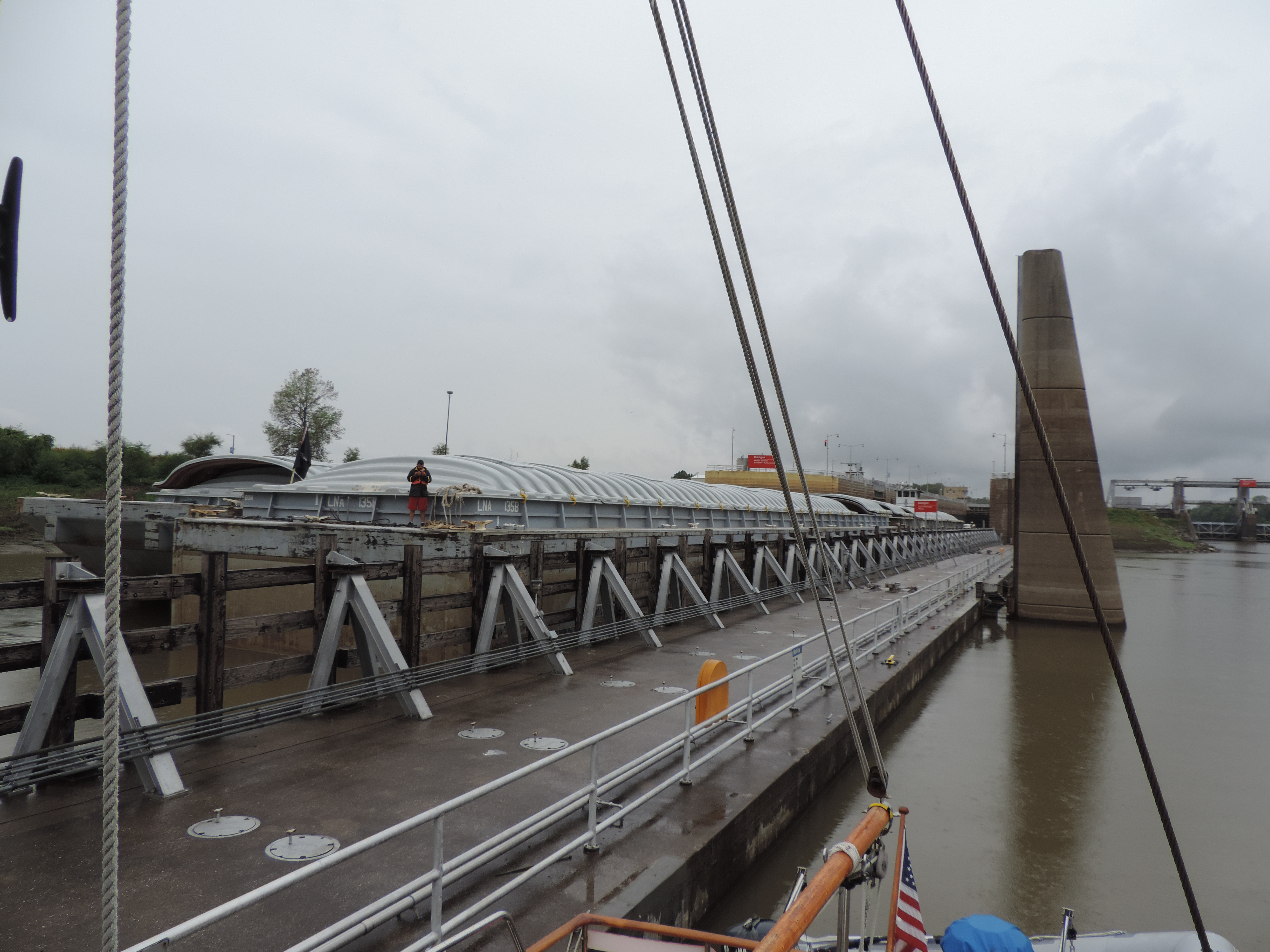
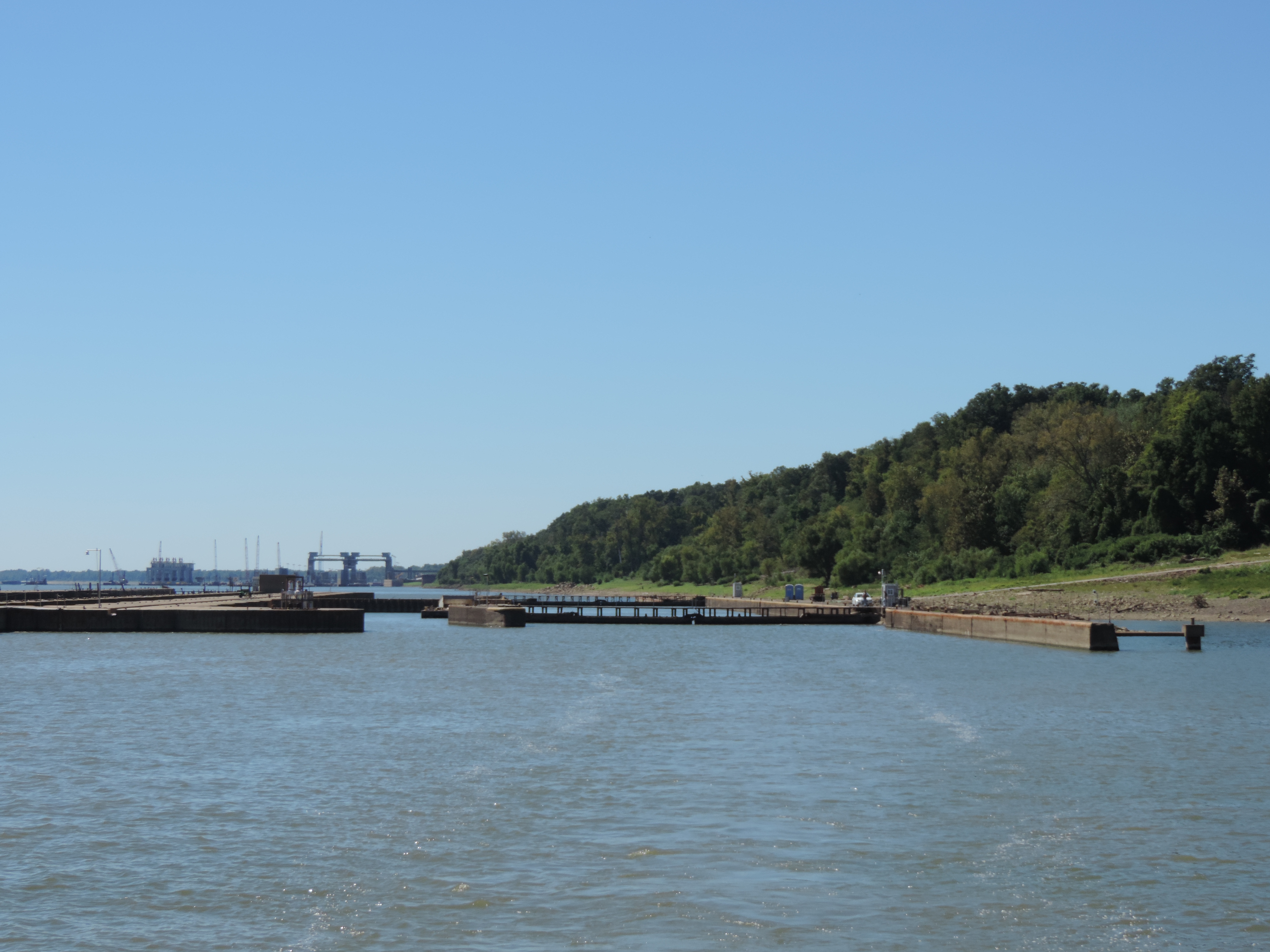
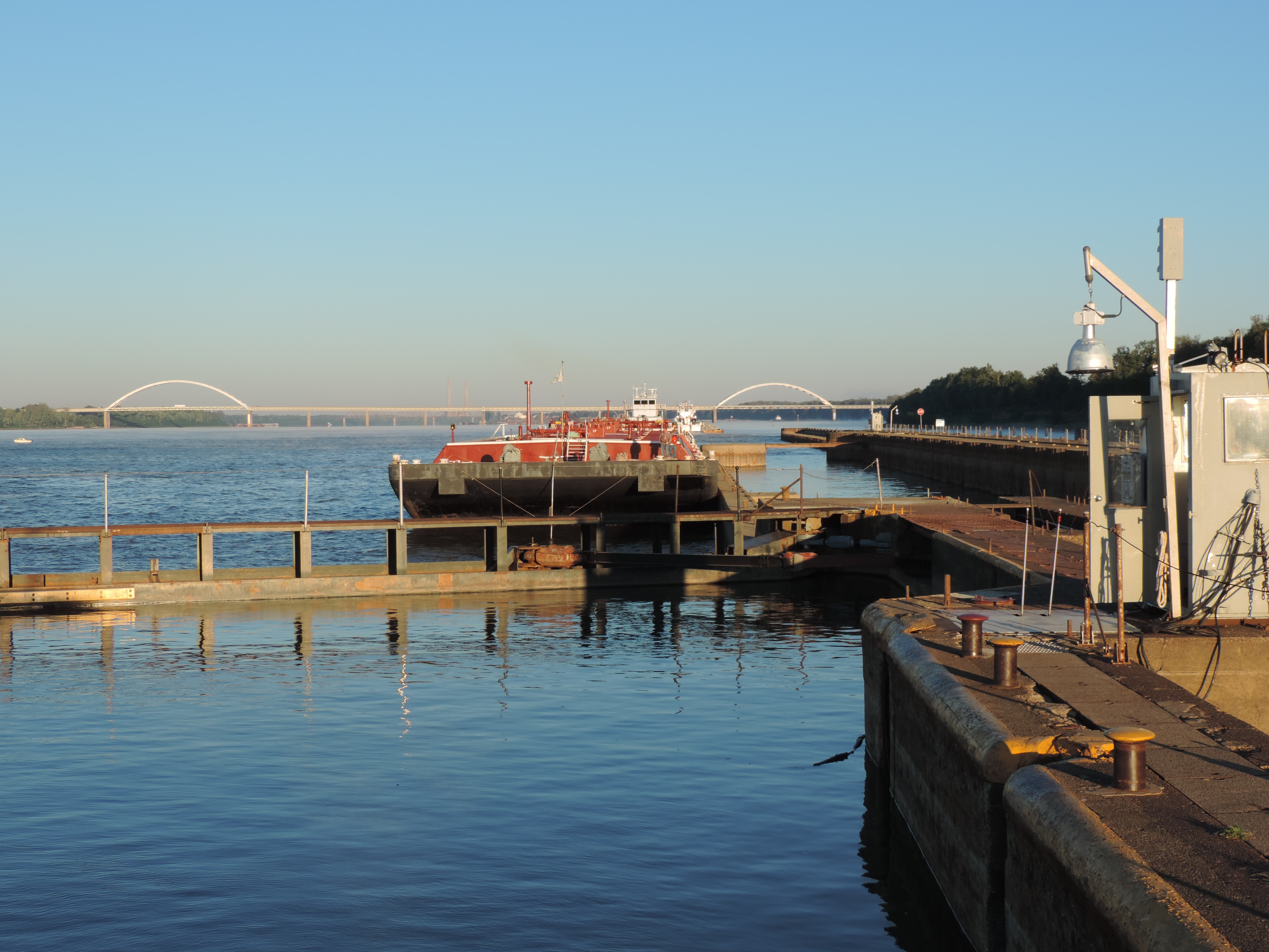
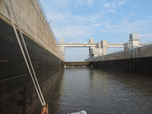
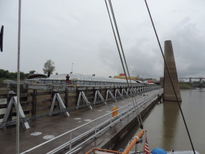
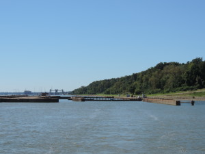
Shortly after passing the construction zone we were able to enter Lock #53 at mile 962. This photo shows Lock #53 from the upstream side after we exited the chamber looking back with the new dam construction site in the background.


2013 Cruise-2013-09-22-14-52-12-

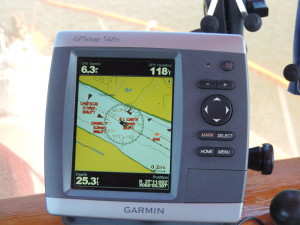
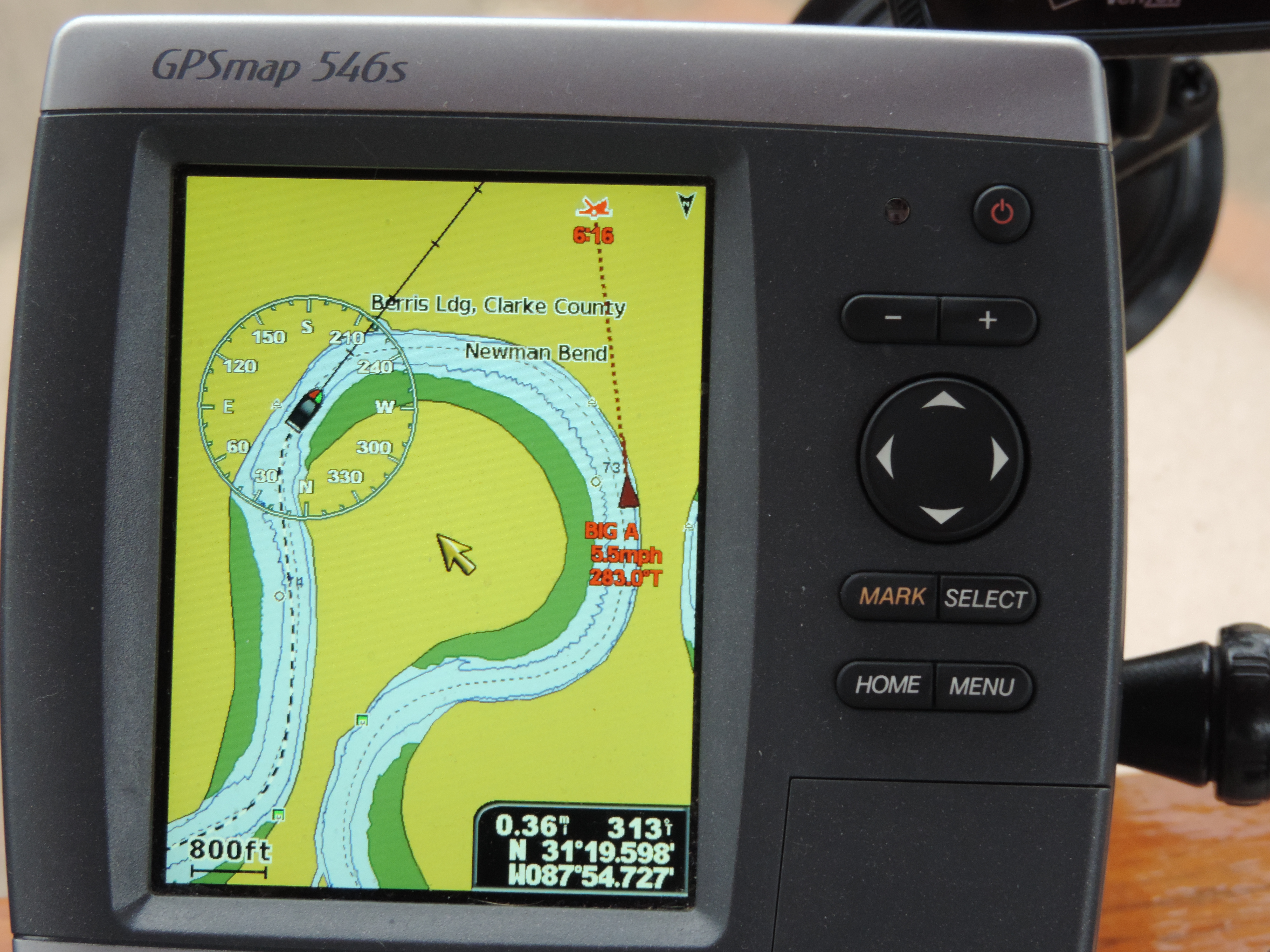
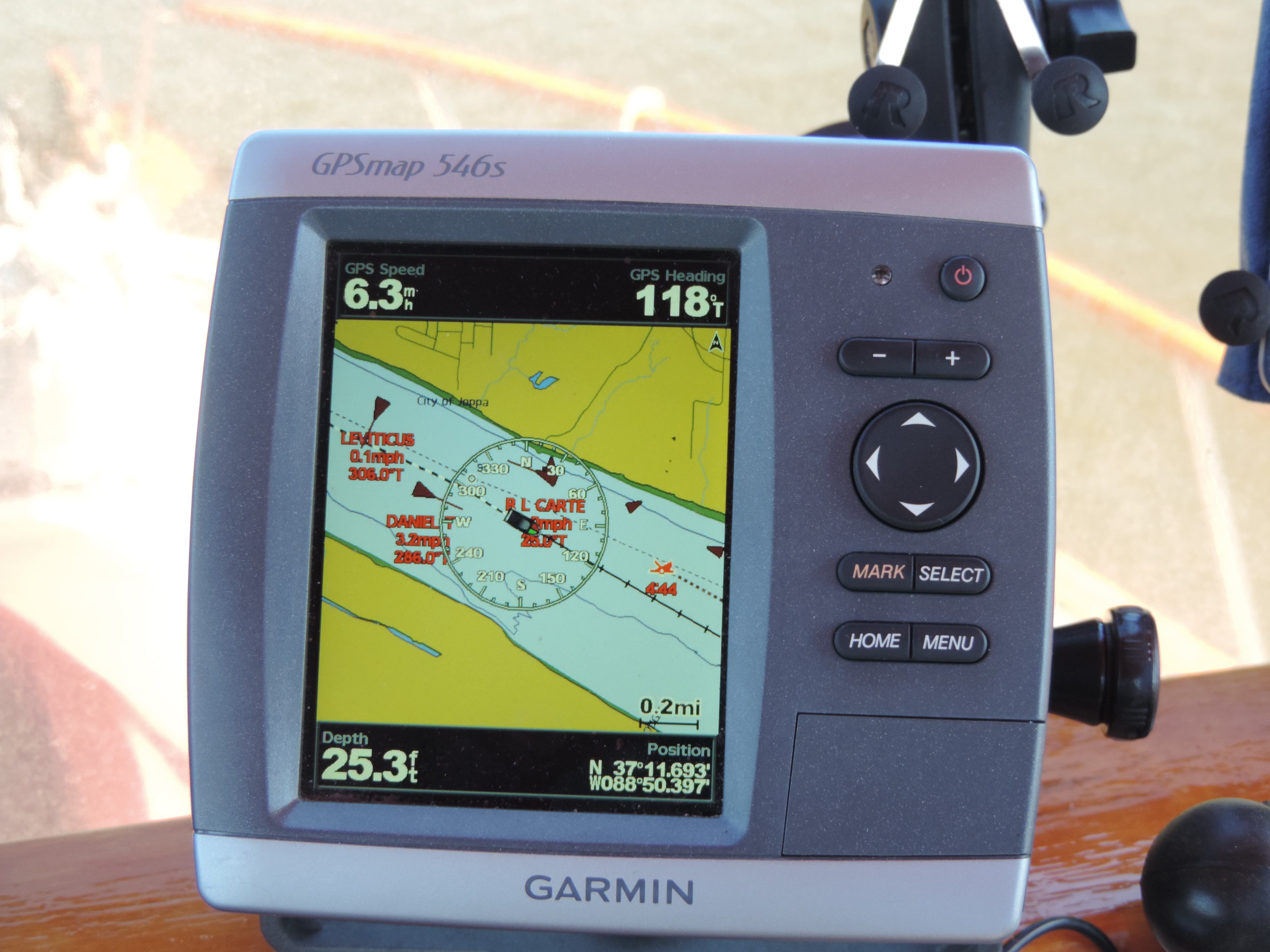
Chartplotter displaying AIS data from nearby tows

We continued to pass several staging areas as we moved up the Ohio approaching Lock #52. Here is a view of our chart plotter (GPS) showing a number of other vessels (all tows or solitary tow boats). The chartplotter shows our speed as 6.3 MPH, our heading as 118 degrees true, and the water depth as 25.3 feet. In the lower right corner is our lattitude/longitude.


We arrived at lock #52 too late in the afternoon to proceed any further upstream – there are no anchorages within range for the remaining daylight – so we anchored on the Kentucky side of the river about 1/2 mile below the dam. Like the previous night, the current was flowing at about 3 MPH (we learned the next morning that the dam was releasing extra water to lower the pool above the dam so some needed repairs could be made to the dam’s wickets. The dam operator told us to call them early the next morning to let them know we wanted to lock through and to get an approximation of when we would be able to go through. We set the alarm for 0530 so we would be ready to go and call them at 0600.

About a hour after we arrived a smaller 36 foot trawler anchored about 100 yards off our port side where the current from the dam was creating more waves than where we were anchored closer to shore and with a little protection from a jetty of land that directed the main flow of water away from us (toward their anchoring area). About an hour later they moved to directly behind us and hopefully had a less “rocky” night.

Day: 67.3SM/58.6NM – 10H05M   Trip: 3288.6NM/3778.8SM – 556H10M

On Monday, September 23, 2013 we were up and at-em by 0530. We had done everything to get ready to get underway except raise the anchor. At about 0600 we heard the other trawler call the lock and let them know that there were two of us who wanted to lock through at their earliest convenience. We confirmed our status with the lock operator. The lock replied that it would be at least six hours before we could lock through since they were currently in the process of locking through one tow and another was on its way. Both of us let them know that we’d be standing by for further instructions and would be ready to go whenever the lock was available.

About 15 minutes later a different voice contacted us via the VHF and told us he had figured out a way to get us through early, and that we should immediately proceed to the lock chamber, but hurry as he was putting us in ahead of a tow that was approaching upbound (we could see the tow about a mile below the lock. We both immediately got our anchors up and headed for the chamber which was slowly opening for us to enter.

2013 Cruise-2013-09-23-07-17-29-

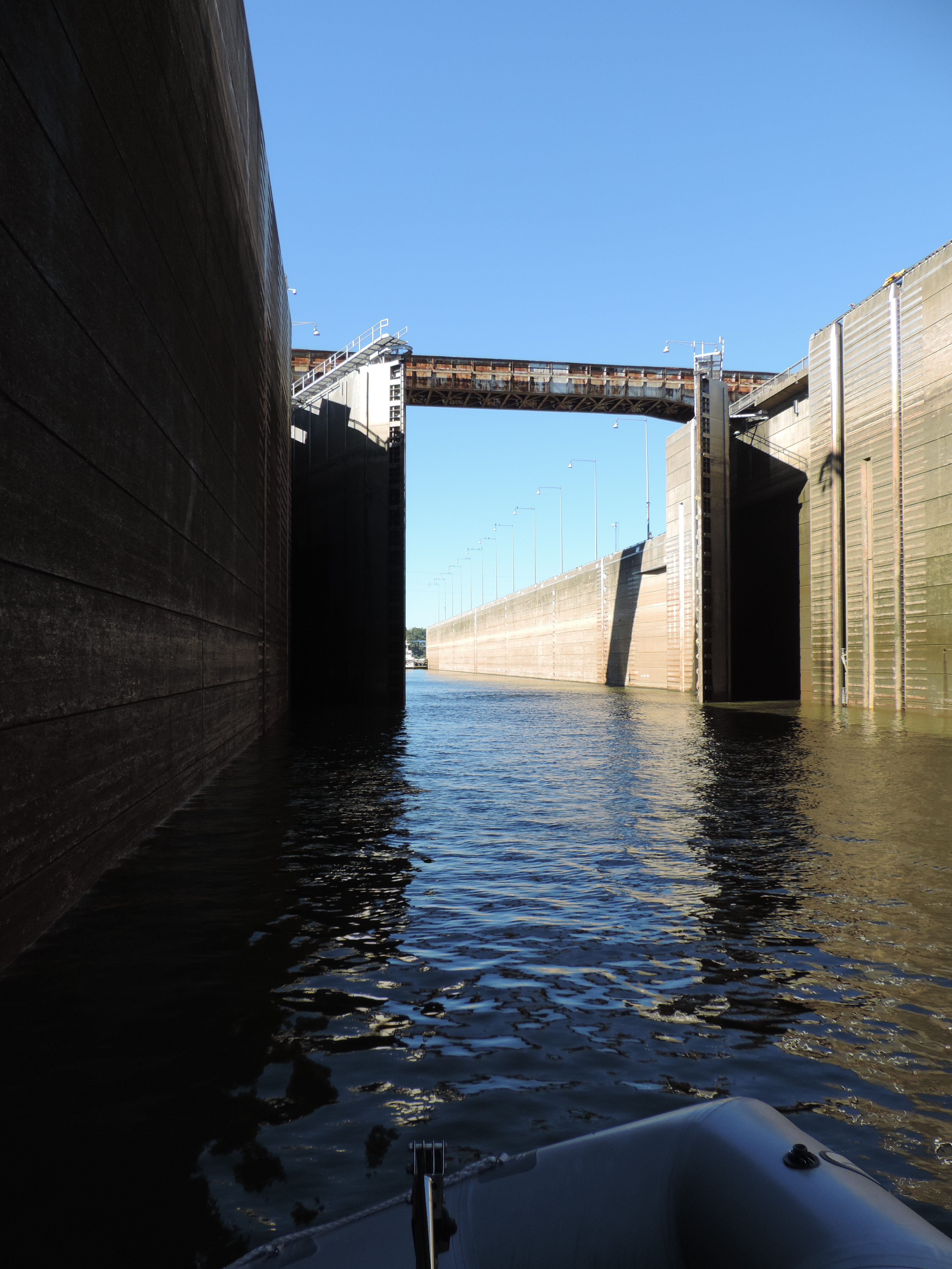
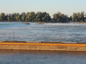
Lock #53 with upbound tow waiting to enter after we exit

2013 Cruise-2013-09-23-07-17-34-

View across the dam with the far wickets lowered to allow more water to escape. We had anchored well downstream of the lock and away from the strongest rushing water.

2013 Cruise-2013-09-23-07-20-40-

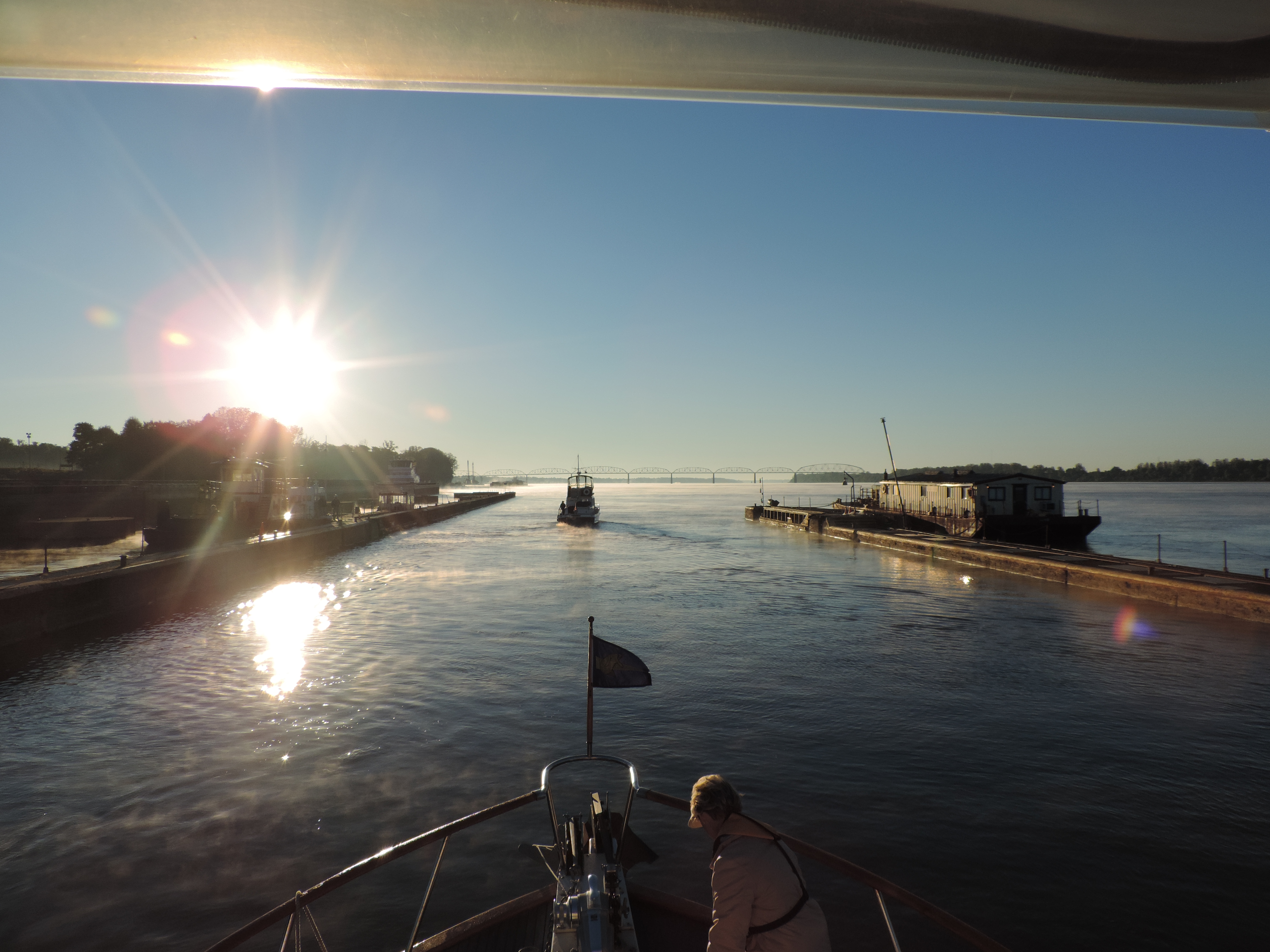
Exiting lock #52 into the sunrise. Judy is securing lines used to tie to the lock wall.

Once we got into the chamber and had the opportunity to talk with one of the lock hands who directed us to the pins he wanted us to take, we learned that between the time the lock was originally contacted and the return call the shift had changed; the current shift supervisor realized that both of us had been anchored overnight and did everything he could to get us through ahead of the tow that was slowly approaching. While we were being raised in the chamber the approaching tow actually tied off to the wall below the dam and waited for our departure and for the lock to be “turned around” so he could enter after we exited.


We then continued up the Ohio River, past Paducah (where the Tennessee River enters the Ohio at mile 932) to the mouth of the Cumberland River at Ohio River mile 920 and turned up the Cumberland River heading to Lake Barkley and the Barkley Lock and Dam, another 30 miles upriver. The other trawler had gotten ahead of us at the mouth of the Cumberland because we waited for a downbound tow before negotiating a blind hairpin curve in the river, but by th2013 Cruise-2013-09-23-14-55-17-
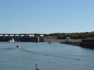
e time we arrived at the Barkley Lock and Dam we were back together again (they had to wait for a tow locking through). As we approached and called the lock operator we were told that the lock was ready for all of us (there was also a small fishing boat waiting to lock through) and to enter the chamber as soon as a tow had cleared the gate area.

2013 Cruise-2013-09-23-15-03-36-

Lower gate closing

2013 Cruise-2013-09-23-15-03-52-

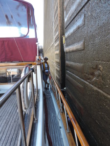
Judy tending to line around floating bollard (also referred to as a “pin”)

2013 Cruise-2013-09-23-15-26-44-

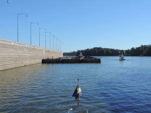
Exiting the lock with the next tow waiting to enter


2013 Cruise-2013-09-23-15-39-13-


A short distance later and we were heading to our assigned slip at Green Turtle Bay Marina on Lake Barkley at Cumberland River mile 30.8, where we would be the next two nights and would catch up with Tie A Knot and our friends Jann and Gary.


Day: 50.9SM/44.3NM – 9H30M   Trip: 3332.9NM/3829.7SM – 565H40M

Lake Michigan here we come! (just as soon as he wind slacks)

Tuesday, August 20, 2013 – St. Ignace, Michigan

2013 Cruise-2013-08-18-12-59-31-After our delightful day trip to Mackinac Island on Sunday, where we took a horse carriage tour and biked around the island’s 8-mile periphery (and ate ice cream and fudge), we were ready to depart the area and start heading down the eastern shore of Lake Michigan. Not! The wind forecast for the next several days was going to put 15-20 knot wind and 3-4 foot waves in the area we needed to transit from St. Ignace for the next several days. So we’re staying put in St. Ignace until at least Thursday (based on the current weather forecasts and wind/wave prediction models) and we may not get out of here until Friday – but Friday is currently a real likelihood with wind predicted at less than 10 knots and waves less than one foot. That’s more to our liking. It’s not that we can’t manage rougher seas, but we prefer not to as long as there is a reasonable alternative by waiting a few days. Seas of 4 feet become uncomfortable, and anything over four is very uncomfortable for Sanderling’s human passengers!

Thursday, August 22, 2013 – Still in St. Ignace, but not for long!

2013 Cruise-2013-08-22-14-04-07-

The crystal clear water of the harbor at St. Ignace, Michigan

Yesterday we debated the pros and cons of heading out this morning and going to Northport or Charlevoix, Michigan. Based on the weather forecasts (waves 2-3 later in the afternoon) we decided to wait. I got up early this morning (0700) and checked the forecast and it was about the same as yesterday’s, so we decided to stick with our earlier plan and wait for another day. Tomorrow and Saturday should be nearly perfect conditions.

We’re now going to head to Traverse City on Grand Traverse Bay by Saturday noon or so, and should be back out to the Northport (near the mouth of the bay) by Saturday evening. The purpose of the trip is to get to a CVS drug store so Judy can get a prescription filled. We originally thought there would be some other options about getting to that CVS via rental car, but the rental car locations seem to be very sparse in this part of the country so the easiest thing to do was to just cruise to Traverse City (the closest CVS). Weather forecast for Sunday is iffy, so we may be stuck in Grand Traverse Bay for a day or so before we can venture out onto Lake Michigan again.

In any event, we’ll get underway around 0600 Friday (tomorrow) morning, cross into Lake Michigan (from Lake Huron) and then head south along the eastern coast of Lake Michigan. It’s about 70 statute miles from here to Northport and about 60 to Charlevoix, so we’ll take either depending on how well we advance over our route. We should be able to make Northport without any difficulty.

We’ve had a nice time here in St. Ignace but we’re ready to leave and get on with our cruise! We don’t like waiting due to weather, but that’s one of those things that we have no control over!

Friday, August 23, 2013 – Northport

2013 Cruise-2013-08-23-07-00-00-

Mackinac Bridge in the early morning sunlight

We departed St. Ignace at 0625 this morning (even before sunrise) and about 0700 crossed under the Mackinac Bridge and into Lake Michigan. There was a bit of a current opposing us as we headed west for about 14 miles before turning south through the shipping channel and started our trek down the eastern side of the lake. We’re anchored tonight at a bay just to the east of Northport, Michigan, in about 15 feet of very clear water.

Our cruising plans for the next few days changed about mid afternoon today when we discovered that there was a rental car agency associated with a collision center in Frankfort. Because of the forecast for high winds starting on Sunday and continuing perhaps for several days, we decided to get as far south as possible tomorrow (Frankfort) where Judy will be able to get a rental car on Monday and drive to Traverse City to the CVS where her prescription are waiting for her. We’ll then continue on south when weather permits, perhaps by Tuesday. Grand Haven, where we want to be in a marina by the 29th so Judy can fly out of Grand Rapids on the 30th, is two days away for us from Frankfort; as long as long as we have two days of good weather we’ll make it without difficulty.

We have only about 70 miles to go tomorrow to get to the marina in Frankfort where we now have reservations, so we’ll get an early start again tomorrow morning. We should get there by mid-afternoon at our slow speed of 7.3 MPH!

Day: 78.4SM/68.2NM  – 10H55M     Trip: 2445.9NM/2810.9SM – 427H10M

Monday, August 26, 2013 – Frankfort, Michigan

We made it to Frankfort from Northport on Saturday, August 24th before the bad weather arrived later that night.

IMG_20130825_131714_211Sunday was blustery with wind from the south at over 15 knots; the nearby beach was filled with sunbathers, kite surfers, paddle boarders, and surfers! It looked like Cocoa Beach on a good day! We spent the day on Sunday checking out the main street of the town (only 1/2 block away), finding ice cream stores and new restaurants.

Judy arranged for a rental car from the local collision center for Monday so we could drive to Traverse City to go to a CVS drug store to pick up her meds.

IMG_20130826_133628_526

The top of the dunes north of Frankfurt at Sleeping Bear Dunes National Seashore Park

IMG_20130826_130218_698

Almost a 45 degree bank of sand leading right down to the lake’s edge

On the way back we drove through the Sleeping Bear Dunes National Lakeshore Park – a spectacular area of dunes between Frankfort and Crystal Lake on the south and Northport to the north. We’d seen the dunes from the water on Friday and they were spectacular; seeing them from the tops gave us an entirely different perspective. Of course my Golden Age Pass got us into the scenic drive at no charge! Along the course of our drive we stopped to do a little shopping in the local Glenn’s Supermarket – a great store for replenishing.

Weather for the next three days is forecast to be great – waves less than 1 foot and wind around 5 to 10 knots – our kind of weather for cruising on the lake. We’ll depart around 0800 heading about 55 miles to Ludington where we’ll anchor for the night. The next day we hope to get around 40 miles to White Lake and the day thereafter 30 miles to Grand Haven. We’ll make it as long as the weather holds.

More later!

Saturday, August 31, 2013 – Muskegon, Michigan

On Tuesday (August 27th) everything looked good, weather wise, when we got up at 0630 despite overcast skies and light rain. Forecast from Frankfort to Ludington looked good all the way with winds out of the north and waves 1-2. We cast off from the dock at 0800 and were soon southbound along the Michigan coast heading to Ludington. The first part of our route took us on a long stretch and about 5 miles offshore in order to make Little Point Sable. By the time we reached Little Point Sable at 1400 the seas had built to about 3 feet and were getting rough, with wind from the southwest at about 15 knots. After rounding the point the seas increased to 3-4 and for the next hour and a half we were tossed about quite a bit heading to Ludington which was the closest harbor. We actually had to go past the harbor entrance by about half a mile in order to work our way back into the harbor without having a beam sea which would have rolled us even more than taking the waves at at 45 degrees angle. We were both seated and hanging onto the seat backs and we both wondered how sore we’d be in the morning from bracing ourselves. As soon as we entered the breakwater everything calmed down and it was like we had suddenly been transported to a different place! We looked at several anchorages which were identified on a web site, but decided we didn’t like either of them due to depth and what appeared to be “clutter” on the bottom (it shows up on our depth/fish finder), so we moved to a 12 foot area at the southeast corner of the harbor and spent a very restful night despite the cement plant 1/4 mile to the north!

Day: 55.0SM/47.9NM – 8H15M      Trip: 2553.7NM/2934.4SM – 444H45M

The forecast for Wednesday (August 28) was again good and when we awoke at 0630 everything seemed OK again! So again, we decided to go out and if it was good we’d continue as far as we could until the afternoon winds came up, perhaps we could get as far as White Lake, about 50 miles. We departed the anchorage at 0715 and threaded our way through numerous small boats trolling for salmon (they’re congregating getting ready to spawn and enter the river there) – all the fishing people seemed to be enjoying themselves, but with all their lines trailing behind their boats they do not like to alter course, so we picked our way around them. Upon exiting the breakwater the lake was quite calm and we again headed south. We added some rpms to cruise at about 8 MPH in order to arrive at our destination a little earlier than we would at 7.3 MPH. As it turned out the weather cooperated fully and at White Lake we decided to keep going all the way to Muskegon (about 12 miles further down the lake) to take advantage of the good weather and ensure that we’d get there in plenty of time to get Judy to the airport on Friday morning. We entered the breakwater at Muskegon at 1445 and had the anchor down in about 10 feet of water in Snug Harbor (northwest corner of the harbor) by 1510. We happened to anchor on a direct path between a public boat launching ramp in a state park and the harbor channel, so every small fishing boat in the area passed by us on the way to or returning from fishing late into the evening and the next morning at first light. There were so many small boats passing into the evening that we turned on all three deck/spreader lights to better illuminate Sanderling rather than relying only on the anchor light and left them on late into the night even after we went to bed. The boats were fishing for salmon as well as bass.

Day: 58.4SM/ 50.8NM  – 7H55M   Trip: 2604.6NM/2992.8SM – 452H40M

On Thursday (August 29) we only had to cross Muskegan Harbor to get to our marina – Great Lakes Marina – where we would spend the next seven day while Judy flies to Kansas for her brother and sister-in-law’s 50th wedding celebration and her mother’s 92nd birthday. We got a rental car from Enterprise (where we have a corporate account) on Friday morning and I drove Judy to the airport in Grand Rapids for her 1215 flight. I’m keeping the rental car for the week she is gone so I can see some of the sights in the area, get to restaurants and do some boat shopping, if necessary.

Day: 30.0SM/2.6NM – 0H45M     Trip: 2607.2NM/2995.8SM – 453H25M