Posted December 8, 2013
The weather cooperated and we were able to leave Dog River Marina on the west side of Mobile Bay about 0900 on Thanksgiving Day. We waited to depart to give the wind on the bay a chance to die down a little more and make our crossing easier. Three other faster boats left at the same time and by the time we had traveled the roughly 24 miles down and across the bay they were well out of radio range. We entered the Gulf Coast Intracoastal Waterway at 1235 at mile 120 (that is, 120 miles east of Harvey Lock at New Orleans). The crossing was fairly calm with a southerly wind creating small waves of 1-2 feet.
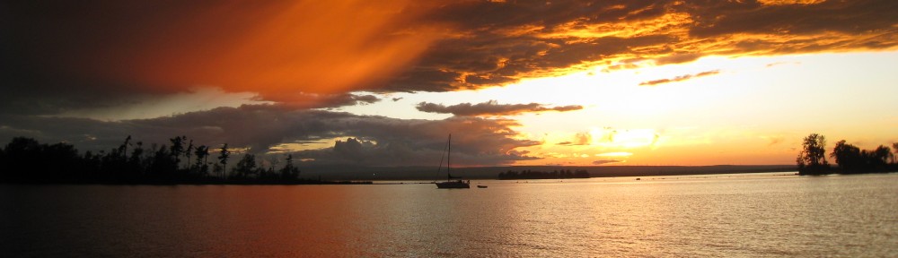
Thanksgiving Day anchorage
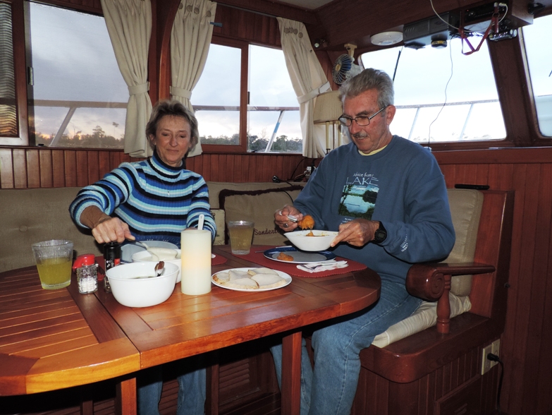 After passing through Gulf Shores, Alabama and past several large marinas, we anchored for the night in a beautiful small bay (Ingram Bayou) at mile 164.0. There were already several boats anchored when we arrived and two more entered after our arrival. There was plenty of room for all of us and we enjoyed our Thanksgiving dinner of turkey breast, blender potato puree, green beans, sweet potato casserole and cranberries. We had a quiet, peaceful night.
Day: 44.7SM/ 38.9NM – 5H50M Trip: 4313.4NM/4956.5SM – 724H50M
Friday, November 29, 2013 – Ingram Bayou – mile 164.0
We were underway at 0635 with the sun barely peaking over the horizon. Another boat was leaving at the same time and we journeyed together for a short way until we slowly pulled away from them. At 0750 we entered Florida waters on the Gulf Intracoastal Waterway. As we continued eastward we passed numerous homes and condos with the Gulf beaches on our starboard side not more than 1/2 mile away most of the time.
Although we had several options for anchorages toward the end of the day, we wanted to inspect the free town docks at Ft. Walton Beach Landing, which would put us within walking distance of a West Marina store and a Florida West Coast chart book which we needed (we apparently forgot to take our existing chart book with us when we left home in May). The docks have been newly renovated or perhaps even replaced, and although they provided no water or electricity they were adjacent to a beautiful town park and within walking distance of numerous restaurants and a Publix grocery store. We took one of the outside slips in 6.5 feet of water, called the number provided on the dock to get permission to stay overnight, then walked about a mile to West Marine where they were holding the chart book for us. On the return hike we stopped at Publix for several items including ice cream!
Day: 59.9SM/52.1NM – 8H05M Trip: 4365.6NM/5016.3SM – 732H55M

Strange tower – revolving restaurant? Not!
On Saturday, November 30th we were underway as the sun came over the horizon and transited lengthy Choctahatchee Bay, near where Judy lived when she was stationed at Eglin AFB. We passed a very unusual tower near the beach which we learned, thanks to Wiki, was a prototype of a Secure Boarder Initiative monitoring tower. Here’s what Wiki has to say:
The 98-foot high tower is a key element of the mobile component of the SBInet system. It provides the relocatable version of the platform for SBInet’s main sensing capability that will deliver the ability to detect and identify entries into the U.S. when they occur (who they are, how many, etc.); allowing the Border Patrol to effectively and efficiently respond to the entry and resolve the situation with appropriate law enforcement. The tower houses cameras and radars, wireless data access points, communications and computer equipment, and a tower security system to prevent tampering with its operations.
We passed through Panama City and anchored in Parker Bayou – a beautiful, well-protected bayou (I understand that term refers to a body of water, such as a creek or small river, that is a tributary of a larger body of water) with a few homes on its shoreline.
Day: 71.7SM/62.4NM – 9H15M Trip: 4428.0NM/5088.0SM – 742H10M
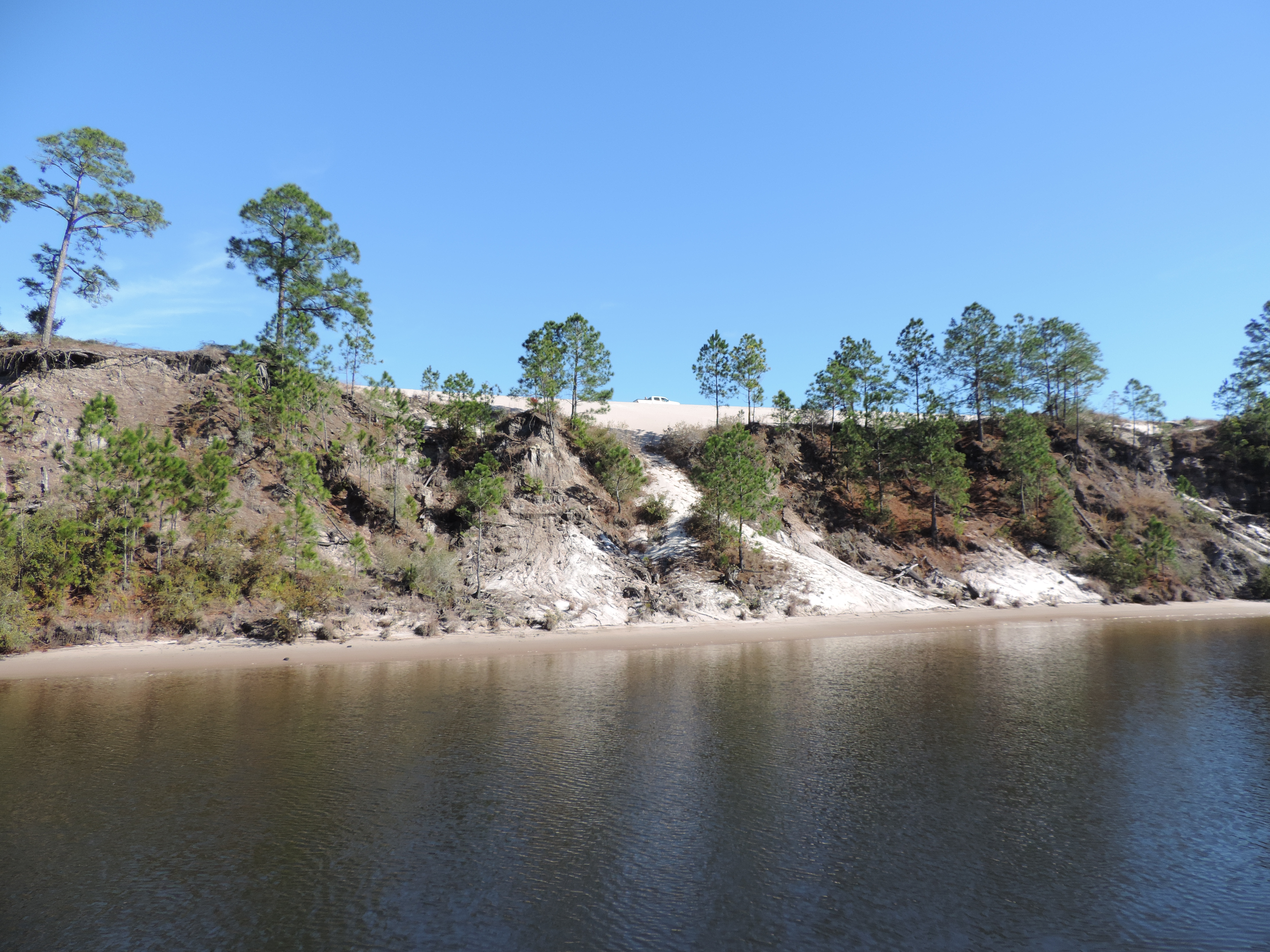
Sand banks of one of the rivers along the Gulf ICW
We were underway with the sun again at 0630 on Sunday, December 1, 2013. We passed through East Bay, Wetappo Creek, Lake Wimico and the Apalachicola River. At 1123 that day we crossed back into the Eastern Time Zone – it was interesting to reflect that we had been in the Central Time Zone since crossing Lake Michigan to Chicago in September. In the Apalachicola River we saw two golden eagles attacking a small group of cormorants on the water surface, but they were too far away to tell if the eagles got their dinner.
We arrived in Apalachicola, Florida with the expectation of spending one night at the Municipal Dock, but it turned out to be way to shallow. Fortunately for us, the bottom was mud and although we stirred up a lot when we came alongside the pier, the depth was only slightly over four feet and our tide tables showed that the water would recede another foot before starting it’s one-day cycle back up to high water (called a “diurnal” cycle – as opposed to a “semi-diurnal” cycle which has two high tides and two low tides daily – see Wiki at http://en.wikipedia.org/wiki/Tide). We slowly moved away from the dock and went to the Apalachicola Marina just north of the Maritime Museum with the intent of staying one night and moving on to Carrabelle the next day (about 26 miles away by water). Carrabelle would be our jumping off point for our trip directly across the Big Bend to Tarpon Springs, or the start of our short-hops through the Big Bend with several stops prior to getting to Tarpon Springs. The direct route was totally weather-dependent; the short-hops were water depth dependent.
Day: 58.6SM/51.0NM – 9H35M Trip: 4479.0NM/5146.6SM
The next morning (Monday, December 2nd) found us debating whether we would continue with our plan to make several stops through the Big Bend area, cut directly across 180 statute miles to Tarpon Springs, or wait for several months. The decision was helped along by the fact that the weather was not going to be particularly conducive to a peaceful crossing of the 180 mile route, the fact that the predominant weather had driven water away from the Big Bend area making the water depths lower than charted, the fact that daylight was getting too short for even 70 mile cruises, and the fact there was an inexpensive and well-rated marina in Carrabelle, only 26 miles away. It was also apparent that we would not get home in time for Christmas at the current rate of advance even if we cut directly across from Carrabelle to Tarpon Springs.
The choice was made to put the cruise on hold for a few months to give the negatives a chance to clear up. We’d get Sanderling to Carrabelle which was a little closer to home and leave the boat there until we were ready to resume our cruise in the spring.
Consequently, we rented a car at the local airport and packed it with our two cats and as much other gear as it would hold and drove to Merritt Island on Tuesday. Judy then drove back to Orlando on Tuesday night to attend a meeting of her Florida Legal Nurse Consulting organization, then we returned to Apalachicola with my car (plus the rental) which we dropped off at the marina in Carrabelle along the way (about a 5.5 hour drive from home). Judy returned the rental car that afternoon, and on Thursday we departed by boat for Carrabelle.
We were underway for Carrabelle at 0930 on Thursday, December 5th, 2013. Although the wind was blowing 10-15 knots from the south (making the direct crossing to Tarpon Springs rather rough), the waves inside Apalachicola Bay and St. Georgs Sound on the way to Carrabelle were only 1-2 feet at the most. We arrived at the C-Quarters Marina in Carrabelle, got Sanderling situation in a slip and started packing my car for the trip back to Merritt Island.
Day: 29.6SM/25.8NM – 3H45M Trip: 4504.7NM/5176.2SM – 755H30M
We drove home on Friday, unloaded the car, and started the process of transitioning to our home. Lot of things to do: remove hurricane shutters around the pool enclosure and back of the house, take the outdoor furniture back onto the lanai, move two kayaks and other outdoor items from the garage to the pool area, etc. We’re already part way there with all the shutters removed and put in their storage area behind the house. In another few days all will be back to “normal” at home.
We plan to return to Sanderling every few weeks to check on her lines and make a few repairs. We also still have some canned and boxed food onboard which will need to be brought home.
We hope to be back on the water cruising in March and will continue our blog at that point.
Hi, Bob!
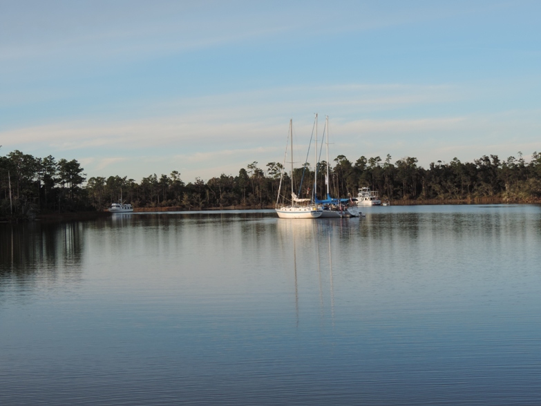
I was just scanning through your blog and saw the picture of Ingram Bayou. I realized that you were there at the same time we were! That is our boat, Microship, in the picture, way back just behind the sailboats. We had been there for almost a week, waiting for wind to abate so we could get back across Mobile Bay.
I remember now that I saw you come in Thanksgiving Day afternoon, and depart early that morning. I just could not see the name on the boat, so did not know it was you until now. Wish I had, we would have invited y’all over for dinner!