We’re Bob and Judy. Our current boat is a Defever 41 motor vessel, 41 feet in length with a single 135 horse-power Ford-Lehman engine. Our home marina is Manatee Cover Marina at Patrick Air Force Base, located on the Banana River between Cocoa Beach and Satellite Beach, Florida. We have cruised from the Dry Tortugas to St. John, New Brunswick, Canada, and inland Canada through the Thousand Islands, along the north shore of Lake Ontario through the Bay of Quinte to Belleville, through the Rideau Canal from Kingston to Ottawa, to Montreal via the St. Lawrence Seaway, then to Sorel and south thru Lake Champlain back into the Hudson River.
In May, 2013, we headed north again from Florida. We arrived in Trenton, Ontario in early June after a number of weather-related delays, then completed the Trent-Severn Waterway, through Georgian Bay and the North Channel, to St. Ignace, Michigan. From there we completed the “Great Loop” traveling the east side of Lake Michigan and across to Chicago, the Illinois, Mississippi and Ohio Rivers and into the Cumberland River above Paducah, Kentucky. We then cruised up the Cumberland to Nashville, Tennessee, and returned downstream, then crossed into the Tennessee River as far upstream as Florence, Alabama. Then the TenTomBigbee Waterway to Mobile, Alabama, east through Florida’s panhandle and around the Big Bend and south to Ft. Myers where we picked up the Okeechobee Waterway to the east coast of Florida and back to our “home” marina.
Our web site, located here, describes some of our earlier cruises and is being updated. All of our blogs located at Blogspot.com have been imported here, and new pages created of our earlier blogs back to 2001. You can also find information about earlier cruises on our web site.

Khepera and Julie waiting for dinner
For the last 10 years we cruised with our two cats, Julie and Khepera, but Julie had to be put to sleep in January 2012 at the age of 20 1/2 years and we are going to miss her. Khepera will have to entertain himself temporarily, until we can find a new cat for him to pester.
Here is a picture of Julie and Khepera taken on our 2012 cruise while they were waiting for the maid to bring dinner. Julie, part Maine Coon, is on the right.
 We found a playmate for Khepera at the South Brevard Animal Shelter in early March 2012. Named him Ernie because he’s a polydactyl cat (guess the connection). He’s about nine months old (March 2012), recently neutered, and very friendly. Even though he’s smaller than Khepera, we sometimes have difficulty telling them apart!
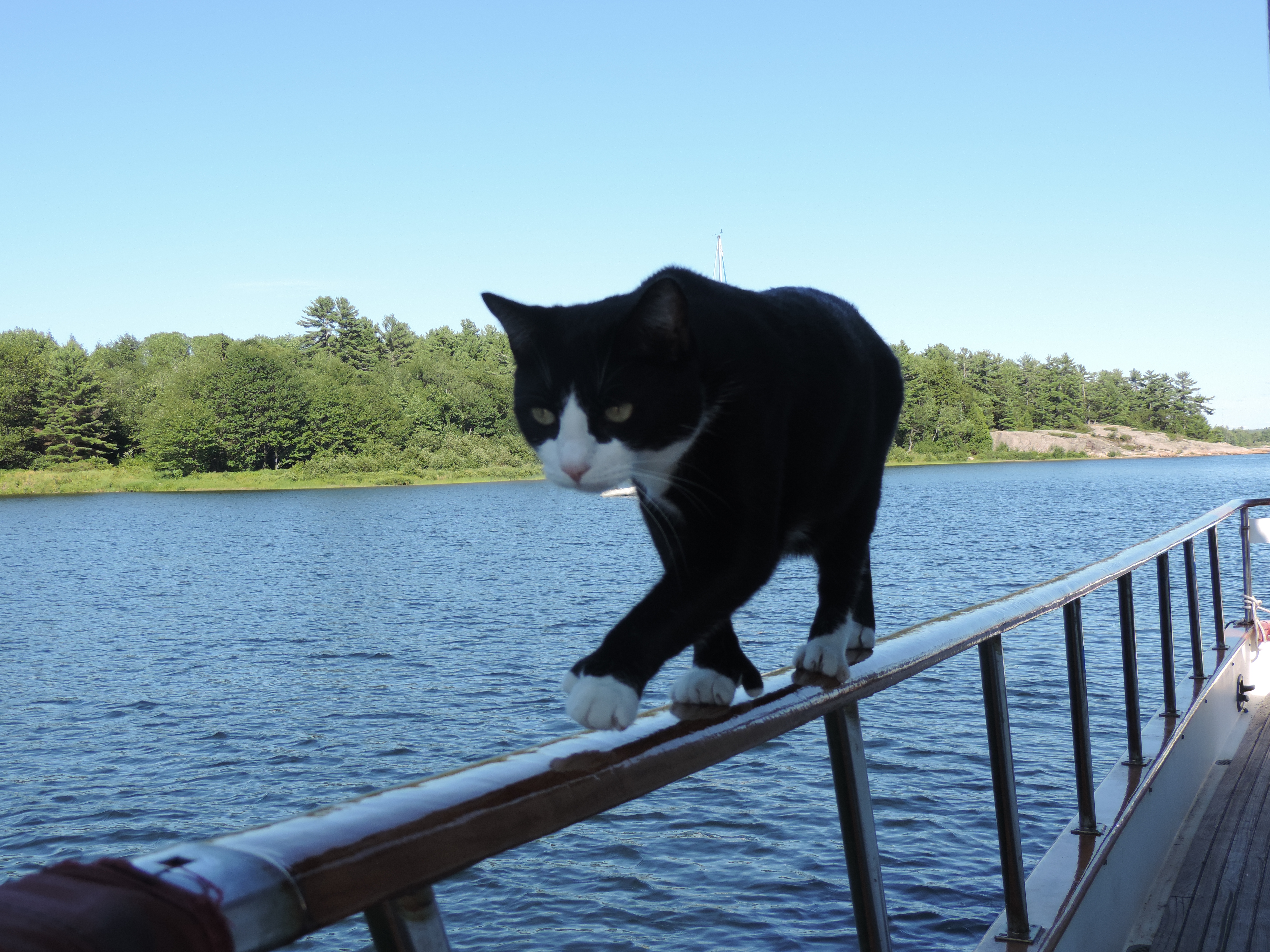
Ernie walking the hand rail
Ernie seems to have adapted well to the boating life, and he isn’t at all reluctant to wonder around the hand rails when we are anchored.
Hello Bob and Judy, you have quite a bit of boating experience. I do envy you. I’m just starting out. I have a question for you based on a response you gave a fellow boater.
You use Fugawi to create your routes. How do you transfer the routes you create in Fugawi to your Garmin chartplotter? What charts do you use? Navonics? I’m told the Garmin file format is different from others therefore you need to convert the file format from Fugawi. How do you accomplish this? Any help would be greatly appreciated. My Garmin is a GPSMAP 640 device.
Regards,
Orlton Lawrence
Our chartplotters are a Garmin GPSMAP 545 and a 546S. Fugawi navigation software supports the Garmin protocol, so as long as you have your computer and the chartplotter linked via a NMEA circuit, you can set the software and the plotter for the Garmin protocol and then upload your routes/waypoints directly.
Charts to use with Fugawi depend on your location. NOAA charts and Army Corps of Engineer maps for US waters are free on the internet. For Canadian waters you’ll have to buy Navionics or other software-based charts that will display using Fugawi on your computer. Then you create routes by simply point and click.
An alternative to directly uploading the routes and waypoints is to export them to an SD card which can then be physically moved to the plotter where the data is imported. The end result is the same as directly uploading via NMEA.
Hi Bob
Is the boat still for sale? We are in Canada on Lake Erie just across from Buffalo
Old sailors moving up.
What are you asking for your DeFever 41 . I see one in Newfoundland, Canada also available.
Regards
Bob Dyer