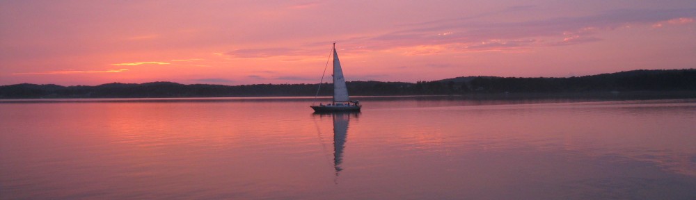
Written November 13, 2013 – Florence, Alabama
Judy has driven to Kansas and back, her mother’s pacemaker was replaced and her mother is doing extremely well. Only problem – while driving through Arkansas about dusk a deer decided to broadside the car Judy was driving, resulting in enough damage to the vehicle that it needed to be replaced; unfortunately, the nearest Enterprise Rental Agency was closed for the night and the only one open was 150 miles away at the airport at Memphis – so she stayed in a resort hotel for the night and took possession of a different vehicle mid-morning on Monday. Had a lot of helpful folks providing advice and comfort along the way, including a local policeman who went out to search for a deer along the roadway (nothing to be seen) and then escorted Judy to the hotel. She arrived back in Florence on Monday afternoon.
In the meantime, I had talked with some boaters who had just returned from Chattanooga who said that the fall foliage had passed its peak. The temp for the next several days was going to be in the 20s at night and 40s during the day with wind gusting to 30 MPH, which makes for some really cold cruising and miserable anchoring out without a constant source of heat. We are also trying to get home before Christmas – only a month and a half away! So . . . .
The decision has been made not to continue upstream to Chattanooga. We’ll tour Chattanooga on another trip by car (we still want to get to Memphis for the Elvis and blues experience). We stayed in this nice marina in Florence through today and tonight (November 13th) and will depart tomorrow morning to head back downstream and join us with the Tenn-Tombigbee Waterway at mile 215 and head toward Mobile, Alabama, and hopefully warmer weather (although even southern Alabama and Florida are experiencing low temperatures, just not as low as here in upper Alabama at 450 feet of elevation).
Today, while Judy worked on some of her consulting cases, I toured the W.C. Handy Home and Museum and the Alabama Music Hall of Fame – both fascinating places and worth the visit if you’re in the area. Although I was slightly familiar with W.C. Handy’s music (St. Louis Blues, for one) I was not aware of how extensive his compositions were and how much he contributed to the music industry beyond being considered “The Father of the Blues.” I was also not aware of the connection between this area, Muscle Shoals (the documentary just hit the movie theaters) and the rest of the country-western, blues, jazz and recording industry. There are still some major recording studios in this area, particularly in Muscle Shoals.
So . . . Mobile, here we come!
Before leaving, here are a few pictures of some of the local sights.
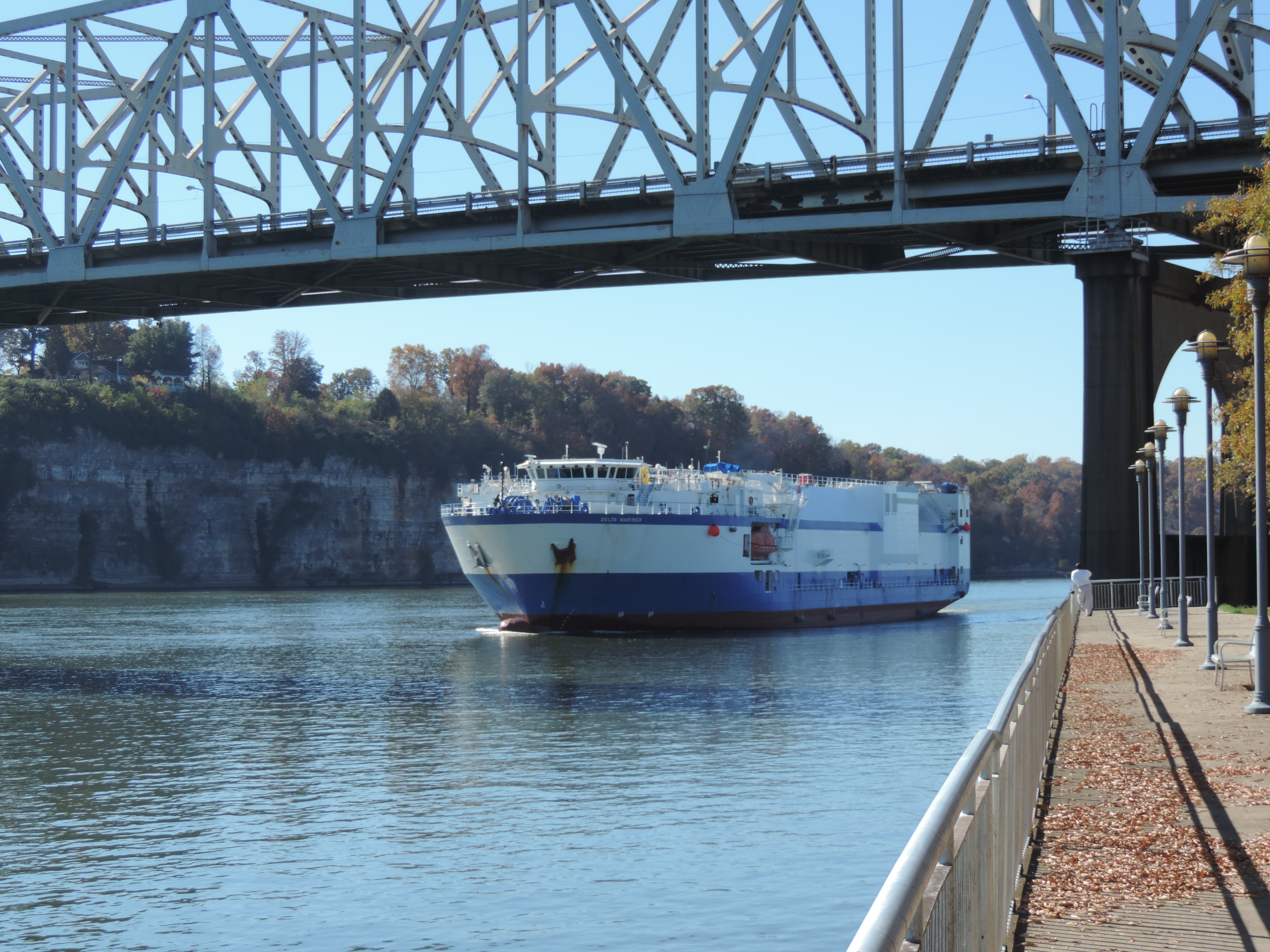
Delta Mariner – the ship that took out the bridge on the lower Tennessee River in 2012
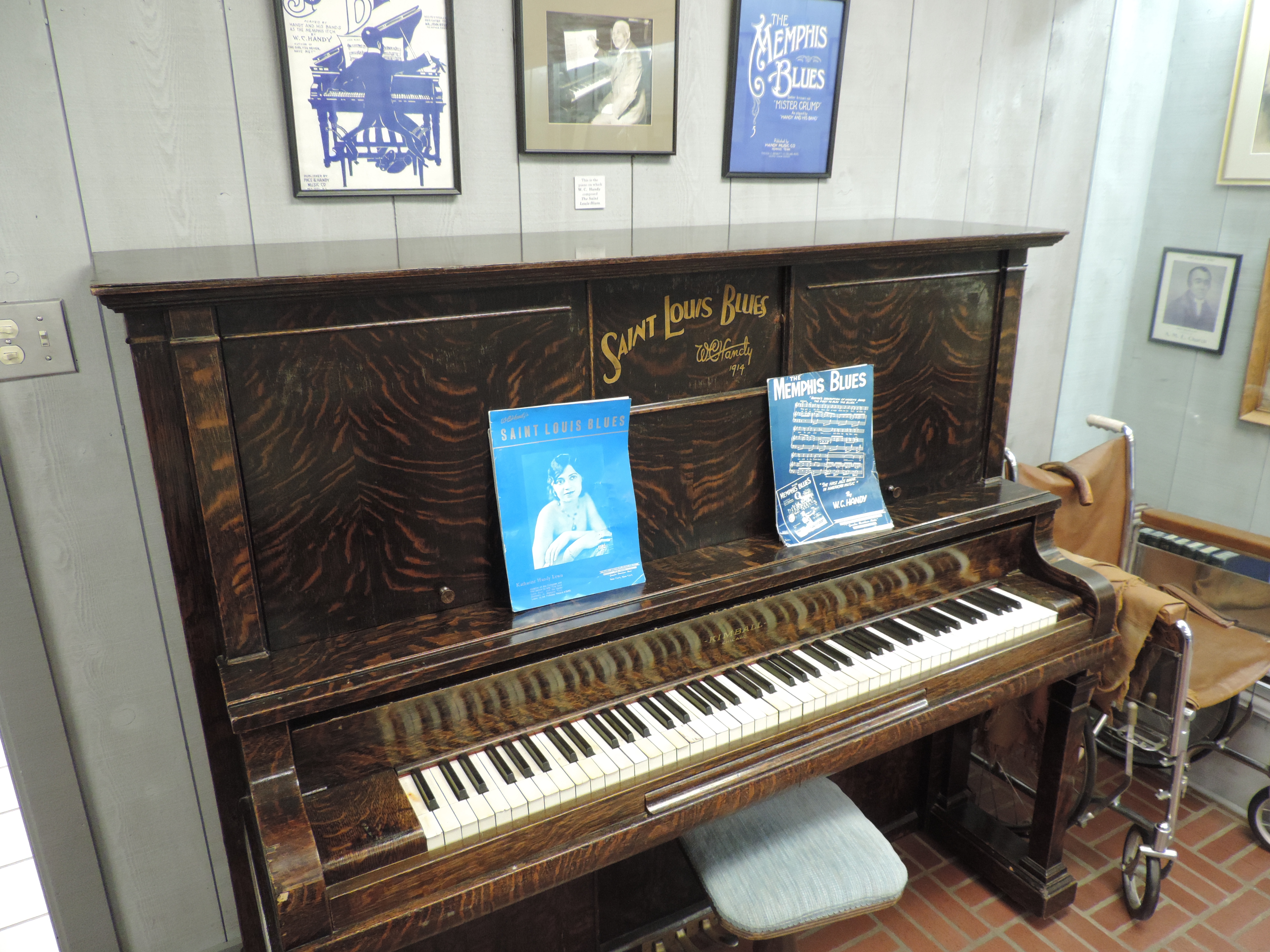
W.C. Handy’s piano at the W.C. Handy House and Museum
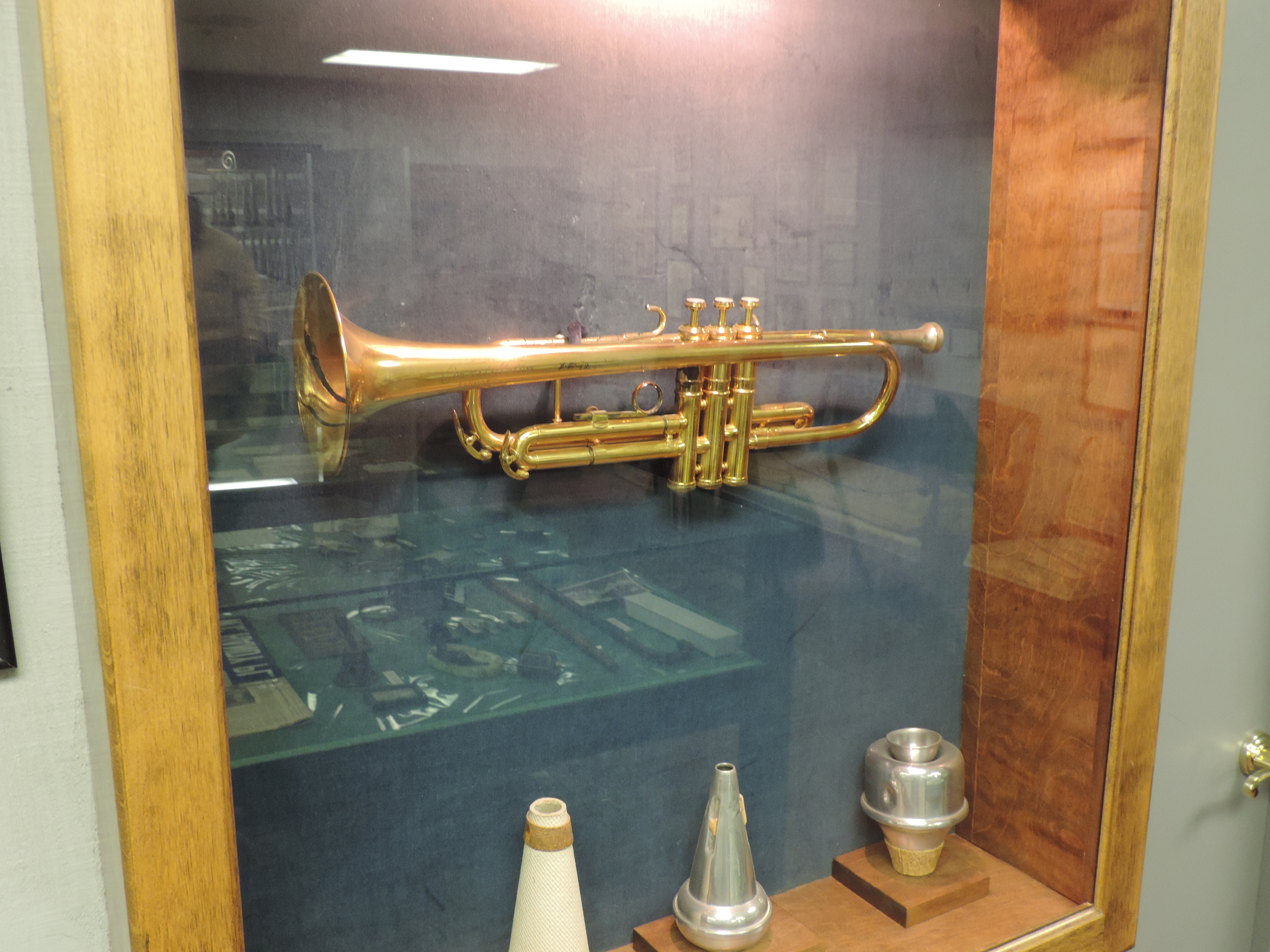
W.C. Handy’s trumpet
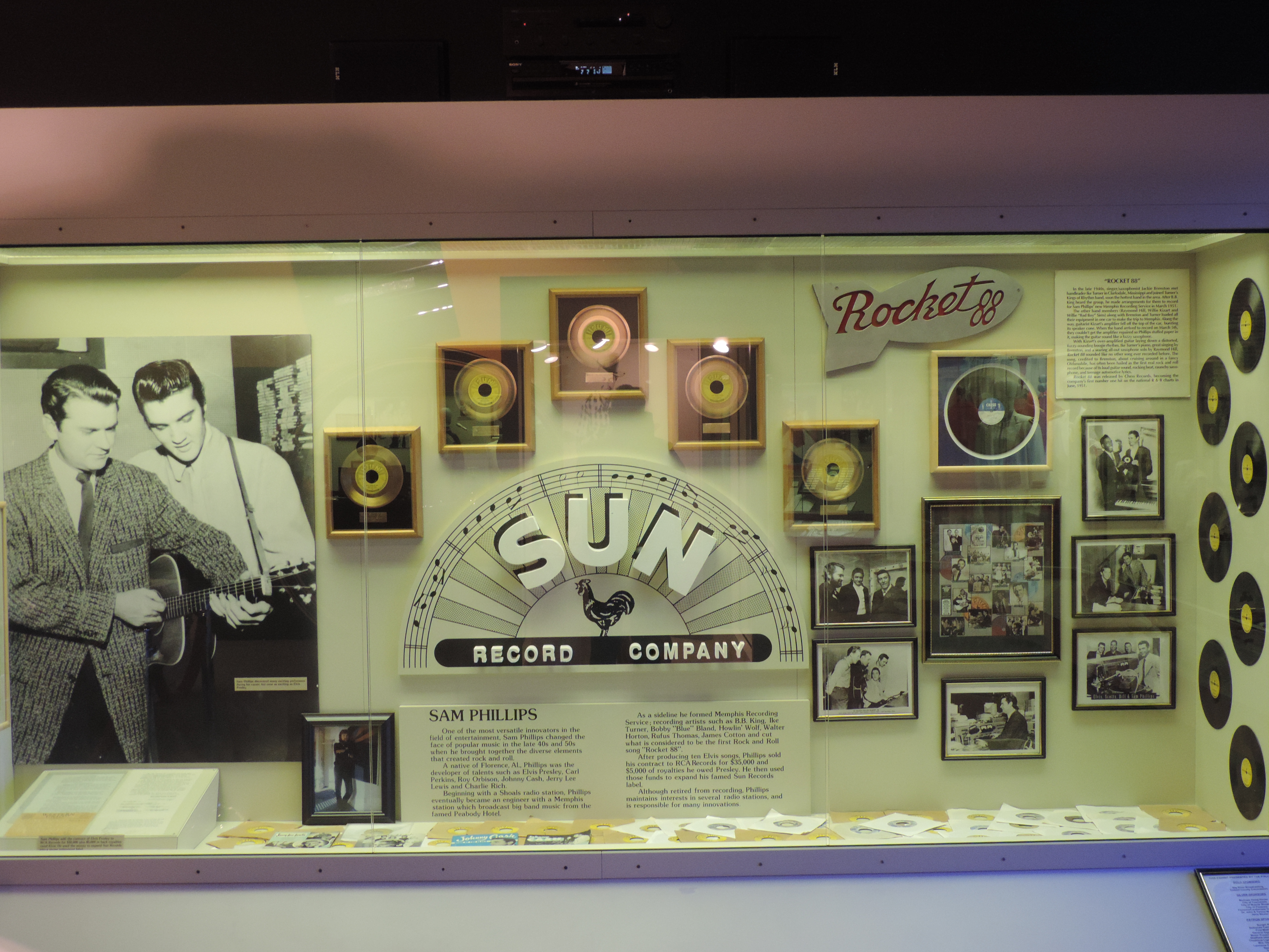
Display about SUN Recording Studio at Muscle Shoals at the Alabama Music Hall of Fame
Written November 9, 2013 – Florence, Alabama
The last blog entry had us anchored behind Diamond Island a short distance below the Pickwick Lock and Dam on November 1st. As we departed the next morning (Saturday, November 2nd) a tow came upriver and passed the island. We knew we had a race on our hands to get to Pickwick Lock and Dam before the tow or we would have to wait several hours while the tow locked through ahead of us. The tow was about 1.5 miles ahead of us as we came back out into the main river channel, but with a little extra rpms we managed to pass it several miles before the lock; the lock was open for us when we arrived and we locked right through into Pickwick Lake. We had arranged to meet friends Lynn and Wayne (Bones) for a day, so after getting our slip at the Pickwick Landing State Park Marina (mile 208) we called them and a short time later they arrived to take us to their farm for the day. Wayne and Lynn lived aboard their large Marine Trader for a number of years, cruising the waterways and being pirates, until they swallowed the anchor and bought a 20 acre farm in the area that they refer to as the “wet confluence of Mississippi, Alabama and Tennessee.” Now they are really into the concept of sustainable farming as described in the book “Omnivore’s Dilemma” a few years ago.
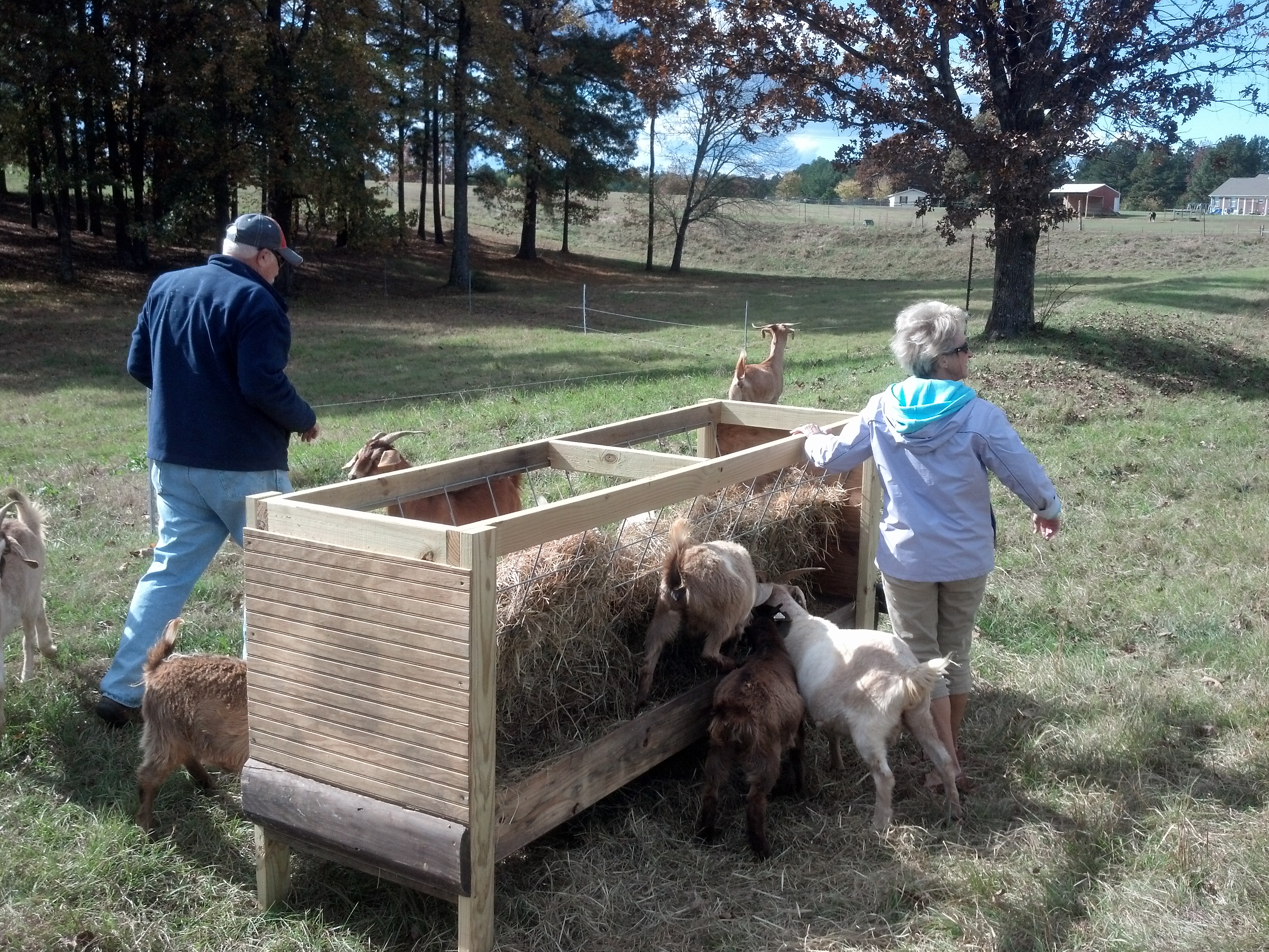
Wayne, Judy and goats
We had a most enjoyable day with them riding around their farm and meeting the donkeys, goats, chickens, and catfish, seeing their extensive garden, and talking about farming and boating. We had a great dinner with their very own vegetables and chicken, and talked into the evening about boating, pirates, farming and such things. We returned to Sanderling on Sunday morning and readied everything for our departure the next day. It was great seeing them again. Sunday evening a park ranger gave us a ride into the small town nearby where we had some great pulled barbeque pork at a small mom and pop restaurant; after dinner, the same ranger came back and returned us to the marina! The next morning (Monday) we walked to the Park’s Inn for breakfast – what a beautiful location overlooking Pickwick Lake.
We were underway on November 4th at 1055 and heading upstream on the Tennessee. It was cold and windy, but the waves on the broad expanses of the lake weren’t bad and we made good time, turning into our chosen anchorage at Ross Branch (mile 229.8) and anchoring at 1415. The little anchorage was very well protected from the southerly wind, and we enjoyed a peaceful night.
Day: 23.0SM/20.0NM – 3H20M Trip: 3802.4NM/4369.2SM – 643H35M
On Tuesday, November 5th we were underway at 0825. The Tennessee started to narrow down a bit but continued it’s serpentine route through the beautiful Tennessee countryside.
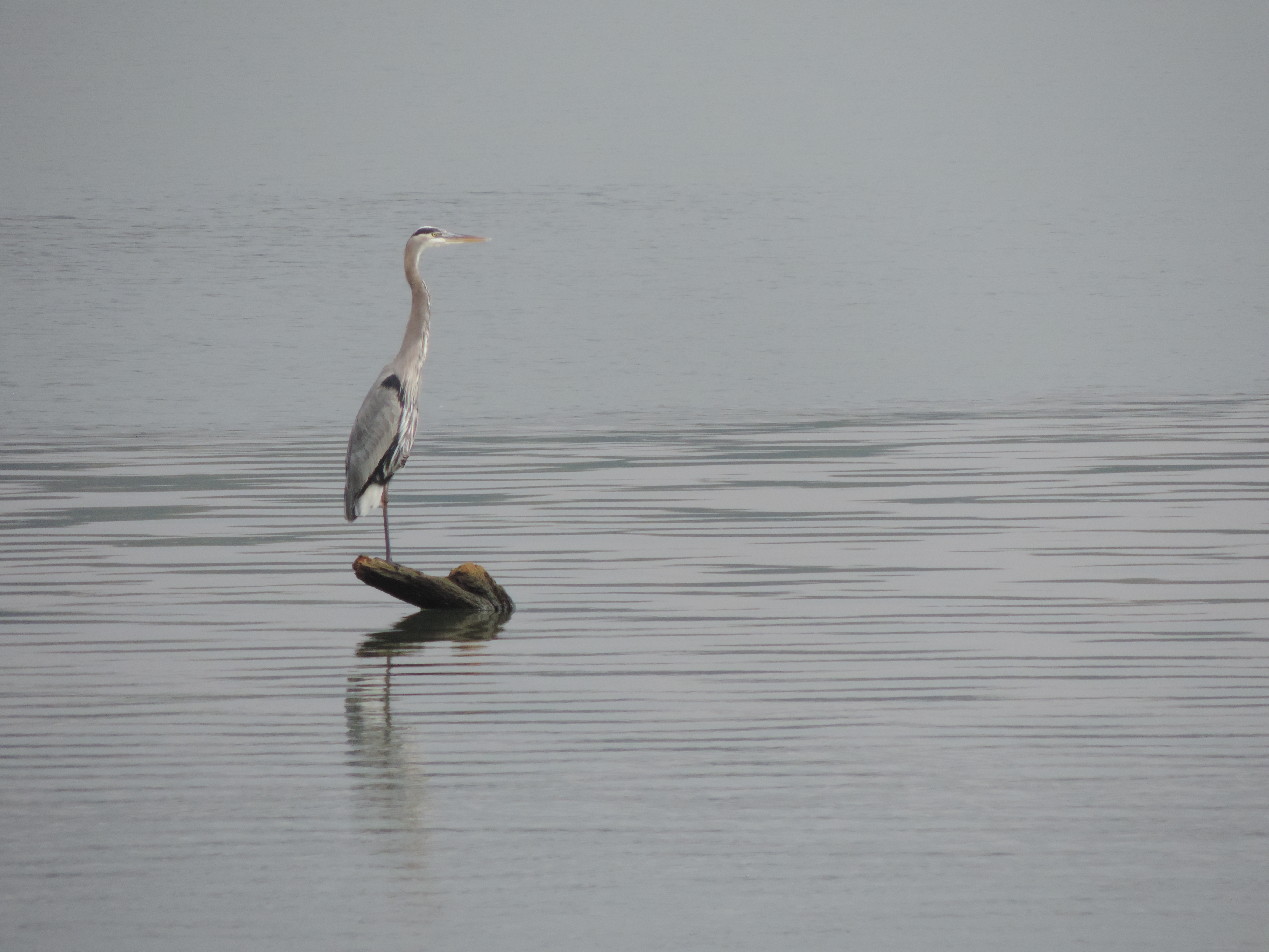
Great Blue Heron fishing
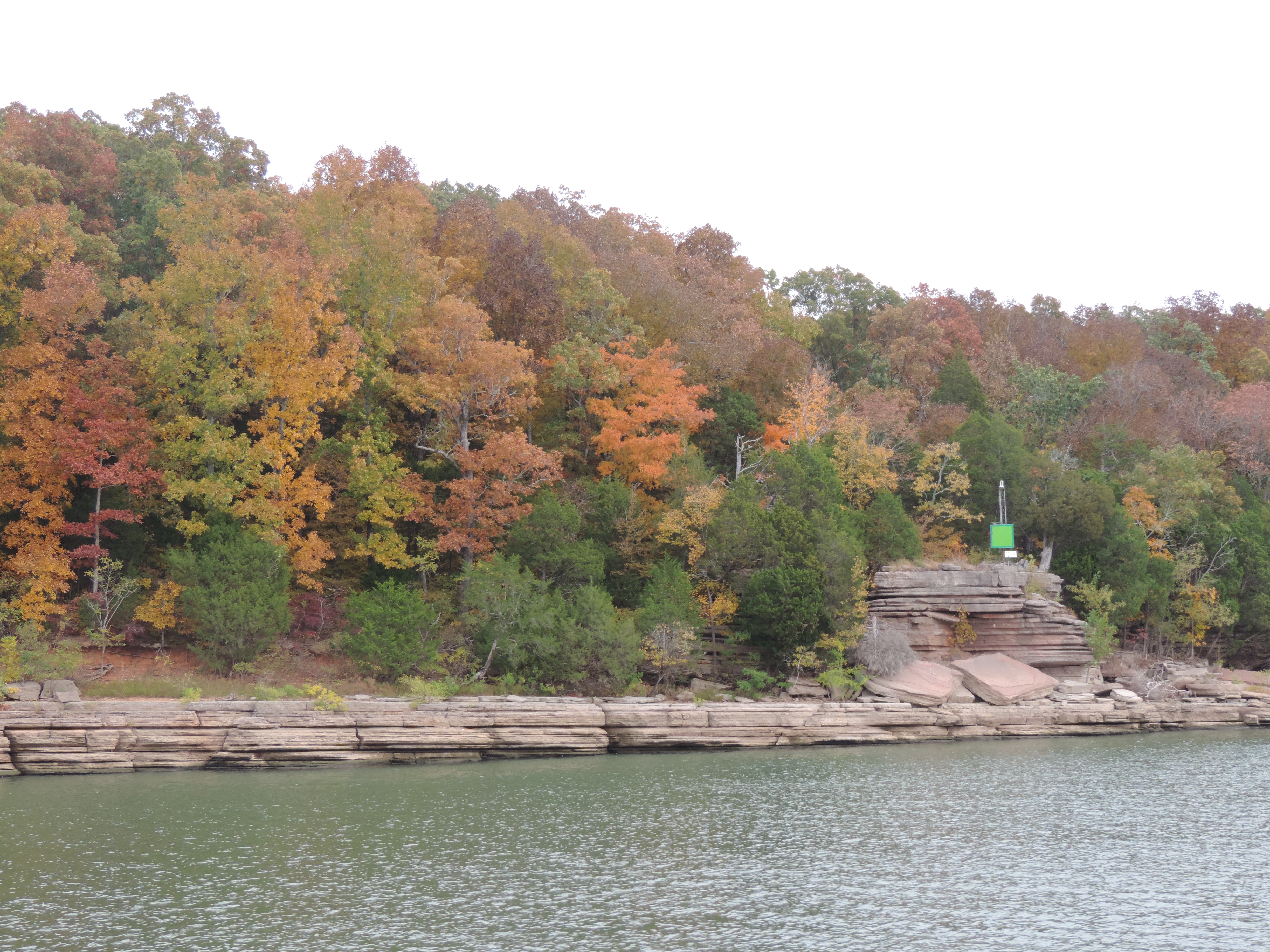
Tennessee River
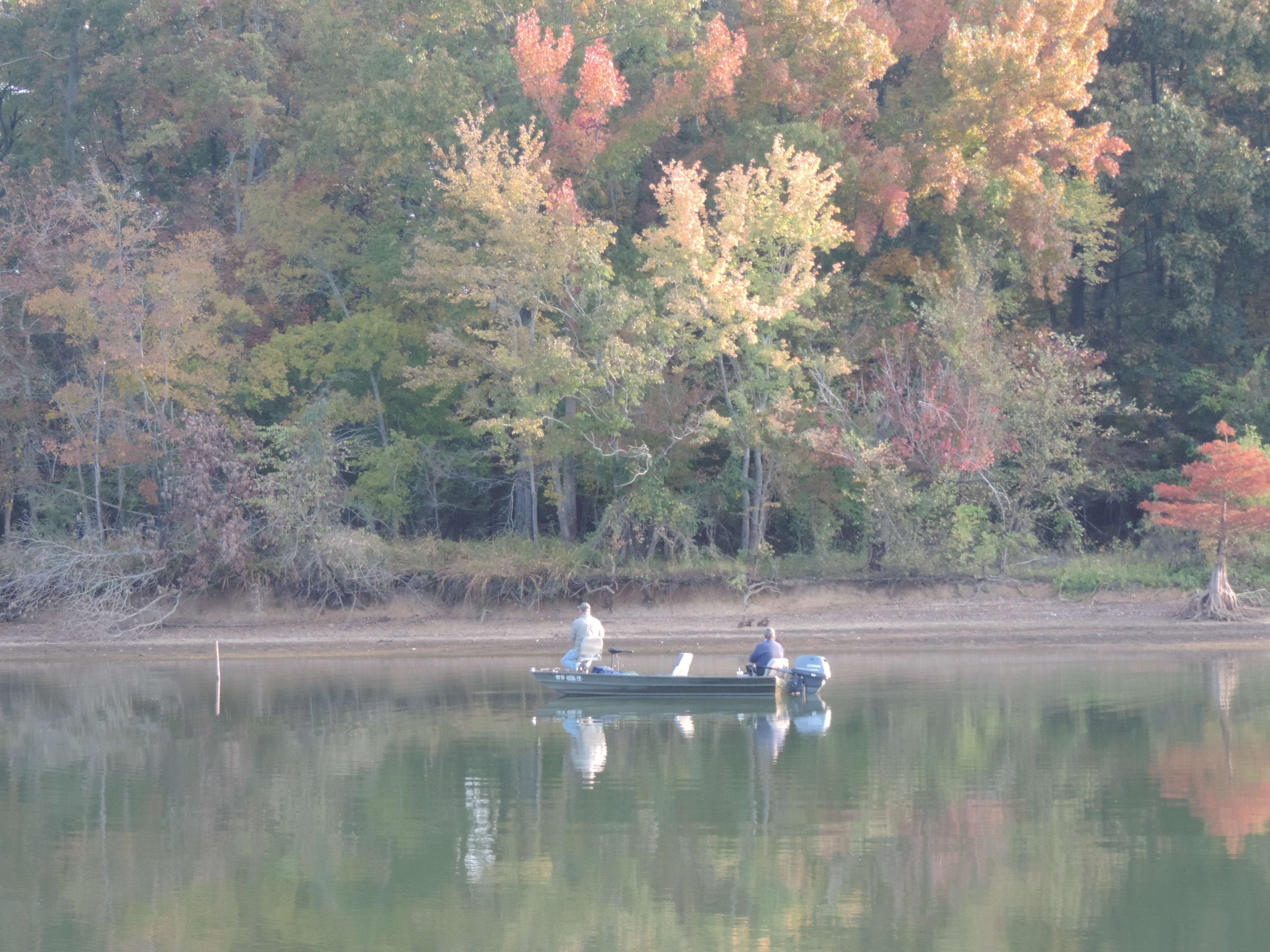
The trees are putting on their fall colors, but because the day was overcast the colors were subdued and not as brilliant as we would have liked. However, it was obvious that we’d continue to have some colorful landscapes for a few weeks as we continued upstream to Chattanooga. The lack of sunshine also made for a chilly day and we welcomed the sun from time to time as it broke through an opening in the overcast and warmed our topside steering area, at least temporarily. We arrived at Florence Harbor Marina at 1255 and tied starboard side to the long transient dock in this nicely protected harbor surrounded by a beautiful park.
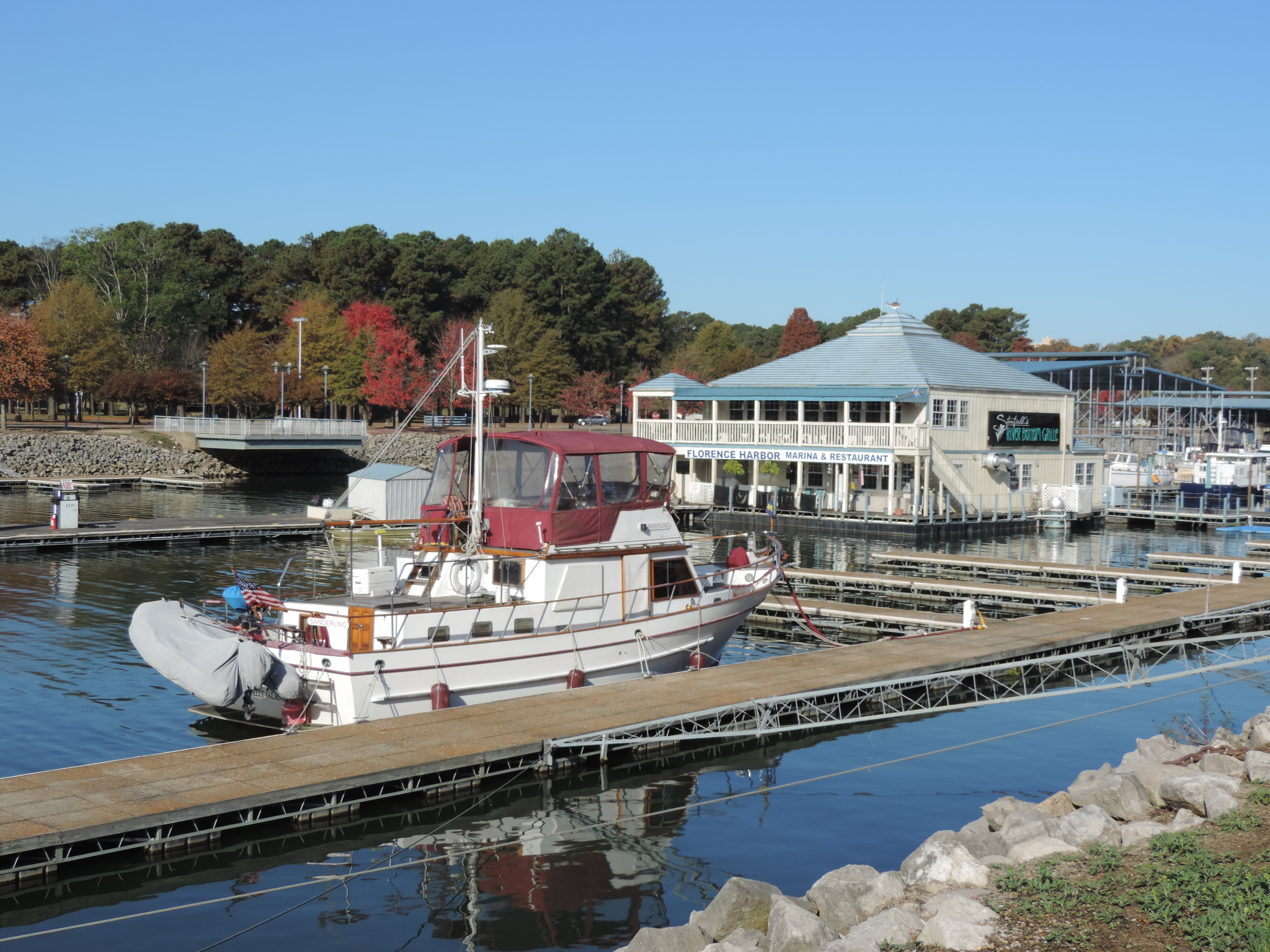
Florence Harbor Marina
There are several large boat launching ramps in the basin as well as a fuel dock and a number of covered floating docks for fairly large boats. We were offered the option of a covered slip (max height was 24 feet) or the uncovered transient dock – we chose the uncovered transient dock so we could get some sunshine when the clouds departed!
Day: 26.9SM/23.4NM – 4H30M Trip: 3825.8NM/4396.1SM – 648H05M
We ate dinner the first night at the River Bottom Grille at the marina – it was great! On Wednesday Judy got her rental car from Enterprise and we did some major shopping at Publix (one of our favorite store chains) since we don’t know how easy it will be to shop once we get to Chattanooga.
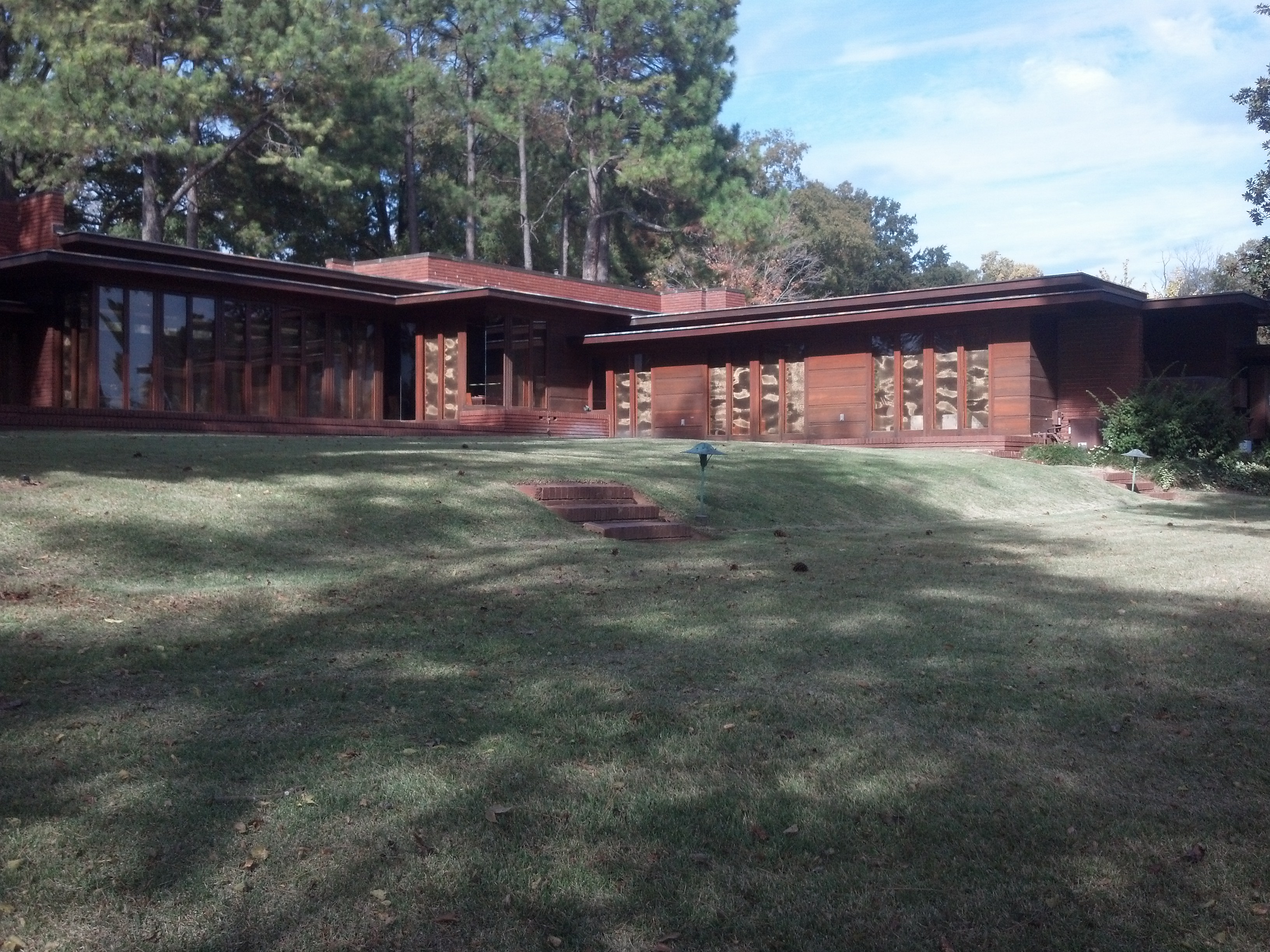
Rosenbaum usonian home by Frank Lloyd Wright
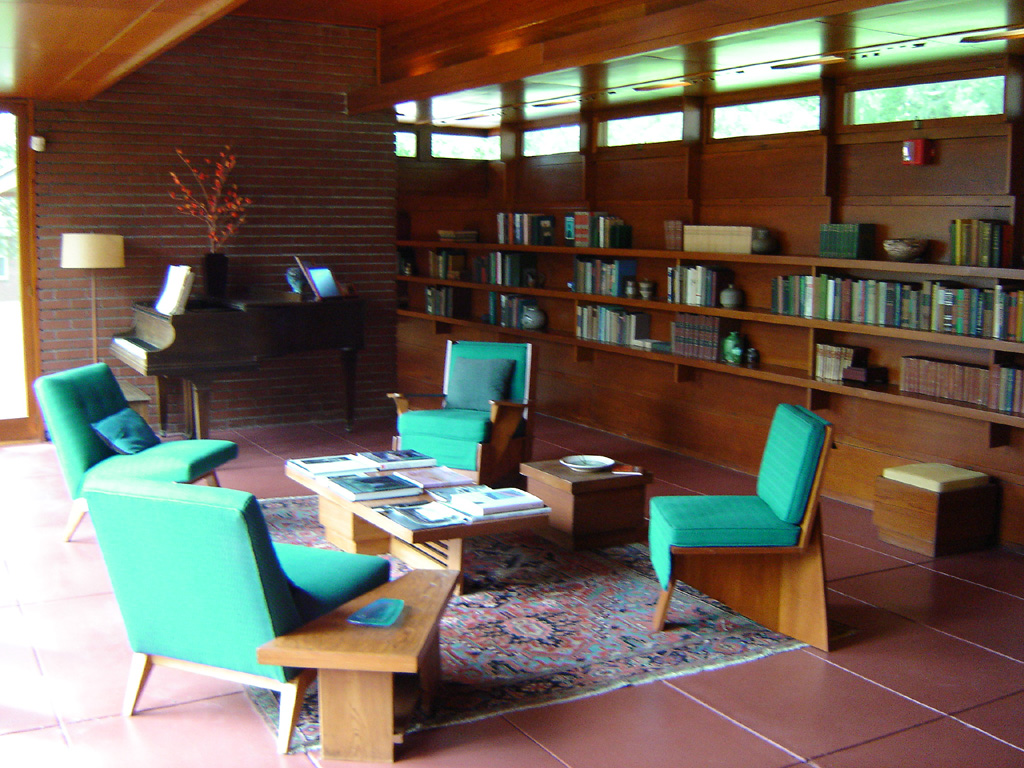
Rosenbaum house interior
We also toured the Frank Lloyd Wright usonian home built by the son of a wealthy theater owner and his wife in the late 1940s.
We had chili and corn bread for dinner and Judy got underway for Kansas at 0430 on Thursday. It took her just about 12 hours to drive to Wichita where she is going to be with her mother while she has her pacemaker replaced. I’m staying behind to take care of the cats and work on a few little projects on Sanderlng (equalize batteries, change oil in the generator, update this blog, etc).
Written November 3, 2013 – Pickwick Marina
While we were in Florida we learned that Judy would be making another trip to Kansas in early November to be with her mother while she (Mom) was having her pacemaker’s battery replaced. Because of her age it would require an overnight stay in the hospital. Consequently we had to come up with a location where we could put the boat (and the cats and me) in a marina somewhere on the Tennessee River while Judy rented a car to drive to Kansas.
We returned to Clarksville (from our home in Florida) on Thursday, October 24th, reprovisioned, turned in the rental car and readied Sanderlng for getting underway on Friday, and departed the Clarksville Marina on Saturday morning, October 26th.
With the river’s current giving us a little “push” we made good 61 miles by 1740 that afternoon and anchored in Terrapin Creek as the sun was going down, where we raised the radar mast (with anchor light) before it got dark. Our trip down river was delayed about an hour when we were hailed by two young men (turned out they were stationed at Fort Campbell) in a john boat who’s motor had stopped working. We turned around and towed them back up river to a boat launch ramp where they were then going to walk further upstream to a boat ramp where they had left their truck and boat trailer earlier in the day. We were happy to give them a tow, but it did cause us a bit of concern about whether we would be able to get to our hoped-for anchorage before dark. The only slight difficulty we encountered was due to the low water level (about 4.5 feet below “normal” pool) – the entrance to the creek (more like a small bay) was very shallow and we dragged our keel through mud for a short distance when entering. Fortunately, the lake level did not drop any further during the night, so we were able to exit without difficulty.
Day: 65.4SM/56.9NM – 8H40M Trip: 35907NM/4125.9SN – 606H50M
Sunday morning (October 27th) we were underway at 0845, entered the Barkley Canal (connects the Cumberland Rive (Lake Barkley) and the Tennessee River (Kentucky Lake) at 1310 and were heading up the Tennessee River. It was a bright, sunny day and there were a number of pleasure vessels (and a few tows) out enjoying the day on Kentucky Lake. We anchored for the night at 1510 in Ewes Bay, a small, isolated bay just off Higgins Bay. Judy commented that it was the nicest anchorage we’d been in since Georgian Bay. There was no sign of civilization anywhere around (except for a few fishing boats) and birds careening overhead. We had been told by a passing trawler that there was a family of coyotes living in the area that we might hear at night – we didn’t!
Day: 46.0SM/40.0NM – 6H25M Trip: 3630.7NM/4171.9SM – 613H15M
We were underway again at 0845 on Monday, October 28th, and another beautiful day – light wind, sunny, and temps in the low 70s. We were still in Kentucky Lake, which runs essentially from mile 30 to mile 208 (Pickwick Lock and Dam) on the Kentucky River. The waterway was wide and deep and we encountered only a few tows during the day. Since we had decided to stay at Florence, Alabama, while Judy drives to Kansas, we were in no hurry, so stopped early at another spectacular anchorage, Clay Bay, at 1120, only 17 miles for the day.
This “embayment” (a small bay between hills) was rather long and was the stopping place for a number of white pelicans as well as hosting an eagle nest in the trees on the south bank. Throughout the remainder of the day we watched as the white pelicans engaged in their unusual fishing behavior along the northern shore opposite Sanderling. Unlike brown pelicans which are so common along the east coast of the US and dive into the water beak-first to get their intended prey, the white pelicans heard schools of small fish from the surface, then strike their necks and beaks downward into the water to grab their prey. The technique seemed to be quite successful as the birds frequently tipped their heads back to swallow after letting the water drain out of their “mouths.”
Day: 17.8SM/15.5NJ – 2H35M Trip: 3646.2NM/4189.7SM – 615H50M
On Tuesday, October 19th, we were underway at 0915 and anchored for the night at 1625 in Birdsong Creek, this time not an embayment but a meandering, shallow river running along he northern side of a wildlife preserve.
Birdsong Creek and fishermen
From the charts/maps it was difficult to tell the water depths in advance, but our cruising guide indicated that by following the private markers we would be able to get a distance away from the river and into a good area. We slowly followed the small red and green markers through water that at a few spots was only 6 feet deep, but eventually came to a nice wide area of 9 foot water with a few homes on one side where we anchored for the night.
Day: 50.1SM/ – 7H10M Trip:
We departed Birdsong Creek and continued upstream on Wednesday, looking for marinas where we could buy diesel. There was no urgency, but we wanted to fill our tanks as we had cruised about 125 hours since we last obtained fuel and our fuel gauges were reading about 1/2 which in reality means the tanks are about 1/4 full (a little less than 100 gallons). Our cruising guide indicated that we would pass several marinas, so Judy began calling them only to learn that they were closed on Mondays, Tuesdays and Wednesdays this time of year! She finally contacted the Clifton Marina and learned that they were open and that their fuel price was comparable to other marinas ($4.19/gallon), and told them that we would be in later in the afternoon. Shortly after that conversation we decided to simply spend the night in that marina, so Judy called them back and got a reservation. Later in the day when checking the next day’s weather forecast we learned that high winds and rain were predicted, so we decided to extend our stay through Thursday as there were no good, protected anchorages beyond the Clifton area until well after the Pickwick Lock and Dam which were too far for us to make that day.
As we rounded the hairpin turn and headed toward Clifton and the marina we heard another boat calling the marina to confirm that they were about to arrive and had a reservation for the night. We saw them approaching as we entered the marina’s entrance; then we tied up at the fuel dock and they entered and tied up on the long transient dock and pulled forward so we can reposition ourselves behind them after fueling. We took 220 gallons of fuel (we never purposely fill the tanks to capacity to avoid spilling diesel fuel out the air vents) and backed out and onto the transient dock. In the meantime we met Linda and Pete on Carina while fueling and they provided a wealth of information about the Tennessee River.
Day: 55.9SM/ – 8H225M Trip:
Thursday was just as forecast – winds reading 40MPH and heavy rain off and on throughout the day. Thursday evening the rain slacked off but the wind increased in intensity and lasted well into the late evening. We were glad that we had decided to stay in this well protected marina during the passing of the storm front.
From Clifton Marina we cruised 6 hours upriver against a current of about 1.5 to 2 MPH and anchored behind Diamond Island. We had a lot of difficulty getting the anchor to hold in a hard-pan riverbed that had been swept clear of any mud and soft clay by the 2-3MPH current through the area. After several tries we got the anchor to catch in about 16 feet of water, and after backing down to 1000 RPM (we usually back to 1200RPM) we called it good enough, let out 175 feet of chain (at one pound per foot plus the 55 pound anchor) and set two anchor alarms. We didn’t budge the entire night although the water level dropped about three feet during the night.
Day: 36.6SM/ – 6H00M