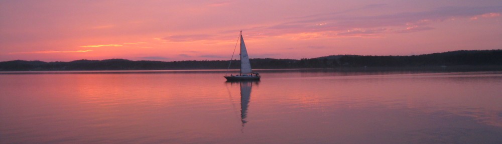
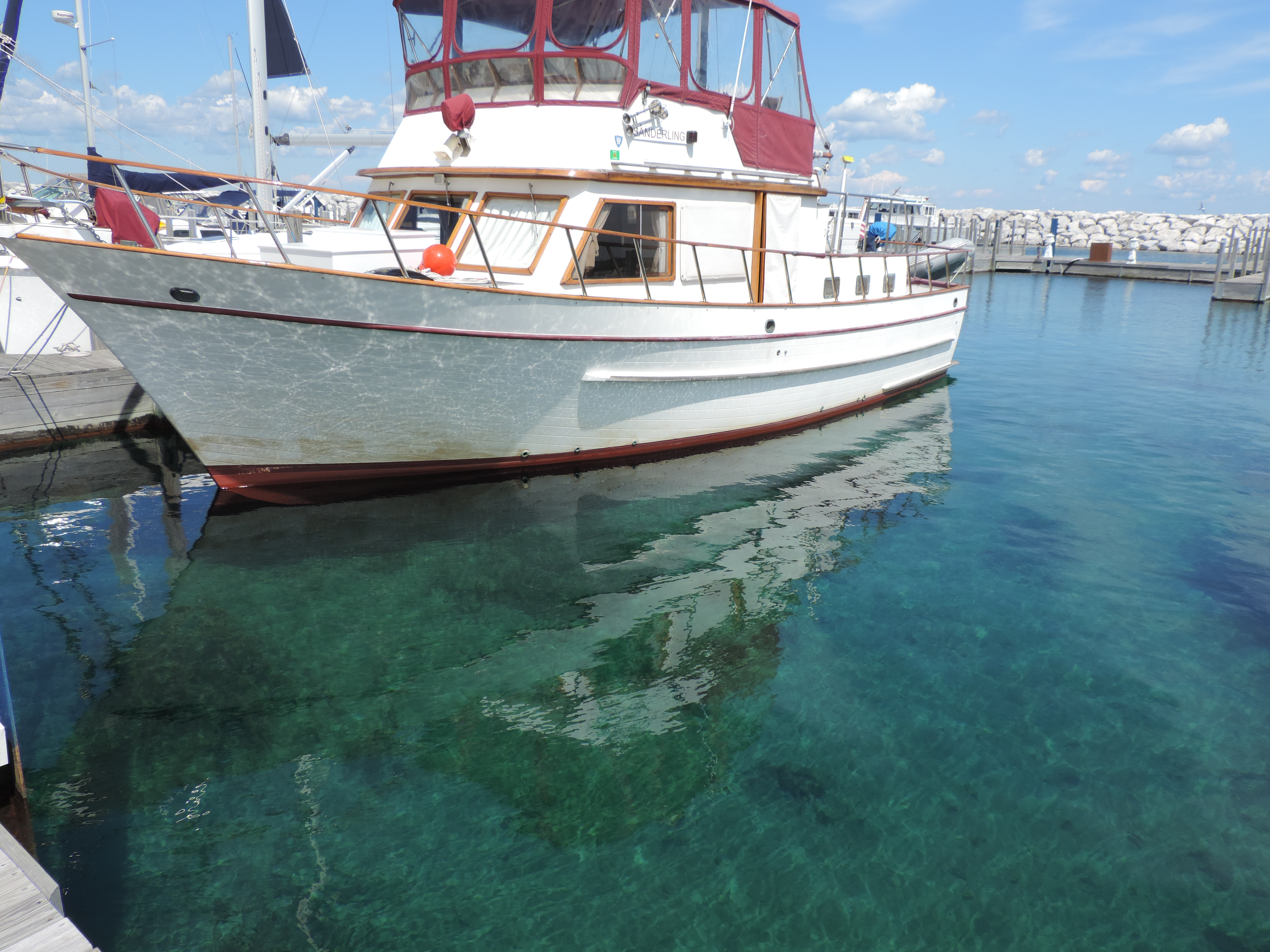
Thursday, June 13, 2013 – Horse Point, Bay of Quinte, Ontario
As much as we had a nice, sunny afternoon yesterday, today was rainy and gray. We awoke to light rain which had started during the night, and got underway at 0925 in the drizzle. The good news – there was no anchor beard, the mass of aquatic plants and grass that sometimes accumulates on the anchor and chain as it lies on the bottom and forms a mass when the anchor is retrieved. There was some visible plant growth in the small bay when we checked it prior to anchoring, but moved into slightly deeper water and apparently avoided it (the grass/weeds won’t grow when the sunlight doesn’t reach the bottom, so the deeper the water the less likely one will find the plant growth).
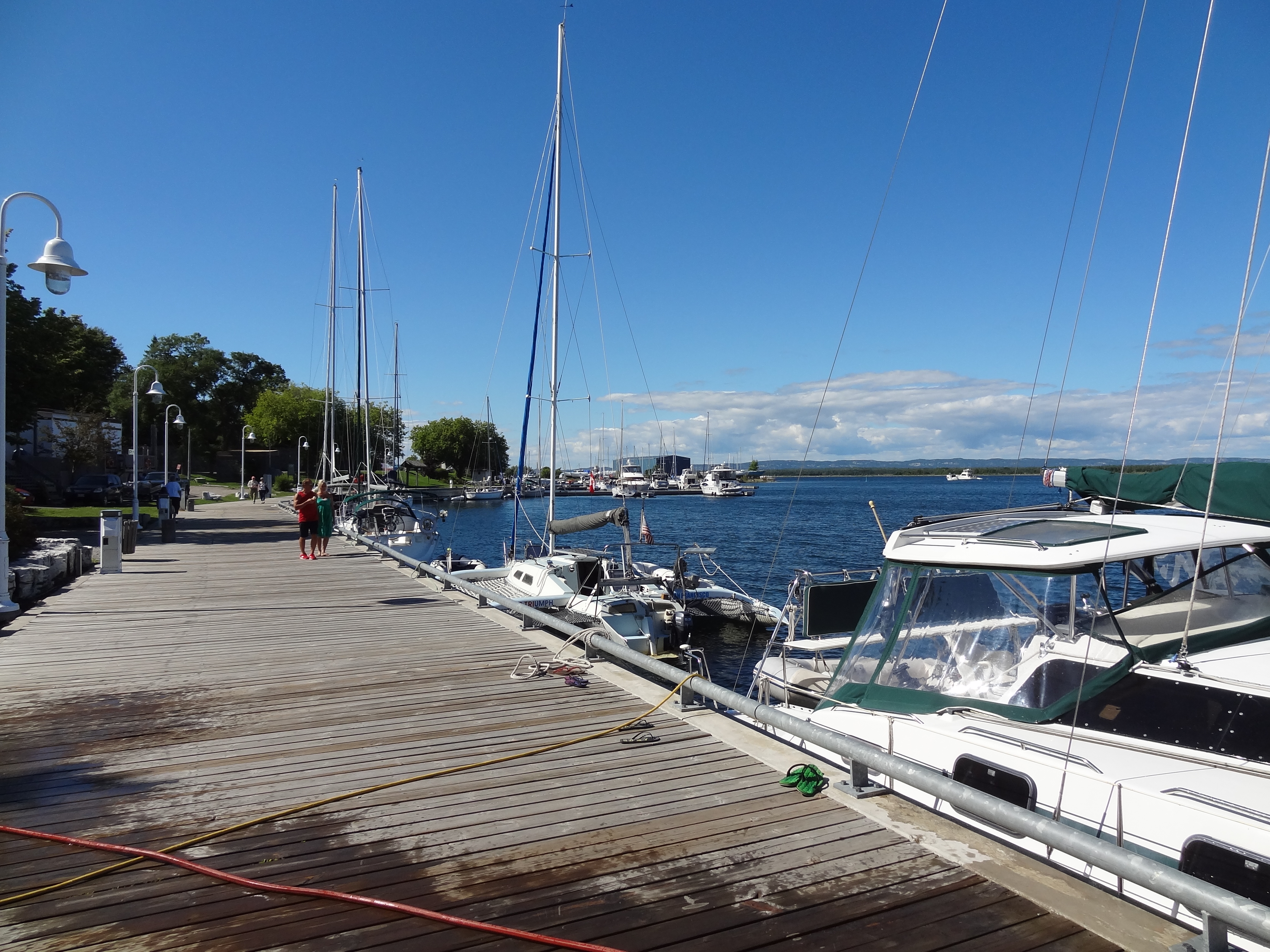
We traveled westward 15 miles to Trenton, Ontario, the “Gateway to the Trent-Severn Waterway” and tied to the dock at the Fraser Park Marina. What a great place it is. Not only is the staff (Craig) incredibly helpful and friendly, the marina is only a block away from a spacious new Metro supermarket (formerly A&P) and the downtown area with other shops and restaurants within easy walking distance. While there we “discovered” Kawartha ice cream and their blackberry cream white chocolate chip ice cream. No other ice cream can compare!
While in Trenton we did about eight loads of laundry in our small European-style washer-dryer (it was running all day long), changed the engine oil and filters, ate out twice, loaded up on diet coke, Lipton diet green tea, and diet mountain dew at the Metro, and also found some olive oil with spices and freshly baked French baguettes!
Saturday, June 15, 2013 – Trenton
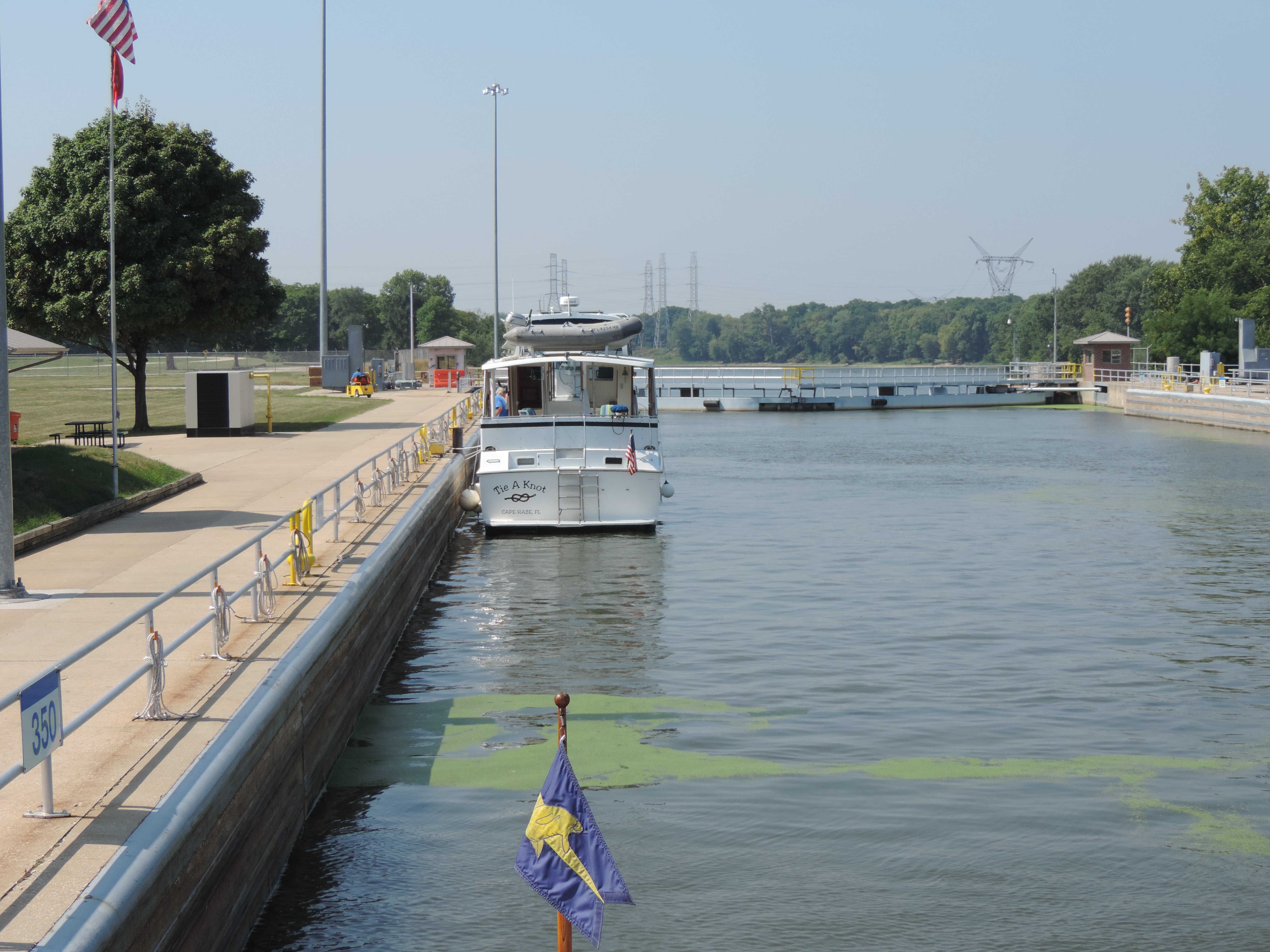
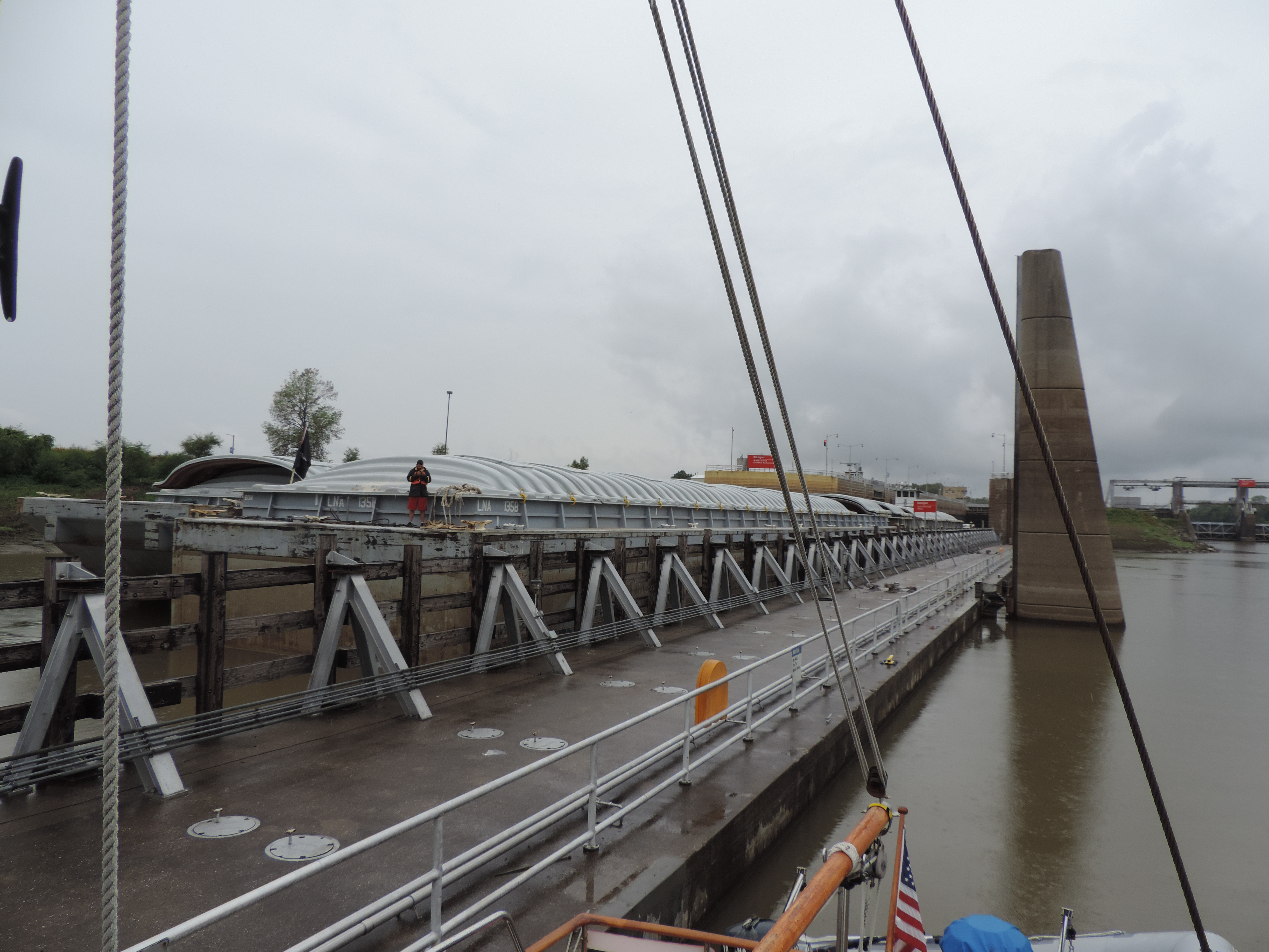
At 0850 we shifted from the dock where we had been staying for two nights to the fuel/pumpout dock to pump out our two holding tanks (absolutely no overboard discharge allowed in these waters). We were then underway and heading under the bridge into the Trent-Severn Waterway at 0915. We had to wait at lock #1 for about 45 minutes and had no response from the Parks Canada employees even after hailing them on the VHF radio several times. Judy finally walked about ¼ mile to the lock and could find no one other than people fishing. About 10 minutes after she returned to Sanderling we saw the lock tenders and the lock doors opened. We learned while we were in the lock that the the lock tenders take care of both locks #1 and #3, and they were assisting boats ahead of us go through #3 when we arrived at #1. Once we were through #1 the rest of the locks were ready for us when we arrived. Each of the crews did take care of two different locks so were driving back and forth the short distance between their locks.
We stopped for the day at the top of lock #6 where there is a beautiful park and camp ground. The name of the local community is Frankford.
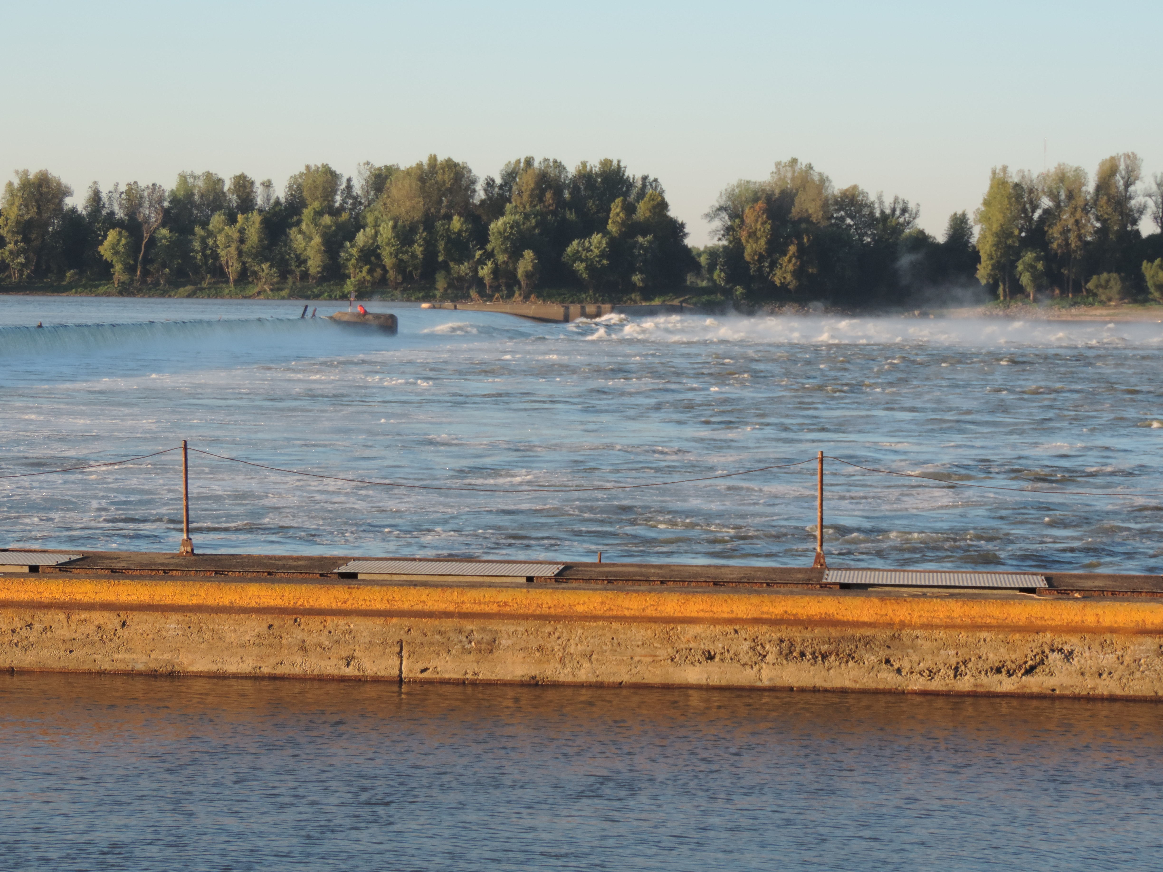
The country is beautiful with tree-covered hills and the rushing Trent River alongside us. There has been more rainfall this past couple of weeks so the waterway authority is allowing more water than normal to flow through the dams in order to prevent serious flooding further upstream.
Tomorrow (Sunday) we hope to reach Campbellford, about 25 miles and another six locks further north (upstream).
Day: 7.6SM/6.6NM – 2H05M Trip: 1696.3NM/1949.1SM – 283H00M
Sunday, June 16, 2013 – Lock #6 – Frankford, Ontario
It’s drizzling this morning and the forecast calls for up to 25 mm (a little over an inch) of rain today. A houseboat that pulled onto the southbound blue line yesterday afternoon departed through the lock about 1100 this morning, but we’re going to stay put for the day and hope for better weather tomorrow (forecast: 40% chance of thunderstorms) to continue northward to Campbellford.
On the Trent-Severn Waterway you’re traveling either north or south when talking to lock and bridge tenders, even though in reality you may at any time be heading north, south, east or west. The basic waterway from the start at Trenton to the finish at Severn is actually northwest, but the waterway follows various rivers (we’re now on the Trent River) and lakes which do not necessarily line up in a north-south direction. So to make it easier, if you’re heading to Severn and eventually Georgian Bay you’re heading north, and if you’re heading to Trenton you’re heading south, no matter what your compass or GPS indicates!
Breakfast this morning for me (Judy’s breakfast is always her hearty coffee) consisted of pancakes, sujuk and kielbasa – the first time I’ve made my at-home-standard-weekend breakfast on this cruise! While we’re underway I usually have toast with peanut butter and honey – it’s fast and easy to fix as well as being fairly nutritious. Some days I’ll eat cheerios with a banana if we have a ripe banana onboard, and I frequently have yogurt in addition to toast and cereal.
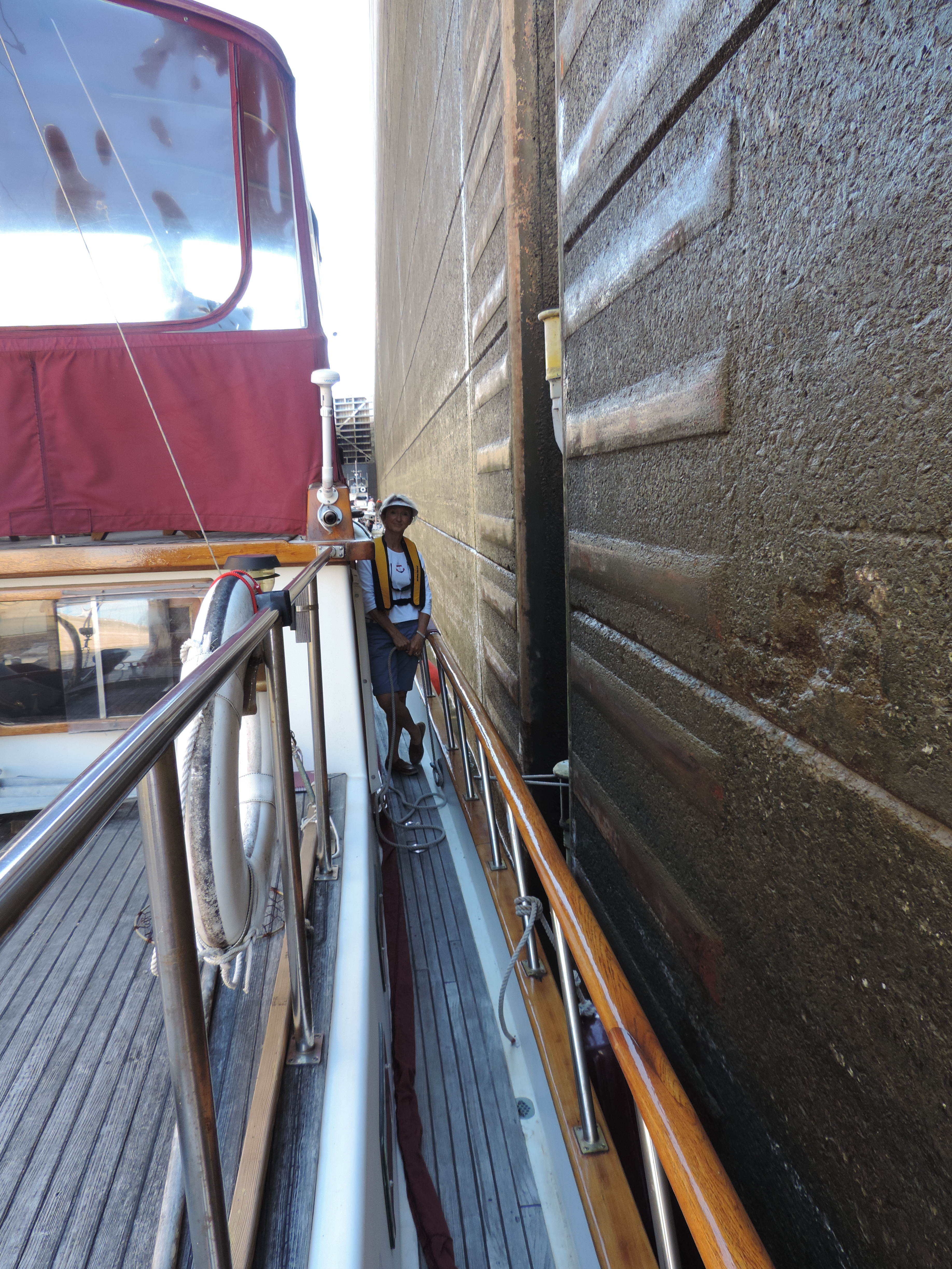
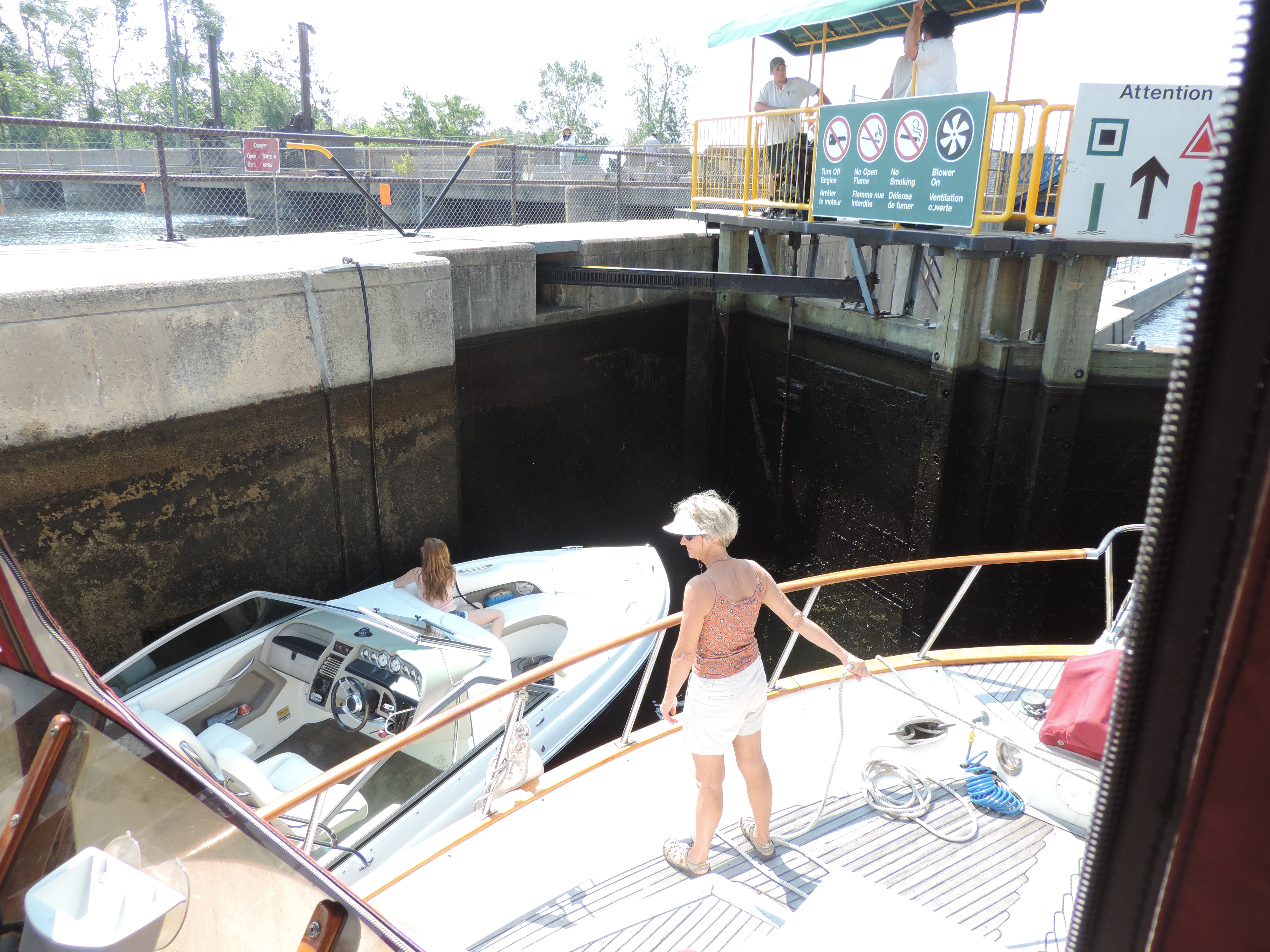
The “blue line” referred to in the first paragraph of this day’s post is actually a wide blue line, painted along the right side of the wall leading to each lock, whether locking up or down. If you intend to go through the lock and the lock gate is not open, you tie to the blue line and wait for the lock door to open. If you’re on the blue line, it means that you intend to proceed through the lock; if you’re behind the blue line (not yet moved forward onto the line, then there’s no expectation that you’re going to go through the lock. It’s more or less a signal to the lock tenders that you do or do not intend to proceed through the lock. Unlike the canals in New York (Erie, Champlain, Oswego) there is no VHF radio contact with the locks in Canada – everything is based on your position on or off the blue line or what you tell the preceding lock tender about which locks you intend to transit that day. If you tell the preceding lock tender that you’re going through the next lock, the tender will call the next lock (by phone) to let them know you’re on your way and will be going through. That allows the next lock tender to prepare the lock for your arrival if there’s not much distance between the lock. The system works quite well and eliminates a lot of radio chatter. You’re not supposed to stay on the blue line during the day, since your presence on the line indicates that you want to proceed through the lock, but once the locks close for the day (1600 during the week; 1700 during the weekend) you can tie up to the blue line to spend the night as long as you’re prepared to lock through when the locks open for the day (0900). We bought a season pass from Parks Canada for both locking and mooring so there is no charge for us to go through the locks or to stay on the lock wall for the night. A few of the locks have hydro (electricity) for an additional $10.00 per night (not included in the Park Canada pass).
Monday, June 17, 2013 – Frankford
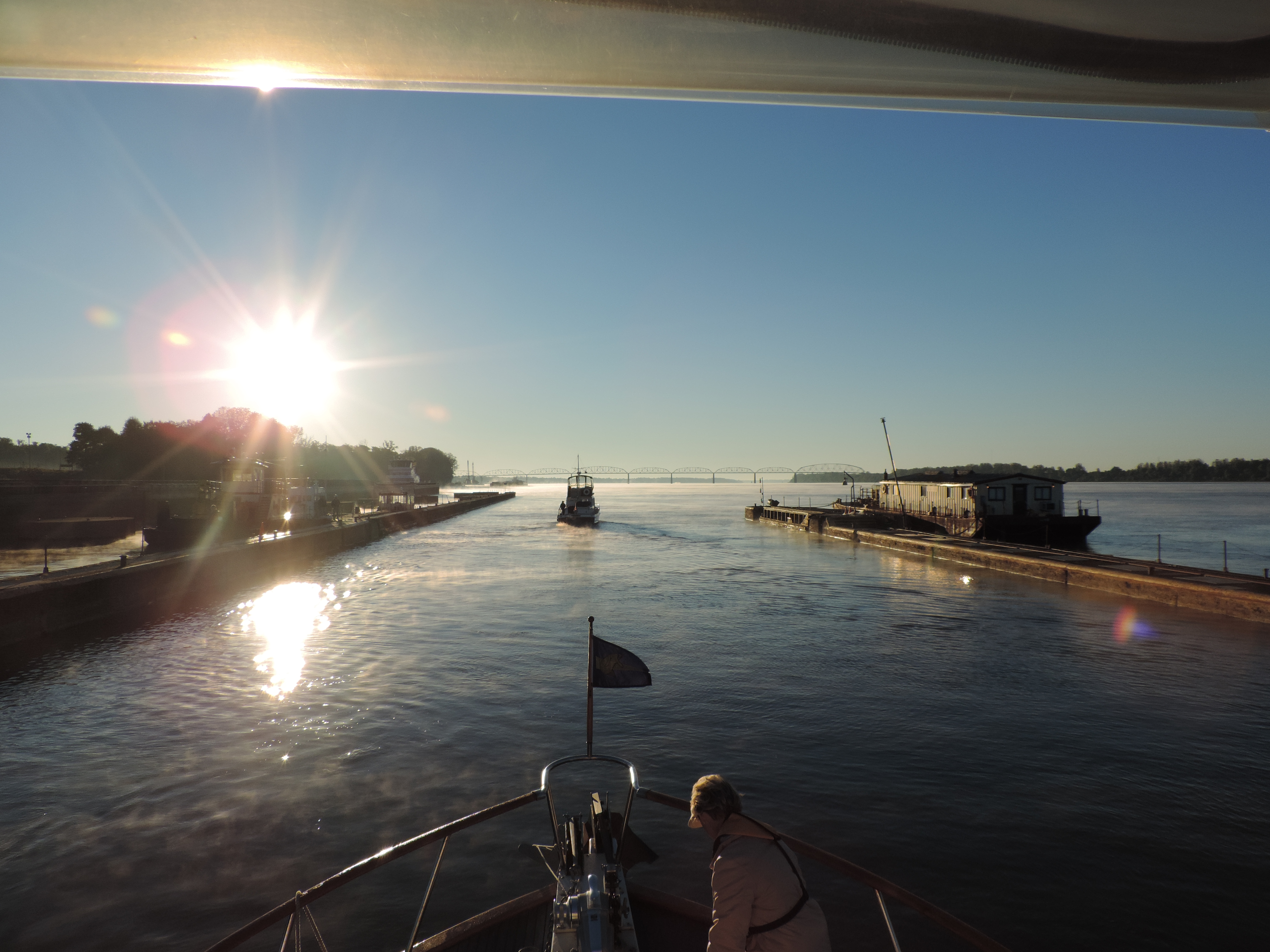
Departed at 0830 to get to Lock #7 (about 6 miles away) in order to get their first opening. Arrived in plenty of time and tied to the blue line; waited about 20 minutes before the lock opened, and as we were entering a Canadian trawler and crew that had been at Frankford came in with us. We were together the rest of the day and the remaining locks to Campbellford.
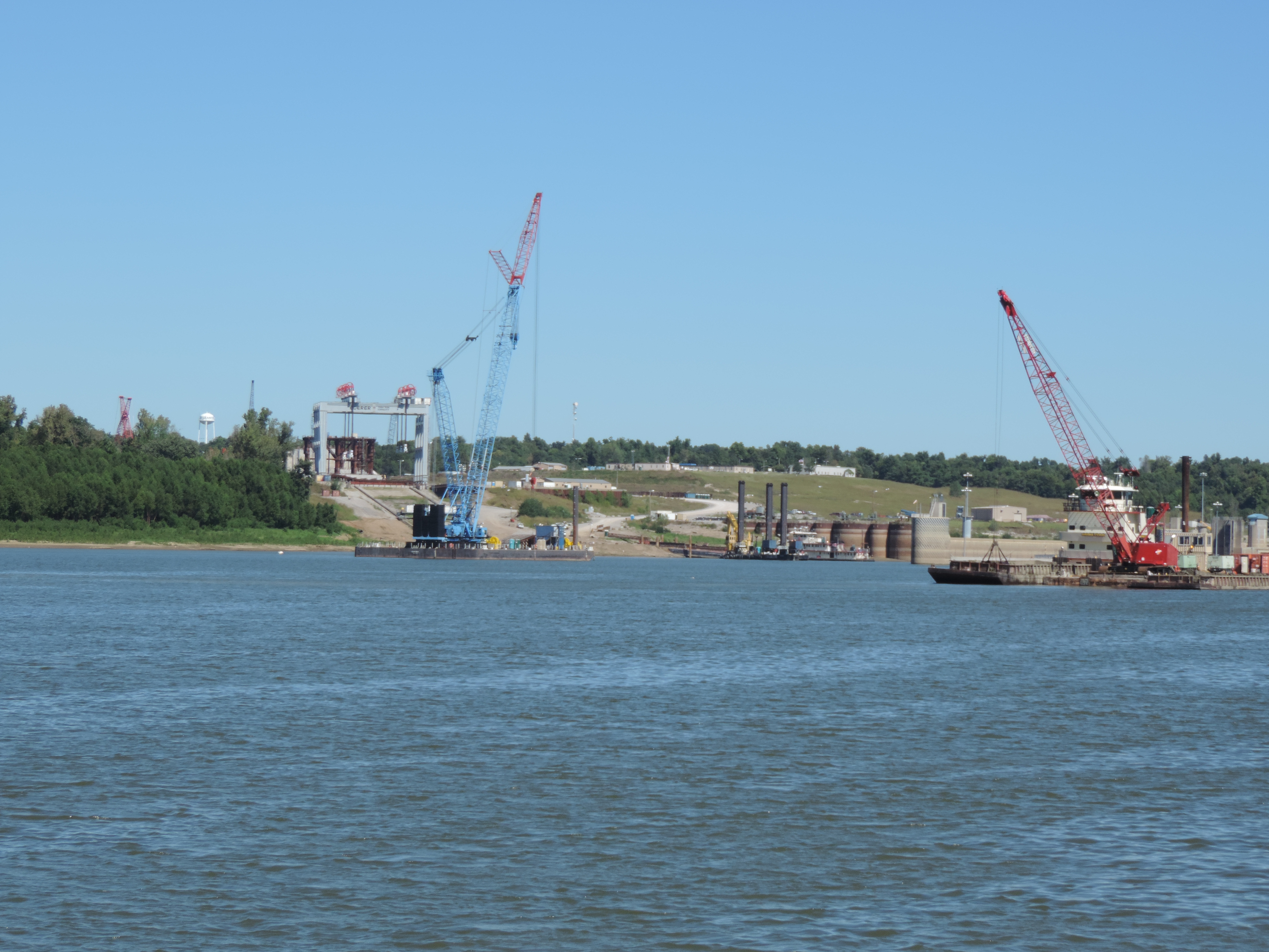
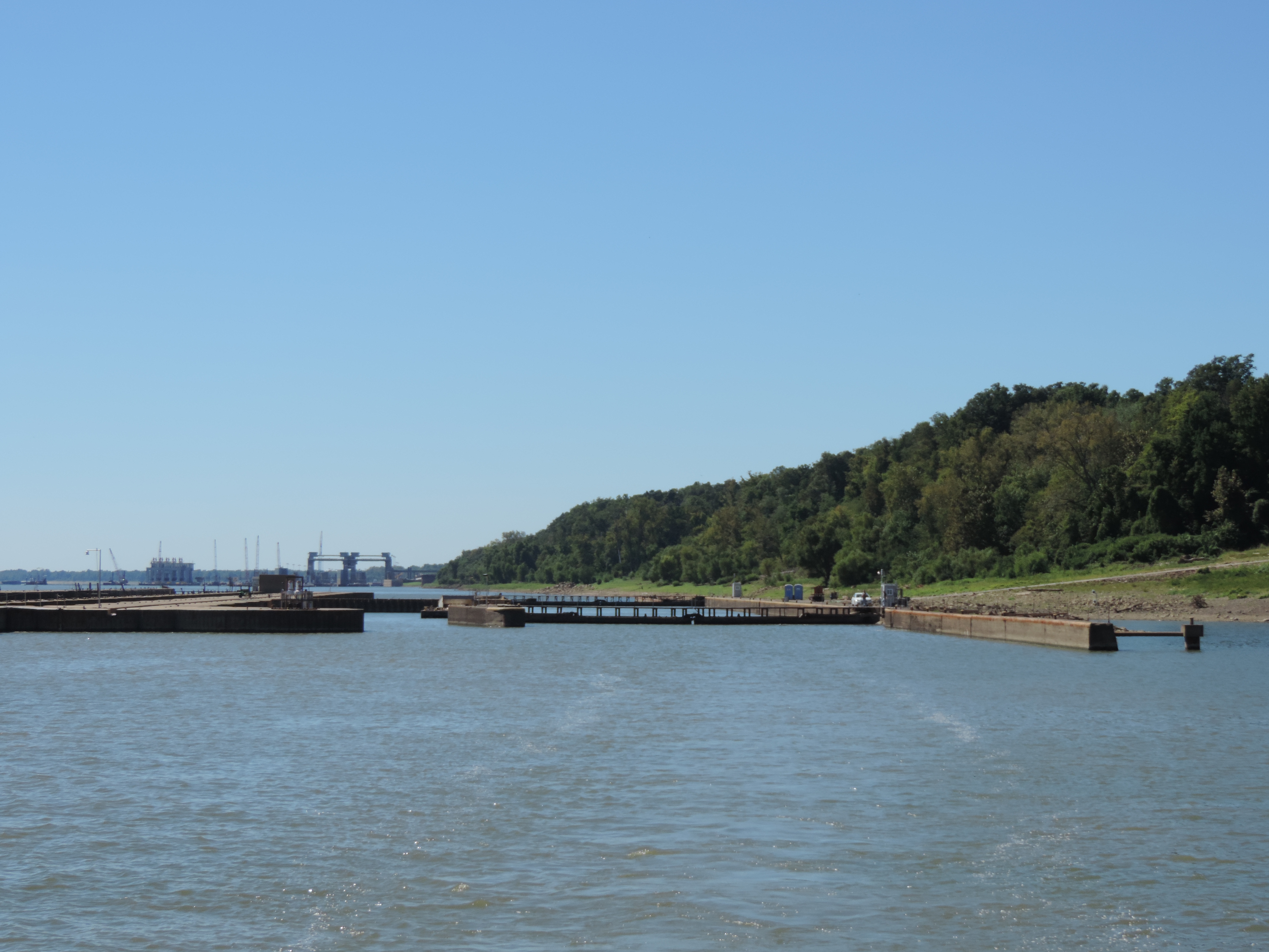
Shortly after we exited the flight of two locks just below Campbellford our engine overheat alarm went off. When I glanced at the temperature gauge it read about 220F degrees, when it’s normally around 170 to 180F in these waters. Fortunately we had moved beyond the dam at that point and were in a rather swiftly flowing, narrow river not too far from where we hoped to moor for the night. Judy immediately put out 125 feet of anchor chain in 10 feet of water which caught and held us firmly.By this time the raw water alarm was screaming, also, so there were two different overheat alarms sounding from both the inside and topside steering stations! The cats were panicked by the sound and were trying to find a place to hide. I turned off the engine and opened two deck plates into the engine room. It was obvious that the alternator belt had NOT broken, so more investigation was required.
I entered the really hot engine room and checked the thru hull intake filter (not clogged) and then took the plate off the impeller housing (the impeller was not broken into pieces) and watched while Judy turned the engine over to check to see whether the water pump was working – it was. We restarted the engine (alarms still screaming) and there seemed to be water coming out of the exhaust as it should be, meaning that raw water was again cooling the engine. Judy noticed that the engine temperature was starting to drop, and shortly the engine temperature alarm had stopped but the raw water alarm on the exhaust hose continued to scream. After the engine continued running for five minutes or so with the raw water alarm still screaming, I returned to the engine room and disconnected the alarm! That solved that problem. We motored forward and took up the anchor line as we went, then continued into the dock at Campbellford and found other boaters waiting to help us get our lines onto the dock in the swift current. Soon all was back to normal.
Although I have no way of knowing for certain, I think we must have sucked something into the engine water intake just after exiting the last lock. When I opened the various ports to inspect the water filter and the impeller the clog must have exited the thru-hull allowing the cooling water to again flow through the engine. I have no other explanation since I didn’t have to “fix” anything in order to get the cooling water flowing again.
We’ll be here in Campbellford for at least the night – we’re currently trying to decide whether to stay tomorrow or continue on to Lake Rice to anchor for a night before getting to the first hydraulic lift lock at Peterborough.
Tuesday, June 18, 2013 – Campbellford
We’ve returned from having our mandatory whipped sweet cream filled glazed donuts at Dooher’s Bakery (also bought a loaf of Canadian Harvest bread and two cheese bagels), buying a number of pounds of chocolate goodies at the World’s Finest Chocolate Factory Outlet Store, and eight bacon-wrapped filet mignons at M&M’s Meat Market. I think we’re all set for a couple of weeks. Those donuts were the best donuts we’ve ever eaten; Judy had two and I had three before we finished!
We did a load of laundry last night and took showers aboard, so we filled the water tanks this morning (total of 160 gallons in two tanks). Judy’s finishing some work using the internet, and then we’re going to head north again. We think we’ll tie to an upper lock wall before reaching Lake Rice later this afternoon. Perhaps Peterborough tomorrow.
Checked the engine this morning and reconnected the raw water alarm – it is no longer screaming. When we started the engine it was pumping water out of the exhaust just like it is supposed to, and there was no sign of any water leaks from hoses around the engine. Most likely cause of the overheating problem yesterday was a plastic bag sucked into the raw water intake thru-hull.
We departed Campbellford at 1200 and at 1230 we were ready to exit Lock #13 with friends Rick and Anna whom we met and traveled with yesterday. They have a beautifully restored Marine Trader 36 which they are taking a short distance north to their home just above lock 17.
At 1430 we exited lock 17 and Rick and Anna veered to port to take their moor
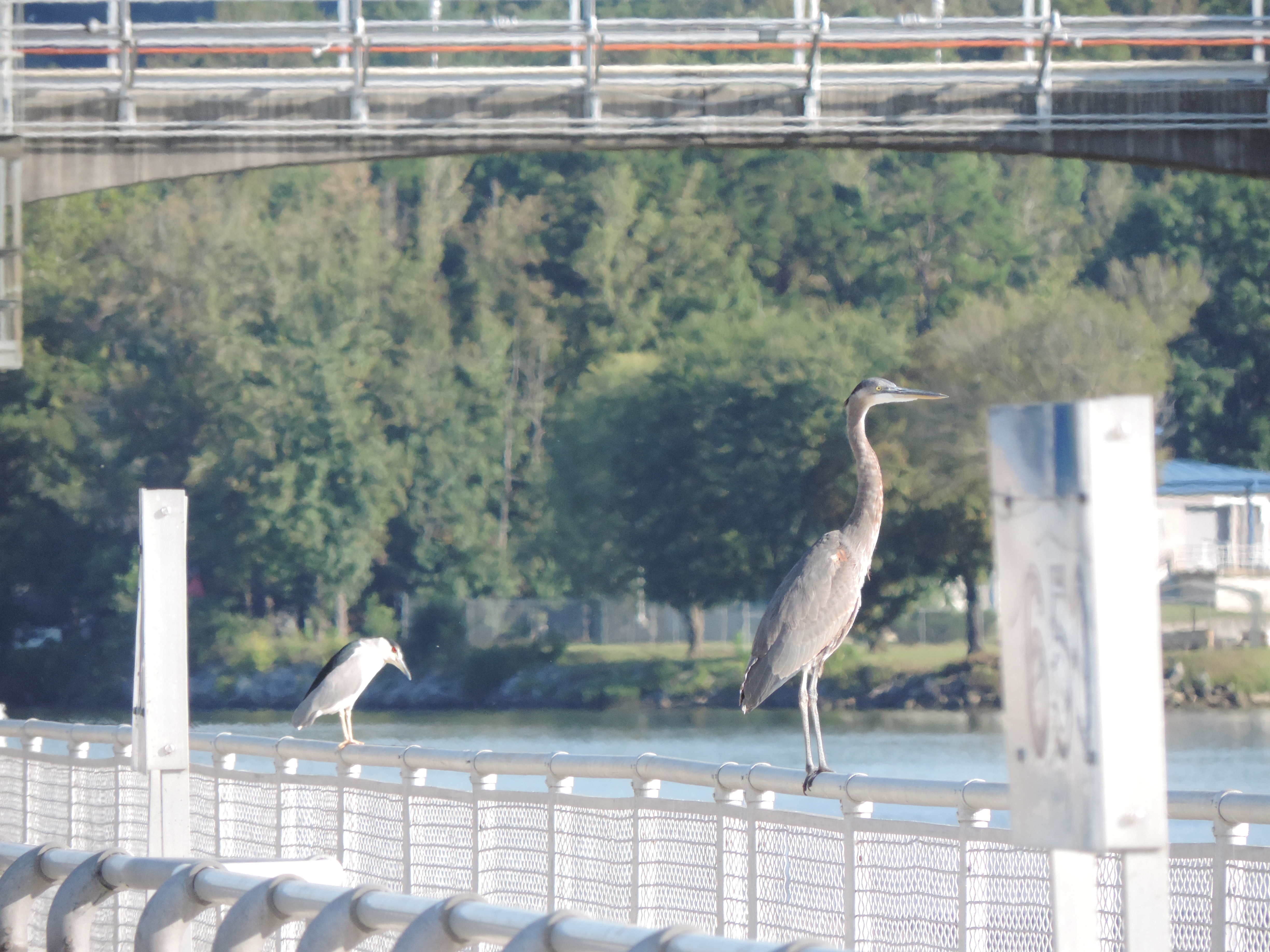
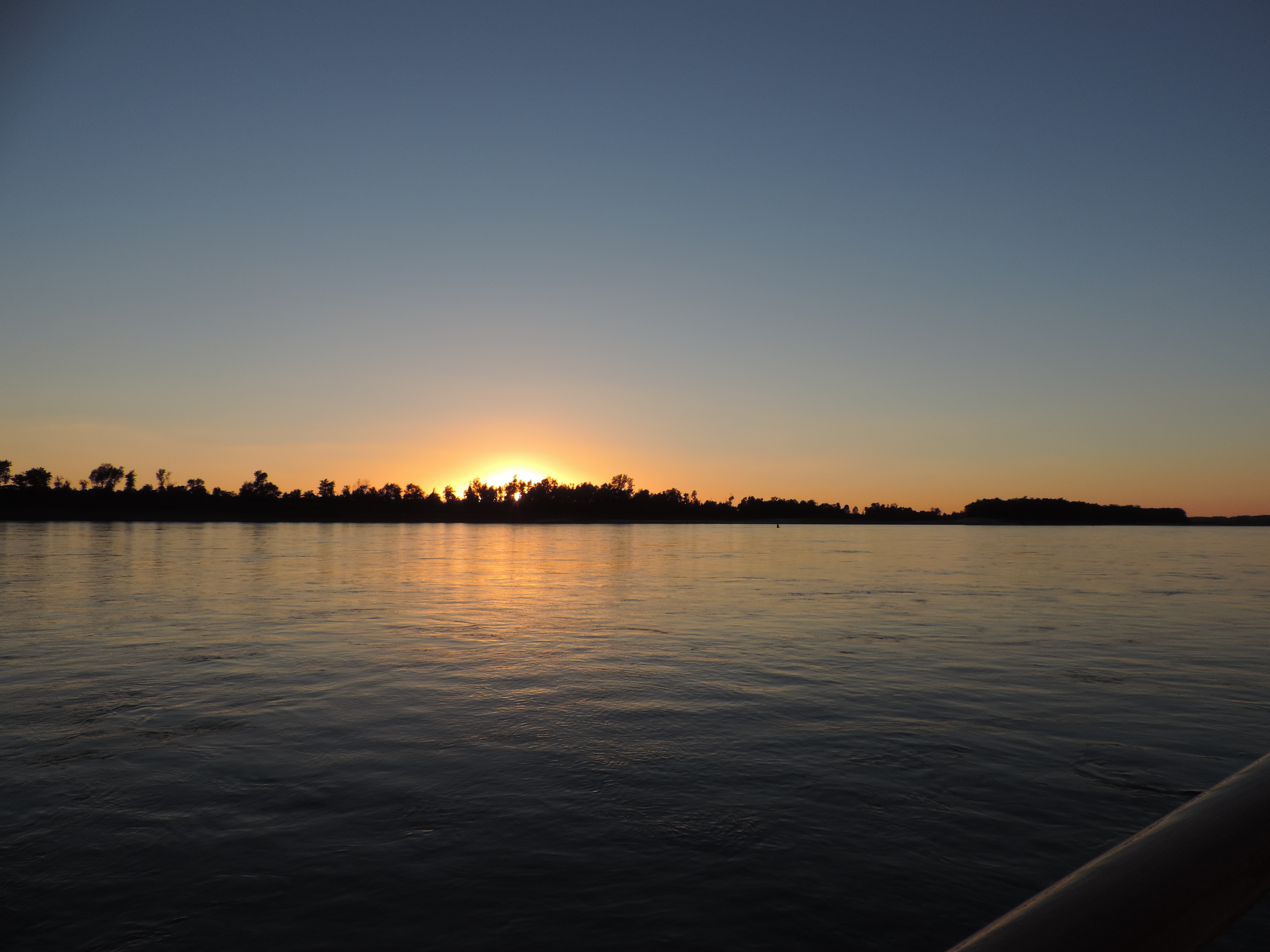
ing in the bay at their home and we continued northward. We anchored at Dunn Point at Trent-Severn mile 41 at 1515 hours, and had an enjoyable afternoon basking in the sun with both cats able to run about the boat. That evening we heard and later saw our first loon of this trip – what a mournful sound and beautiful sight they are on the water.
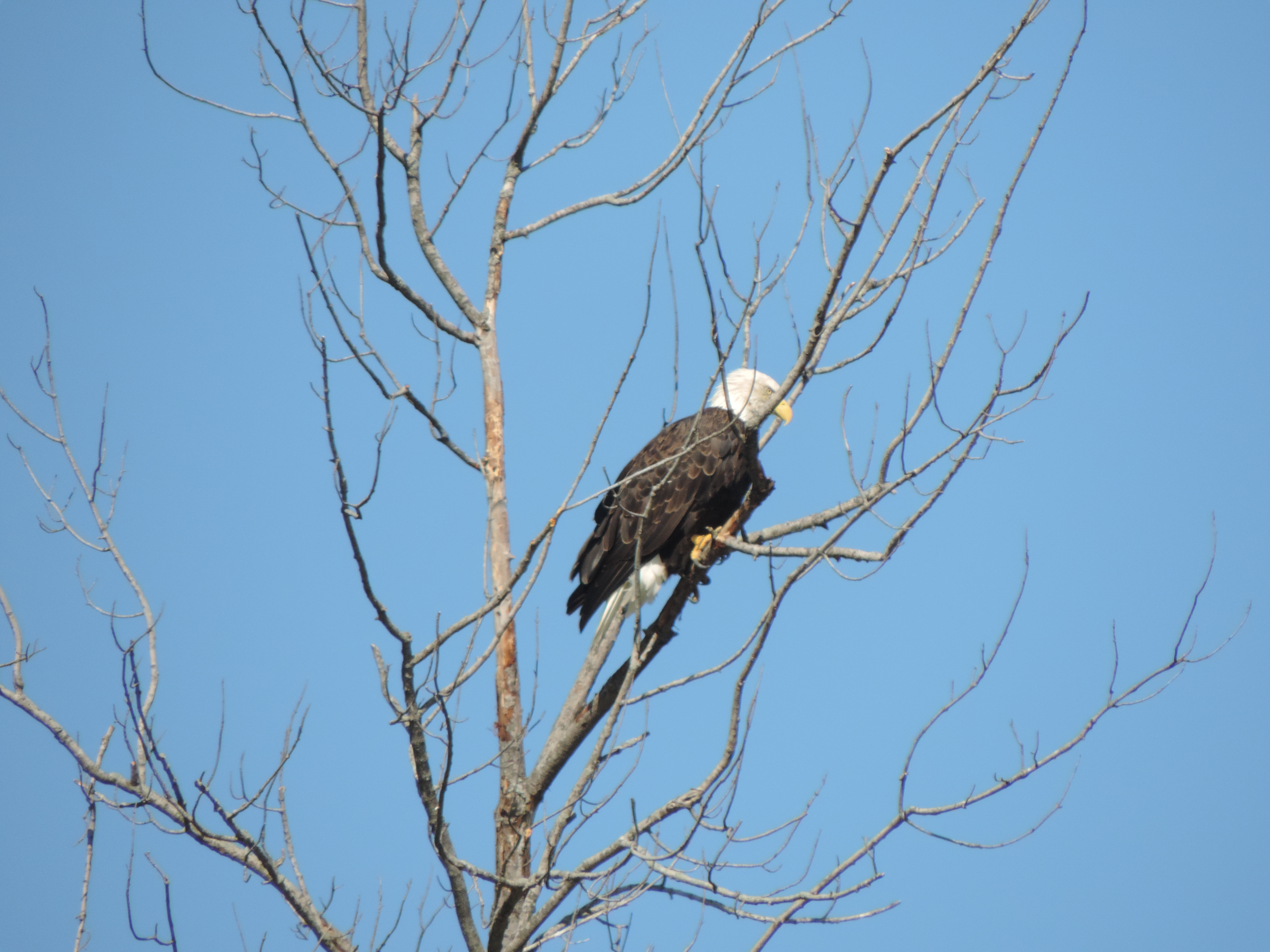
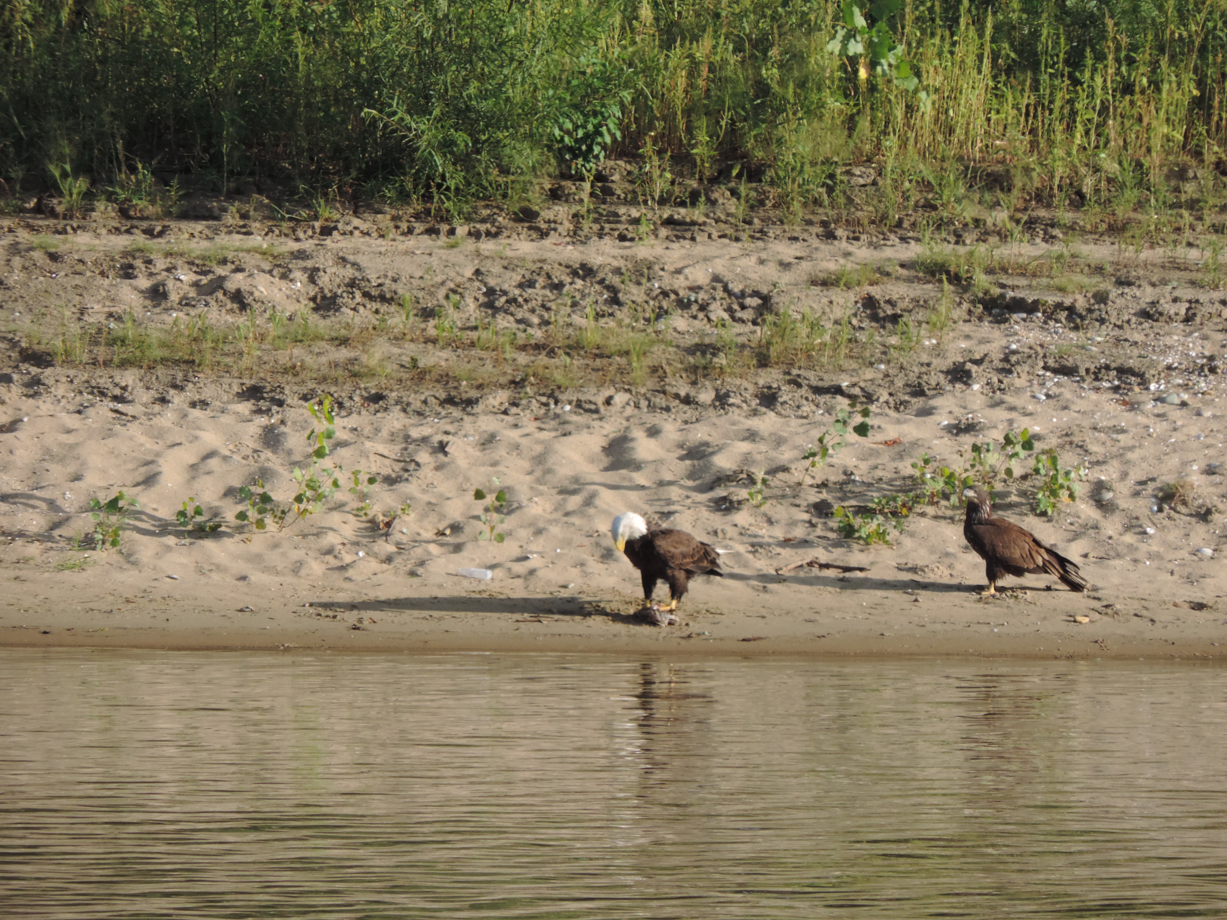
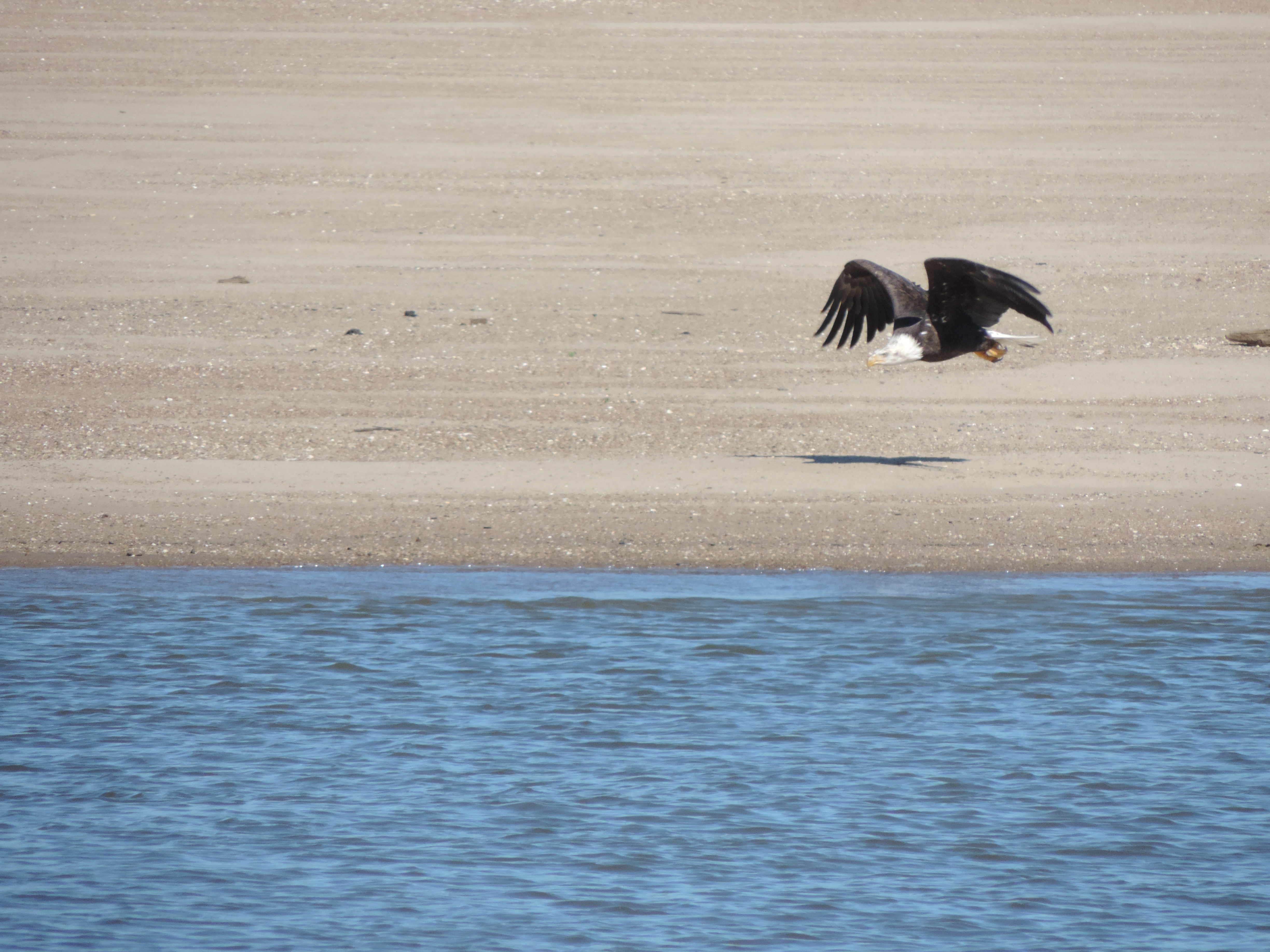
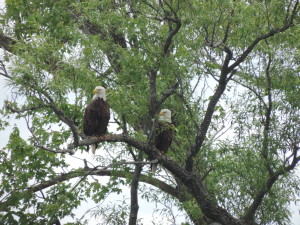
Forgot to mention that we saw TWO bald eagles on a tree limb yesterday and Judy got some great pics of them as we passed slowly by.
Day: 9.9SM/ 3H15M – Trip:
Wednesday, June 19, 2013 – Dunn Point
We had the anchor up and were underway at 0940. Surprisingly there was no grass “beard” on the anchor. We are not in the real “cottage” area of the Trent-Severn and the banks of the rivers and lakes are lined with summer cottages (a few newer year-round homes as well, it appears). We passed through lock #18 at Hastings and into Lake Rice. We looked for a place to anchor where we could find an unsecured WiFi (from someone’s home) and finally found a good spot further along the lake near the Hiawatha Indian Reservation not too far from where we would turn north into the Otanabee River. We could see a few weeds growing from the bottom, so figured that we’d have a “beard” tomorrow when we raised anchor!
Day: 27.3SM/ 4H45M – Trip:
Thursday, June 20, 2013 – Hiawatha Indian Reservation north shore Lake Rice
Another clear and sunny day with little wind and temperature about 65F when we got underway at 0900. We did have a bit of a “beard” when the anchor was raised and it took awhile to clear off the grass while Judy headed toward the Otanabee River.
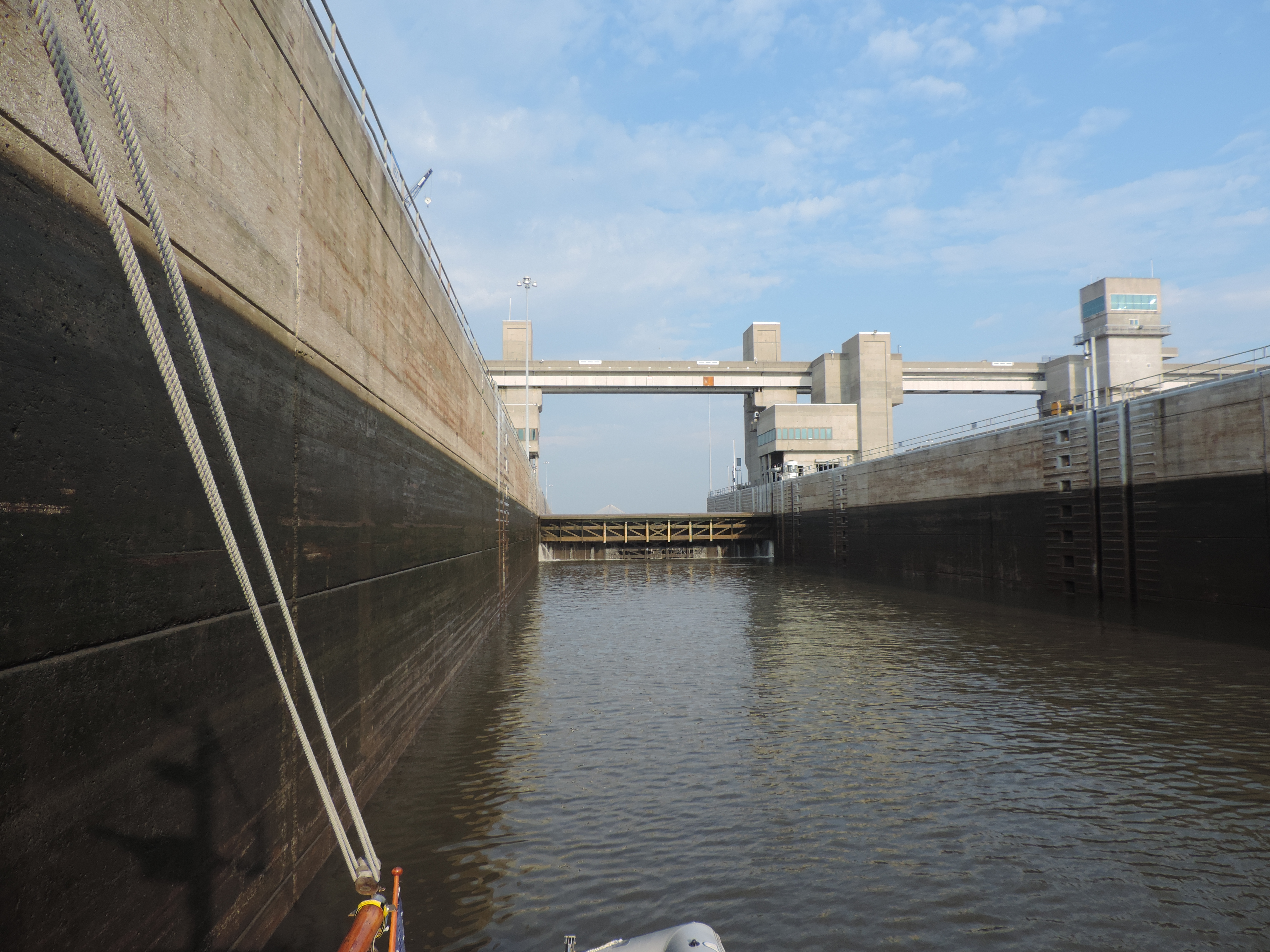
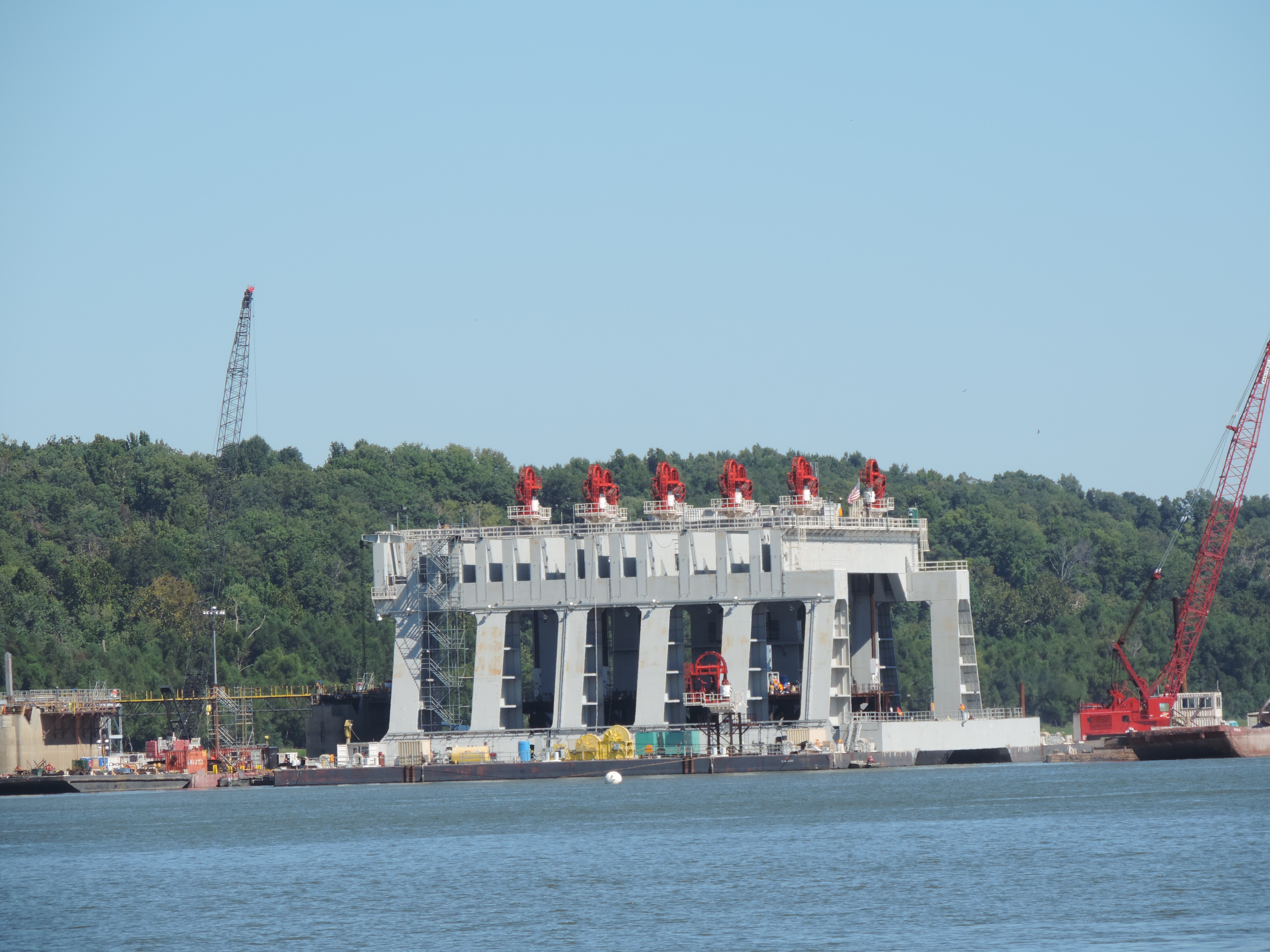
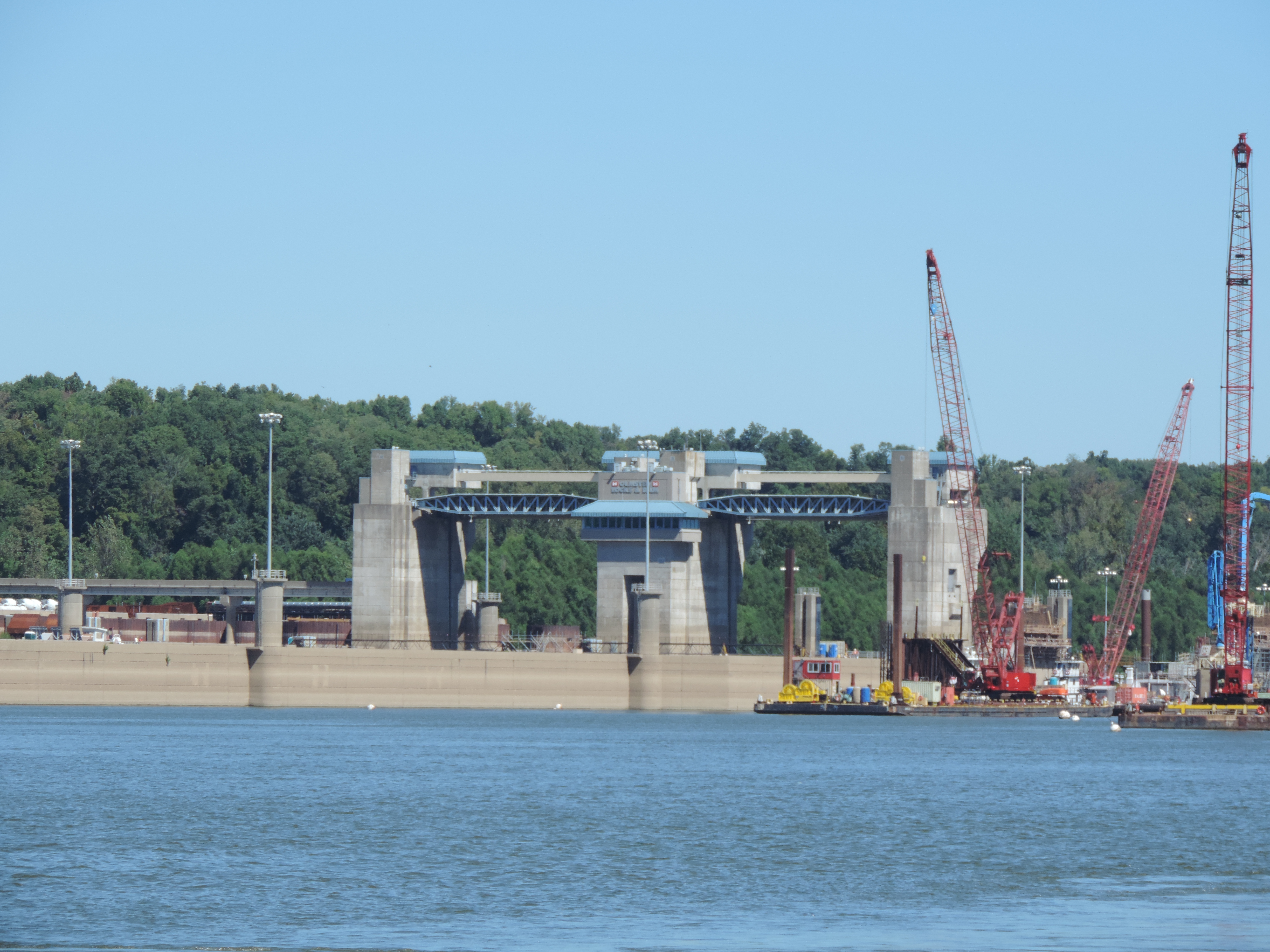
At 1230 we went into lock #19, and at 1305 we had lines to the dock at the Municipal Marina in Peterborough. After we had registered and each had two scoops of Kawartha ice cream (Blackberry Thunder) we walked several miles to the lift lock just north of Peterborough to get a feel for what we would be doing tomorrow. While this is one of seven lift locks in the world (Canada, England, France and Belgium), it will be a first for us. This one is the world’s tallest. We hope to depart the marina about 1000 and be in the lift lock between 1100 and 1200.
Day: 23.9SM 4H25M – Trip:
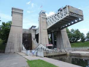
Peterborough Lift Lock
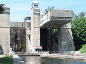
Peterborough Lift Lock
Monday, June 24, 2013
Since departing Peterborough we’ve stayed at Lakeville Lock #26 (where we were able to walk into town and buy containers of Hawatha ice cream), anchored near Taylor Island in Clear Lake, and then anchored in beautiful small Gilchrist Bay off Stony Lake where we’ll soon depart this morning heading to the Whetung Ojibwa Crafts and Art Gallery dock for a short stop and then will find an anchorage in Buckhorn Lake.
More later!
Wednesday, June 26, 203 – Bobcaygeon Lock #32 mile 138
This morning Bob walked to a restaurant and had an omelette, home fries, bacon and toast for breakfast before we got underway. We watched a couple of house boats (rented locally) lock through the lock with the assistance of the lock operator, and then at 1030 we went into the lock ourselves. We went through several more locks before anchoring in Fells Bay off Cameron Lake at 1400.
The bay was very small and we were well protected from wind from about any direction. There were cottages and larger houses around the edge of the lake and people were swimming from shore and generally enjoying the nice afternoon.
It wasn’t very long after we anchored that we began to hear loons calling and saw them in the water. Upon inspection with our binoculars, it was apparent that the pair had a small chick that they were taking care of. Later in the day we even observed the chick on the back of one of the adult loons! The little family stayed between us and the shore for the entire time we were anchored in the small bay.
Day: 19.1SM/16.6NM 3H30M – Trip: 1842.3NM/2116.9SM 318H40M
Thursday, June 27, 2013 – Fells Bay, Cameron Lake mile 155
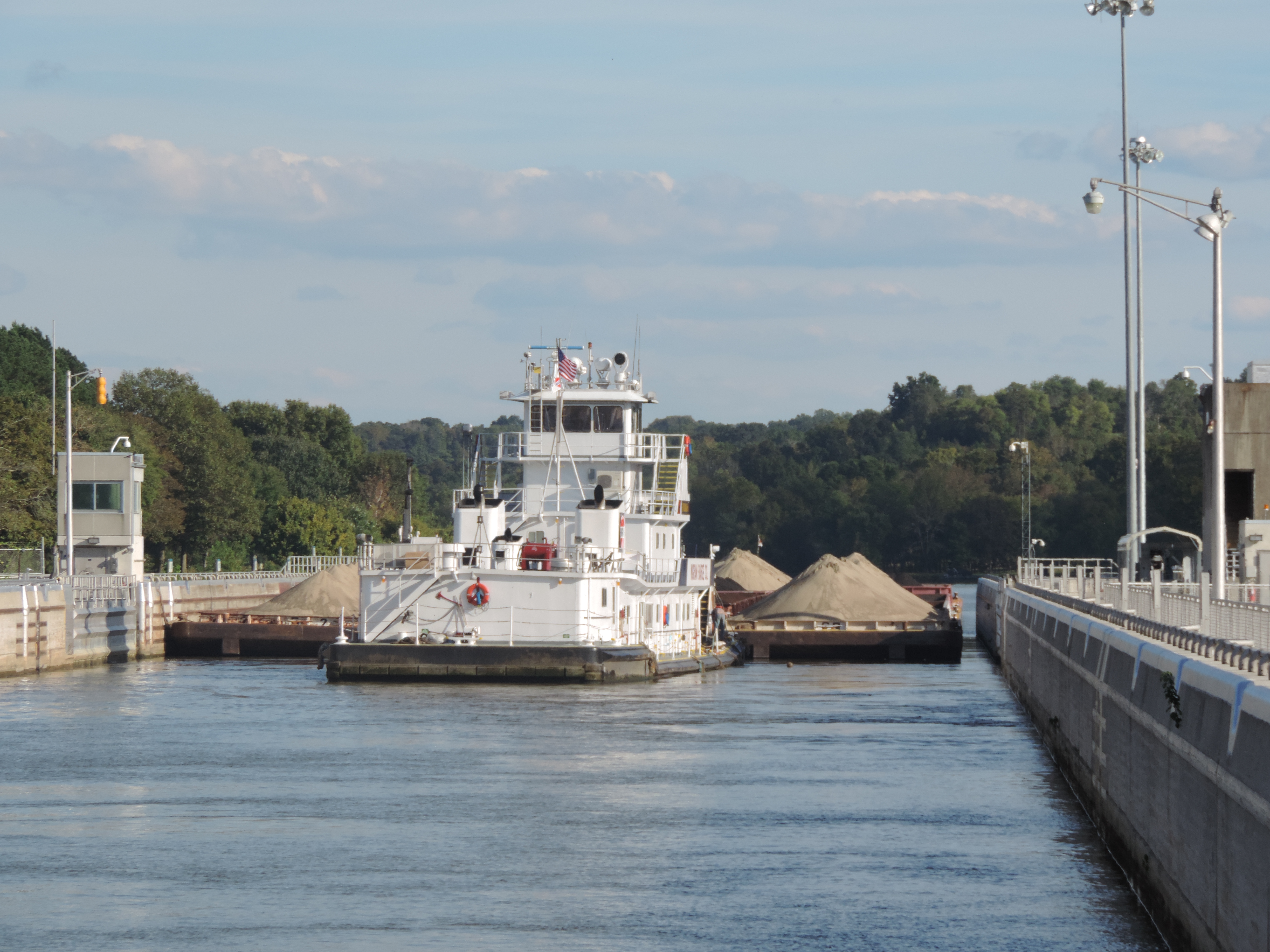
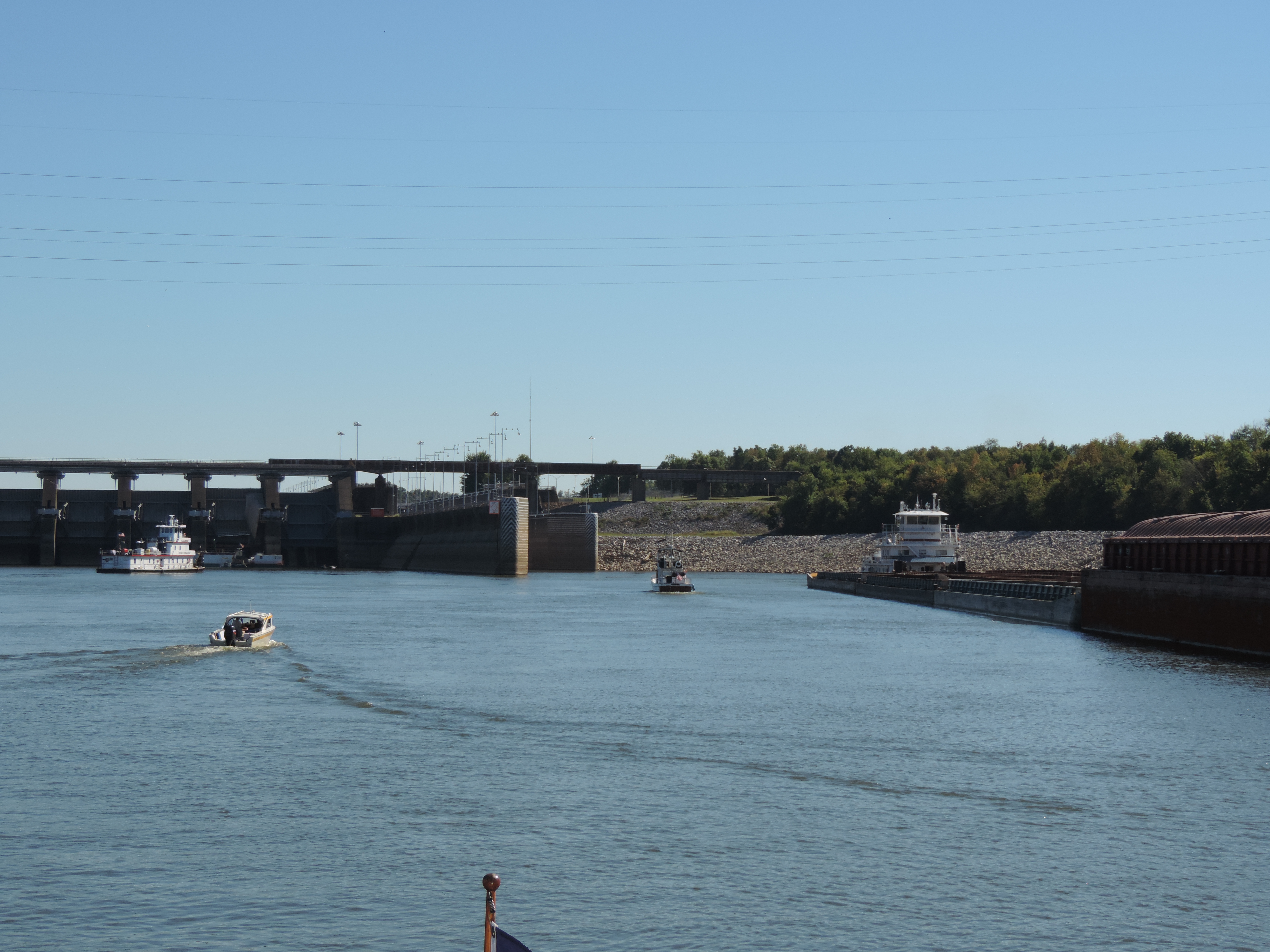
Just before raising the anchor this morning we saw another loon who was swimming very close to Sanderling. Judy was able to get some good photos of it while it swam by. The anchor was up at 0935 and we were on our way. The next lock was just a few miles further northward and a 40 foot vertical lift; as it turned out we were in the lock with three rental house boats, not the best of all possible worlds since the house boats operators are generally very inexperienced and to be avoided, if at all possible, to lessen the possibility of a collision! Despite their lack of experience, the lock tenders are very good at helping them get their boats tied to the walls (this is basically rental house boat nirvana) and as long as they understand directions the boat operators get along fairly well. We helped the last houseboat into the lock get their lines fixed to the lock walls – we had been in another lock with the same boat the previous day, so at least this wasn’t the boat operator’s first lock!
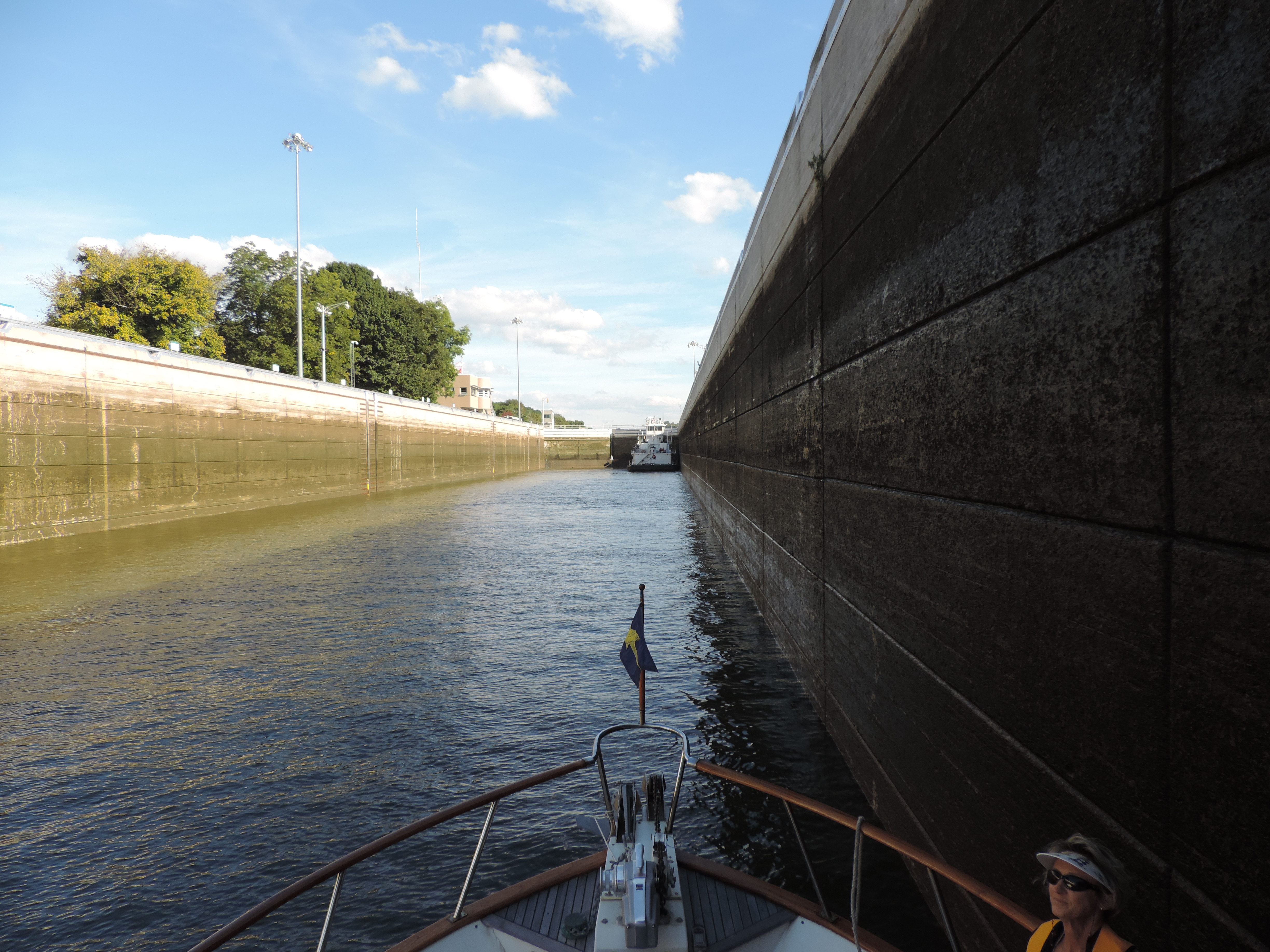
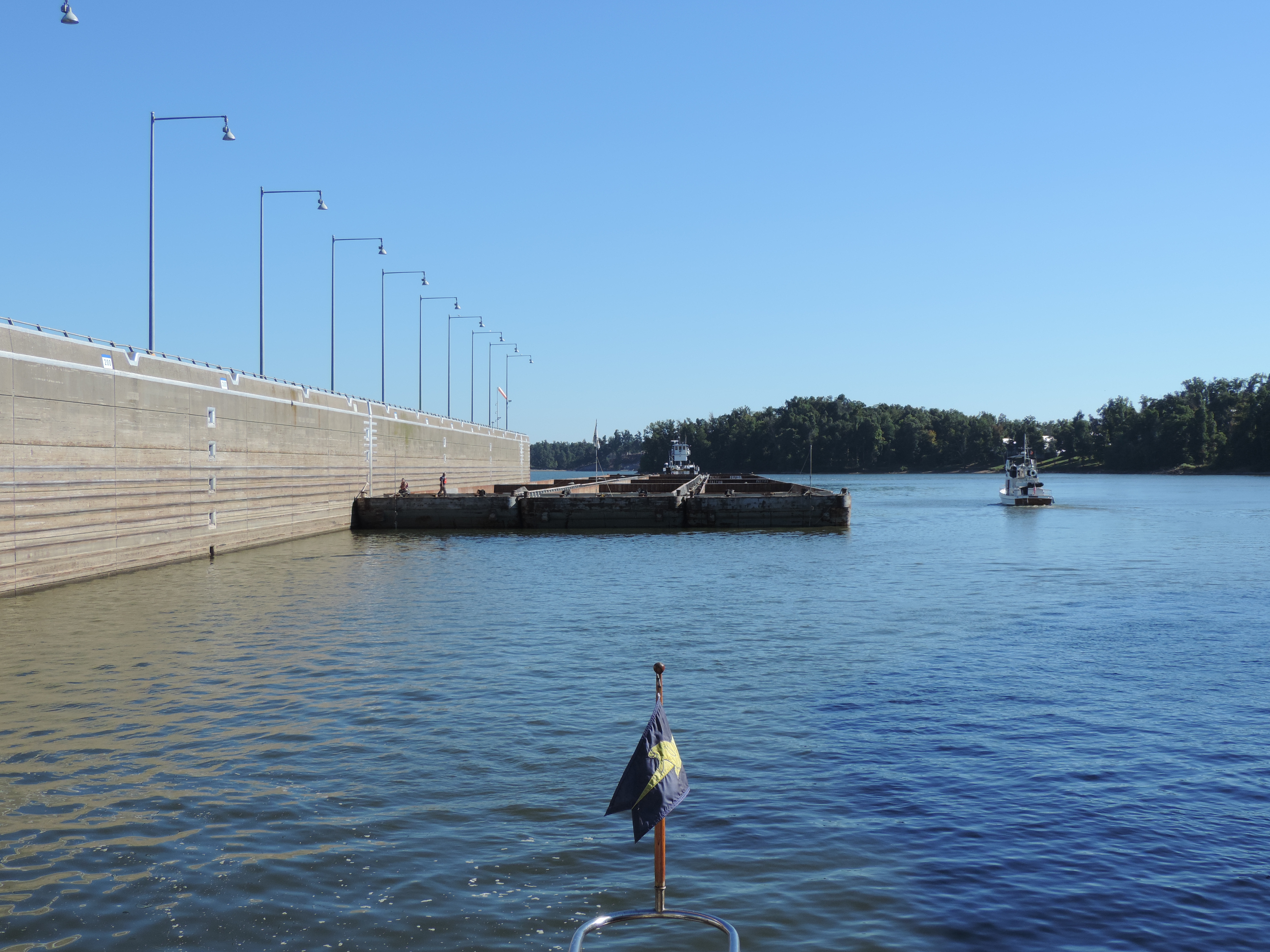
By 1225 we had our lines to the wall above the Kirkville Lock #36 (the second hydraulic lift lock on the waterway) and walked forward to the lockmaster’s office to discuss what was available for an overnight further along the waterway. After learning that the next five locks all could accommodate several boats beyond their blue lines, we proceeded into the port “bathtub” along with a beautiful Ranger 28 tug behind us, and shortly were being lowered about 45 feet to the lower level. This was the first “down” lock we encountered on the waterway – all of the preceding locks were locking us up to a higher level of water. The highest lake level is 840 feet above sea level (Lake Balsam). We started on Lake Ontario (Trenton) at about 243 feet above sea level, and we’ll be lowered at Georgian Bay (Port Severn) to 576 feet above sea level! There are a total of 44 locks (one number isn’t used) and Lock 44 at Big Chute is really not a lock but a marine railway. The last lock at Port Severn is #45.
By 1305 we were out of the Kirkville lift and on our way. At 1620 we had traversed four more locks and had our lines to the lower wall at lock #40 where we were going to spend the night in a quiet, rural setting. There was one small boat tied to the far end of the wall when we arrived and they had their Honda generator and a 2.5 gallon gasoline container on shore with a long yellow etension cord running to their boat to power their refrigerator and air conditioner. We met them while we were eating our garlic shrimp and pasta dinner and they were heading to the lock wash room to wash their dinner dishes.
Day: 25.6SM/22.3NM 6H45M – Trip: 1864.6NM/2142.5SM 325H225M
Friday, June 28, 2013 – Lock #40 lower wall shortly before Lake Simcoe mile 180
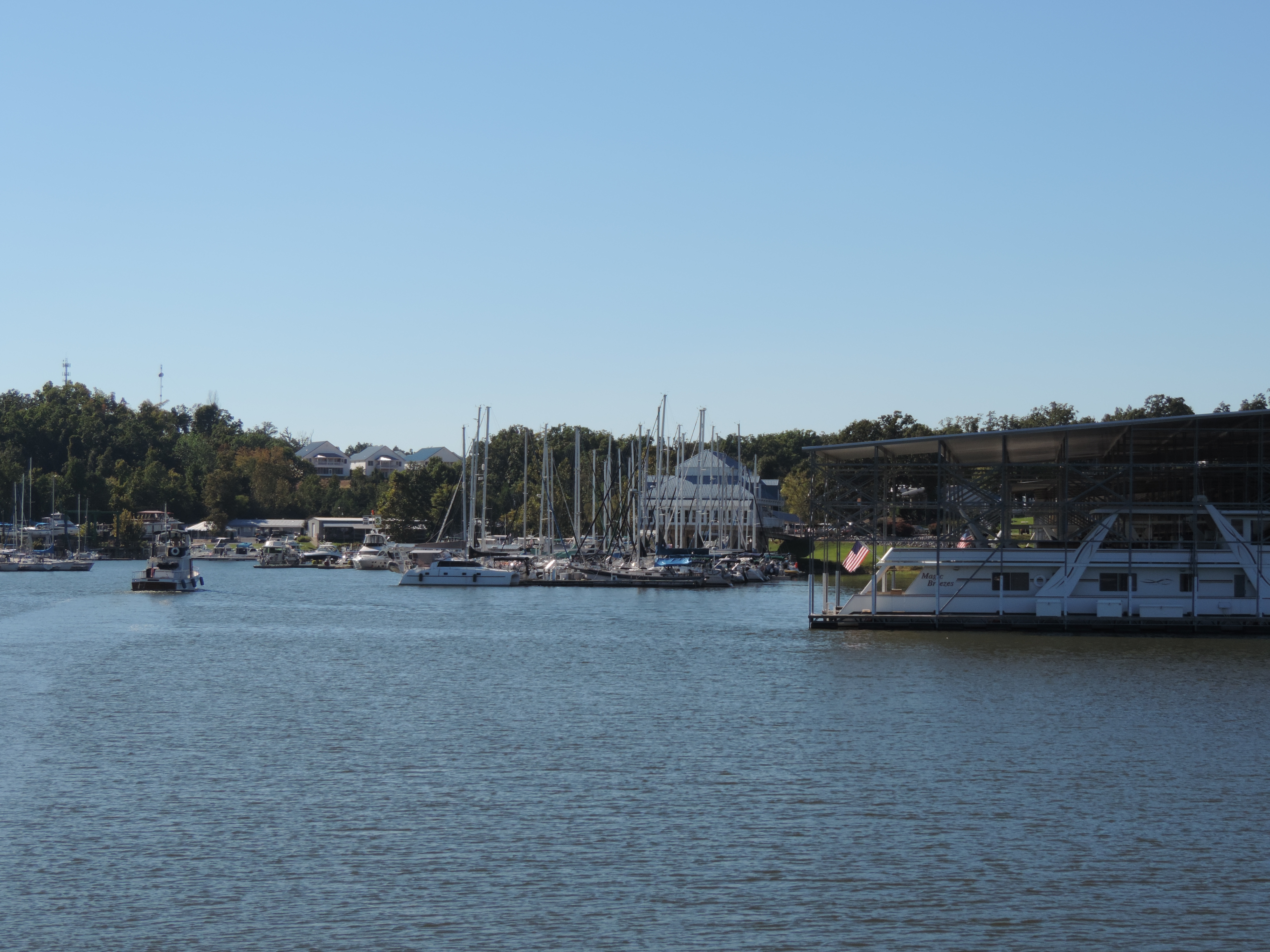
After discarding the accumulated trash in the lock’s trash bin, we cast off the lines from the downside wall about 0840 and slowly moved to the wall of Lock #41 in order to be there when the lock crew lowered the water for the first lock at about 0900. We tied to the upper lock wall and waited while the crew took care of their preliminary tasks (such as raising the Canadian flag, placing fire extinguishers and life preservers around the lock) and when the gate opened we proceeded in and tied to the starboard wall (our preferred side). A few minutes later we were out of the lock and were passing under a railroad bridge and then a low car bridge which opened for us. Immediately after the car bridge we tied to a long wall prior to entering Lake Simcoe in order to decide whether to go into a marina or to anchor somewhere. We eventually tried to get a reservation at a marina in Orillia (just off Lake Simcoe) for three days starting on Saturday, but there was no slip available for a boat our size. Monday is the first of July, Canada Day, and apparently everyone with a boat is going out for the three day weekend and many go into marinas to party.
We crossed the eastern end of the lake still heading northward and anchored in a relatively large bay, McPhee Bay at the northeastern corner of Lake Simco. The water is a clear bluish-green and we can easily see the bottom at 14 feet below Sanderling. There is a marina on a smaller bay on the southern side of McPhee Bay and there are a few ski boats, and slightly larger boats, out for the afternoon. It will undoubtedly be busier tomorrow (Saturday) with the start of the weekend.
The weather forecast is fairly benign, so we’ll stay here for a couple of days before proceeding through the next lock and looking for another place to anchor. We want to avoid the weekend crowds at the lock walls and “party spots” as much as possible, so won’t try to move very far until Tuesday morning. We have contacted a marina at Port Severn (the nothern end of the Trent-Severn Waterway, and will stay there for two nights beginning either Tuesday or Wednesday.
Day: 17.8SM/15.5NM 3H55M – Trip: 1880.1NM/21603SM 329H20M
We ended up anchored in McPhee Bay for four nights – the weather was delightful (not too hot, not too cool), and we were well protected from any wind from all directions but the southwest (nothing materialized). There were a lot of small boats out on the bay every day and we could see larger boats crossing the southwestern end of the bay heading toward Orillia or out into Lake Simcoe, so we knew things were busy at “The Narrows” with its several marinas and narrow channel. One day we lowered the dinghy and rode around the bay and into the two marinas located a bit off the bay through narrow channels. One of them was quite large, with many covered slips as well as a very active fuel dock. During the four days we were there several larger boats (34-38 feet, guessing) rafted at the far end of the bay and several other boats anchored near them, but everyone seemed to clear out at night (except the two rafted boats) and head back to their marinas. Different boats showed up on other days. Guess they preferred to party at night in their marinas than enjoy the peaceful lake after the water skiers called it quits!
One unpleasant aspect of anchoring in the bay were bugs – hundreds of them – little flying things, some with white wings and bodies and others looking more like mosquitoes (without the sting) and still others that reminded me of the mayflies we had on the rivers in Iowa at night. I had to vacuum the decks every morning to get rid of them and the little bodies piled up near the LED anchor light I set out on the bow every night.
Tuesday, July 2, 2013 – McPhee Bay mile 195
We got underway at 1010 and proceeded just a few miles onto the free dock at the Port of Orillia to shop at the Metro supermarket within walking distance of the dock in Lake Couchiching. We also had hoped to find some water for our tanks since we assumed we were getting low after filling the tanks (160 gallons total) at Peterborough on the 22nd of June (12 days earlier). There were no water bibs on the free dock, and the nearby marina would not give or sell us any water unless we stayed overnight; since staying at the marina that we had tried to get into four days earlier, but couldn’t due to the holiday, was not in our plans, we continued on without filling the water tanks, although we did some major grocery restocking at Metro. We also found a small ice cream store right across the street so had a little mid-afternoon treat!
We continued on for another 12 miles or so to the upper wall at Couchiching lock #42. We had intended to go through that lock and anchor in a lake for the night and arrived at the lock before the “normal” 4:30 locking time, but when we were about 100 yards from entering the lock on a green light, the light suddenly turned read and the staff told us that we had to be there at 4:15 in order to lock through. There was no way to argue – they control the lock, so we ended up on the upper wall for the night. A short time after we tied to the wall (after 4:30 now) a small boat came in and complained that they needed to get through because they were driving a rental boat and it had to be returned; the crew let them lock down! Needless to say, we were a bit perturbed, but again, what could we do – complaining wouldn’t accomplish anything and would probably result in a less than harmonious locking through the next morning. So we stayed the night on the wall, along with several other boats.
Day: 21.2SM/18.4NM – 4H10M Trip: 1898.5NM/2181.5SM 333H30M
Wednesday, July 3, 2013 – Couchiching Lock #42 mile 209
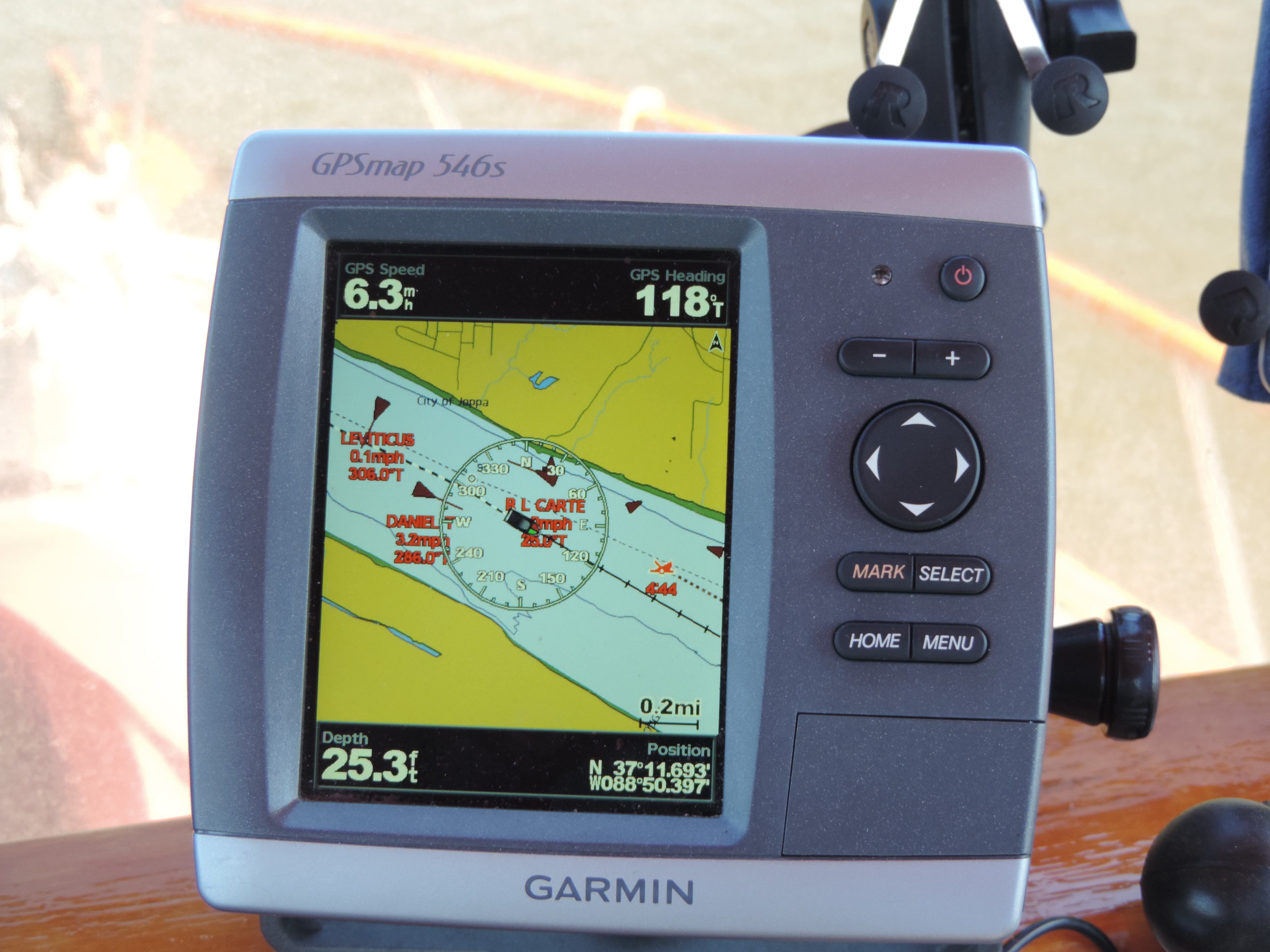
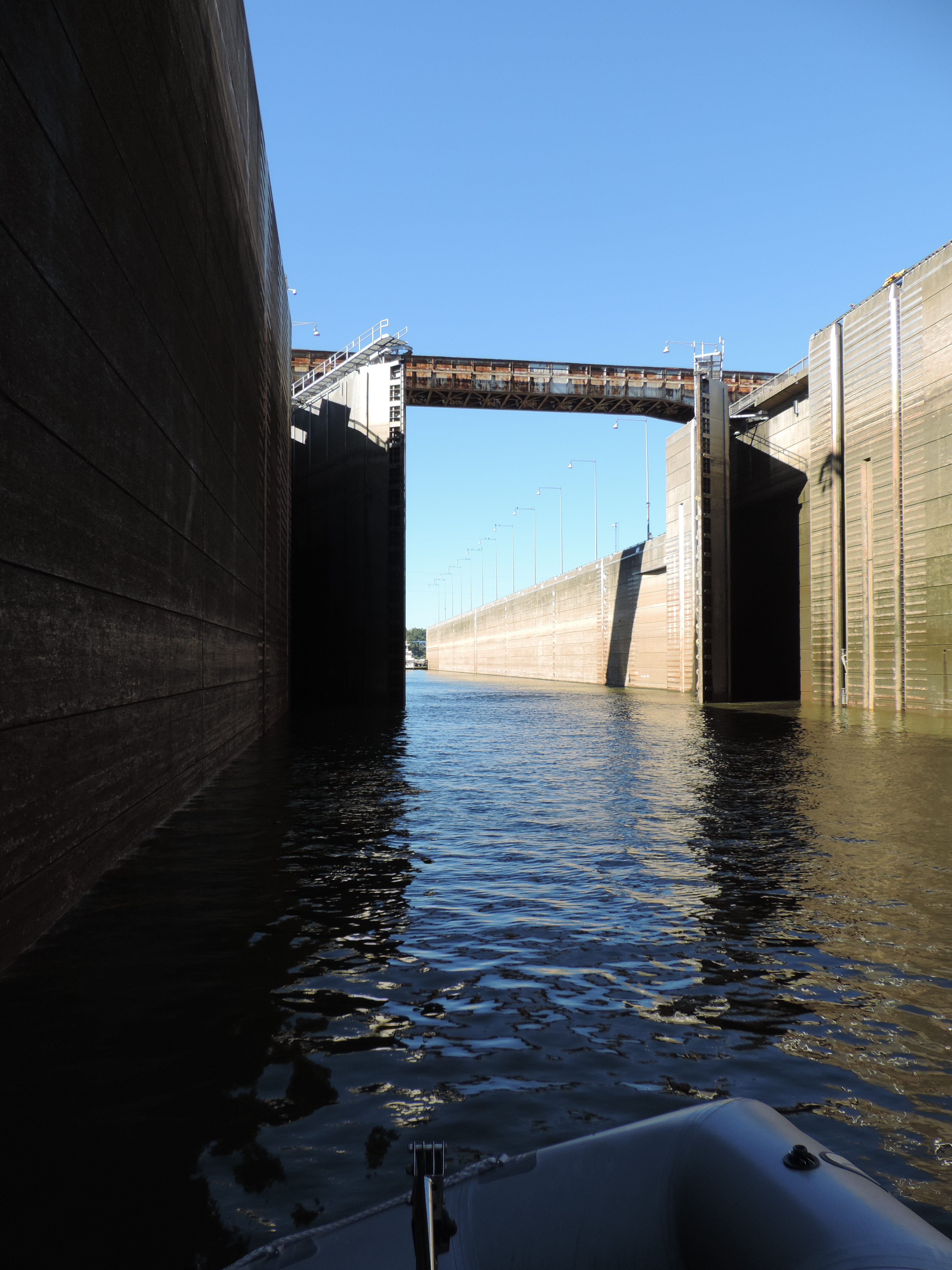
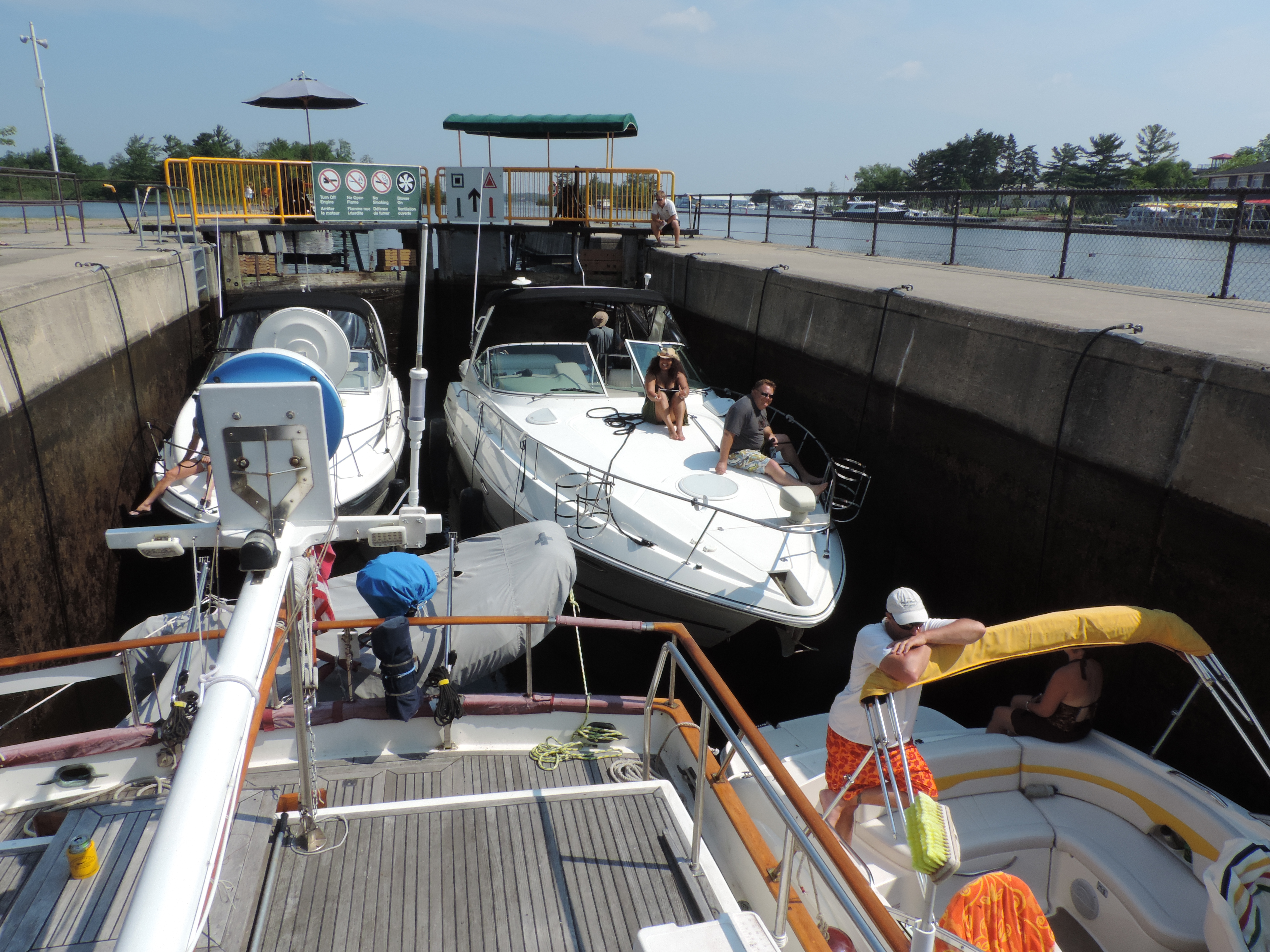
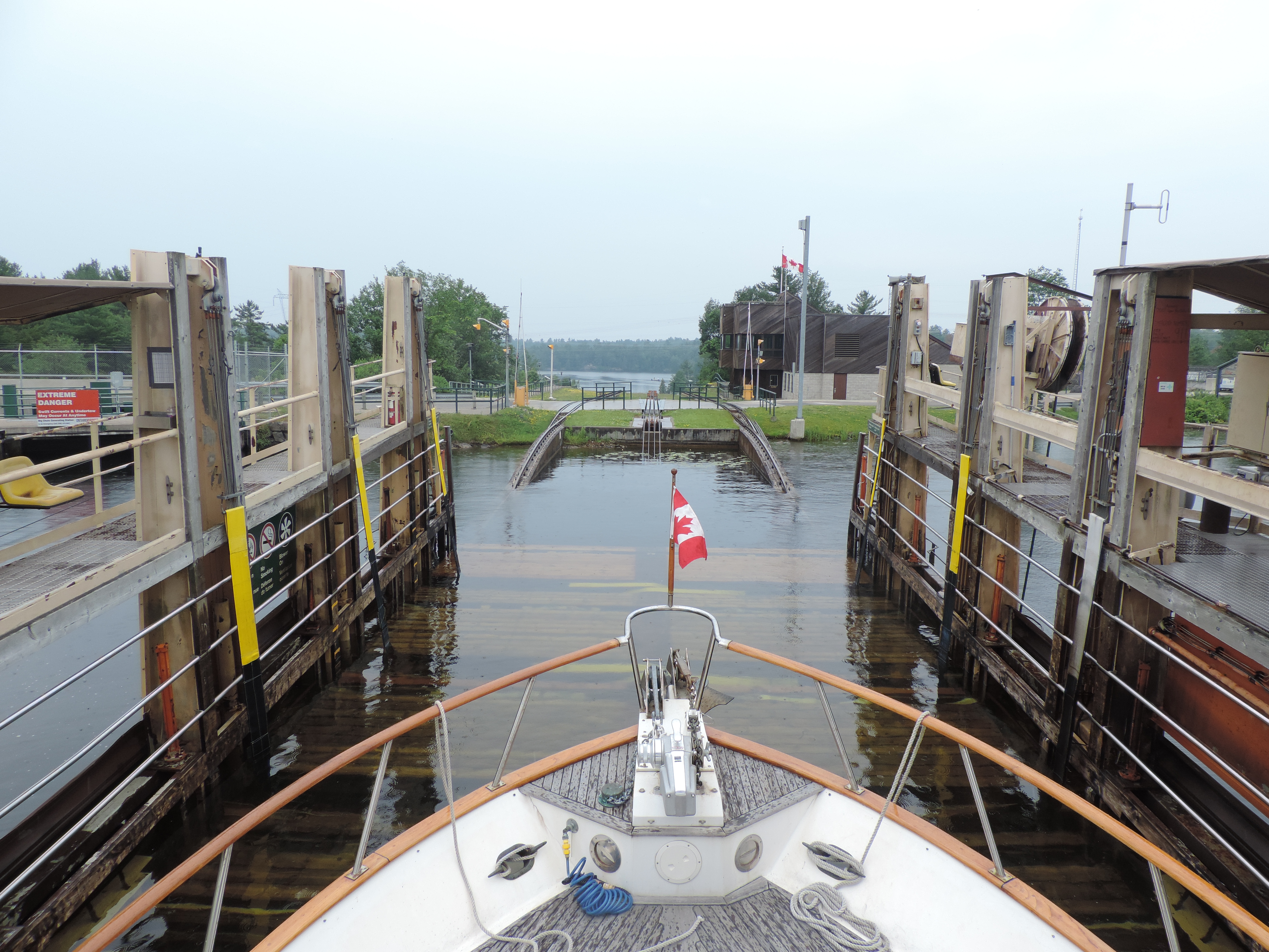
Despite not being able to lock through Couchching lock the night before, we were able to reach our day’s destination early in the afternoon after locking through and exiting the lock at 09:15 this morning. We think the lock crew felt a little guilty about shutting us out the night before, because they actually opened the lock early for us to enter – something that we’d never experienced before on the Waterway. We had a slight delay at lock #43, Swift Rapids, while an electrician tried to repair a locking pin, but we were on our way after waiting about 40 minutes. The pin wasn’t repaired while we were waiting, but the lock was safe to operate anyway since the pressure from the water above the lock is what actually holds the doors in place while the water inside the lock is being raised or lowered (we were being lowered). This was the first time on the waterway that we were in a lock with more than four other boats (that happened only once); there were seven of us in this lock, Sanderling and 6 smaller boats of various types. The lock couldn’t have held any more boats.
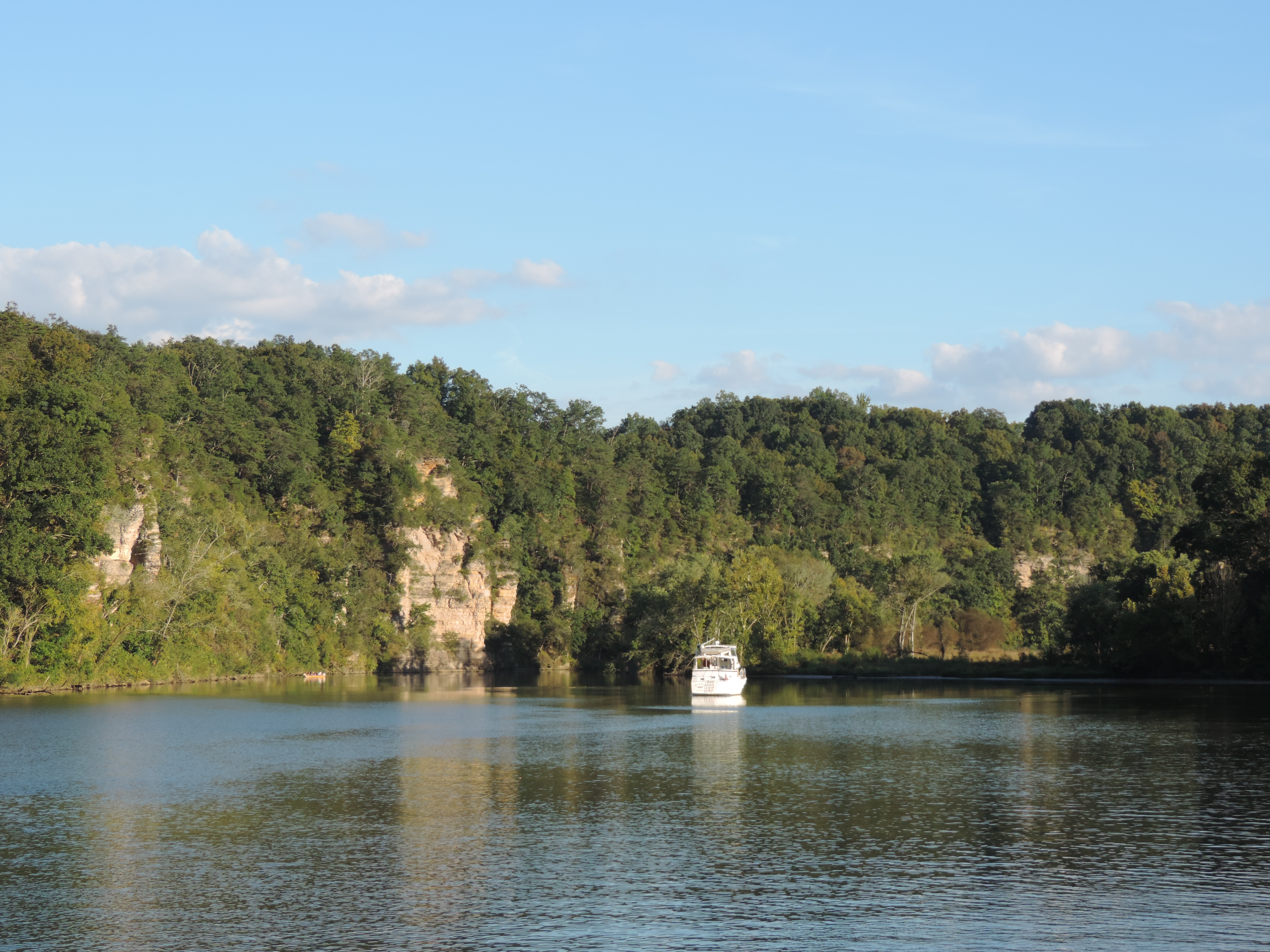
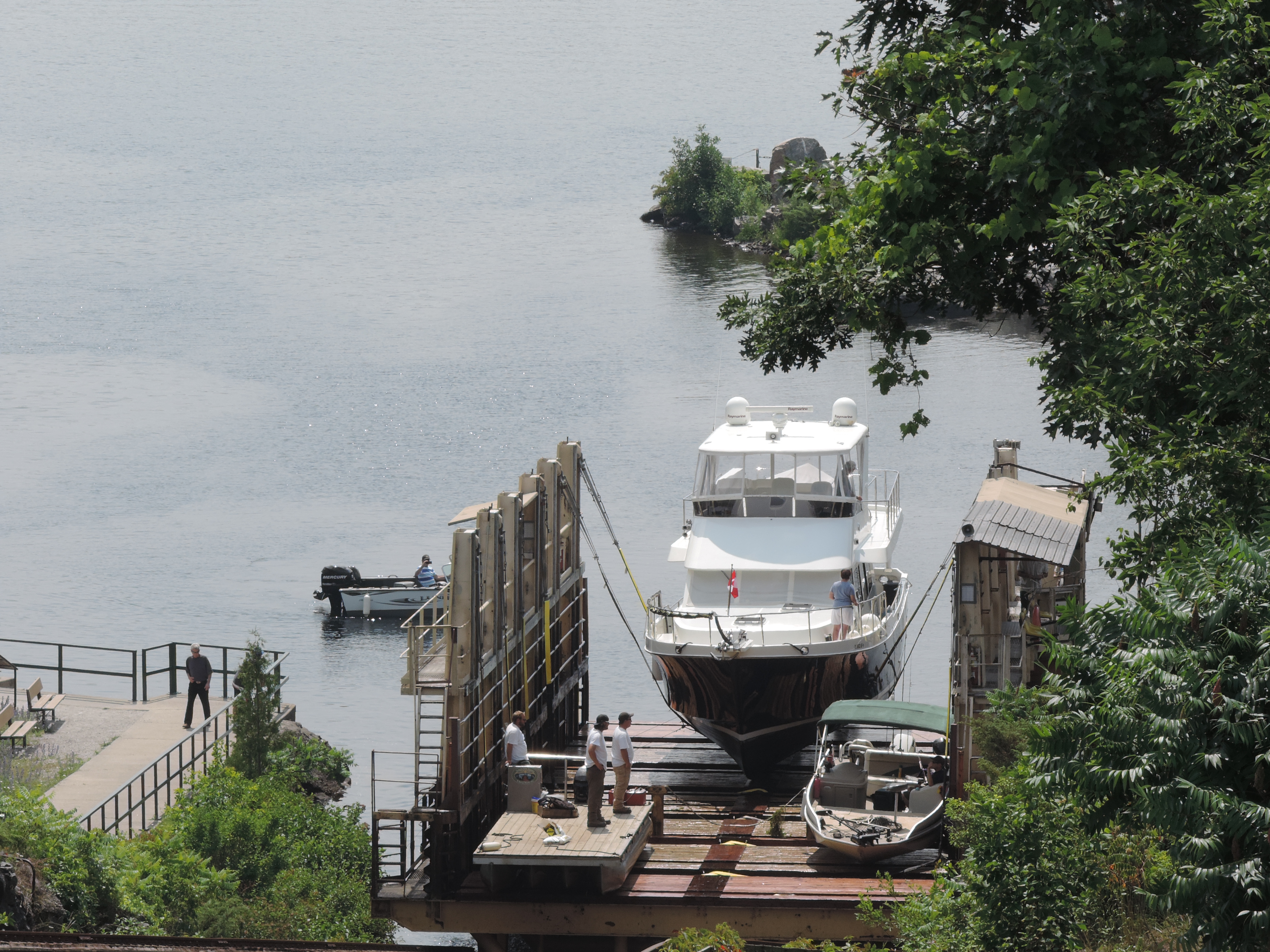
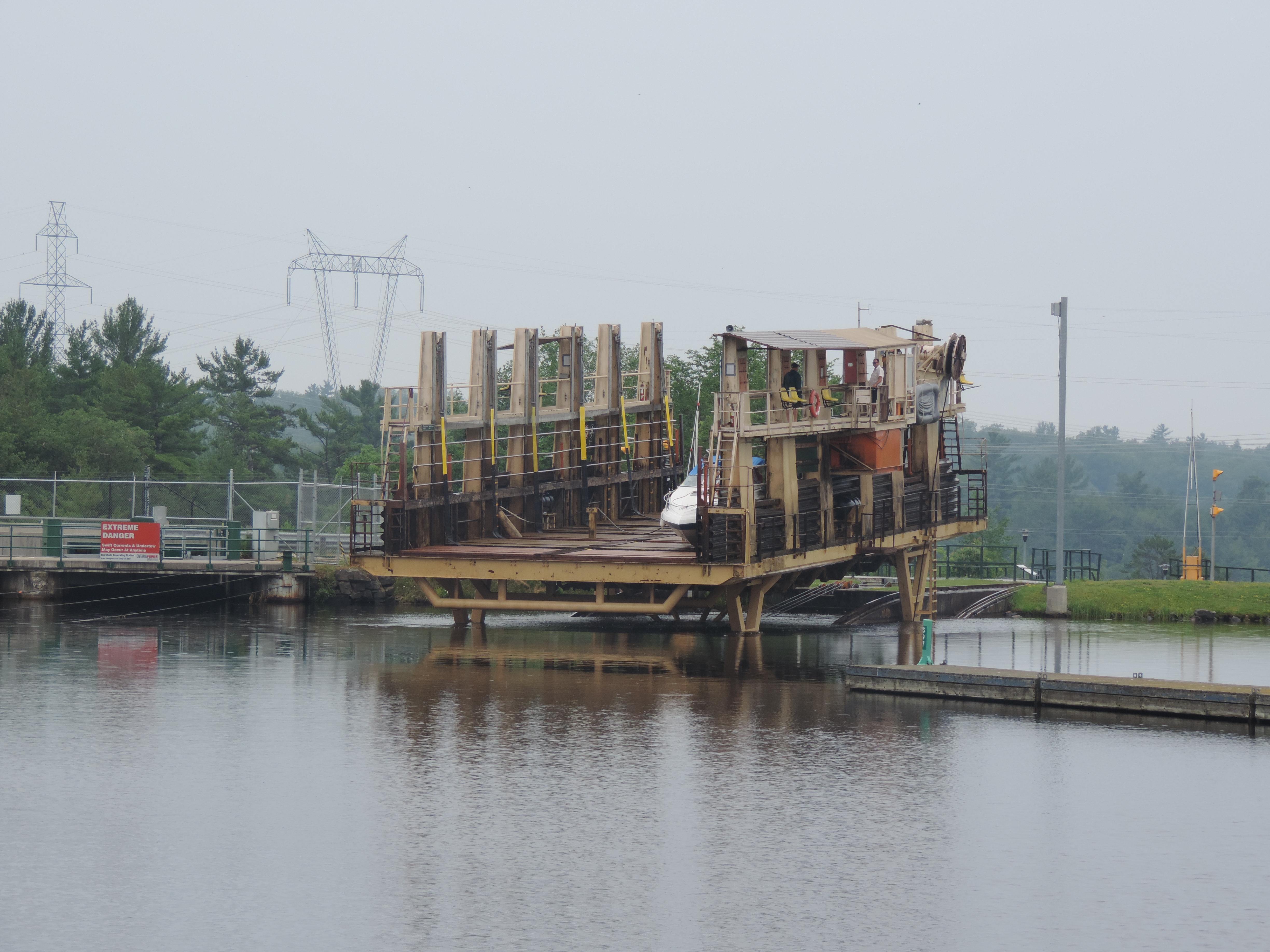
After locking through we continued on through some beautiful, rugged lake country with large homes built alongside the lakes and rivers and on their own small islands (granite outcroppings) to THE BIG CHUTE! This is called a “lock” even though it’s totally different from any other kind of lock in the world – it is essentially a marine railway or subdued roller-coaster. A boat is driven onto a large wheeled platform and secured with a complex system of straps very similar to how a boat would be lifted from the water at a boatyard by a travel lift, and then the boats (it can take several at a time depending on size) and the platform are moved along the track over a huge granite formation and down into the lake water on the other side 57 feet below (or above, if you’re heading southbound). The lift at this location was originally built in 1917 and has been modernized several times. The current railway was constructed in 1978 and can carry 110 tons and vessels up to 100 feet in length.
We arrived at 1325 and tied to the Parks Canada dock just west of the railway and walked to the lock with plenty of time to watch the railway make a number of trips up and down the inclined railway before they stopped for the day at 4:30 (like all the other locks). We got a good feel for the way the railway operates and how we would maneuver Sanderling onto the platform. We also visited the small museum which explained some of the history of the area and the lock, then ate dinner at the restaurant in the nearby marina.
Day: 22.8SM/19.8NM – 4H10M Trip: 1918.4NM/2204.3SM – 337H40M
Thursday, July 4, 2013 – Big Chute Lock #44 mile 232
HAPPY FOURTH OF JULY!!!
We were up about 0715 today to prepare for our great adventure on the Big Chute. We removed all the fenders (so they wouldn’t snag anything on the platform as we were going in and wouldn’t interfere with the securing straps) and marked the starboard cap rail to indicate where it would be safe to locate the straps.
The crew has so much experience with all different types of boats that they only need to ask a few questions of each boat to know how to position the boat and the straps. Every boat wishing to lock through moves to the blue line on a wall near the lock, and then the lock operator calls each boat in the order he deems appropriate to approach the platform and enter. It’s not a first-come, first-serve type of operation operation as most other locks on this waterway..
Boat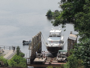 lifting up

Boats being lowered into upper lake

Sanderling in the slings ready to be lifted over and down
We were on the blue line about 0855 and the lift’s first boats were brought from the lower level. We entered the platform about 0915 (the only boat down bound) and by 0930 we had been deposited in the lower lake and exited the platform to continue northward.
We knew we didn’t have far to go to Port Severn so took our time winding through more lakes and narrow channels that were undoubtedly rapids in the days before the construction of all the dams and locks – in fact, many areas still have a very swift current of several knots and the existence of huge rock boulders is apparent on the depth sounder – it’s just that they are now 20 or more feet underwater!
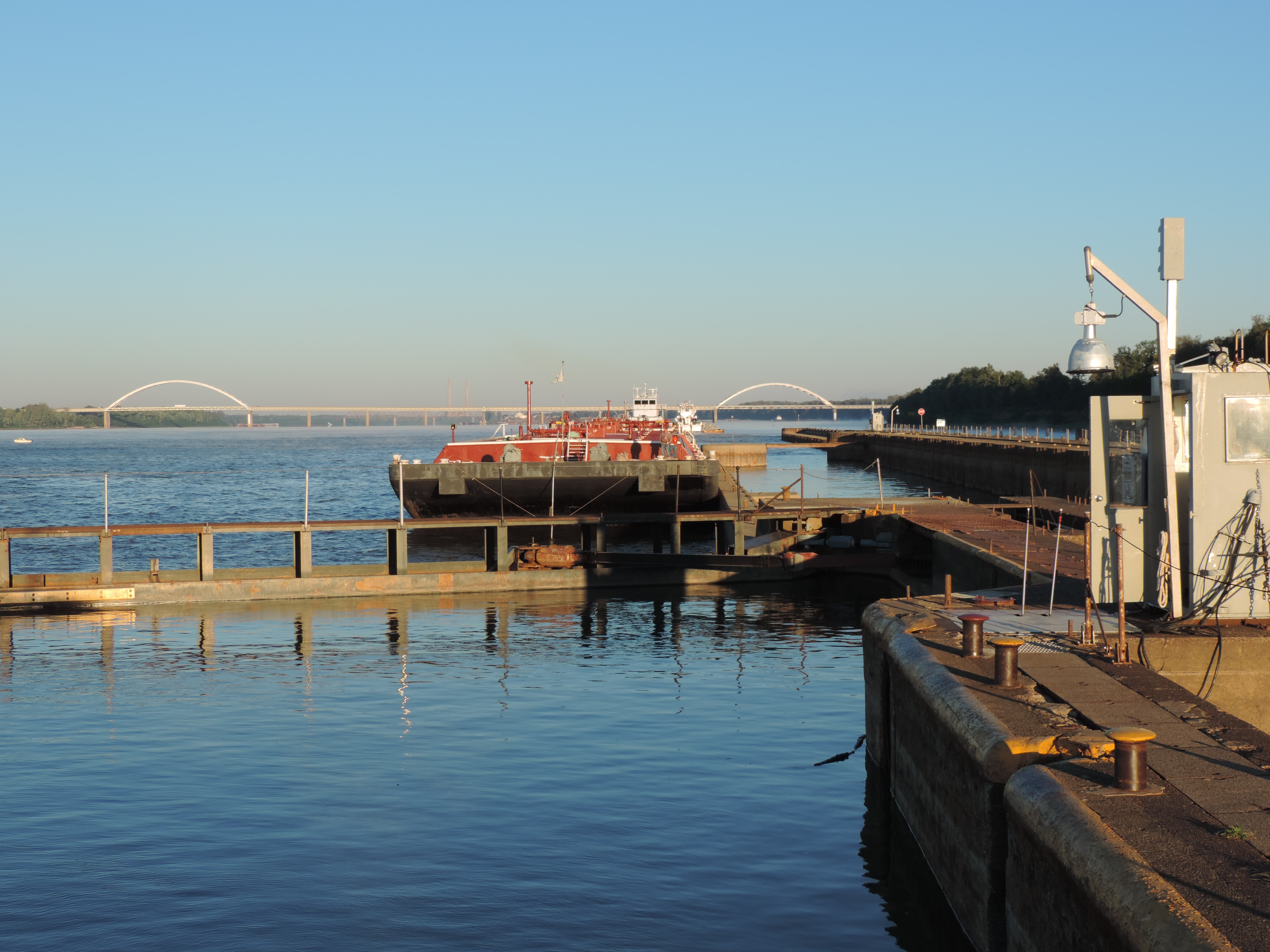
We arrived at the Starport Marina at Port Severn and first went to the pump out dock to get our slip assignment, empty the forward holding tank, and pay for our two-night stay. By 1125 we were at our assigned slip hooking up the electric line and filling the water tanks. We determine the amount of water we add to our 160 gallon tanks (total) by first filling a small two gallon bucket and timing how long it takes to add the two gallons. Today, it took 20 seconds to fill the two gallon bucket – 10 seconds per gallon – six gallons per minute. When we switched the hose to the water fill, it only took 12 minutes until the water was coming out of the air vents – 72 gallons, and it had been 13 days since we last filled the tanks. Guess we really didn’t have to worry about running out of water.
We’ll be in Port Severn above the last lock on the Trent-Severn Waterway. On Saturday morning we’ll lock through into Georgian Bay and start a new chapter in our adventure.
Day: 6.0SM/5.2NM – 1H35M Trip: 1923.6NM/2210.3SM – 339H15M
Friday, July 5, 2013
How nice to have showers with as much hot water as you wish and full capacity washers and dryers! This marina (Starport Marina) is very nice. There are a lot of boaters here – obviously the boats gets used, there are no “marina queens” here! Talked with several of them today to get some ideas about Georgian Bay.
Most of my day was spent troubleshooting our forward heater/air conditioner which wasn’t pumping water through the system and consequently shutting down. At the same time the batteries were equalizing to put them up to their full charge capacity – something that can be done only with a 4-hour supply of 110 volt electricity. We always do it at a marina and try to do it about every 30 days or so. The last equalization took place when we were at Waterford; we had used almost 6,000 amp/hours of 12 volt electricity since then!
The AC system wasn’t as successful, although I have identified the source of the problem – it’s just something I cannot fix myself without ready access to parts from Mermaid – it will wait until we get back to Florida. There is no electricity to the 110 volt raw water pump that must operate in order to produce either heat or cool air – without it the system shuts down. I don’t know what the actual problem is, but in order to trouble shoot it further I need to remove the entire unit so I can get to the circuit boards. In the meantime, if we do need either heat or AC for an extended period of time, I can run a 110 volt line to the pump from any one of our 110 volt outlets, and just plug it in when we want to run the AC or have heat in the saloon. We do have a small space heater that we can use for heat, and the aft cabin AC/heat system is still working.
Judy spent most of the day working online and laundered the sheets, pillow cases and towels in the marina’s laundry (included with the docking fee).
We’re going to eat out at the Dam Restaurant tonight and will probably stop at the Icebreaker ice cream shop for some Kawartha ice cream for desert.
We’ll depart some time tomorrow morning – no hurry – and head into Georgian Bay.