Tuesday, July 30, 2013 – Britt, Ontario
We did depart Britt at 1055 after purchasing two more pints of ice cream at the convenience store, and at 1253 cruised through Rogers Gut. We were a little concerned about the depth, although several power boaters we had talked to along the way said it wouldn’t be a problem. The 200 yard long channel had to be blasted out of the granite to a depth of seven feet when the small boat channel was created, but even with Georgian Bay water levels at datum (for the first time in a number of years) the guide books caution that winter ice will sometimes move boulders into the narrow channel and create hazards to passing boats. Fortunately about the time we were going to pass through the gut a smaller Canadian boat Rigadon came up behind us, and after a brief conversation via radio they agreed to go ahead of us and report the depths as they went. Turned out that the lowest depth was about six feet. Thanks Rigadon for removing the “pucker factor.” We then turned into Henvey Inlet and passed through the narrow entrance to the inlet only to discover that several boats, including Rigadon, had moored to the sheer granite walls of the passage and tied their lines around rocks and trees to hold their position! First time we’d seen that. We continued further along and found a nice anchorage that provided protection from the SW wind blowing that day.
Day: 19.0 SM/16.5NM – 3H15M Trip: 2123.1NM/2439.6SM – 375H00M
Wednesday, July 31, 2013
As we departed Henvey Inlet there were even more boats moored against the granite rock faces along the narrow entry channel; a few had portable generators ashore and were fixing breakfast in electric skillets! We continue through the 17 mile stretch that is open to Georgian Bay and unprotected by outlying islands in fairly calm water and entered Beaverstone Bay where we eventually anchored near Burnt Island. The wind was from the SW at about 10-15 MPH most of the day and the first anchorage we tried at Muskrat Bay (in Beaverstone Bay) didn’t provide the protection we wanted, particularly after the wind shifted to the west later in the day as was forecast. After 20 minutes at anchor in Muskrat Bay and consulting several different weather sources, we moved a short distance to Burnt Island.
Day: 39.2SM/34.1NM – 5H10M Trip: 2157.2NM/2478.8SM – 380H10M
Thursday, August 1, 2013 – Burnt Island, Beaverstone Bay
Shortly after getting underway we passed through a very shallow area but well-marked area with mud bottom (we’d been told that sail boats just drag through the mud if it’s too shallow) and saw about 5 feet at it’s shallowest. We turn turned hard to port and entered Collins Inlet and the beautiful passage through high pink granite walls toward Mill Lake, which is part of Collins Inlet. When we got to Mill Lake we decided to anchor there for the night and found a nice protected spot to the east of Green Island. A sailboat anchored about 1/4 mile away during the day, but otherwise we were the only larger boats in the area. As is getting to be the norm for this area, the scenery was fantastic – pink, rose and white granite covered with evergreen trees everywhere you looked.
Day: 7.9SM/6.9NM – 1H15M Trip: 2164.1NM/ 2486.7SM – 381H25M
Friday, August 2, 2013 – Mill Lake, Collins Inlet
As we departed Mill Lake and eventually got an internet connection we learned that the winds for the next few days would be gusting to 25 MPH to the west of Killarney, so we decided to stop at a marina in Killarney for a couple of days to let the wind gusts pass. We’ve now been here for three days, but tonight the winds are forecast to die down and the next several days should be good cruising.
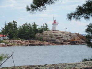
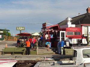
Yesterday we hiked about 6 kilometers and an hour through a forest with lots of mosquitos and over huge granite outcroppings to the eastern Killarney light house. Although the hike and trail were interesting, we weren’t prepared for the number of mosquitos and the fact that the trail was very poorly maintained. Consequently, our hike back took the road and only 15 miinutes to reach town where we stopped for ice cream (not Kawartha) for our reward! We’ve also eaten at the local fish and chips place (a converted school bus on a dock with picnic table seating) which everyone recommends as having the best fish and chips in Georgian Bay – the fish is locally caught white fish and it is delicious.
Tomorrow when we depart the marina (Killarney Mountain Lodge) we’ll get another pump out and about 200 liters of diesel which will get us well into Michigan. We could probably make it to Michigan with the fuel we have onboard, but I’d rather have too much fuel than not enough so we’ll take on a little for insurance.
Day: 17.1SM/14.9NM – 2H00M Trip: 2179.0NM/2503.8SM – 383H25M
Monday, July 29, 2013
The decision was easy – winds kept us in the small, protected bay thru Sunday. The weather calmed down last night and despite torrential rain during the night the weather (winds) were nice and calm today, permitting us to transit the 7 mile open-water stretch without a problem. The channel we were in prior to the open water is “Hang Dog Channel” – not sure of the basis for the name – which had several 45 degree turns which made it very interesting. Down one side of a long string of granite outcroppings, then a hard turn and up another narrow area between rock outcroppings. Then we reached the open water stretch and were in water as shallow as about 9 feet – it’s really disconcerting to watch the bottom roll by the boat apparently so close that it seemed like we would run aground even though the water is so clear one can see the bottom at 15 feet of depth!
At Byng Inlet we turned east and proceeded up the inlet (more like a “reach” in New England) to the small town of Brit, where we are now. The “grocery stores” are essentially what we would call convenience stores, but we were able to do a little shopping to narrow down our list at the store in the marina and at an even smaller store about 3/4 of a mile away.. We also found ice cream at the grocery right at the end of the dock, although it is not Kawartha it is the next best thing – Ben and Jerry’s.
The weather is forecast to continue to be favorable through tomorrow (and perhaps further out) and we’ll be departing here in the morning to go to Henvey Inlet, about 15 miles further north. To get to Henvey Inlet we’ll pass through Roger’s Gut, the only area on the small boat channel that was blasted through the granite – it’s depth at datum is only 6 feet, but we will have 2 feet to spare under the keel.
Day: 32.1SM/27.9NM 4H30M – Trip:2106.6NM/2420.6SM
Saturday, July 28, 2013
These next entries are being written on Saturday, July 27, 2013 as we are again anchored in a protected area while some gusting winds pass through the area. Hopefully this will bring you up to date and give you an idea of where we have been the last week or so, starting at Parry Sound.
We arrived at Parry Sound (the town) from Wilcox Island anchorage on July 18, 2013 after cruising through the North Channel in rain for about 16 miles. We wanted to get to a marina in Parry Sound before a predicted thunderstorm with winds approaching 40 MPH reached the area the next day. We made it with plenty of time to spare and went into Big Sound Marina, operated by the Parry Sound Chamber of Commerce for three night (three for the price of two). We had a delightful stay there in a very nice marina close enough to town to walk to restaurants and a little shopping, used the free shuttle to shop for our major supplies at Canadian Tire (found a solar camp shower), Sobeys (food) and Kawartha ice cream (both a cup as well as two pints for the boat), ate dinner out three nights (one at a great restaurant a short walk past downtown with the best schnitzel I’ve had outside of Germany, and attended an opera gala at the interesting Charles W. Stockey Centre for the Performing Arts just outside the marina in a beautiful setting overlooking Parry Sound (the body of water).
Judy took a 35 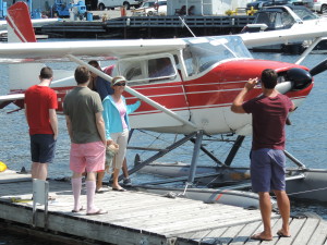 minute ski plane ride around Parry Island – something she has wanted to do (ride in a ski plane) since we first saw them on the Trent-Severn Waterway; from the smile on her face I think she had a great time. We actually had a busy three days, but were ready to leave on Sunday, July 21st.
Before departing Parry Sound (the town) we moved to another marina across a small bay to have our forward holding tank pumped out – something that needs to be done every so often. We have two 22-gallon holding tanks aboard, one for each of the heads. The toilets can be set to pump waste into the holding tank or into the onboard sewage treatment system called a LectroSan, but in this area we are not permitted to pump any waste (even treated waste) overboard so must use the holding tanks and then have them pumped out periodically, usually at a marina.
From Parry Sound (the town) we cruised out into Parry Sound (the body of water) on July 21st and about 8 statue miles into Sawdust Bay on the northwest corner of the sound. We had intended to stay only one night, but weather intervened and resulted in us staying there for three nights waiting for high gusting winds to pass through the area. On our first night, Ernie was apparently practicing his balancing or climbing skills, slipped and fell overboard after hitting the swim platform. We both heard the thump and knew from the sound that it was more than Ernie simply jumping from the upper deck to a lower deck. Judy ran outside and immediately spotted Ernie holding onto the swim platform with his front paws while trying to climb out of the water with his back feet; she got down to the swim platform in record time and pulled Ernie out of the water. His lower body looked a little like the proverbial drowned rat and his front claws were shredded from hanging onto the wooden platform. Judy dried him off with a towel and he appeared to be terribly embarrassed for the rest of the evening as he stayed inside. At that point we decided that we couldn’t trust him to “play” outside at night, so have been keeping both cats confined to the interior of boat after dinner. Ernie, particularly, is not happy with that arrangement, but we both sleep better at night since we don’t have to keep one ear open listening for the splash of a cat falling overboard. Interestingly, Ernie didn’t let out any cat sounds while he was struggling to get back aboard, so in the absence of a splash or a thud as was the case this time, we wouldn’t know he was in the water.
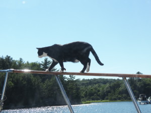
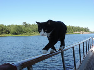 Since then, while at anchor in these still waters, we’ve noticed that Ernie frequently demonstrates his admiration for the Flying Wallendas by walking along the hand rail, across the stern of the boat, into the dinghy and perching atop the motor, but also along the side hand rails from bow to stern; he’s also quite proficient at turning around on the 2.5 inch wide rails!
From Sawdust Bay we went to Kilcoursi Bay, a place that all of our new Canadian boating friends recommended for its sand beaches and great holding. We arrived on a Wednesday figuring that there would be fewer boaters in the middle of the week. Well, I’d hate to see it on weekends – the main anchorage area was packed. Various groups of boats were rafted and Med-moored (a Canadian favorite, apparently) one “pod” with six boats, and several with four boats. We picked a nice open spot (the only one) among some sailboats and set our anchor in 20 feet of water with 125 feet of scope. By late afternoon a BUFF (Big Ugly Fast F . . .) came in and dropped his anchor almost on top of ours while backing at a fair rate of speed sideways to the wind while playing out some unknown amount of anchor rode, then threw out a stern anchor so that he was essentially sitting broadside to the rest of us who were swinging on our single anchors and would rotate as the wind rotated during the day. At one point his kids got in a dinghy and used it as a tug to try to push the stern bow in toward the beach, but since he apparently had no idea how to anchor in the first place he had no idea that the kids needed to push the stern of the boat using this interesting technique rather than close to the bow, so their efforts had little effect. Later in the day a much smaller LUFF (you guess) came in and waved to the BUFF, then proceeded to anchor using a similar ineffective technique of dragging the anchor while playing out rode (apparently waiting for the anchor to catch something). Once the LUFF got the bow anchor to grab, the BUFF team used their dinghy to haul out the LUFF’s stern anchor toward shore and drop it to hold the LUFF in position. Then the BUFF got underway again and circled around to raft with the smaller boat – another interesting technique best understood by the participants. The BUFF crew then again used their dinghy as a tug to push the BUFF close against the LUFF so they could exchange lines, then used the dinghy to take both the stern and bow anchors of the BUFF out away from the boat and drop it. Never once did anyone back down on an anchor to ensure that it was actually holding. Fortunately for all of us, the winds died to less than 5 MPH that evening so no one moved about in the anchorage.
The area itself was interesting, with a long horse-shoe shaped sand beach in a provincial park (Kilbear Park). There were fenced-off swimming areas at various locations along the beach, picnic tables and campsites behind the trees lining the beach. There were a lot of people in the water swimming, canoeing and kayaking when we arrived. Everyone was having a great time, it appeared, and the weather was fairly warm (mid 70s) and sunny.
One evening at Kilcoursi Bay was enough for us, despite the entertaining value of watching interesting anchoring techniques! We departed on Thursday, July 25th and anchored in the eastern Hopewell Bay after cruising about 22 statute miles. There were two other boats anchored in the bay when we arrived, but it was a big bay and we all had plenty of room to swing. That evening as we were planning our next day’s move, we were concerned that the weather forecast indicated we’d be having 15 MPH winds with gusts to 25 from the southeast for a good portion of the next day or two, making it imperative to find a better protected anchorage since the bay we were in was fully exposed to the southeast and 25 knot gusts would make it very uncomfortable. We found several small bays that would provide the protection we needed, and the next morning (Thursday) moved to a much smaller bay immediately west of the bay we were on (we refer to it as West Hopewell Bay) which was only open to the northeast. It took us all of 30 minutes to shift to the new location and get our anchor down in a beautiful, narrow bay about 400 yards wide and surrounded on all three sides by tall stands of evergreen trees atop granite mounds. Unfortunately, there was a cottage just before the area we wanted to anchor in and there were a number of young people with their ski boat and various other watercraft sitting on the porch. While not outwardly hostile to our presence, it was obvious that we were intruding on their ski area; however, we felt we didn’t have much choice, explained our situation and the fact that they could ski around us all they wanted and it wouldn’t be a problem for us. Consequently, we were treated to some great displays of water skiing, took videos of them, and that evening invited them to come aboard where we gave them a thumb drive with the videos and showed them around Sanderling. None of them had ever been on a large boat and appeared interested in what we were doing. Turns out they were grade-school friends who all grew up in Columbus, Ohio. The cottage was built by one of the fellows grandfather 40 years ago. They had been coming to this cottage for a number of years every summer for their annual get-together. They were a nice bunch of young adults; we appreciated their understanding and willingness to let us share their area. They left on Saturday morning to return to their respective homes in Columbus and Chicago.
Trip: 2076.1NM/2385.6SM 366H45M plus 2.9SM and 30 minutes to shift to the western Hopewell Bay.
Now we’re trying to figure out what to do tomorrow (Sunday). About 15 miles further along is a 12 mile stretch of water that is essentially out in Georgian Bay and unprotected by any islands, so we want to have some low winds before traversing that stretch. Between here and the unprotected area (15 miles) are a lot of small islands that will provide some protection from winds, but no nice bays like we are currently anchored in. The current forecast for tomorrow shows wind gusts to 25 MPH most of the day; Monday is forecast to be good for crossing that 12 mile stretch of water. All could change by tomorrow morning or even later tonight.
Do we stay or do we go and find a place to anchor before the unprotected 12 mile open stretch? Stay tuned!
After cutting and pasting the above to our blog I realize that it is really out of date. Here is a list of our locations from Port Severn to Parry Sound:
July 6 – Lonoguissa Point Bay across from Bone Island
July 8 – Weber Island/Good Harbor
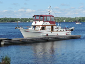 July 9 – Sandpiper dock at Beausoleil Island (a national park)
July 11 – Chimney Bay at Beausoleil Island
July 12 – Inner Bay north of Go Home Bay
July 16 – Wilcox Island (lower end of Spider Bay)
Saturday, July 6, 2013 – Port Severn into Georgian Bay
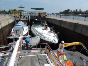
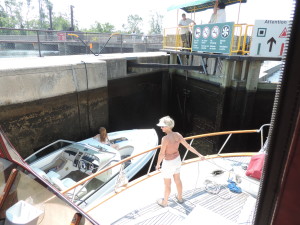
The lock at Port Severn that takes boats from the 240 mile long Trent-Severn Waterway into Georgian Bay is the smallest on the entire waterway – 84 feet long and only 23.5 ft wide. When we departed Upper Starport Severn marina at 1005 there was a 42 foot trawler ahead of us approaching the lock. It went through ahead of us with a much smaller boat. After we tied to the blue line while the first trawler was being locked through a number of boats of various sizes arrived waiting to lock through. This was Saturday morning, the sun was shining, and EVERYONE wanted to get out onto beautiful Georgian Bay for the weekend. The lock master knew some of the waiting boats from previous experience, and for those of us who were new to the lock he asked our measurements – we are almost 15 feet wide (beam) and with the dinghy hanging out on the stern davits we’re about 46 feet in length. He then told the waiting boats (or most of them) their order into the lock and where theywould be positioned. He kept repeating that this was his plan – we’d have to see if it would work. Work it did! There were five of us in the lock. We were the first inside and onthe far forward starboard position with two smaller boats on our port side with about 2 feet of clearance on either side of them. Then he brought in two more boats that shared the space behind us across the width of the lock – the anchor of the boat behind us was about 2 feet from our dinghy and the anchor of the boat on the port side overlapped the swim platform of the boat along side of us. Everyone was in a good mood and chatting back and forth, giving us advice of good places to anchor for the weekend, where to visit on Georgian Bay, etc.
At 1100 the two smaller boats on our port side had exited the lock and we were out behind them, prepared for the very swift rushing rapids that would take us downstream under a highway bridge through a twisting narrow channel marked with red and green buoys into Georgian Bay. The two smaller boats went out fast and we delayed our exit to give them plenty of room, then we made the 1/4 mile run through the turbulent water. The short run turned out to be not nearly as challenging as we thought it would be and we were shortly delivered to the smooth waters of Georgian Bay.
As we were about to enter the bay proper we had a call on the VHF radio from a friend we have gotten to know via the internet and email asking our location. He told us where his boat was anchored and as it was still some distance away we agreed to reestablish contact once we were closer. Earlier he had suggested several small bays in which we could anchor near the area where he and some other boats would be anchored for the weekend. We eventually reached his area and because our cats prefer to be outdoors whenever the mood strikes them we elected to anchor by ourselves (rather than rafting with other boats) in Longuissa Point Bay just across the main route between islands from our friends.
After we raised the radar mast (which also has the anchor light as well as several other antennas) we got the dinghy in the water and set off for the mile or so to meet our friends in person and get some advice about places to visit on Georgian Bay. Their boat was sunk during hurricane Charlie in Florida in 2004 and they have completely restored it to better than new condition – a beautiful boat (about 46-48 foot Present) that required much fiberglass, electrical and mechanical work (as well as full Awlgrip paint) in order to make it their own. We had a nice visit and tour of their better-than-new boat, then dinghied back to Sanderling.
A few small boats and some PWCs came through the bay on their way to a small river at the top of the bay, but that traffic stopped about sunset (2100 or so). The night was peaceful and quiet.
Day: 22.8SM/19.8NM – 4H15M Trip: 1943.4NM/2233.1SM – 343H30M

