Toogoodoo Creek to Alligator River, North Carolina

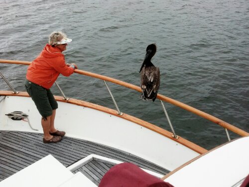
On Friday, May 10th we departed Toogoodoo Creek under sunny skies, warming temperature, and light winds from the southwest. Our route continued to meander through the South Carolina low country with lots of water and salt grass marshes, punctuated here and there with land of a slightly higher elevation hosting trees – real trees (not palms). It’s always amazing to again see what a difference a foot or two of elevation can make in the type of vegetation that will grow on a hummock.

By noon we were passing through Charleston Harbor and popping out the northeast side into more low country with long straight stretches of waterway dredged through the marshes when the ICW was created in the 1930s. Again, where the spoils from the dredging were dumped, trees sprout. We continued at a good pace (7.3 miles per hour is our speed when running the engine at 1600 rpms) and ended the day at South Santee River, about 15 miles south of Georgetown, South Carolina.

Day: 76.9 statute miles – 10H05M
Trip: 518.5 statute miles – 66H5555M

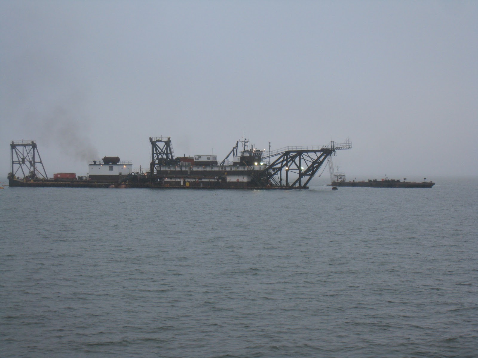
Saturday was an unusual day for cruising. As we lifted anchor at 0650 the current in the South Santee River was against us until we turned northward in the ICW channel. At that point the current was pushing us and increased our speed by almost almost one mph. The unusual part is that the fair current continued with us for the entire day – into Winyah Bay, past Georgetown, South Carolina, past the Pee Dee River (original rive in Stephen Foster’s “Way Down Upon the . . . “) and Bucksport, and into Myrtle Beach (tacky, tacky, tacky). We stopped for the day at Barefoot Landing Marina in Myrtle Beach – not a great marina with absolutely no amenities except electricity and water, but it is right on the ICW and a with a few decent restaurants in the area. As we were departing Sanderling for dinner out, a huge “dredge train” came by traveling at about 3 mph southbound; it was probably 1/2 mile long, with a large tug pulling the dredge and assorted barges loaded with dredge pipes, then a second tug lashed in the middle, followed by floating dredge pipes. It was quite a site and the docks on both sides of the river were lined with spectators. We ate a relatively late dinner at Joe’s Crab Shack that evening. We have seen such “trains” several other times on the ICW and it is always an amazing site. They are so long that they have 4-6 very small tugs pushing the “train” from the sides to keep everything centered in the river.

Day: 67.7 SM – 8H30M
Trip: 586.2 SM – 75H25M

On Sunday, May 12, we departed Barefoot Landing Marina and crossed into North Carolina at Little River Inlet, then continued to the Cape Fear River (where we did not see either Roberts) where the ocean breeze of 15 mph or so was opposed to the combined river and tidal current to make a slow (5.5 mph) and bumpy ride most of the way along the 12 mile stretch until we turned off of the main channel to head through Snows Cut and into a mooring field at Carolina Beach. We’d anchored at Carolina Beach several times in the past and the holding was always problematic; this time there was a new mooring field with 10 balls, and it was perfect – no worries about dragging anchor in the middle of the night.

Day: 59.4SM – 8H30M
Trip: 645.6SM – 83H55M

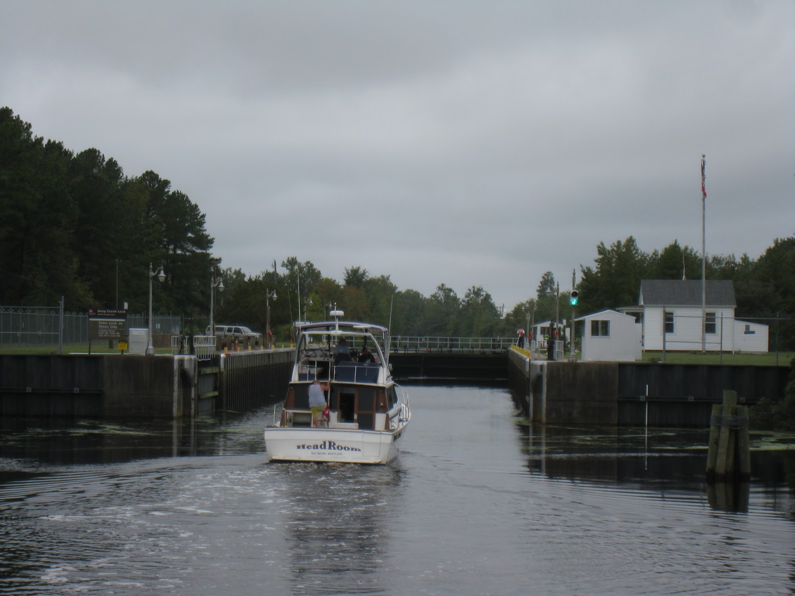
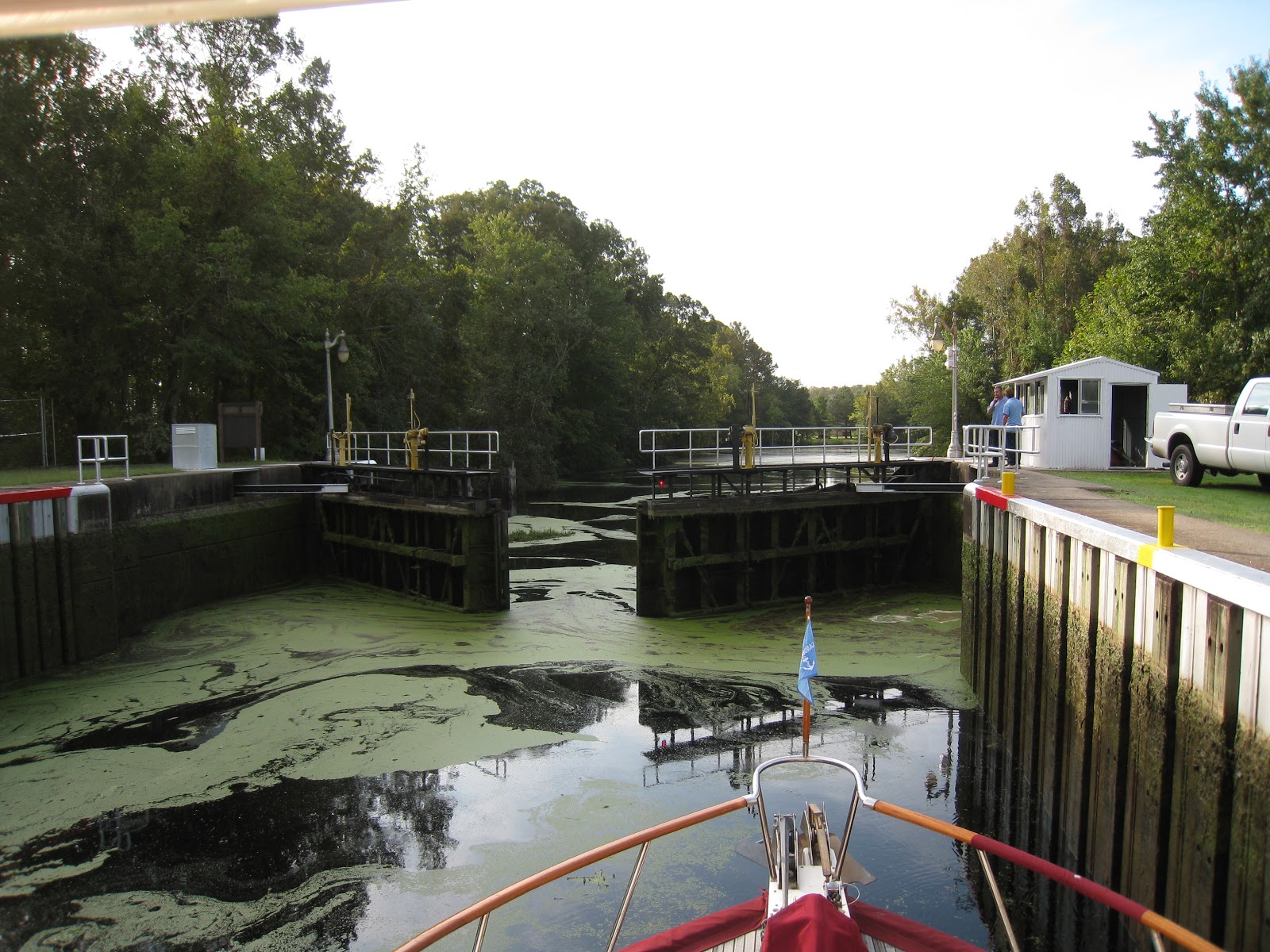
The stretch of ICW from Carolina Beach to Mile Hammock Bay is notorious for it’s low bridges with opening schedules that slow down all but the smallest boats. Two of the bridges have only a 12 foot clearance (we require 15.5 feet with our mast down; 23 feet with the mast up). It’s the equivalent of having stop lights at every intersection of a major highway that are not synchronized to keep traffic moving. Consequently, with a combination of tidal currents that sometimes were fair and sometimes foul, and having to go slower than usual in order to time the arrival at the next bridge in time for an opening (or wait for an opening if arriving too soon) Monday was a slow day. We did arrive at Mile Hammock Bay at Camp LeJeune, North Carolina (the bit Marine base) leading a parade of one trawler (Sanderling) and three sailboats where we were met by four battle-ready RIBS each with about six marines heading out for games in the training area – the lead boat playing an Eric Clapton song from loud speakers! Fun! We frequently see V-22 Ospreys exercising here, but so far tonight there has been no indication that V-22s are in the area. There are ten boats anchored in the bay; we’ve been here in the past when there were 16 boats and there was still room for a few more.

Day: 52.6SM – 8H25M
Trip: 698.2SM – 92H20M

Tuesday, May 14, 2013

Departing Mile Hammock Bay heading either way requires a little coordination for boats over 12 feet in height as there are bridges that only open at certain times (on the hour and half hour, or on the hour, or at 15 and 45 past the hour). Consequently, we departed Mile Hammock Bay in order to make the northbound bridge opening at 0830 and we arrived about 5 minutes early and were joined by several sailboats before the bridge opened. The bridge tender was very kind and held the bridge open for a slower sailboat that didn’t arrive until about 0840 – very few bridge tenders are so considerate, but on the other hand there wasn’t much traffic going from the mainland to the small Marine-owned barrier island.

The ICW from Mile Hammock Bay to Moorehead City/Beaufort, North Carola, is a 25 mile stretch of the ICW that takes a broad sweep to the east along the north side of Bogue Sound. You start in a northeasterly direction and end at Moorehead city heading east for quite a few miles. The weather was calm and sunny, so the trip was easy and we arrived at Moorehead City at 1335, then turned north to pass through a long cut to the Neuse River and Oriental, North Carolina. We anchored in Smith Creek on the western side of Oriental at 1710 and after cleaning up a bit and took the dinghy to the free town dinghy dock for dinner at a local restaurant. While eating dinner the wind picked up to about 15 MPH out of the southeast, and we enjoyed a bit of a wet ride for back to the boat until we turned the corner into Smith Creek.

Day: 65.4SM – 9H10M
Trip: 763.7SM – 106H05M

We departed Oriental at 0710 on May 15th in hopes of getting through the Neuse River before the predicted higher winds kicked in mid-morning. Even then by the time we rounded Maw Point and got to Hobucken the Neuse got a little rough with 15-20 MPH wind, but the remainder of the day was in relatively protected waters until we got to the Alligator River on the north end of the Alligator-Pungo River Canal (a l-o-n-g 25 mile stretch). By the end of the canal the wind had picked up to 15-20 with higher gusts from the SW. We anchored in the lee of a strip of land that jutted out into the river along with two sailboats and another trawler.

Day: 84.9SM – 11H00M
Trip: 846.6SM – 117H-5M


Track us on Marinetraffic.com

You can see our actual progress on a Google Earth display by going to Marinetraffic.com and searching (upper right corner of the page) on one of the following terms:

(1) Our boat name “Sanderling” (without the quotes) then look for one of the Sanderlings that is a pleasure vessel and has our MMSI number or call sign (both below); or
(2) Our MMSI number: 37656180, or
(3) Our call sign: WDG7031

You should see a picture of Sanderlng with some information about her.

Click on the latitude/longitude position in the left column and you’ll be taken to a map view of our location, then you can select satellite view if you wish.

Our position should show up if we’re underway and for 4-5 hours after we stop for the day.

Daytona FL to Toogoodoo Creek SC

Toogoodoo Creek
Written May 9, 2013

We’ve been moving right along since I last wrote when we were in the marina at Marineland.

The weather did calm down quite a bit and we departed Marineland Marine at about 1000 on Sunday heading north. We made good time and the inlet at St. Augustine was relatively calm. Because of the heavy rain for the past two days the water level everywhere was higher than normal, so even the “thin” spots were easily passable. We anchored for the night at Pine Island anchorage, a nice, quiet spot about 14 miles north of Daytona. Two sailboats joined us later in the afternoon.

We were underway from Pine Island at 0740 on Monday and again on our way north. We crossed the Florida/Georgia border just north of Fernandina Beach at 1400 and had the anchor down at Little Cumberland Island at 1735 later in the afternoon. It’s always interesting going past the Navy submarine base at Kings Bay as one never knows how aggressive the security boats will be. This time they simply came out to show their presence and watched as a sailboat and we turned northeasterly to continue up the ICW. Shortly after we encountered one of the glaring errors on the navigational charts produced by NOAA – the “magenta line” (which some cruisers follow without fail) pass on the wrong side of three strategically located red day-marks and can easily result in a boat going aground. It’s a trip for cruisers who pay closer attention to their electronic toys than to the real world! The sailboat following us by about 3/4 of a mile failed to pass on the correct side of the markers, but due to the stage of the tide and the extra water from the rain it didn’t go aground. Lucky!

This was our best day yet – 73.9 statute miles.

We anchored on Monday at Little Cumberland Island, where it is not uncommon to see wild ponies grazing on the beach. We didn’t see any that evening, but we did see one lone pony the next morning as we were getting underway.

On Tuesday we were underway at 0825 and ran until we anchored at Wahoo Creek at 1815 along with another trawler from Canada which had passed us a few hours earlier. The past few days have been great – warm temps and sun!

On Wednesday we were underway at 0740, crossed the Savannah River into South Carolina at 1540, and anchored in the Bull Island anchorage (Bull Creek) just before Calobogue Sound (Hilton Head) at 1715. There was another trawler already anchored in the creek, and two sailboats joined us later. We had a relatively early dinner and then cleared the saloon for dancing – practicing the West Coast Swing! We also had the pleasure of seeing a “dinner cruise” from Hilton Head pass up the creek and return just before sunset.

We departed Bull Creek at 0750 (the next to the last boat to depart) and cruised under sunny skies and fair winds until 1800 when we anchored in Toogoodoo Creek, south of Charleston, South Carolina, our fourth time in this anchorage!

Cruise to date: 441 SM – 567H50M
image

image

Judy and friend in Daytona
Written May 2, 2013

image

As we were coming under the Seabreeze bridge in Daytona on Thursday and about to turn into the anchorage, this pelican flew along our starboard side and landed on the rail. Judy was already at the bow preparing to drop the anchor, so I started taking pics as she approached the pelican. This was about as close as she got before it flew away.

We departed Daytona this morning (Saturday) expecting to tie alongside our friends Mike and Melissa’s boat at their home in Palm Coast and had lowered our mast in order to clear a 17 foot bridge on the canal leading to their house. When we turned off the ICW and checked the bridge clearance, there was only 14 feet showing on the tide board. We’ve had a lot of rain in the past few days. So, we went back to the ICW and continued north for another 7 miles and were fortunate enough to get a slip in the Marine land Marina. As we pulled into the assigned slip in a driving rain, we spotted cruising friends Randy and Cindy in the boat in the next slip. Consequently, Mike and Melissa drove to the marina and the six of us had a nice dinner together at a good restaurant a few miles away.

Weather is forecast to calm down a bit tomorrow (Sunday) so we may get out of here and on our way north.

Cruising to date: 119.1 SM – 13H05M

2013-05-01 Underway

After several days of checking lists, adding items, shopping for food, and multiple trips to Sanderling to load and store food, we got underway on our new Canadian adventure at 1205 on May 1st.

We stopped about two and a half hours later at Harbortown Marina to take on fuel, and about half an hour later had nearly full tanks and were off. Although the sky was overcast all day, the weather was decent with minimal wind.

About 1730 we anchored just north of the Titusville (Florida) marina and got settled in for our first night afloat. It seems like there are so many things to remember about how we have done things in the past, and other things that need to be done to get things in order for our long cruise. We stowed items that hadn’t already been put away, and relocated things that we felt were in the wrong place. The cats were fed and we prepared our first meal aboard, then in what would undoubtedly become our ritual we read for a short while and went to bed. Seems like all the fresh air results in an early bed time when we’re on Sanderling – much earlier than were we at home.

On Thursday we were underway about 0830 after feeding the cats, having our first cup of coffee, and checking the engine oil, other fluids, water pump belt, and generally making sure that everything was in order in the engine room.

We cruised much of the day on Thursday in windy conditions and rain. Tidal currents also slowed our progress in a few areas, and actually gave us a push in a few other locations. By the time we got to Daytona about 1530 it was too late in the day to get to our friends dock at Palm Coast (another 4 hours away). Consequently, we anchored at our “usual” spot in Daytona – just north of the Seabreeze Bridge. The weather forecast for the next few days was not good, with predicted wind from the E and ENE at gusts up to 40 and a lot of rain (flood warnings have been issued as I’m writing this), so we weren’t sure whether we’d get underway on Friday and attempt to get to St. Augustine, whether we’d try to get to our friend’s dock at Palm Coast, or whether we’d stay put in Daytona.

The anchorage where we’re located in Daytona is a good one for easterly winds, as we’re on the east side of the channel with the barrier island of Daytona Beach dampening the wind and the short fetch of water to our east (we’re about ¼ mile from the shore) lessening he effect of wind-driven waves.

After dinner we again checked with weather forecasts and radar images to try to get a feel for our options for Friday. We were hoping that we’d be able to get to St. Augustine or at the very least to our friend’s dock in Palm Coast.

There was quite a bit of rain and only a little wind on Thursday night. The rain facilitated the discovery of a couple of minor leaks at one port light (window) and at the deck on the starboard side, and a slight leak at the aft companionway hatch door which I thought we had eliminated several years ago. Looks like there’s a little more leak detective work in the offing as soon as we get some dry weather. Luckily for me, the aft companionway hatch leak is on Judy’s side of the bed! :-{)

Friday morning. The decision was made to stay at our anchorage in Daytona. The weather forecast for the area from Daytona to the Florida/Georgia border is for strong wind and a lot of rain by mid-morning and we felt that with our relatively large “sail” area (the part of the boat above the water) and wind from the east, cruising would be a uncomfortable, tiring and wet! Between Daytona and St. Augustine the ICW follows several different rivers with a few spots that are fully exposed to easterly winds and has only a few places to seek refuge. Although our friend’s dock is only 28 statute miles and about 4 hours cruising away, we anticipate that we will encounter the poor weather conditions before reaching their safe harbor. St. Augustine is out of the question, and once there the mooring fields are very exposed to easterly wind and the ICW at the St. Augustine inlet goes almost into the ocean and would be extremely rough and difficult to transit if the forecast conditions were accurate.

So, today (Friday) we stay put in St. Augustine. The weather to the north looks bad and the rain bands are hitting us frequently. So far we’ve had wind gusts approaching 20 MPH, but we anticipate more to come. I’ve removed the outer window covering from the forward saloon and side windows so we can see outside better and keep an eye on the conditions as they develop.

Now if only I could get our new Ubiquity WiFi antenna to pick up a local hot-spot!

More of the same is forecast for tomorrow.

Back at "Home" marina – October 15, 2011

Here is a link to a spreadsheet in XLS format which has many of the details of our cruise. This was brought up-to-date after we arrived home. It contains all the locations where we stopped, mileage between stops, hours underway, etc. It may be helpful to anyone planning a cruise along the waters we traveled. 2011 Cruise spreadsheet-final

We arrived home on Saturday, October 15, 2011. We were delayed for four days at Savannah due to high winds and rain, then made good time after departing the Isle of Hope Marina on Tuesday, October 11th.

Here’s the itinerary since arriving in Oriental, North Carolina, on September 30th.

We stayed in Oriental, ICW mile180.8, an extra day until October 2nd, 2011, waiting for higher-than-comfortable wind to lay down on Bogue Sound which runs about 25 miles from Beaufort/Morehead City to Swansboro. After departing on October 2nd we stopped for fuel at Jarretts Bay Boat Works on the way to Morehead City, then continued on through Bogue Sound (the wind was decent) to Mile Hammock Bay at Camp Lejeune, North Carolina, where we anchored for the night.

The next day we were underway by 0650 and after almost 10 hours underway (45 minutes or so waiting for various bridges to open) we had gone down Cape Fear River and were tied to the free dock at the Provision Company at Southport, North Carolina. Remind us never to stop there again – the food is very poor – we can’t figure out why anyone comes from any distance to eat there!

On October 4th we departed at 0710 and anchored for the night in the Wacama River anchorage at ICW mile 375, just off the Wacama River.

Over the next several daysWe stopped for the night at Graham Creek (north of Charleston) at mile 439, then at the Seabrook anchorage at Fenwick Island at mile 512, and on the night of October 7th at the Isle of Hope Marina just east of Savannah, Georgia, at mile 584. Druing the day on the 7th we read repeated weather forecasts, all predicting stormy weather for the next several days and boats were discussing what they were going to do while the storm passed. Since we had stopped at the marina in order to get fuel and spend the night, we arranged to stay several more days while the storm passed. By the end of the next day (October 8th) the marina was totally full and had boats tied to the fuel dock (a spot normally kept open for boats needing to get fuel). For the next three days we had high winds and torrential rain (one boat clocked some gusts at 55 mph).

By October 10th the wind and rain had subsided, and the forecast was decent for the next day, so on Tuesday, the 11th of October we departed at 0920 (had to wait for the tidal current to subside a bit) and started laying tracks to get home as soon as we could. We anchored that night in the North River at mile 652, then on October 12th we crossed into Florida and a few hours later anchored at South Amelia River at mile 725.8.

October 13th took us through St. Augustine and then because there are no good anchorages for a number of miles we stopped for the night at the newly opened marina at Marineland. What a nice facility it is! We’ve gone by there by boat and car for a number of years and always wondered why no one had opened a marina in the nicely protected basin just off the ICW. Well, this August someone did, and it is a great, if remote, facility. Just across the road is the dolphin research center which reopened 4-5 years ago after being abandoned for a few years. The Georgia Aquarium is involved in the education center, and kayak tours of the surrounding area are operating out of the marina. Right across route A1A is a series of beautiful beaches. Nice place to stop!

Statistics for the trip at this point:
676hours 15 minutes underway; 3848.5 nautical miles/4422.2 statute miles

We departed Marineland Marina as soon as we could see the surface of the water on October 14th at 0700 and cruised the longest distance we made on any day of our trip: 89.9 statute miles in 12 hours and 30 minutes. We anchored after sunset just south of the NASA Causeway Bridge south of Titusville, Florida, at mile 885.

On Friday, October 15, 2011 we were underway at a leisurely 0810 and at 1210 we were back in our slip at Manatee Cove Marina at Patrick Air Force Base.

Trip: 702H45M     4013.6NM/4611.9SM based on the onboard GPS.
Total engine hours: 730
Fuel consumed (approximately): 1100 gallons

These past six months have been great and the cruise was fantastic.

Oriental, North Carolina – October 1, 2011

September 23, 2011 Baltimore. We met Jennifer for dinner and enjoyed hearing of her experiences teaching in the Baltimore City school system. She’s teaching geometry to 10th & 11th graders through a program that encouraged college grads from other disciplines to enter the teaching profession and provided concentrated training throughout the summer to prepare them for jobs in inner-city schools. She says it is more difficult than being a Division Officer on a Navy ship!

We departed Baltimore at 0655 on September 24th and headed straight down Chesapeake Bay after transiting the Baltimore channel to the Bay Bridge north of Annapolis. We arrived in Solomons and took a mooring at Zahniser’s Marina at 1825, before sunset.

We had contemplated traveling all the way to Hampton, Virginia (just north of Norfolk) in one day so that the next morning Judy could get to a pharmacy to have some photos taken for a visa (more about that later), but it is a long trip and if the tidal current isn’t just right, we’d get there after dark (something we prefer not to do). So we cut the distance in half and made it a two day trip. On the 25th of September (Sunday) we cast off the mooring at 0815 and anchored in Jackson Creek off the Piankatank River at 1705 for a day of 8 hours and 50 minutes. On Monday the 26th we were underway at 0805 and were at the Hampton Public Dock at 1515. Judy immediately went in search of a place that could take some passport-type photos for the visa she needs, but the best she could find was a small drug store where she could print some photos from pictures we had taken earlier. There wasn’t time to get to a post office, so that was delayed for another stop.

One of the reasons we’re hurrying back to Florida is that Judy was given the opportunity to travel to Tanzania, Africa, as part of a team teaching an instructor course for the American Heart Association. She is required to get a visa plus some immunizations prior to her departure on October 22nd, so the visa application had to get sent to the Tanzanian embassy in Washington, DC, as soon as possible, and passport-type photos were required to accompany the application.

HUGE dredge working
on the channel at Norfolk

On Tuesday the 27th we departed Hampton at 0715 heading for the Dismal Swamp Canal. This leg took us past the U.S. Navy base at Norfolk with it’s long rows of every type of warship imaginable, then through the commercial areas with their container ships and loading facilities, through downtown Norfolk and the USS Wisconsin display, and finally through the industrial areas south of Norfolk in the area of Chesapeake, Virginia.

Entering lock at Deep Creek,
Dismal Swamp Canal
Mileage from the lock

After the Gilmerton Bridge we departed the “standard” ICW and headed toward the Dismal Swamp Canal and the “secondary” ICW route into Albermarle Sound. We had only a short wait for the lock at Deep Creek, and after locking through stopped at a small dock for a short time to get a few grocery items and look for a post office where Judy’s visa application could be mailed. The post office was 4-5 miles away, too far to walk, so we continued on through the 22 mile stretch of the canal between locks to South Mills bridge where we missed the 1600 opening by 15 minutes. We tied up to the bridge’s approach wall for the night, and found a post office about two blocks away where Judy placed her visa application in the outgoing mail drop!

Waiting from bridge at South Mills
South Mills Lock entry into
the Pasquotank River

The next morning (Wednesday, Sept 28th) we went through the South Mills bridge and lock and were in the Pasquotank River heading for Elizabeth City and Albermarle Sound by 0905. The river current was favorable all the way past Elizabeth City (about 20 miles from the South Mills Lock) and into Albermarle Sound. Weather was good with light wind from the south, so we continued through the sound and into the Alligator River. Shortly after passing through the Alligator River bridge, about 4 miles from the mouth of the river, the wind speed started to increase slightly, the waves started showing a few white-caps, and clouds started building in the west. After checking several weather sources and radar images online it was apparent that we were in for some thunderstorms and heavy rain, and NOAA started broadcasting severe weather alerts for the area to the north of us. As we approached the part of the river that turns west, the rain started and we decided we would not turn to the west and head toward some of the storms, but would find a place to anchor on the western shore which would provide some protection from the westerly winds and the rain which began to rapidly increase. Judy prepared the anchor to deploy without her assistance and we closed up the topside steering area to provide protection from the wind and rain. We used the GPS and radar to guide us into a good anchorage just south of the ICW, and lowered the anchor with the bow pointing into the wind. We watched the radar and GPS for 30 minutes or so as the wind and rain continued and then gradually subsided. In another half an hour all was quiet and the storms had passed out of the area. We had a quiet dinner and everything was calm for the rest of the night.

Our travel for the next two days (Thursday and Friday) was dictated by Judy’s need to complete a Webinar presented by her Legal Nurse Consulting organization in Orlando (and which she had worked on during the summer).  We originally had planned to travel as far as the Pungo River the next day and anchor near a marina in Bellhaven which had a WiFi that we could pay for so that Judy could be assured of a good internet connection. That would have resulted in one short cruising day on Thursday and staying anchored near the WiFi for the day on Friday.

On Thursday, September 29th, we suddenly realized that we could get as far as Oriental, North Carolina in one long day and find an available WiFi there, so at 0850 we got underway from the Alligator River and arrived in Oriental, anchoring in Smith Creek at 1920 just as twilight faded. The next morning, Friday, we moved two miles to the Oriental Marina which had assured Judy that their WiFi was working well where we spent the remainder of the day and Judy completed the Webinar. As we were eating dinner that evening at the restaurant associated with the marina we became aware of a major change in the weather forecast which was for wind up to 25 mph from the northwest the following day for the area west of Beaufort, North Carolina, where we would need to travel. It is a stretch of water without much protection, and any wind in excess of 15 mph can create rough conditions. Temperatures were also forecast to drop into the 60s during the day. Consequently, we decided to stay another day in Oriental and the easiest place to stay was to remain at the Oriental Marina. We have walked to the only grocery store to buy fresh fruit and a few other items and now beef stew is simmering in the crockpot filling the boat with mouth-watering aroma!

Tomorrow the wind is forecast to subside a bit, so we’ll depart Oriental and hope to get to Mile Hammock Bay at Camp LeJeune Marine Corps base past Swansboro, North Carolina. We’ll stop for about 140 gallons of fuel on the way before we get to Beaufort/Morehead City.

Chesapeake Bay – September 23, 2011

Fast and brief. We stayed a night on the south wall at Champlain Canal lock #9 on September 12th, two nights at the yacht basin in Fort Edward (where I changed the engine oil and filters), then another two nights (due to weather) in Mechanicville at the free town dock (with electricity).

We departed Mechanicville on September 17, 2011, and haven’t stopped for more than one night since.

Kingston, New York at the Kingston Municipal Marina on September 17th after exiting the Champlain Canal and passing through the Federal Lock at Troy.

Haverstraw Bay on the night of September 18th.

Great Kills (Staten Island) New York on September 19th where we had dinner with a good friend, Kevin.

Atlantic City, New Jersey, on September 20th where we were lucky enough to get a spot on the dock at Gardner’s Basin after a 13 hour, 86 nautical mile day!

Cape May, New Jersey, at the anchorage, on September 21st.

We refueled on Thursday morning then departed Cape May on September 22nd and made it all the way into the Chesapeake where we anchored for the night in Veasey Cove on the Bohemia River just a few miles from the western end of the Chesapeake and Delaware Canal. Delaware Bay was as peaceful as it gets, and we saw the tall ship Danmark following and then passing us on its way up the bay heading to Philadelphia (we assume).

This morning we departed Veasey Cove and caught a fair tide down the upper Chesapeake to Baltimore where we’re going to have dinner with Jennifer tonight (it’s raining cats and dogs).

Tomorrow we’ll head to Solomons and the next day to Norfolk. The weather is predicted to be good for those two legs – all except the 90% chance of rain both days.

Into the Champlain Canal – September 12, 2011

After two nights at Button Bay waiting for word about the Champlain Canal and when all the locks would be open, we departed on Sunday, September 11, 2011 heading south after learning that lock C-12 at Whitehall (the northern most lock at the south end of Lake Champlain) had opened for transit. Locks C-4 through C-1 (at the south end of the canal) remain closed. As the Notice To Mariners (NOTAMS) states it:

Mariners are advised that the Champlain Canal from Lock C-1 (Waterford) to Lock C-4 (Schagticoke/Hempstreet Park) remains closed due to high water levels until further notice.

The forecast included winds from the south gusting to 20 mph and with our full exposure to southerly winds in Button Bay, we wanted to find a place to anchor further south that would provide some protection. We identified a potential anchorage at Five Mile Point, but couldn’t find any information about that location; nonetheless, we decided to give it a try after concluding that there weren’t any other possible anchorages that provided protection from southerly winds. We left Button Bay at 1030, and at 1340 the anchor was down in about 9 feet of water just north of Five Mile Point on the west (New York) side of Lake Champlain. The wind subsided, never reaching 20 mph, and we spent a quiet night there.

This morning we departed Five Mile Point at 0735 in order to get the 30 miles to the start of the Champlain Canal around noon. Since the canal has some low bridges, we lowered the mast while underway and it now sits in a “crutch” on the back deck; with the mast down our “air draft” is a little less than 15 1/2 feet, so we will be able to clear all of the fixed bridges on the Champlain Canal. By 1200 we had exited lock C-12 at Whitehall and were in the Champlain Canal heading south. We stopped for the day at 1515 on the south west side of lock C-9, a nice, quiet spot in a park-like setting. We are the only boat on the long wall.

Weather tomorrow is forecast to be windy with the temperature in the high 70s. We have to do a little engine work to trouble-shoot an overheating issue that came up today, and then we’ll move a little further south to lock C-7 and Fort Edward. A friend from Fort Edward, Fred Wehner (who has been helping a lot of boaters get through this area with all the flooding), drove up to see us tonight and to report that there should be plenty of room for us at the Fort Edward Yacht Basin.

Cruising to date: 477H50M – 2973.2 SM

Button Bay – September 10, 2011

Judy arrived from Kansas after a long, frustrating day flying from Wichita to Boston via Dallas, only to find that Colgan Air (a contract airline for USAir and Continental) “couldn’t find a crew” to fly from Boston Logan to Plattsburg on the evening of September 5th. Due to Colgan’s poor reputation for flights in and out of Plattsburgh (we learned too late) she didn’t want to take a chance that the first flight the next morning would have a crew and certainly didn’t want to spend the night in the airport (after being told that USAir would not put her up in a hotel for the night). She rented a car from Hertz for a one-way dropoff in Plattsburgh and drove about 240 miles through the beautiful mountains of New Hampshire and Vermont heading northwest in rain and fog most of the way, took the ferry across Lake Champlain at Gordon Landing, and arrived (in rain) at the Plattsburgh Boat Basin about 0100 on the 6th! It was a terrible experience for her and a lesson for both of us: don’t ever trust Colgan Air!

Since we had a rental car for the remainder of the day on Wednesday we did some major reprovisioning at Hannaford’s (a great supermarket chain, BTW) and got Sanderling ready to depart the marina the next day.

We departed the Plattsburgh Boat Basin on Wednesday, September 7th and after pumping out the holding tanks arrived at Shelburne Shipyard about 1425 that same day. We had arranged with the shipyard to install a new shaft saver when we were at the yard several weeks earlier, and at 0745 on Thursday (September 8th) morning John came aboard with a new shaft saver and had it installed in short order. We then topped off the water tanks, took on 100 gallons of fuel, and departed at 1105 heading south on the lake.

We stopped for the day a few hours later at Mile Bay where we wanted to visit the Lake Champlain Maritime Museum (http://www.lcmm.org/). We took a mooring belonging to the Basin Harbor Club (a resort fronting on the next small bay to the south) http://www.basinharbor.com/. After getting the boat secured, we lowered the dinghy and tied to the small dock where the Lake Champlain Maritime Museum has some of its boats, walked up the hill to the museum to ask how to get to the Basin Harbor Club’s dock master’s office, then walked a mile or so to the office, paid our $20.00 for the night’s use of the mooring, and went back to Sanderling for the rest of the day.

On Friday, September 9th, we went ashore again, this time to visit the Lake Champlain Maritime Museum. What a great place to learn about the history of Lake Champlain, the Revolutionary War and the War of 1812. The exhibits start with the history of the area with a major emphasis on the contact of cultures in 1609 and Samuel de Champlain “The Father of New France,” a French navigator, cartographer, draughtsman, soldier, explorer, geographer, ethnologist, diplomat, and chronicler. He founded New France and Quebec City on July 3, 1608. There is an exhibit of the 1902 ice yacht Storm King and a collection of dugout and bark canoes, kayaks, rowing skiffs and other small watercraft; the story of the Revolutionary War in the Champlain Valley; an exhibit featuring steamboats, lighthouses, early powerboats, engines and outboard motors; a nautical archeology center where work is underway to preserve artifacts and the 300 shipwrecks in Lake Champlain; a blacksmith shop; an active youth boatbuilding and outdoor education program; and an exhibit of photographs taken by local amateur and professional photographers. One of the things we learned that impressed both of us is that Benedict Arnold wasn’t just a traitor; he played a major role fighting for the revolutionaries in the war on Lake Champlain. After touring the LCMM we had a late lunch at the Red Mill Restaurant (part of the Basin Harbor Club) and then headed back to Sanderling.

(Pictures to follow)

We departed Mile Bay and the Lake Champlain Maritime Museum at 1505, September 9th. The NOAA weather forecast from Burlington, Vermont, predicted winds from the west gusting to 25 mph early the next morning and Mile Bay and our mooring were fully exposed to wind from any direction except the south and east. A very congenial fellow at the 1776 gunboat replica of Philadelphia II suggested several bays on the western shore of the lake, but when we checked them they were either too small and deep, or provided little protection. We ended up in the bay we had originally identified as a good spot, Button Bay, just south of Mile Bay on the eastern shore and fully protected from any northerly winds. As it turned out, the 25 mph gusts did not materialize (consistent with non-NOAA forecasts).

The lower locks and the northern-most lock of the Champlain Canal remain closed today due to high water (the lake level is still three feet above “normal”), so we’re going to stay here in Button Bay for at least another day. No rain is forecast until next week, so perhaps the lake level will lower a bit and the canal can reopen to traffic. We’d like to get heading south, but for the time being we are unable to leave Lake Champlain. Not a bad place to be, but it’s starting to get chilly up here in the north.

Plattsburgh Boat Basin – September 2, 2011

Wind is blowing 15-20 from the south today, almost as much as when we were anchored at Nichols Point last week. The marina, despite the breakwater which extends to the southern side, and Sanderling are rockin’ and rollin’ almost as much as our anchorage when we had 25-30 mph winds! At least I can get off the boat by walking along the docks that are rolling and pitching – sea legs are definitely required.

I’ve just uploaded to our Picasa web site a few photos I took of a catamaran that was damaged when tropical storm Irene passed over Vermont a few days ago. Our blog dated August 29th has some information about how we spent TS Irene at anchor. The photos were taken August 31st the day after we arrived at the marina.

Here’s the link to the photos of the catamaran: http://tinyurl.com/3kb6lmx
The photos are the last 8 photos on the page (other photos are a mix from our current cruise).

The catamaran is a 42 foot Venezia with a beam of around 24 feet. She was on a mooring at the Plattsburgh Boat Basin when Irene blew through. People I talked with who witnessed the event said that a total of four boats (all sail) broke their mooring pendants and were blown onto the breakwater which protects the marina and the mooring field. Unfortunately, the breakwater does not provide wind protection from the north, and that is where the strongest winds came from during Irene’s passing. I understand that the owner’s pendant broke during the height of the storm, as occurred with two of the other boats that went adrift; on the 4th boat, the marina’s pendant parted. A fifth boat pulled it’s mooring (1500+ pound blocks of concrete) through the mooring field (carefully avoiding other moored boats) before the owner, who was aboard, cut the line and motored into a slip on the south side of the marina. A crew of marina personnel (there was a hurricane party taking place during the storm) went out in a small boat during the storm, pulled the floundering boats from the breakwater and got them into the marina.

The cat is still sitting where she was placed when removed from the water, and I haven’t noticed any activity regarding removal of equipment or repairs.

The water level on Lake Champlain at Plattsburg has risen about 1.5 feet since Irene; all of that extra water is creating havoc throughout the region. There was little damage to boats in the marina itself, and minimal damage to the marina. Marina employees have been working the past couple of days to lengthen the chains holding each dock section in place; many sections were listing as a result of chain that was too short to permit the dock to float level at the surface with the increased water height.

Judy is currently in Kansas for her mother’s 90th birthday and I’m here in Plattsburgh taking care of the cats and Sanderling. We’ll start heading south after Judy returns early next week; hopefully the Champlain Canal will be open to the Hudson River by then.