North Channel

Posted on August 17, 2013

Sunday, August 11, 2013 Little Current

We departed Little Current at 1200 and after a short 15.2 statute miles anchored in Logan Bay on Clapperton Island. The cruise was uneventful, with a few boat departing Little Current about the same time, and other boats coming in to Little Current to spend a few hours at the town docks (free unless spending the night) or to go through Little Current to the east on the hour when the bridge spanning the channel opens for boat traffic. Little Current is located at a narrow channel which more or less divides the eastern section of the North Channel cruising grounds from the western areas and the main North Channel body of water. Although there are no lunar/solar tides in North Channel, there are wind driven water level fluctuations called seiches which can create quite a current in some locations, particularly at a restriction like Little Current. During the short time we were there the wind was blowing out of the west, causing water to move in an easterly direction through the confined channel. The low bridge across the channel opens only on the hour, so boats wanting to proceed to the east had to stop well in advance of the bridge and keep well off until the bridge opened; boats westbound have to keep in forward gear dead slow in order to keep close to the bridge in order to get through when it opens. It makes for quite a pile-up of boats on either side of the bridge depending on the amount of bigger boat traffic at any given time (small boats can go under the bridge when it is closed so don’t have to wait for the opening.

You can read an excellent explanation of seiches at http://web2.geo.msu.edu/geogmich/seiches. That article states in part:

A seiche has to occur in an enclosed body of water such as a lake, bay or gulf. A seiche, a French word meaning “to sway back and forth”, is a standing wave that oscillates in a lake as a result of seismic or atmospheric disturbances creating huge fluctuations of water levels in just moments. The standing waves slosh back and forth between shores of the lake basin, often referred as tide-like changes of the Great Lakes, by many. Most seiches on the Great Lakes are results of atmospheric disturbances and a cease in wind, not seismic activity or huge tidal forces.

Logan Bay was a nice stop after departing around noon and provided good protection for the westerly winds that were forecast to gust up to 25 MPH later in the evening and into the night. There were only two other boats there (one sail and one LUFF) during our stay.

Day: 12SM5./13.2NM – 2H20M       Trip: 2245.8NM/2580.5SM – 395H05M

Monday, August 12, 2013 Logan Bay to Eagle Island

We departed Logan Bay at 0930 and headed to another island that would provide good protection for winds forecast to be from the west and northwest gusting to 25 for the afternoon and the day – Eagle Island. It proved to be a good choice and although there were as many as six boats there at one time, there was plenty of room for everything even as the wind gusts shifted from southwest to west to northwest through the afternoon and next day.

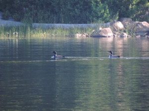
One thing I haven’t mentioned that is common to all the bodies of water in this area – loons. We see them constantly, and hear their mournful calls as the sun sets and rises each day. Eagle Bay was no exception and it seemed that there was always at least a pair of loons present on the bay, fishing or preening.

Day: 11.2SM/9.7NM – 1H35M   Trip: 2255.5NM/2591.7SM

Wednesday, August 14, 2013 Eagle Island to Moiles Harbour (John Island)

We stayed in the protected bay at Eagle Island for two days waiting for the wind gusts to subside so we could move a little further west. By Wednesday morning the time had come to move a little further, so we departed Eagle Island at 0845 and anchored at 1125 at Moiles Harbour (really just a bay) at the eastern end of John Island. There were several other boats in this small but very protected anchorage and we found a good spot in about 20 feet of water. Winds picked up again, so instead of moving on to Beardrop Harbor we stayed for an extra day. We originally intended to move to Beardrop for our last night before heading 60 miles to the west in the main bay of North Channel, but because we needed a calm day for the long-distance and because Beardrop was only four miles away, we just stayed put in Moiles Harbour for an additional night rather than moving and anchoring in an area that was not as well protected from the southwesterly wind. The forecast for the next day was very good for the entire 60 mile route, so we planned an early departure.

Day: 18.1SM/15.8NM – 2H40M     Trip: 2271.3NM/2609.8SM – 399H20M

Friday, August 16, 2013 Moiles Harbour to Witney Bay via Drummond Island U.S. Customs

We were up at underway at 0630 as the sun rose and the wind had died to less than 6 MPH as forecast. The water was like glass as the sun rose over the mountains to the east – the first time in a week when the wind hadn’t been blowing at 12 MPH or more.

Once we cleared the few small islands to the west of Moiles Harbour we set a course that was almost due west for the next 40 miles, then crossed the boarder into the US, raised our yellow quarantine flag, and shortly afterwards turned south at the northern tip of Drummond Island to head to Yacht Haven Marina and the US Customs where we were required to check in to reenter the US legally. We had no plans to stop at the marina other than to clear Customs and we were glad we didn’t – it was in terrible shape and the marina had virtually nothing to offer other than access to Customs. The young Customs officer came aboard and examined our boat documentation and passports, did a cursory inspection of the interior (looking for smuggled aliens?), and checked through their computer system (as far as we know), we were given a Customs Log number and our passports were returned.

As we were heading back to Sanderling to get underway we overheard a radio call from a boat that had hit a rock and was sinking about a mile north of the marina. The marina staff scrambled and one of them jumped in a boat to go to the rescue. The radio call indicated the boat was a Tiara and we could see it from the marina sitting stern down in an area with about 15 feet of water. Apparently the driver had failed to notice that it was crossing a very shallow area out of the channel leading into the marina and at its high rate of speed had struck a rock and somehow damaged the bottom to such an extent that the onboard pumps could not keep up with the incoming water. Just like the Titanic, the women and children aboard got in a dinghy and were helped ashore by nearby boat. The marina’s boat took the Tiara in tow and as we were leaving the Customs dock the Tiara, with two men aboard, was being towed to a travel lift where we assume they were going to place the sinking craft while it was still afloat and lift it out of the water. We don’t know the outcome.

Since it was still fairly early (1600) we got underway and continued on around the west side of Drummond Island (in the main shipping channel from Lake Superior and Soo St. Marie) to Whitney Bay at the southwest corner of Drummond Island. We anchored at 1805 in about 10 feet of water so clear we could see every detail on the bottom, including our anchor and chain. We immediately fired up the grill and had hamburgers for dinner as the sun was setting.

Day: 78.5SM/

Saturday, August 17, 2013 Whitney Bay, Michigan to St. Ignace, Michigan

We were underway at 0705 on our way westward along the south shore of Michigan’s upper peninsula to St. Ignace. Again, the wind was fairly calm and the sun was shining to help warm the cool (to us) air. We saw a few Great Lakes ships enroute toward Lake Michigan, and a few heading east into Lake Huron. Since it was a weekend there were quite a few pleasure boats (both power and sail) out and about. As we rounded the northern tip of Mackinac Island we saw a number of high speed ferries plying back and forth between St. Ignace and Mackinac Island and their wakes actually created quite a chop in the narrows between the two locations.

When we stopped at the St. Ignace Municipal Marina we pulled into the fuel dock and took on 200 gallons of diesel fuel and pumped out the forward holding tank before proceeding to our slip.

We’re going to Mackiinac Island tomorrow for the day, and if the weather cooperates we’ll depart Monday for the western shore of mainland Michigan.

Day: 43.8SM/

——————————————————————————-

Monday, August 5, 2013 – Killarney to Covered Portage

Day: 5.4SM/4.7NM – 0H45M      Trip: 2183.7NM/2509.2SM – 384H20M

Thursday, August 8, 2013 – Covered Portage to Baie Fine

25.0SM/21.8NM – 3H30M      2205.5NM/253.2SM – 387H50M

Friday, August 9, 2013 – Baie Fine to Beaver Island Anchorage (Strawberry Island)

21.2SM/18.4NM – 3H05M     2223.9NM/2555.4SM – 390H55<M

Saturday, August 10, 2013 – Beaver Island Anchorage (Strawberry Island) to Little Current

2013 Cruise-2013-08-10-15-08-02-054to Little Current (Town Docks)

Day: 9.9SM/


Sunday, August 11, 2013 – Little Current to Logan Bay (Clapperton Island)

IMG_20130811_094747_390

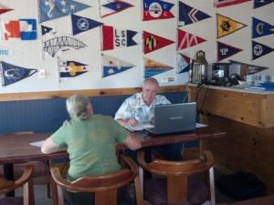
Roy’s cruiser’s net broadcast on Saturday mornings

We’re about to depart Little Current. I attended Roy’s Cruisers’ Net broadcast on VHF-71 this morning and there were around 140 boats that called in (Roy thought it was probably a record number for this time of year). His all-time high was around 175 on July 27th this year – who says people aren’t cruising!

You can listen to Roy’s broadcasts (and read his newsletters) at http://www.lcyc.ca/index.php/cruisers-net

We’ll be heading to one of the anchorages at Clapperton Island today, then Eagle island, then perhaps to Beardrop Bay. Weather will be the big factor beyond Clapperton. From Beardrop Bay we’re going to head to Drummond Island (Michigan) to check back into the US, and from there to St. Ignace where we’ll spend a couple of nights and take a day-trip by ferry to Mackinac Island to see what the hoopla is all about. From there we’ll head over to the Michigan coast and make our way down the eastern side of Lake Michigan.

Will provide more info to this blog and fill in all the blanks as WiFi permits.

Georgian Bay

Tuesday, July 30, 2013 – Britt, Ontario

We did depart Britt at 1055 after purchasing two more pints of ice cream at the convenience store, and at 1253 cruised through Rogers Gut. We were a little concerned about the depth, although several power boaters we had talked to along the way said it wouldn’t be a problem. The 200 yard long channel had to be blasted out of the granite to a depth of seven feet when the small boat channel was created, but even with Georgian Bay water levels at datum (for the first time in a number of years) the guide books caution that winter ice will sometimes move boulders into the narrow channel and create hazards to passing boats. Fortunately about the time we were going to pass through the gut a smaller Canadian boat Rigadon came up behind us, and after a brief conversation via radio they agreed to go ahead of us and report the depths as they went. Turned out that the lowest depth was about six feet. Thanks Rigadon for removing the “pucker factor.” We then turned into Henvey Inlet and passed through the narrow entrance to the inlet only to discover that several boats, including Rigadon, had moored to the sheer granite walls of the passage and tied their lines around rocks and trees to hold their position! First time we’d seen that. We continued further along and found a nice anchorage that provided protection from the SW wind blowing that day.

Day: 19.0 SM/16.5NM   –  3H15M              Trip: 2123.1NM/2439.6SM  –  375H00M

Wednesday, July 31, 2013

As we departed Henvey Inlet there were even more boats moored against the granite rock faces along the narrow entry channel; a few had portable generators ashore and were fixing breakfast in electric skillets! We continue through the 17 mile stretch that is open to Georgian Bay and unprotected by outlying islands in fairly calm water and entered Beaverstone Bay where we eventually anchored near Burnt Island. The wind was from the SW at about 10-15 MPH most of the day and the first anchorage we tried at Muskrat Bay (in Beaverstone Bay) didn’t provide the protection we wanted, particularly after the wind shifted to the west later in the day as was forecast. After 20 minutes at anchor in Muskrat Bay and consulting several different weather sources, we moved a short distance to Burnt Island.

Day: 39.2SM/34.1NM – 5H10M                Trip: 2157.2NM/2478.8SM – 380H10M

Thursday, August 1, 2013 – Burnt Island, Beaverstone Bay

Shortly after getting underway we passed through a very shallow area but well-marked area with mud bottom (we’d been told that sail boats just drag through the mud if it’s too shallow) and saw about 5 feet at it’s shallowest. We turn turned hard to port and entered Collins Inlet and the beautiful passage through high pink granite walls toward Mill Lake, which is part of Collins Inlet. When we got to Mill Lake we decided to anchor there for the night and found a nice protected spot to the east of Green Island. A sailboat anchored about 1/4 mile away during the day, but otherwise we were the only larger boats in the area. As is getting to be the norm for this area, the scenery was fantastic – pink, rose and white granite covered with evergreen trees everywhere you looked.

Day: 7.9SM/6.9NM – 1H15M               Trip: 2164.1NM/ 2486.7SM – 381H25M

Friday, August 2, 2013 – Mill Lake, Collins Inlet

As we departed Mill Lake and eventually got an internet connection we learned that the winds for the next few days would be gusting to 25 MPH to the west of Killarney, so we decided to stop at a marina in Killarney for a couple of days to let the wind gusts pass. We’ve now been here for three days, but tonight the winds are forecast to die down and the next several days should be good cruising.

2013 Cruise-2013-08-03-12-43-16-

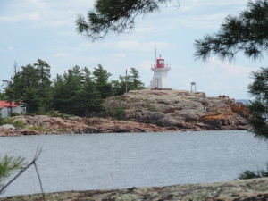
Eastern Killarney lightnouse

2013 Cruise-2013-08-03-12-36-54-

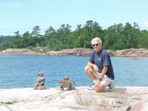
Inukshuks along the route to the lighthouse

2013 Cruise-2013-08-02-17-49-34-049

The best fish and chips on Georgian Bay!

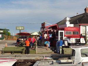
Yesterday we hiked about 6 kilometers and an hour through a forest with lots of mosquitos and over huge granite outcroppings to the eastern Killarney light house. Although the hike and trail were interesting, we weren’t prepared for the number of mosquitos and the fact that the trail was very poorly maintained. Consequently, our hike back took the road and only 15 miinutes to reach town where we stopped for ice cream (not Kawartha) for our reward! We’ve also eaten at the local fish and chips place (a converted school bus on a dock with picnic table seating) which everyone recommends as having the best fish and chips in Georgian Bay – the fish is locally caught white fish and it is delicious.

Tomorrow when we depart the marina (Killarney Mountain Lodge) we’ll get another pump out and about 200 liters of diesel which will get us well into Michigan. We could probably make it to Michigan with the fuel we have onboard, but I’d rather have too much fuel than not enough so we’ll take on a little for insurance.

Day: 17.1SM/14.9NM – 2H00M               Trip: 2179.0NM/2503.8SM – 383H25M

Monday, July 29, 2013

The decision was easy – winds kept us in the small, protected bay thru Sunday. The weather calmed down last night and despite torrential rain during the night the weather (winds) were nice and calm today, permitting us to transit the 7 mile open-water stretch without a problem. The channel we were in prior to the open water is “Hang Dog Channel” – not sure of the basis for the name – which had several 45 degree turns which made it very interesting. Down one side of a long string of granite outcroppings, then a hard turn and up another narrow area between rock outcroppings. Then we reached the open water stretch and were in water as shallow as about 9 feet – it’s really disconcerting to watch the bottom roll by the boat apparently so close that it seemed like we would run aground even though the water is so clear one can see the bottom at 15 feet of depth!

At Byng Inlet we turned east and proceeded up the inlet (more like a “reach” in New England) to the small town of Brit, where we are now. The “grocery stores” are essentially what we would call convenience stores, but we were able to do a little shopping to narrow down our list at the store in the marina and at an even smaller store about 3/4 of a mile away.. We also found ice cream at the grocery right at the end of the dock, although it is not Kawartha it is the next best thing – Ben and Jerry’s.

The weather is forecast to continue to be favorable through tomorrow (and perhaps further out) and we’ll be departing here in the morning to go to Henvey Inlet, about 15 miles further north. To get to Henvey Inlet we’ll pass through Roger’s Gut, the only area on the small boat channel that was blasted through the granite – it’s depth at datum is only 6 feet, but we will have 2 feet to spare under the keel.

Day: 32.1SM/27.9NM              4H30M  –   Trip:2106.6NM/2420.6SM

Saturday, July 28, 2013

These next entries are being written on Saturday, July 27, 2013 as we are again anchored in a protected area while some gusting winds pass through the area. Hopefully this will bring you up to date and give you an idea of where we have been the last week or so, starting at Parry Sound.

We arrived at Parry Sound (the town) from Wilcox Island anchorage on July 18, 2013 after cruising through the North Channel in rain for about 16 miles. We wanted to get to a marina in Parry Sound before a predicted thunderstorm with winds approaching 40 MPH reached the area the next day. We made it with plenty of time to spare and went into Big Sound Marina, operated by the Parry Sound Chamber of Commerce for three night (three for the price of two). We had a delightful stay there in a very nice marina close enough to town to walk to restaurants and a little shopping, used the free shuttle to shop for our major supplies at Canadian Tire (found a solar camp shower), Sobeys (food) and Kawartha ice cream (both a cup as well as two pints for the boat), ate dinner out three nights (one at a great restaurant a short walk past downtown with the best schnitzel I’ve had outside of Germany, and attended an opera gala at the interesting Charles W. Stockey Centre for the Performing Arts just outside the marina in a beautiful setting overlooking Parry Sound (the body of water).

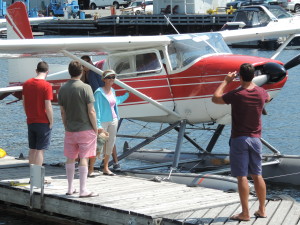
Judy took a 35 2013 Cruise-2013-07-20-12-18-01-_01minute ski plane ride around Parry Island – something she has wanted to do (ride in a ski plane) since we first saw them on the Trent-Severn Waterway; from the smile on her face I think she had a great time. We actually had a busy three days, but were ready to leave on Sunday, July 21st.

Before departing Parry Sound (the town) we moved to another marina across a small bay to have our forward holding tank pumped out – something that needs to be done every so often. We have two 22-gallon holding tanks aboard, one for each of the heads. The toilets can be set to pump waste into the holding tank or into the onboard sewage treatment system called a LectroSan, but in this area we are not permitted to pump any waste (even treated waste) overboard so must use the holding tanks and then have them pumped out periodically, usually at a marina.

2013 Cruise-2013-07-21-18-41-05-

July 21st dinner in Sawdust Bay

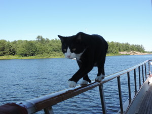
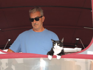
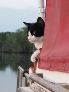
From Parry Sound (the town) we cruised out into Parry Sound (the body of water) on July 21st and about 8 statue miles into Sawdust Bay on the northwest corner of the sound. We had intended to stay only one night, but weather intervened and resulted in us staying there for three nights waiting for high gusting winds to pass through the area. On our first night, Ernie was apparently practicing his balancing or climbing skills, slipped and fell overboard after hitting the swim platform. We both heard the thump and knew from the sound that it was more than Ernie simply jumping from the upper deck to a lower deck. Judy ran outside and immediately spotted Ernie holding onto the swim platform with his front paws while trying to climb out of the water with his back feet; she got down to the swim platform in record time and pulled Ernie out of the water. His lower body looked a little like the proverbial drowned rat and his front claws were shredded from hanging onto the wooden platform. Judy dried him off with a towel and he appeared to be terribly embarrassed for the rest of the evening as he stayed inside. At that point we decided that we couldn’t trust him to “play” outside at night, so have been keeping both cats confined to the interior of boat after dinner. Ernie, particularly, is not happy with that arrangement, but we both sleep better at night since we don’t have to keep one ear open listening for the splash of a cat falling overboard. Interestingly, Ernie didn’t let out any cat sounds while he was struggling to get back aboard, so in the absence of a splash or a thud as was the case this time, we wouldn’t know he was in the water.

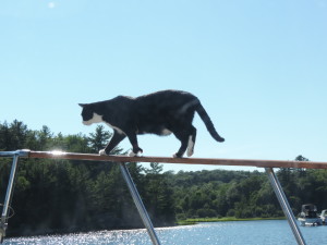
2013 Cruise-2013-07-21-17-27-38- 2013 Cruise-2013-07-21-17-26-18-_01Since then, while at anchor in these still waters, we’ve noticed that Ernie frequently demonstrates his admiration for the Flying Wallendas by walking along the hand rail, across the stern of the boat, into the dinghy and perching atop the motor, but also along the side hand rails from bow to stern; he’s also quite proficient at turning around on the 2.5 inch wide rails!


From Sawdust Bay we went to Kilcoursi Bay, a place that all of our new Canadian boating friends recommended for its sand beaches and great holding. We arrived on a Wednesday figuring that there would be fewer boaters in the middle of the week. Well, I’d hate to see it on weekends – the main anchorage area was packed. Various groups of boats were rafted and Med-moored (a Canadian favorite, apparently) one “pod” with six boats, and several with four boats. We picked a nice open spot (the only one) among some sailboats and set our anchor in 20 feet of water with 125 feet of scope. By late afternoon a BUFF (Big Ugly Fast F . . .) came in and dropped his anchor almost on top of ours while backing at a fair rate of speed sideways to the wind while playing out some unknown amount of anchor rode, then threw out a stern anchor so that he was essentially sitting broadside to the rest of us who were swinging on our single anchors and would rotate as the wind rotated during the day. At one point his kids got in a dinghy and used it as a tug to try to push the stern bow in toward the beach, but since he apparently had no idea how to anchor in the first place he had no idea that the kids needed to push the stern of the boat using this interesting technique rather than close to the bow, so their efforts had little effect. Later in the day a much smaller LUFF (you guess) came in and waved to the BUFF, then proceeded to anchor using a similar ineffective technique of dragging the anchor while playing out rode (apparently waiting for the anchor to catch something). Once the LUFF got the bow anchor to grab, the BUFF team used their dinghy to haul out the LUFF’s stern anchor toward shore and drop it to hold the LUFF in position. Then the BUFF got underway again and circled around to raft with the smaller boat – another interesting technique best understood by the participants. The BUFF crew then again used their dinghy as a tug to push the BUFF close against the LUFF so they could exchange lines, then used the dinghy to take both the stern and bow anchors of the BUFF out away from the boat and drop it. Never once did anyone back down on an anchor to ensure that it was actually holding. Fortunately for all of us, the winds died to less than 5 MPH that evening so no one moved about in the anchorage.

The area itself was interesting, with a long horse-shoe shaped sand beach in a provincial park (Kilbear Park). There were fenced-off swimming areas at various locations along the beach, picnic tables and campsites behind the trees lining the beach. There were a lot of people in the water swimming, canoeing and kayaking when we arrived. Everyone was having a great time, it appeared, and the weather was fairly warm (mid 70s) and sunny.

One evening at Kilcoursi Bay was enough for us, despite the entertaining value of watching interesting anchoring techniques! We departed on Thursday, July 25th and anchored in the eastern Hopewell Bay after cruising about 22 statute miles. There were two other boats anchored in the bay when we arrived, but it was a big bay and we all had plenty of room to swing. That evening as we were planning our next day’s move, we were concerned that the weather forecast indicated we’d be having 15 MPH winds with gusts to 25 from the southeast for a good portion of the next day or two, making it imperative to find a better protected anchorage since the bay we were in was fully exposed to the southeast and 25 knot gusts would make it very uncomfortable. We found several small bays that would provide the protection we needed, and the next morning (Thursday) moved to a much smaller bay immediately west of the bay we were on (we refer to it as West Hopewell Bay) which was only open to the northeast. It took us all of 30 minutes to shift to the new location and get our anchor down in a beautiful, narrow bay about 400 yards wide and surrounded on all three sides by tall stands of evergreen trees atop granite mounds. Unfortunately, there was a cottage just before the area we wanted to anchor in and there were a number of young people with their ski boat and various other watercraft sitting on the porch. While not outwardly hostile to our presence, it was obvious that we were intruding on their ski area; however, we felt we didn’t have much choice, explained our situation and the fact that they could ski around us all they wanted and it wouldn’t be a problem for us. Consequently, we were treated to some great displays of water skiing, took videos of them, and that evening invited them to come aboard where we gave them a thumb drive with the videos and showed them around Sanderling. None of them had ever been on a large boat and appeared interested in what we were doing. Turns out they were grade-school friends who all grew up in Columbus, Ohio. The cottage was built by one of the fellows grandfather 40 years ago. They had been coming to this cottage for a number of years every summer for their annual get-together. They were a nice bunch of young adults; we appreciated their understanding and willingness to let us share their area. They left on Saturday morning to return to their respective homes in Columbus and Chicago.

Trip: 2076.1NM/2385.6SM    366H45M plus 2.9SM and 30 minutes to shift to the western Hopewell Bay.

Now we’re trying to figure out what to do tomorrow (Sunday). About 15 miles further along is a 12 mile stretch of water that is essentially out in Georgian Bay and unprotected by any islands, so we want to have some low winds before traversing that stretch. Between here and the unprotected area (15 miles) are a lot of small islands that will provide some protection from winds, but no nice bays like we are currently anchored in. The current forecast for tomorrow shows wind gusts to 25 MPH most of the day; Monday is forecast to be good for crossing that 12 mile stretch of water. All could change by tomorrow morning or even later tonight.

Do we stay or do we go and find a place to anchor before the unprotected 12 mile open stretch? Stay tuned!

After cutting and pasting the above to our blog I realize that it is really out of date. Here is a list of our locations from Port Severn to Parry Sound:

July 6 – Lonoguissa Point Bay across from Bone Island

July 8 – Weber Island/Good Harbor

2013 Cruise-2013-07-10-17-42-05-July 9 – Sandpiper dock at Beausoleil Island (a national park)


July 11 – Chimney Bay at Beausoleil Island

2013 Cruise-2013-07-13-08-25-26-037

Inner Bay

July 12 – Inner Bay north of Go Home Bay

July 14 – Port Rawson Bay2013 Cruise-2013-07-14-09-24-26-


July 16 – Wilcox Island (lower end of Spider Bay)

Saturday, July 6, 2013 – Port Severn into Georgian Bay

Port Severn lock aft

Port Severn lock aft of Sanderling

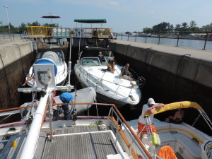
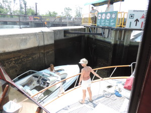
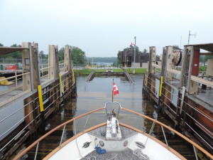
The lock at Port Severn that takes boats from the 240 mile long Trent-Severn Waterway into Georgian Bay is the smallest on the entire waterway – 84 feet long and only 23.5 ft wide. When we departed Upper Starport Severn marina at 1005 there was a 42 foot trawler ahead of us approaching the lock. It went through ahead of us with a much smaller boat. After we tied to the blue line while the first trawler was being locked through a number of boats of various sizes arrived waiting to lock through. This was Saturday morning, the sun was shining, and EVERYONE wanted to get out onto beautiful Georgian Bay for the weekend. The lock master knew some of the waiting boats from previous experience, and for those of us who were new to the lock he asked our measurements – we are almost 15 feet wide (beam) and with the dinghy hanging out on the stern davits we’re about 46 feet in length. He then told the waiting boats (or most of them) their order into the lock and where theywould be positioned. He kept repeating that this was his plan – we’d have to see if it would work. Work it did! There were five of us in the lock. We were the first inside and onthe far forward starboard position with two smaller boats on our port side with about 2 feet of clearance on either side of them. Then he brought in two more boats that shared the space behind us across the width of the lock – the anchor of the boat behind us was about 2 feet from our dinghy and the anchor of the boat on the port side overlapped the swim platform of the boat along side of us. Everyone was in a good mood and chatting back and forth, giving us advice of good places to anchor for the weekend, where to visit on Georgian Bay, etc.

Port Severn lock forward

Port Severn lock forward


At 1100 the two smaller boats on our port side had exited the lock and we were out behind them, prepared for the very swift rushing rapids that would take us downstream under a highway bridge through a twisting narrow channel marked with red and green buoys into Georgian Bay. The two smaller boats went out fast and we delayed our exit to give them plenty of room, then we made the 1/4 mile run through the turbulent water. The short run turned out to be not nearly as challenging as we thought it would be and we were shortly delivered to the smooth waters of Georgian Bay.

As we were about to enter the bay proper we had a call on the VHF radio from a friend we have gotten to know via the internet and email asking our location. He told us where his boat was anchored and as it was still some distance away we agreed to reestablish contact once we were closer. Earlier he had suggested several small bays in which we could anchor near the area where he and some other boats would be anchored for the weekend. We eventually reached his area and because our cats prefer to be outdoors whenever the mood strikes them we elected to anchor by ourselves (rather than rafting with other boats) in Longuissa Point Bay just across the main route between islands from our friends.

After we raised the radar mast (which also has the anchor light as well as several other antennas) we got the dinghy in the water and set off for the mile or so to meet our friends in person and get some advice about places to visit on Georgian Bay. Their boat was sunk during hurricane Charlie in Florida in 2004 and they have completely restored it to better than new condition – a beautiful boat (about 46-48 foot Present) that required much fiberglass, electrical and mechanical work (as well as full Awlgrip paint) in order to make it their own. We had a nice visit and tour of their better-than-new boat, then dinghied back to Sanderling.

A few small boats and some PWCs came through the bay on their way to a small river at the top of the bay, but that traffic stopped about sunset (2100 or so). The night was peaceful and quiet.

Day: 22.8SM/19.8NM – 4H15M          Trip: 1943.4NM/2233.1SM – 343H30M

Trent-Severn Waterway

Thursday, June 13, 2013 – Horse Point, Bay of Quinte, Ontario

As much as we had a nice, sunny afternoon yesterday, today was rainy and gray. We awoke to light rain which had started during the night, and got underway at 0925 in the drizzle. The good news – there was no anchor beard, the mass of aquatic plants and grass that sometimes accumulates on the anchor and chain as it lies on the bottom and forms a mass when the anchor is retrieved. There was some visible plant growth in the small bay when we checked it prior to anchoring, but moved into slightly deeper water and apparently avoided it (the grass/weeds won’t grow when the sunlight doesn’t reach the bottom, so the deeper the water the less likely one will find the plant growth).

We traveled westward 15 miles to Trenton, Ontario, the “Gateway to the Trent-Severn Waterway” and tied to the dock at the Fraser Park Marina. What a great place it is. Not only is the staff (Craig) incredibly helpful and friendly, the marina is only a block away from a spacious new Metro supermarket (formerly A&P) and the downtown area with other shops and restaurants within easy walking distance. While there we “discovered” Kawartha ice cream and their blackberry cream white chocolate chip ice cream. No other ice cream can compare!

While in Trenton we did about eight loads of laundry in our small European-style washer-dryer (it was running all day long), changed the engine oil and filters, ate out twice, loaded up on diet coke, Lipton diet green tea, and diet mountain dew at the Metro, and also found some olive oil with spices and freshly baked French baguettes!

Saturday, June 15, 2013 – Trenton

At 0850 we shifted from the dock where we had been staying for two nights to the fuel/pumpout dock to pump out our two holding tanks (absolutely no overboard discharge allowed in these waters). We were then underway and heading under the bridge into the Trent-Severn Waterway at 0915. We had to wait at lock #1 for about 45 minutes and had no response from the Parks Canada employees even after hailing them on the VHF radio several times. Judy finally walked about ¼ mile to the lock and could find no one other than people fishing. About 10 minutes after she returned to Sanderling we saw the lock tenders and the lock doors opened. We learned while we were in the lock that the the lock tenders take care of both locks #1 and #3, and they were assisting boats ahead of us go through #3 when we arrived at #1. Once we were through #1 the rest of the locks were ready for us when we arrived. Each of the crews did take care of two different locks so were driving back and forth the short distance between their locks.

We stopped for the day at the top of lock #6 where there is a beautiful park and camp ground. The name of the local community is Frankford.

The country is beautiful with tree-covered hills and the rushing Trent River alongside us. There has been more rainfall this past couple of weeks so the waterway authority is allowing more water than normal to flow through the dams in order to prevent serious flooding further upstream.

Tomorrow (Sunday) we hope to reach Campbellford, about 25 miles and another six locks further north (upstream).

Day: 7.6SM/6.6NM – 2H05M Trip: 1696.3NM/1949.1SM – 283H00M

Sunday, June 16, 2013 – Lock #6 – Frankford, Ontario

It’s drizzling this morning and the forecast calls for up to 25 mm (a little over an inch) of rain today. A houseboat that pulled onto the southbound blue line yesterday afternoon departed through the lock about 1100 this morning, but we’re going to stay put for the day and hope for better weather tomorrow (forecast: 40% chance of thunderstorms) to continue northward to Campbellford.

On the Trent-Severn Waterway you’re traveling either north or south when talking to lock and bridge tenders, even though in reality you may at any time be heading north, south, east or west. The basic waterway from the start at Trenton to the finish at Severn is actually northwest, but the waterway follows various rivers (we’re now on the Trent River) and lakes which do not necessarily line up in a north-south direction. So to make it easier, if you’re heading to Severn and eventually Georgian Bay you’re heading north, and if you’re heading to Trenton you’re heading south, no matter what your compass or GPS indicates!

Breakfast this morning for me (Judy’s breakfast is always her hearty coffee) consisted of pancakes, sujuk and kielbasa – the first time I’ve made my at-home-standard-weekend breakfast on this cruise! While we’re underway I usually have toast with peanut butter and honey – it’s fast and easy to fix as well as being fairly nutritious. Some days I’ll eat cheerios with a banana if we have a ripe banana onboard, and I frequently have yogurt in addition to toast and cereal.

The “blue line” referred to in the first paragraph of this day’s post is actually a wide blue line, painted along the right side of the wall leading to each lock, whether locking up or down. If you intend to go through the lock and the lock gate is not open, you tie to the blue line and wait for the lock door to open. If you’re on the blue line, it means that you intend to proceed through the lock; if you’re behind the blue line (not yet moved forward onto the line, then there’s no expectation that you’re going to go through the lock. It’s more or less a signal to the lock tenders that you do or do not intend to proceed through the lock. Unlike the canals in New York (Erie, Champlain, Oswego) there is no VHF radio contact with the locks in Canada – everything is based on your position on or off the blue line or what you tell the preceding lock tender about which locks you intend to transit that day. If you tell the preceding lock tender that you’re going through the next lock, the tender will call the next lock (by phone) to let them know you’re on your way and will be going through. That allows the next lock tender to prepare the lock for your arrival if there’s not much distance between the lock. The system works quite well and eliminates a lot of radio chatter. You’re not supposed to stay on the blue line during the day, since your presence on the line indicates that you want to proceed through the lock, but once the locks close for the day (1600 during the week; 1700 during the weekend) you can tie up to the blue line to spend the night as long as you’re prepared to lock through when the locks open for the day (0900). We bought a season pass from Parks Canada for both locking and mooring so there is no charge for us to go through the locks or to stay on the lock wall for the night. A few of the locks have hydro (electricity) for an additional $10.00 per night (not included in the Park Canada pass).

Monday, June 17, 2013 – Frankford

Departed at 0830 to get to Lock #7 (about 6 miles away) in order to get their first opening. Arrived in plenty of time and tied to the blue line; waited about 20 minutes before the lock opened, and as we were entering a Canadian trawler and crew that had been at Frankford came in with us. We were together the rest of the day and the remaining locks to Campbellford.

Shortly after we exited the flight of two locks just below Campbellford our engine overheat alarm went off. When I glanced at the temperature gauge it read about 220F degrees, when it’s normally around 170 to 180F in these waters. Fortunately we had moved beyond the dam at that point and were in a rather swiftly flowing, narrow river not too far from where we hoped to moor for the night. Judy immediately put out 125 feet of anchor chain in 10 feet of water which caught and held us firmly.By this time the raw water alarm was screaming, also, so there were two different overheat alarms sounding from both the inside and topside steering stations! The cats were panicked by the sound and were trying to find a place to hide. I turned off the engine and opened two deck plates into the engine room. It was obvious that the alternator belt had NOT broken, so more investigation was required.

I entered the really hot engine room and checked the thru hull intake filter (not clogged) and then took the plate off the impeller housing (the impeller was not broken into pieces) and watched while Judy turned the engine over to check to see whether the water pump was working – it was. We restarted the engine (alarms still screaming) and there seemed to be water coming out of the exhaust as it should be, meaning that raw water was again cooling the engine. Judy noticed that the engine temperature was starting to drop, and shortly the engine temperature alarm had stopped but the raw water alarm on the exhaust hose continued to scream. After the engine continued running for five minutes or so with the raw water alarm still screaming, I returned to the engine room and disconnected the alarm! That solved that problem. We motored forward and took up the anchor line as we went, then continued into the dock at Campbellford and found other boaters waiting to help us get our lines onto the dock in the swift current. Soon all was back to normal.

Although I have no way of knowing for certain, I think we must have sucked something into the engine water intake just after exiting the last lock. When I opened the various ports to inspect the water filter and the impeller the clog must have exited the thru-hull allowing the cooling water to again flow through the engine. I have no other explanation since I didn’t have to “fix” anything in order to get the cooling water flowing again.

We’ll be here in Campbellford for at least the night – we’re currently trying to decide whether to stay tomorrow or continue on to Lake Rice to anchor for a night before getting to the first hydraulic lift lock at Peterborough.

Tuesday, June 18, 2013 – Campbellford

We’ve returned from having our mandatory whipped sweet cream filled glazed donuts at Dooher’s Bakery (also bought a loaf of Canadian Harvest bread and two cheese bagels), buying a number of pounds of chocolate goodies at the World’s Finest Chocolate Factory Outlet Store, and eight bacon-wrapped filet mignons at M&M’s Meat Market. I think we’re all set for a couple of weeks. Those donuts were the best donuts we’ve ever eaten; Judy had two and I had three before we finished!

We did a load of laundry last night and took showers aboard, so we filled the water tanks this morning (total of 160 gallons in two tanks). Judy’s finishing some work using the internet, and then we’re going to head north again. We think we’ll tie to an upper lock wall before reaching Lake Rice later this afternoon. Perhaps Peterborough tomorrow.

Checked the engine this morning and reconnected the raw water alarm – it is no longer screaming. When we started the engine it was pumping water out of the exhaust just like it is supposed to, and there was no sign of any water leaks from hoses around the engine. Most likely cause of the overheating problem yesterday was a plastic bag sucked into the raw water intake thru-hull.

We departed Campbellford at 1200 and at 1230 we were ready to exit Lock #13 with friends Rick and Anna whom we met and traveled with yesterday. They have a beautifully restored Marine Trader 36 which they are taking a short distance north to their home just above lock 17.

At 1430 we exited lock 17 and Rick and Anna veered to port to take their moor

ing in the bay at their home and we continued northward. We anchored at Dunn Point at Trent-Severn mile 41 at 1515 hours, and had an enjoyable afternoon basking in the sun with both cats able to run about the boat. That evening we heard and later saw our first loon of this trip – what a mournful sound and beautiful sight they are on the water.

Forgot to mention that we saw TWO bald eagles on a tree limb yesterday and Judy got some great pics of them as we passed slowly by.
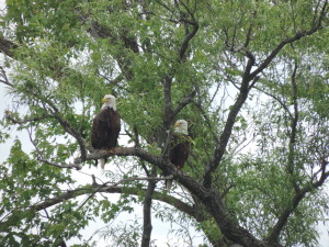
Eagle pair

Day: 9.9SM/     3H15M       – Trip:

Wednesday, June 19, 2013 – Dunn Point

We had the anchor up and were underway at 0940. Surprisingly there was no grass “beard” on the anchor. We are not in the real “cottage” area of the Trent-Severn and the banks of the rivers and lakes are lined with summer cottages (a few newer year-round homes as well, it appears). We passed through lock #18 at Hastings and into Lake Rice. We looked for a place to anchor where we could find an unsecured WiFi (from someone’s home) and finally found a good spot further along the lake near the Hiawatha Indian Reservation not too far from where we would turn north into the Otanabee River. We could see a few weeds growing from the bottom, so figured that we’d have a “beard” tomorrow when we raised anchor!

Day: 27.3SM/              4H45M   –  Trip:

Thursday, June 20, 2013 – Hiawatha Indian Reservation north shore Lake Rice

Another clear and sunny day with little wind and temperature about 65F when we got underway at 0900. We did have a bit of a “beard” when the anchor was raised and it took awhile to clear off the grass while Judy headed toward the Otanabee River.

At 1230 we went into lock #19, and at 1305 we had lines to the dock at the Municipal Marina in Peterborough. After we had registered and each had two scoops of Kawartha ice cream (Blackberry Thunder) we walked several miles to the lift lock just north of Peterborough to get a feel for what we would be doing tomorrow. While this is one of seven lift locks in the world (Canada, England, France and Belgium), it will be a first for us. This one is the world’s tallest. We hope to depart the marina about 1000 and be in the lift lock between 1100 and 1200.

Day: 23.9SM         4H25M         –   Trip:
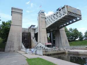
Peterborough Lift Lock
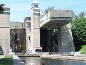
Peterborough Lift Lock

Peterborough Lift Lock

Peterborough Lift Lock


Monday, June 24, 2013

Since departing Peterborough we’ve stayed at Lakeville Lock #26 (where we were able to walk into town and buy containers of Hawatha ice cream), anchored near Taylor Island in Clear Lake, and then anchored in beautiful small Gilchrist Bay off Stony Lake where we’ll soon depart this morning heading to the Whetung Ojibwa Crafts and Art Gallery dock for a short stop and then will find an anchorage in Buckhorn Lake.

More later!

Wednesday, June 26, 203 – Bobcaygeon Lock #32 mile 138

This morning Bob walked to a restaurant and had an omelette, home fries, bacon and toast for breakfast before we got underway. We watched a couple of house boats (rented locally) lock through the lock with the assistance of the lock operator, and then at 1030 we went into the lock ourselves. We went through several more locks before anchoring in Fells Bay off Cameron Lake at 1400.

The bay was very small and we were well protected from wind from about any direction. There were cottages and larger houses around the edge of the lake and people were swimming from shore and generally enjoying the nice afternoon.

It wasn’t very long after we anchored that we began to hear loons calling and saw them in the water. Upon inspection with our binoculars, it was apparent that the pair had a small chick that they were taking care of. Later in the day we even observed the chick on the back of one of the adult loons! The little family stayed between us and the shore for the entire time we were anchored in the small bay.

Day: 19.1SM/16.6NM 3H30M – Trip: 1842.3NM/2116.9SM 318H40M

Thursday, June 27, 2013 – Fells Bay, Cameron Lake mile 155

Just before raising the anchor this morning we saw another loon who was swimming very close to Sanderling. Judy was able to get some good photos of it while it swam by. The anchor was up at 0935 and we were on our way. The next lock was just a few miles further northward and a 40 foot vertical lift; as it turned out we were in the lock with three rental house boats, not the best of all possible worlds since the house boats operators are generally very inexperienced and to be avoided, if at all possible, to lessen the possibility of a collision! Despite their lack of experience, the lock tenders are very good at helping them get their boats tied to the walls (this is basically rental house boat nirvana) and as long as they understand directions the boat operators get along fairly well. We helped the last houseboat into the lock get their lines fixed to the lock walls – we had been in another lock with the same boat the previous day, so at least this wasn’t the boat operator’s first lock!

By 1225 we had our lines to the wall above the Kirkville Lock #36 (the second hydraulic lift lock on the waterway) and walked forward to the lockmaster’s office to discuss what was available for an overnight further along the waterway. After learning that the next five locks all could accommodate several boats beyond their blue lines, we proceeded into the port “bathtub” along with a beautiful Ranger 28 tug behind us, and shortly were being lowered about 45 feet to the lower level. This was the first “down” lock we encountered on the waterway – all of the preceding locks were locking us up to a higher level of water. The highest lake level is 840 feet above sea level (Lake Balsam). We started on Lake Ontario (Trenton) at about 243 feet above sea level, and we’ll be lowered at Georgian Bay (Port Severn) to 576 feet above sea level! There are a total of 44 locks (one number isn’t used) and Lock 44 at Big Chute is really not a lock but a marine railway. The last lock at Port Severn is #45.

By 1305 we were out of the Kirkville lift and on our way. At 1620 we had traversed four more locks and had our lines to the lower wall at lock #40 where we were going to spend the night in a quiet, rural setting. There was one small boat tied to the far end of the wall when we arrived and they had their Honda generator and a 2.5 gallon gasoline container on shore with a long yellow etension cord running to their boat to power their refrigerator and air conditioner. We met them while we were eating our garlic shrimp and pasta dinner and they were heading to the lock wash room to wash their dinner dishes.

Day: 25.6SM/22.3NM 6H45M – Trip: 1864.6NM/2142.5SM 325H225M

Friday, June 28, 2013 – Lock #40 lower wall shortly before Lake Simcoe mile 180

After discarding the accumulated trash in the lock’s trash bin, we cast off the lines from the downside wall about 0840 and slowly moved to the wall of Lock #41 in order to be there when the lock crew lowered the water for the first lock at about 0900. We tied to the upper lock wall and waited while the crew took care of their preliminary tasks (such as raising the Canadian flag, placing fire extinguishers and life preservers around the lock) and when the gate opened we proceeded in and tied to the starboard wall (our preferred side). A few minutes later we were out of the lock and were passing under a railroad bridge and then a low car bridge which opened for us. Immediately after the car bridge we tied to a long wall prior to entering Lake Simcoe in order to decide whether to go into a marina or to anchor somewhere. We eventually tried to get a reservation at a marina in Orillia (just off Lake Simcoe) for three days starting on Saturday, but there was no slip available for a boat our size. Monday is the first of July, Canada Day, and apparently everyone with a boat is going out for the three day weekend and many go into marinas to party.

We crossed the eastern end of the lake still heading northward and anchored in a relatively large bay, McPhee Bay at the northeastern corner of Lake Simco. The water is a clear bluish-green and we can easily see the bottom at 14 feet below Sanderling. There is a marina on a smaller bay on the southern side of McPhee Bay and there are a few ski boats, and slightly larger boats, out for the afternoon. It will undoubtedly be busier tomorrow (Saturday) with the start of the weekend.

The weather forecast is fairly benign, so we’ll stay here for a couple of days before proceeding through the next lock and looking for another place to anchor. We want to avoid the weekend crowds at the lock walls and “party spots” as much as possible, so won’t try to move very far until Tuesday morning. We have contacted a marina at Port Severn (the nothern end of the Trent-Severn Waterway, and will stay there for two nights beginning either Tuesday or Wednesday.

Day: 17.8SM/15.5NM 3H55M – Trip: 1880.1NM/21603SM 329H20M

We ended up anchored in McPhee Bay for four nights – the weather was delightful (not too hot, not too cool), and we were well protected from any wind from all directions but the southwest (nothing materialized). There were a lot of small boats out on the bay every day and we could see larger boats crossing the southwestern end of the bay heading toward Orillia or out into Lake Simcoe, so we knew things were busy at “The Narrows” with its several marinas and narrow channel. One day we lowered the dinghy and rode around the bay and into the two marinas located a bit off the bay through narrow channels. One of them was quite large, with many covered slips as well as a very active fuel dock. During the four days we were there several larger boats (34-38 feet, guessing) rafted at the far end of the bay and several other boats anchored near them, but everyone seemed to clear out at night (except the two rafted boats) and head back to their marinas. Different boats showed up on other days. Guess they preferred to party at night in their marinas than enjoy the peaceful lake after the water skiers called it quits!

One unpleasant aspect of anchoring in the bay were bugs – hundreds of them – little flying things, some with white wings and bodies and others looking more like mosquitoes (without the sting) and still others that reminded me of the mayflies we had on the rivers in Iowa at night. I had to vacuum the decks every morning to get rid of them and the little bodies piled up near the LED anchor light I set out on the bow every night.

 Tuesday, July 2, 2013 – McPhee Bay mile 195

We got underway at 1010 and proceeded just a few miles onto the free dock at the Port of Orillia to shop at the Metro supermarket within walking distance of the dock in Lake Couchiching. We also had hoped to find some water for our tanks since we assumed we were getting low after filling the tanks (160 gallons total) at Peterborough on the 22nd of June (12 days earlier). There were no water bibs on the free dock, and the nearby marina would not give or sell us any water unless we stayed overnight; since staying at the marina that we had tried to get into four days earlier, but couldn’t due to the holiday, was not in our plans, we continued on without filling the water tanks, although we did some major grocery restocking at Metro. We also found a small ice cream store right across the street so had a little mid-afternoon treat!

We continued on for another 12 miles or so to the upper wall at Couchiching lock #42. We had intended to go through that lock and anchor in a lake for the night and arrived at the lock before the “normal” 4:30 locking time, but when we were about 100 yards from entering the lock on a green light, the light suddenly turned read and the staff told us that we had to be there at 4:15 in order to lock through. There was no way to argue – they control the lock, so we ended up on the upper wall for the night. A short time after we tied to the wall (after 4:30 now) a small boat came in and complained that they needed to get through because they were driving a rental boat and it had to be returned; the crew let them lock down! Needless to say, we were a bit perturbed, but again, what could we do – complaining wouldn’t accomplish anything and would probably result in a less than harmonious locking through the next morning. So we stayed the night on the wall, along with several other boats.

Day: 21.2SM/18.4NM – 4H10M          Trip: 1898.5NM/2181.5SM     333H30M

Wednesday, July 3, 2013 – Couchiching Lock #42 mile 209

Despite not being able to lock through Couchching lock the night before, we were able to reach our day’s destination early in the afternoon after locking through and exiting the lock at 09:15 this morning. We think the lock crew felt a little guilty about shutting us out the night before, because they actually opened the lock early for us to enter – something that we’d never experienced before on the Waterway. We had a slight delay at lock #43, Swift Rapids, while an electrician tried to repair a locking pin, but we were on our way after waiting about 40 minutes. The pin wasn’t repaired while we were waiting, but the lock was safe to operate anyway since the pressure from the water above the lock is what actually holds the doors in place while the water inside the lock is being raised or lowered (we were being lowered). This was the first time on the waterway that we were in a lock with more than four other boats (that happened only once); there were seven of us in this lock, Sanderling and 6 smaller boats of various types. The lock couldn’t have held any more boats.

After locking through we continued on through some beautiful, rugged lake country with large homes built alongside the lakes and rivers and on their own small islands (granite outcroppings) to THE BIG CHUTE! This is called a “lock” even though it’s totally different from any other kind of lock in the world – it is essentially a marine railway or subdued roller-coaster. A boat is driven onto a large wheeled platform and secured with a complex system of straps very similar to how a boat would be lifted from the water at a boatyard by a travel lift, and then the boats (it can take several at a time depending on size) and the platform are moved along the track over a huge granite formation and down into the lake water on the other side 57 feet below (or above, if you’re heading southbound).  The lift at this location was originally built in 1917 and has been modernized several times. The current railway was constructed in 1978 and can carry 110 tons and vessels up to 100 feet in length.

We arrived at 1325 and tied to the Parks Canada dock just west of the railway and walked to the lock with plenty of time to watch the railway make a number of trips up and down the inclined railway before they stopped for the day at 4:30 (like all the other locks). We got a good feel for the way the railway operates and how we would maneuver Sanderling onto the platform. We also visited the small museum which explained some of the history of the area and the lock, then ate dinner at the restaurant in the nearby marina.

Day: 22.8SM/19.8NM  – 4H10M               Trip: 1918.4NM/2204.3SM – 337H40M

Thursday, July 4, 2013 – Big Chute Lock #44 mile 232

HAPPY FOURTH OF JULY!!!

We were up about 0715 today to prepare for our great adventure on the Big Chute. We removed all the fenders (so they wouldn’t snag anything on the platform as we were going in and wouldn’t interfere with the securing straps) and marked the starboard cap rail to indicate where it would be safe to locate the straps.

The crew has so much experience with all different types of boats that they only need to ask a few questions of each boat to know how to position the boat and the straps. Every boat wishing to lock through moves to the blue line on a wall near the lock, and then the lock operator calls each boat in the order he deems appropriate to approach the platform and enter. It’s not a first-come, first-serve type of operation operation as most other locks on this waterway..

BoatBoats lifting up lifting up
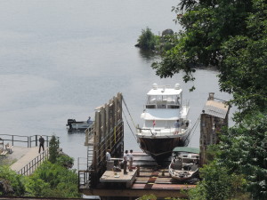
 

Boats being lowered into upper lake
Boats being lowered into upper lake


Sanderling in the slings ready to be lifted over and down

Sanderling in the slings ready to be lifted over and down


We were on the blue line about 0855 and the lift’s first boats were brought from the lower level. We entered the platform about 0915 (the only boat down bound) and by 0930 we had been deposited in the lower lake and exited the platform to continue northward.


We knew we didn’t have far to go to Port Severn so took our time winding through more lakes and narrow channels that were undoubtedly rapids in the days before the construction of all the dams and locks – in fact, many areas still have a very swift current of several knots and the existence of huge rock boulders is apparent on the depth sounder – it’s just that they are now 20 or more feet underwater!

We arrived at the Starport Marina at Port Severn and first went to the pump out dock to get our slip assignment, empty the forward holding tank, and pay for our two-night stay. By 1125 we were at our assigned slip hooking up the electric line and filling the water tanks. We determine the amount of water we add to our 160 gallon tanks (total) by first filling a small two gallon bucket and timing how long it takes to add the two gallons. Today, it took 20 seconds to fill the two gallon bucket – 10 seconds per gallon – six gallons per minute. When we switched the hose to the water fill, it only took 12 minutes until the water was coming out of the air vents – 72 gallons, and it had been 13 days since we last filled the tanks. Guess we really didn’t have to worry about running out of water.

We’ll be in Port Severn above the last lock on the Trent-Severn Waterway. On Saturday morning we’ll lock through into Georgian Bay and start a new chapter in our adventure.

Day: 6.0SM/5.2NM – 1H35M        Trip: 1923.6NM/2210.3SM – 339H15M

Friday, July 5, 2013

How nice to have showers with as much hot water as you wish and full capacity washers and dryers! This marina (Starport Marina) is very nice. There are a lot of boaters here – obviously the boats gets used, there are no “marina queens” here! Talked with several of them today to get some ideas about Georgian Bay.

Most of my day was spent troubleshooting our forward heater/air conditioner which wasn’t pumping water through the system and consequently shutting down. At the same time the batteries were equalizing to put them up to their full charge capacity – something that can be done only with a 4-hour supply of 110 volt electricity. We always do it at a marina and try to do it about every 30 days or so. The last equalization took place when we were at Waterford; we had used almost 6,000 amp/hours of 12 volt electricity since then!

The AC system wasn’t as successful, although I have identified the source of the problem – it’s just something I cannot fix myself without ready access to parts from Mermaid – it will wait until we get back to Florida. There is no electricity to the 110 volt raw water pump that must operate in order to produce either heat or cool air – without it the system shuts down. I don’t know what the actual problem is, but in order to trouble shoot it further I need to remove the entire unit so I can get to the circuit boards. In the meantime, if we do need either heat or AC for an extended period of time, I can run a 110 volt line to the pump from any one of our 110 volt outlets, and just plug it in when we want to run the AC or have heat in the saloon. We do have a small space heater that we can use for heat, and the aft cabin AC/heat system is still working.

Judy spent most of the day working online and laundered the sheets, pillow cases and towels in the marina’s laundry (included with the docking fee).

We’re going to eat out at the Dam Restaurant tonight and will probably stop at the Icebreaker ice cream shop for some Kawartha ice cream for desert.

We’ll depart some time tomorrow morning – no hurry – and head into Georgian Bay.
 

Into Canada

June 10, 2013

After a pleasant night at anchor in beautiful White’s Bay (off of Henderson Bay) in New York at the eastern end of Lake Ontario, we were underway at 0545 with a slight overcast, cool temp of 56F, and virtually no wind. We made our way northwesterly behind some large islands, across the main shipping lanes to the St. Lawrence River, crossed into Canada at 0825 and raised the yellow quarantine flag, and then into Adolphus Reach between Kingston and Picton. We encountered some light rain and drizzle as we proceeded westerly along the reach and turned south into Picton Harbor, but the rain stopped as we tied to the Picton Harbor Marina dock at 1315 after a 59.5SM mile run. We cleared into Canada by calling a toll-free number from the dockmaster’s office and in short order were given our Canadian Customs number which we have to display in the front window – the whole process is so easy – once I’d given the person on the other end of the phone Sanderling’s US documentation number, they had all of our information available and it didn’t need to be repeated. I did have to answer the questions about whether we had any alcohol, cigarettes, or firearms aboard (no to all). At that point we lowered the quarantine flag and hoisted a small Canadian flag in the position of honor on the radar mast.

As we were preparing to walk into town, who should show up but our friend Kenn from Naponee and his son, Corey. They came aboard and we quickly caught up from the last time we saw them in Montreal in 2011. We then drove into Picton in Kenn’s truck for a little shopping and stopped for gelato at a Bean Counter’s and used their free WiFi to download email.

Phone service in Canada is EXPENSIVE even with a Canadian plan on your US phone – we won’t be checking email every hour nor checking weather every couple of hours unless we have free WiFi (which we frequently do as a result of our WiFi radio connected to a router onboard).

June 11, 2013

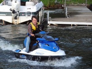
After breakfast at a local cafe (“the best breakfast in Canada”) and a little more shopping by foot (had to get more OKA cheese with mushrooms at the local cheese shop) we got underway at 1215 for Kenn’s mooring on the north-south stretch of the Bay of Quinte in front of their cottage. Kenn was there to meet us on his jet ski and assisted in taking the mooring by running our mooring line through the ring on the ball. Later that afternoon he transported us to shore on his BIG jet ski so we wouldn’t have to uncover and lower our dinghy. We had a most enjoyable dinner with Kenn, Kim, Corey, Aaron and Katey, talking about their adventures on the Trent-Severn Waterway last summer, and about their upcoming cruise from the Hudson River to Boston, then south to Florida – we hope to see them in December in Florida after we return from our cruise.

Kenn took us back to Sanderling at his mooring and again transported2013 Cruise-2013-06-11-19-41-08 us the 50 yards between their dock and our boat via jet ski. The jet ski experience was new for me, having never been on one before. After getting us back on Sanderling he stopped at their dock to let their border collie Texas hop into the driver’s seat of the jet ski (Kenn sat behind to drive) and they took off at a fast clip heading north and returned a short time later – all of this in temps of about 60 degrees just after sunset! Apparently Texas loves to jet ski!!

We spent another quiet night at Kenn’s mooring, then left this morning (June 12) to head toward Trenton,. The day is sunny, with temp about 72F and very little wind. We’ve anchored in a small bay just a few miles east of Belleville (about 17 miles from Kenn’s mooring), and have reservations for the marina in Trenton for two nights starting tomorrow (Thursday) night.

Day: 17.5SM/15.2NM – 2H40M      Trip: 1676.6NM/1926.5SM – 277H00M

Waterford, NY and the Erie Canal!

June 9, 2013

We spent the day on Friday in Sylvan Beach, getting a few groceries and generally staying warm in the cool, rainy weather.

We departed June 8th at 0655 and by 0950 were across Lake Oneida and looking for Winter Harbor Marina where we intended to get fuel. We tied to their fuel dock a short time later and were pleased to learn that the price of their diesel was only $3.699 per gallon – much cheaper than anywhere else we’d seen along the Hudson River or Erie Canal. We took on 267.27 gallons, giving us a burn rate of 2.188 gallons per hour since our last fill. Normally we cruise at 1600 rpm and burn right at 1.75 gallons per hour, but on this leg since refueling in Norfolk we ran much of the time at 1800 rpm because of the long distances we were trying to cover each day. Once we cross Lake Ontario we’ll be back to our normal cruising speed.

We continued after about an hour at the fuel dock and turned into the Oswego Canal at 1215, then passed through six of the seven Oswego Canal locks to tie to the free wall between Lock #7 and Lock #8 in the town of Oswego. For those of you who are mathematically inclined, there is no lock #4.

Today we couldn’t get through Lock #8 until 0810 when it opened. The weather forecast for Lake Ontario looked good this morning with wind from the west at about 10 and SUNSHINE, but when we got several miles into the lake we realized that the direct route to our turning point on Adolphus Reach was going to put us in a rolling beam sea situation for the 25 miles across the lake which was very uncomfortable and would necessitate that we “tack” back and forth at a 45 degree angle on each side of the wave lines thereby increasing the distance substantially. Since we didn’t want to arrive in Picton (where we’ll clear Canadian Customs/Immigration) too late in the evening, we opted to head east and take an extra day to reach Picton. Even then we had to tack once in order to make the headlands on the eastern shore of Lake Ontario where we eventually anchored in a beautiful small bay (Whites Bay) on the southwest corner of Henderson Bay.

We hope to continue northwestardly to Picton tomorrow, depending on the weather forecast which foretells rain in the afternoon but gentle winds from the south-southeast  throughout the day. We’ll see!

Day: 46.9SM/40.8NM – 6H25M  Trip: 1600.4NM/1838.9SM – 265H10M

June 7, 2013

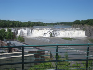
You will recall from our last blog page that when we arrived at Waterford, New York (the beginning of the Erie Canal) on Sunday, June 2nd, there was no space left anywhere on either the low floating dock or the high wall dock, so we tied alongside Tug Chancellor (with the help of friend Fred). On Monday morning a number of boats left the dock and walls; we saw a sailboat go past us heading east (either to proceed down the Hudson or up the Champlain Canal) and when I checked the dock I discovered a gap that was just the right length for Sanderling to slid into, so at 0715 we got underway to move up about 100 yards to the space formerly occupied by the departing sailboat. We fit in like a glove. We then walked about a mile along the old canal towpath (didn’t see any mules named “Sal”) where we shopped at a hardware store, meat market, Dollar General Sore, and an ice cream store all within the same small strip mall – what a find! We were able to get many items on our lists and found many items that we didn’t realize we needed until we saw them. On the way back we bought a 10-day pass for the Erie Canal that will be more than adequate to get us to Oswego. That afternoon Fred was gracious enough to take us on a tour of Waterford and the Cohoes areas. We saw the spectacular falls  Cohoes Falls on the Mohawk River at the power station, and the old Erie Canal weigh station, among other old Erie Canal sites. These are things we would have never seen without Fred and his wealth of knowledge about the Erie Canal and its historic sites.

Cohoes Falls on the Mohawk River near Waterford

Cohoes Falls on the Mohawk River near Waterford

We departed Waterford on Tuesday, June 4th at 0905 and entered the first of a five lock flight of locks along with four other boats. Although these initial locks are close together, they do not share a common gate as do the 8-flight set of locks in Ottawa, Ontario. The Erie’s series has a short stretch of canal between each lock, so there is a little respite after leaving one lock and entering the next. By 1100 we had risen 160 feet vertically and exited lock #6 (lock #1 is the Federal lock at Troy) and were clear of the flood gate (a huge metal guillotine-type door that can be lowered to block water in the entire canal). We transited a series of locks the rest of the day and stopped for the night on the west wall of lock #8 at Scotia, New York.

Day: 23.3SM/20.3NM-6H10M   Trip: 1420.9NM/1632.7SM – 229H50M

On Wednesday, June 5th, we continued westward trough the south end of the beautiful Adirondack Mountains and stopped at lock #16 on the west wall for the night at 1615.

Day: 46.9SM/40.8NM – 9H25M  Trip: 1461.7NM/1679.6SM – 239H15M

On June 6th we were underway at 0655 in order to get to lock #17 for the first lock-through at 0800. Lock #17 is highest lock on the Erie Canal system at 40 feet and is unusual in that the east gate raises to permit a 20 foot clearance when entering or exiting, whereas other locks’ gates swing open for entry/exit. We entered the lock with three other boats, three sailboats (with their masts down and braced on their decks) and Sanderling (with her mast laid down. Since the maximum clearance on the eastern part of the canal is 20 feet, every boat has to be less than 20 feet in height. The maximum height on the western part of the Erie and on the Seneca Canal is 15.5 feet! Since Sanderling’s clearance with the mast up is 22.5 feet, we lower the mast and lay it in a crutch on the aft deck to give us a total height of 15.3 feet to the top of the bimini. At the lower height we can clear every fixed structure on any of the canals in the US and Canada. We tied to the free dock at Sylvan Lake (on the east side of Lake Oneida) at 1715 after traveling most of the afternoon in a light rain with cool temperatures. We decided to eat in a restaurant about 100 yards away from Sanderling last night – it was a nice, warm place with good food – the perfect plact to warm up after a chilly day on the water.

Day: 58.4SM/50.8NM – 10H20M     Trip: 1512.5NM/1738.0SM – 249H35M

Tomorrow: Fuel and Oswego looking at Lake Ontario for Sunday.

Baltimore, Baltimore, Baltimore to Waterford!

Thru June 2, 2013

On May 31st we departed Great Kills at 0820, were through New York harbor by 1240 and anchored in Haverstraw Bay (about 35 miles up the Hudson River) at 1540 in the afternoon. Weather was perfect and we spent a quiet night at anchor.

The next day, June 1st – we’ve been underway for a month – we were underway at 0810 and had a fair tide most of the day. We anchored in a shallow area to the west side of the Hudson River just south of the river leading into Kingston, New York. Another quiet night at anchor.

This morning we departed the anchorage at Kingston and had a fair tide pushing us along at up to 8.2 knots most of the way until we got to Albany. When we reached Troy (about 5 miles north of Albany) the skies opened and it rained for about 30 minutes, then cleared off as we were entering the Federal Lock which is the first of many we’ll encounter on this part of our trip. When we exited the Federal Lock I called a friend who lives near Waterford and he met us at the dock to have us tie alongside the canal corporation’s historic tug which is more or less permanently located at the Waterford visitor’s center dock. There was no space at the dock itself due to the number of boats now waiting to go into either the Erie or Champlain Canals. We had an early dinner with Fred and he delivered a cruising guide which we had ordered early last week for delivery at Fred’s house.

Day: 55.1NM – 8H30M

Trip:

Larry Zeitlin’s GUIDE to Hudson River (2015)

May 30, 2013

The biggest problem of the day was trying to find a mooring in the small harbor (the yacht clubs and marinas are too expensive, and we like moorings because our two cats can have the run of the outside of the boat at night). None of the yacht clubs or marinas had moorings available, but with our last telephone call we were directed to an individual who GAVE us his private mooring to stay on for as long as we’d like! What a generous person. We ended up staying just one night, but his willingness to help out a fellow boater can only be repaid with a big “thank you!”

Day: 86.3NM  12H40M            Trip:

May 29, 2013

Departed Cape May 15 at 0550 this morning and while the ocean wasn’t a mill pond, it wasn’t a maelstrom either. Seas were 3-4 feet from the south from the time we departed the Cape May Inlet until we reached the Absecon Inlet (Atlantic City). The Simrad/Robertson autopilot handled the quartering seas fairly well, and we only had to hand steer a few times when we were overtaken by larger waves. We kept both cats shut inside initially, worried that if Ernie were outside he may loose his balance and go overboard, but after an hour or so Judy opened the aft companionway hatch so they could come and go as they wished. Ernie tends to stay topside with us when we’re underway; Khepera generally stays inside sleeping on his cat toy or the sofa.

We turned into the Atlantic City inlet channel at 1050, exactly five hours after we got underway, and had lines to an outside dock at Gardner’s Boat Basin Marina (the Atlantic City Aquarium) at 1110. Nice place to stay, inexpensive, and a few restaurants close by. Judy and I did some walking around the local area of town and found some ground espresso coffee at a local store, along with an Italian sub sandwich! Back to Sanderling for a nap while Judy worked, then showers and dinner at a local Ale House which we usually patronize when we’re here – great seafood!

The current forecast for tomorrow (Thursday) looks even better than the forecast for today, so we plan to depart at sunrise (about 0530) on our 14-hour day to Great Kills Harbor 82 nautical miles away.

Stay tuned!

May 28, 2013

Stayed in Baltimore until the morning of May 27th (Monday – Memorial Day) when we were underway at 0700. Had a nice time there, despite the delay, and we were able to have dinner all but one night with my daughter, saw friends Norm & Nancy for lunch and Charlie and Mujgan for dinner (with Jennifer). All in all, a good stop despite the delay.

Monday we ran 63.8NM to Reedy Island at the top of Delaware Bay with a favorable tide until we reached the Elk River (just west of the C&D Canal) then a foul tide the remainder of the way. Averaged 6.3knots for the day, arriving at Reedy Island anchorage at 1700.

This morning we departed the anchorage at 0635 and enjoyed a 2 knot push for three hours and a 1.8 knot drag for another four hours running down Delaware Bay. We arrived at Cape May and had the anchor set at 1355 after 48.6NM and 7H20M.

Next stop: Atlantic City, New Jersey. We’ll give it a try early, early, early tomorrow morning (Wednesday) before the wind picks up. All will depend on the forecast tonight and what we see in the ocean when we peak out tomorrow morning before committing to go north!

More later!

May 24, 2013

We’re still in Baltimore, after arriving on Tuesday the 21st expecting to stay for two nights. If there’s anything you quickly learn when boating it’s that you can’t control Mother Nature! After dinner the first night and Wednesday night with my daughter (who lives in Baltimore) and meeting long-term friends from Northern Virginia for grocery shopping and lunch on Wednesday, the weather forecast did not look favorable for our hoped-for departure on Thursday.

Not only do we have about 45 miles of Chesapeake Bay remaining, there is then about 22 miles of relatively protected waters of the Chesapeake and Delaware Canal connecting the two bays, and another 55 miles of big, open water of Delaware Bay before we get into relatively protected Cape May, New Jersey. So while we might have had a decent trip up the remaining Chesapeake Bay, Delaware Bay would have been dreadful on Friday, with winds gusting to 30 knots. The winds are forecast to continue through Sunday – so here we sit waiting for decent weather on Delaware Bay (and to some extent, now, on the upper Chesapeake).

Tomorrow (Saturday) we’ll decide whether to head out after noon on Sunday to Veasey Cove, about 40 miles north. Sunday afternoon the winds are forecast to gradually lay down so on Monday and Tuesday (at least) Delaware Bay should be decent. That will at least get us to Cape May, New Jersey. After that we have about a 45 mile stretch of the Atlantic Ocean along the New Jersey coast to Atlantic City – we’d be doing that on Tuesday if we depart Baltimore on Sunday afternoon – and the forecast now looks good on the ocean for Tuesday. After Atlantic City it’s the ocean again to Great Kills on Staten Island where we hope to meet up with a friend from that area for dinner.

We’ll have to see how Mother Nature smiles or frowns in the next couple of days to determine how far we get before we have more weather-induced lay days.
So this isn’t all bad – it’s just another delay in our non-schedule plan!

Alligator River to Chesapeake Bay-Balimore

Thursday, Mat 16, 2013

This part of the ICW from the Alligator River into Virginia presents several options, but all of it involves BIG water – the Alligator River itself is as much as five miles wide in spots, then the ICW crosses Albermarle Sound where one must decide whether to head easterly through the conventional ICW past Coinjock and Currituck Sound or head more northerly into the Pasquatank River past Elizabeth City into the Dismal Swamp Canal. While we have traveled the conventional ICW a few times and it is slightly (by a few miles) shorter, we much prefer the route through the Dismal Swamp even though it takes a bit longer. Either way, conditions on Albermarle Sound dictate when you can cross. The 12 mile wide sound has a bit of a current that runs easterly and if wind has any easterly component above 5-10 mph the conditions are horrible since the wind and current generated waves are moving perpendicular to the path your boat must take to reach the far side – known as a beam sea. This means that a boat rolls from side to side as the waves pass under the boat and creates what can become a very unsafe situation as the boat rolls from side to side tossing everything and everyone from side to side.

We lucked out and had very light winds as we crossed the sound into the Pasquatank River, past the blimp “factory,” the Coast Guard Station (recently infamous for it’s rescue of some of the crew of the Bounty) and Elizabeth City. We chose not to stop at Elizabeth City because we wanted to get into the Dismal Swamp Canal at the first (0830) locking northbound the next morning. We anchored near Goat Island about four miles upriver from Elizabeth City in a nice, quiet, rural setting (other than the water skiers who stopped about 1930 in the evening.

Day: 62.2SM – 8H40M
Trip: 910.8SM – 125H45M

On Friday, May 17th we were underway at 0620 in order to travel the remaining distance to

Keeping a sharp lookout

Keeping a sharp lookout

the South Mills lock for the 0830 opening. We arrived about 0805 and were soon joined by a Hinkley sailboat that had departed Elizabeth City at 0530 in order to make the opening.

We both locked through at 0830 and by 0855 were through South Mills Bridge and on our

way to the NC/VA boarder and what we hoped would be an open dock at the far northern end of the canal where we could tie

up and shop for groceries at Deep Creek before the 1330 opening. The dock was available when we got there and a quick shopping trip to the nearby Food Lion replenished a few of the items we

Watching for pirates!

Watching for pirates!

needed. We were back aboard Sanderling at about 1300 and had gone through the bridge by 1335 and were in the Deep Creek Lock a few minutes later. Robert, the lockmaster, is well known throughout the cruising

community for his engaging personality and his willingness to share his vast knowledge of the local area and boating in general. This trip was no exception. Since we were the only boat in the lock we had a most enjoyable conversation with Robert and

eventually departed the lock 1415 and were on our way to rejoin the conventional ICW and on to Norfolk.

In Norfolk we stopped for fuel at the Ocean Marine Yacht Center which typically has the

lowest price in the area for diesel fuel. I’m sure the $3.46 (with taxes and a Boat US discount) per gallon price will be the cheapest diesel fuel we’ll encounter on this year’s cruise. We also filled our water tanks and got rid of our accumulated trash.

We then proceeded through the industrial and military section of Norfolk/Portsmouth to

anchor in one of our usual anchorages in this area at Old Point Comfort (Fort Monroe) where we spent a fairly comfortable night with winds around 10 MPH from the east (blocked by Old Point Comfort). The forecast for the next few days was concerning because of continued winds from the east reaching 20 mph gusts. We’d have to wait until the morning to see how we would fare!

Day: 56.3SM – 11H50M
Trip: 967.3SM – 137H35M


More about Saturday’s progress later, but just to eliminate the suspense for now we got underway at 0850 and by 1050 we anchored in the Back River about 10 miles up the Chesapeake from where it turns north along the western shore. Waves were running 3-4 feet and we couldn’t seem to find any relief. It was easier to move into the Back River to a protected anchorage than to go back to Norfolk and take a chance on an anchorage there. We may be here for another day before venturing out again – we’re waiting for the wind to clock around to the west to get the Bay settled down.

More later!

We’ve made it to Solomons on May 20th – beautiful weather for the past two days. Baltimore tomorrow.

Saturday, May 18, 2013 – Old Point Comfort

We knew the conditions on Chesapeake Bay wouldn’t be ideal, but the NOAA forcasts (and all the other weather sites we consult) suggested that once we got north of the Norfolk area things would settle down a bit, and, we assumed, would result in a bumpy but doable passage to the Great Wicomoco River just south of the Potomac River entrance. Wrong! We departed the anchorage about 0850 and as soon as we exited into the main ship channel we encountered rolling and wind-blown seas. Sanderling was pitching and rocking as we rounded the intersection of the bay and the ship channel to head north and we couldn’t find any area where the waves had settled down. Here’s Judy’s assessment of the situation as she wrote in our ship’s log:

Roughest water we’ve experienced in this Sanderling. Topside table/chairs over, regridge door came open and all contents in saloon floor and down into aft cabin. No breakage, because all “mobile” items had been previously secured.

We were able to get to the western side of the bay and enter Back River, and as soon as we got into the Back River channel the seas settled down; when we rounded the little peninsula the water was flat calm! We proceeded further into the river and anchored immediately north of Langley Air Force Base. We planned to spend the remainder of the day and possibly the next day waiting for the easterly winds to subside or clock to the southwest.

Day: 15.9SM/13.8NM – 2H00M

Trip: 855.4 NM/983.0SM – 139H35M

The next day (Sunday, May 19th) we got underway at 0830 to take a look at the bay. Weather forecasts suggested things would be calm, but we were prepared to turn back if it looked at all rough. Turned out to be a mill pond – as smooth as it gets on Chesapeake Bay. We made good time against an ebb current with light wind from the SSE and anchored at Sandy Point in the Great Wicomoco River at 1715.

Day: 51l8NM/59.5SM – 8H25M

Trip: 907.NM/1042.5SM – 148H00M

Monday, May 20, 213 – Great Wicmoco River

Anchor was up and we were underway at 0630. A large portion of the day was spent crossing the wide mouth of the Potomac River, then past the Navy targets and around Cedar Point into the Patuxent River. We took a mooring at Zanhiser’s Yacht Center at 1540 – another beautiful day on the bay! We got showers at the marina, made a dinghy trip to West Marine to get a couple of needed boat items, and then had a wonderful dinner at the CD Cafe – one of our favorite restaurants in Solomons.

Day: 42.4NM/48.7SM – 6H05M

Trip: 949.6NM/1091.2SM – 154H05M

On Tuesday, May 21st we were underway at 0545 in order to make Baltimore in time to meet Jennifer for dinner. Again, the bay was uneventful with long stretches letting the autopilot steer up the bay, past Annapolis and under the Bay Bridge into the channel leading to Baltimore. As we approached Annapolis our AIS and radar showed four large ships anchored in the designated anchorages, presumably waiting for a favorable tidal current into Baltimore. We had to change our course slightly to avoid them, and then maneuver off to the far western side of the main channel just before the bridge in order to let a HUGE car carrier safely pass at 16 knots! Once we got into the Baltimore Channel we had to be continually on the lookout for the four waiting ships, and as we passed under the Francis Scott Key bridge one of them was getting close with two Moran tugs keeping it company. We turned off into the channel into the downtown Baltimore area before we saw where she was heading. We had lines to the dock at Henderson’s Wharf Marina at 1540 and met Jennifer for dinner about 1800 when she arrived. We hadn’t seen Jennifer for almost a year, and it was nice being able to catch up in person rather than by phone.

We’ll depart tomorrow (weather permitting) to resume our trip to Canada.

Day: 65.2NM/74.9SM – 9H55M

Trip: 10114.8NM/1166.1SM – 164H00M

Toogoodoo Creek to Alligator River, North Carolina

On Friday, May 10th we departed Toogoodoo Creek under sunny skies, warming temperature, and light winds from the southwest. Our route continued to meander through the South Carolina low country with lots of water and salt grass marshes, punctuated here and there with land of a slightly higher elevation hosting trees – real trees (not palms). It’s always amazing to again see what a difference a foot or two of elevation can make in the type of vegetation that will grow on a hummock.

By noon we were passing through Charleston Harbor and popping out the northeast side into more low country with long straight stretches of waterway dredged through the marshes when the ICW was created in the 1930s. Again, where the spoils from the dredging were dumped, trees sprout. We continued at a good pace (7.3 miles per hour is our speed when running the engine at 1600 rpms) and ended the day at South Santee River, about 15 miles south of Georgetown, South Carolina.

Day: 76.9 statute miles – 10H05M
Trip: 518.5 statute miles – 66H5555M

Saturday was an unusual day for cruising. As we lifted anchor at 0650 the current in the South Santee River was against us until we turned northward in the ICW channel. At that point the current was pushing us and increased our speed by almost almost one mph. The unusual part is that the fair current continued with us for the entire day – into Winyah Bay, past Georgetown, South Carolina, past the Pee Dee River (original rive in Stephen Foster’s “Way Down Upon the . . . “) and Bucksport, and into Myrtle Beach (tacky, tacky, tacky). We stopped for the day at Barefoot Landing Marina in Myrtle Beach – not a great marina with absolutely no amenities except electricity and water, but it is right on the ICW and a with a few decent restaurants in the area. As we were departing Sanderling for dinner out, a huge “dredge train” came by traveling at about 3 mph southbound; it was probably 1/2 mile long, with a large tug pulling the dredge and assorted barges loaded with dredge pipes, then a second tug lashed in the middle, followed by floating dredge pipes. It was quite a site and the docks on both sides of the river were lined with spectators. We ate a relatively late dinner at Joe’s Crab Shack that evening. We have seen such “trains” several other times on the ICW and it is always an amazing site. They are so long that they have 4-6 very small tugs pushing the “train” from the sides to keep everything centered in the river.

Day: 67.7 SM – 8H30M
Trip: 586.2 SM – 75H25M

On Sunday, May 12, we departed Barefoot Landing Marina and crossed into North Carolina at Little River Inlet, then continued to the Cape Fear River (where we did not see either Roberts) where the ocean breeze of 15 mph or so was opposed to the combined river and tidal current to make a slow (5.5 mph) and bumpy ride most of the way along the 12 mile stretch until we turned off of the main channel to head through Snows Cut and into a mooring field at Carolina Beach. We’d anchored at Carolina Beach several times in the past and the holding was always problematic; this time there was a new mooring field with 10 balls, and it was perfect – no worries about dragging anchor in the middle of the night.

Day: 59.4SM – 8H30M
Trip: 645.6SM – 83H55M

The stretch of ICW from Carolina Beach to Mile Hammock Bay is notorious for it’s low bridges with opening schedules that slow down all but the smallest boats. Two of the bridges have only a 12 foot clearance (we require 15.5 feet with our mast down; 23 feet with the mast up). It’s the equivalent of having stop lights at every intersection of a major highway that are not synchronized to keep traffic moving. Consequently, with a combination of tidal currents that sometimes were fair and sometimes foul, and having to go slower than usual in order to time the arrival at the next bridge in time for an opening (or wait for an opening if arriving too soon) Monday was a slow day. We did arrive at Mile Hammock Bay at Camp LeJeune, North Carolina (the bit Marine base) leading a parade of one trawler (Sanderling) and three sailboats where we were met by four battle-ready RIBS each with about six marines heading out for games in the training area – the lead boat playing an Eric Clapton song from loud speakers! Fun! We frequently see V-22 Ospreys exercising here, but so far tonight there has been no indication that V-22s are in the area. There are ten boats anchored in the bay; we’ve been here in the past when there were 16 boats and there was still room for a few more.

Day: 52.6SM – 8H25M
Trip: 698.2SM – 92H20M

Tuesday, May 14, 2013

Departing Mile Hammock Bay heading either way requires a little coordination for boats over 12 feet in height as there are bridges that only open at certain times (on the hour and half hour, or on the hour, or at 15 and 45 past the hour). Consequently, we departed Mile Hammock Bay in order to make the northbound bridge opening at 0830 and we arrived about 5 minutes early and were joined by several sailboats before the bridge opened. The bridge tender was very kind and held the bridge open for a slower sailboat that didn’t arrive until about 0840 – very few bridge tenders are so considerate, but on the other hand there wasn’t much traffic going from the mainland to the small Marine-owned barrier island.

The ICW from Mile Hammock Bay to Moorehead City/Beaufort, North Carola, is a 25 mile stretch of the ICW that takes a broad sweep to the east along the north side of Bogue Sound. You start in a northeasterly direction and end at Moorehead city heading east for quite a few miles. The weather was calm and sunny, so the trip was easy and we arrived at Moorehead City at 1335, then turned north to pass through a long cut to the Neuse River and Oriental, North Carolina. We anchored in Smith Creek on the western side of Oriental at 1710 and after cleaning up a bit and took the dinghy to the free town dinghy dock for dinner at a local restaurant. While eating dinner the wind picked up to about 15 MPH out of the southeast, and we enjoyed a bit of a wet ride for back to the boat until we turned the corner into Smith Creek.

Day: 65.4SM – 9H10M
Trip: 763.7SM – 106H05M

We departed Oriental at 0710 on May 15th in hopes of getting through the Neuse River before the predicted higher winds kicked in mid-morning. Even then by the time we rounded Maw Point and got to Hobucken the Neuse got a little rough with 15-20 MPH wind, but the remainder of the day was in relatively protected waters until we got to the Alligator River on the north end of the Alligator-Pungo River Canal (a l-o-n-g 25 mile stretch). By the end of the canal the wind had picked up to 15-20 with higher gusts from the SW. We anchored in the lee of a strip of land that jutted out into the river along with two sailboats and another trawler.

Day: 84.9SM – 11H00M
Trip: 846.6SM – 117H-5M


Track us on Marinetraffic.com

You can see our actual progress on a Google Earth display by going to Marinetraffic.com and searching (upper right corner of the page) on one of the following terms:

(1) Our boat name “Sanderling” (without the quotes) then look for one of the Sanderlings that is a pleasure vessel and has our MMSI number or call sign (both below); or
(2) Our MMSI number: 37656180, or
(3) Our call sign: WDG7031

You should see a picture of Sanderlng with some information about her.

Click on the latitude/longitude position in the left column and you’ll be taken to a map view of our location, then you can select satellite view if you wish.

Our position should show up if we’re underway and for 4-5 hours after we stop for the day.

Daytona FL to Toogoodoo Creek SC

Toogoodoo Creek
Written May 9, 2013

We’ve been moving right along since I last wrote when we were in the marina at Marineland.

The weather did calm down quite a bit and we departed Marineland Marine at about 1000 on Sunday heading north. We made good time and the inlet at St. Augustine was relatively calm. Because of the heavy rain for the past two days the water level everywhere was higher than normal, so even the “thin” spots were easily passable. We anchored for the night at Pine Island anchorage, a nice, quiet spot about 14 miles north of Daytona. Two sailboats joined us later in the afternoon.

We were underway from Pine Island at 0740 on Monday and again on our way north. We crossed the Florida/Georgia border just north of Fernandina Beach at 1400 and had the anchor down at Little Cumberland Island at 1735 later in the afternoon. It’s always interesting going past the Navy submarine base at Kings Bay as one never knows how aggressive the security boats will be. This time they simply came out to show their presence and watched as a sailboat and we turned northeasterly to continue up the ICW. Shortly after we encountered one of the glaring errors on the navigational charts produced by NOAA – the “magenta line” (which some cruisers follow without fail) pass on the wrong side of three strategically located red day-marks and can easily result in a boat going aground. It’s a trip for cruisers who pay closer attention to their electronic toys than to the real world! The sailboat following us by about 3/4 of a mile failed to pass on the correct side of the markers, but due to the stage of the tide and the extra water from the rain it didn’t go aground. Lucky!

This was our best day yet – 73.9 statute miles.

We anchored on Monday at Little Cumberland Island, where it is not uncommon to see wild ponies grazing on the beach. We didn’t see any that evening, but we did see one lone pony the next morning as we were getting underway.

On Tuesday we were underway at 0825 and ran until we anchored at Wahoo Creek at 1815 along with another trawler from Canada which had passed us a few hours earlier. The past few days have been great – warm temps and sun!

On Wednesday we were underway at 0740, crossed the Savannah River into South Carolina at 1540, and anchored in the Bull Island anchorage (Bull Creek) just before Calobogue Sound (Hilton Head) at 1715. There was another trawler already anchored in the creek, and two sailboats joined us later. We had a relatively early dinner and then cleared the saloon for dancing – practicing the West Coast Swing! We also had the pleasure of seeing a “dinner cruise” from Hilton Head pass up the creek and return just before sunset.

We departed Bull Creek at 0750 (the next to the last boat to depart) and cruised under sunny skies and fair winds until 1800 when we anchored in Toogoodoo Creek, south of Charleston, South Carolina, our fourth time in this anchorage!

Cruise to date: 441 SM – 567H50M
image

image

Judy and friend in Daytona
Written May 2, 2013

image

As we were coming under the Seabreeze bridge in Daytona on Thursday and about to turn into the anchorage, this pelican flew along our starboard side and landed on the rail. Judy was already at the bow preparing to drop the anchor, so I started taking pics as she approached the pelican. This was about as close as she got before it flew away.

We departed Daytona this morning (Saturday) expecting to tie alongside our friends Mike and Melissa’s boat at their home in Palm Coast and had lowered our mast in order to clear a 17 foot bridge on the canal leading to their house. When we turned off the ICW and checked the bridge clearance, there was only 14 feet showing on the tide board. We’ve had a lot of rain in the past few days. So, we went back to the ICW and continued north for another 7 miles and were fortunate enough to get a slip in the Marine land Marina. As we pulled into the assigned slip in a driving rain, we spotted cruising friends Randy and Cindy in the boat in the next slip. Consequently, Mike and Melissa drove to the marina and the six of us had a nice dinner together at a good restaurant a few miles away.

Weather is forecast to calm down a bit tomorrow (Sunday) so we may get out of here and on our way north.

Cruising to date: 119.1 SM – 13H05M