An account of the voyage of Sanderling from Wianno, Massachusetts, to Patuxent River, Maryland
Written in Atlantic Highlands, New Jersey (Sandy Hook).
On Tuesday, November 4, 1997, Andrew and I met at BWI airport. Andrew had flown in from Salt Lake City the night before, and arrived at BWI about 0800. A friend dropped me at the airport about 0830, and Andrew was sitting right by the door as I entered the terminal.
We arrived without difficulty in Providence, were met by Vic and Helga Piccoli, and drove straight to Osterville (Wianno) on Cape Cod and Sanderling. Shortly after we got our supplies from the car onboard, Bob Gill (the former owner) showed up and we went over a few details of the boat, then drove Andrew and me over to his home which wasn’t far away to pick up the two cartons I’d shipped up by UPS, and he drove us with the cartons back to the boat. Helga, Vic, Andrew and I transferred the contents of the boxes to the boat, then went to a restaurant for lunch. Afterwards, Vic drove Andrew back to the boat so he could get a nap (hadn’t slept all night on the flight from Salt Lake City) and got the two propane tanks to be filled, while Helga and I started shopping for groceries. Vic then joined up with Helga and me, we finished shopping, and had to drive a short distance to get the propane tanks filled (they only needed a little gas, but we wanted to make sure they were full).
When we returned to the boat, Bob Gill was there and we continued to review the boat systems. He had some repair work done by the boat yard, including getting the diesel heater working (he had never used it in three years). I was grateful for that, since we were sure we were going to need some heat if we got laid up because of weather. Helga left to return to Bristol, and Vic, Andrew and I were on our own to get the boat ship-shape for the trip south. We stayed aboard until about 8:00PM, then walked half a mile to a restaurant for dinner. By the time we returned about 9:30, the delivery captain, Tom Montgomery from Winthrop, Massachusetts, had arrived, and Bob Gill had stopped by and chatted with Tom about the boat. We turned on the diesel heater to take the chill off the air and chatted about the trip and what we would be doing. Tom Montgomery is a delightful person, with a LOT of experience with all types of boats and the Intra Coastal Waterway (ICW), and a Coast Guard Master’s license; he was in the Merchant Marines for almost 30 years, and skippered cargo vessels for about 15 years, all over the world. He has some great tales to tell.
We left Wianno as soon as we had enough light to make out the buoys readily – was about 0630. The draw bridge which would have led us directly to the sound doesn’t operate after October 31st, so we had to take the longer way around to the sound, which included travelling over some very “thin” water. Fortunately, we were able to leave about 2 hours before slack tide, so there was just enough water to clear a couple of shallow areas. When you know that the boat draws 4’4″ and the depth recorder reads 4 feet, you don’t have a lot of water under the keel, but in our case the transponder for the depth recorder is about 1 foot below the waterline, so we actually had about a foot to spare! Needless to say, Tom Montgomery proceeded very slowly over those areas and we never once touched bottom, as far as we know!
We headed in a westerly direction, and entered Buzzard’s Bay by turning into the Woods Hole area, then going out through a very narrow channel with an extremely fast current running against us for about 1/4 mile. That was actually fairly exciting for me, but Tom had done it on a number of occasions and knew exactly what to do. That was also our first encounter with a VERY LARGE BOAT, the passenger ferry which runs between Woods Hole and Martha’s Vineyard. We let the ferry pass in front of us before entering the passage into Woods Hole. This turned out to be the first of many encounters with other boats of our trip up to this point, none of which caused any problem. It’s amazing how accustomed one becomes to being dwarfed by really huge ships.
After entering Buzzard’s Bay we set up a two-man team watch system, each watch lasting two hours. That system continued for the next 24 hours, and worked well, allowing everyone a chance to eat and get some sleep throughout the day. The period between 2400 and 0600 were the worst, however, when the body couldn’t understand why it was being required to be alert instead of having a good sleep! Andrew and Tom were one team; Vic and I the other.
From Buzzard’s Bay we continued basically east past the entrance to Narragansett Bay (could see the Newport bridge from quite a distance even over Acquidneck Island), and then entered Long Island Sound at The Race, just off Point Lookout. We stayed to the right of Fisher’s Island and entered Fisher’s Sound before actually entering Long Island Sound because the current running against us wasn’t quite as strong there. By the time we left Fisher’s Sound, it was dark and we were getting ready for a long night on Long Island Sound. Tom set up all the courses well in advance, let us know what buoys to look for and their characteristics, and was generally available for questions, even if he was off watch. Fortunately, Vic and I never had to awaken him.
We essentially navigated Long Island Sound from buoy to buoy. Some of the distances between buoys were as much as 20 miles, and the unfavorable current tended to set us to the Long Island side of the sound, but generally by steering slightly higher (on the compass) than the intended track, we were always able to pick up the next buoy. Vic and I agreed that in many ways navigating at night was easier than in the daytime, since the light characteristics of the buoys were easier to identify in the darkness and at quite a distance (about 4.7 nautical miles at our height sitting down on the outside steering station – standing up gave us about 5 miles visibility to the horizon). There are many cities on both shore of Long Island Sound, so it was frequently difficult to distinguish the lights on the Sound (boats and navigational aids) from those on shore. No matter how confusing it seemed initially, eventually everything would fall into place. The flashing, colored lights of the buoys were always consistent and would become readily apparent as we got closer to each.
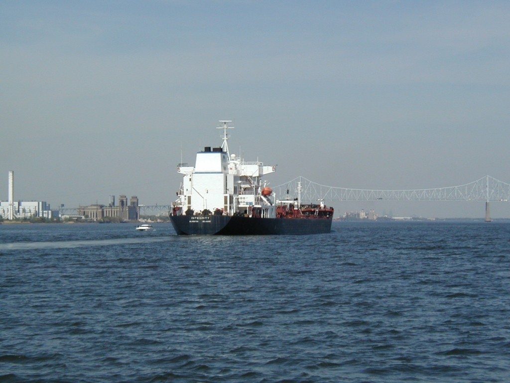
There was quite a bit of traffic on the Sound. We saw several ferries, which run generally from Long Island to Connecticut, 4-5 tows, and a number of other boats including fishing boats and at least one very large sailboat which was in sight for a long time because it had it’s high spreader lights on and was on a reciprocal course to ours. The night sky was very clear, and both watches also observed a lot of “falling stars” throughout the night. The temperature was relatively mild, although the damp air made it seem a little chilly – we all bundled up well. The tide was running against us on the first part of the transit and our speed over the ground slowed to about 5.2 knots despite our speed through the water was a little over 8 knots. About half way through the Sound, the tide changed, and our speed over the ground was as high as 12 knots on occasion. All the average speeds were displayed by the Loran at the touch of a button – what an improvement (at least easier) over having to calculate it directly from a chart and the DR plot.
Andrew made dinner for us, with the chili that Helga sent along, and some home-made biscuits that he made in the oven. The sea was calm enough that we could actually eat sitting down. Tom and Andrew ate toward the end of their “rest” period, and Vic and I as soon as we got off watch at 8:00 PM.
About 0430 Thursday morning, Tom and Andrew’s team brought us into the area of City Island, New York, which is just before the entrance to the East River which flows through New York City. By the time we found a mooring buoy and tied up, it was around 0500. Vic immediately began working on a problem with the fresh water pump. It had stopped working suddenly the night before we left Wianno, and Vic had concluded that it was a faulty in-line pressure switch; I had called Bob Gill to see if he had any thoughts about something we might have overlooked, but he had no suggestions other than to tell us where the switch and pump were located. With Vic’s expertise, he by-passed the pressure switch in the water line; that permitted us to get pressurized water at the sinks by turning on the water pump switch at the electrical panel, opening the faucet to get the water, then turning off both the faucet and switch. Throughout the preceding day, we’d been using water from a 2.5 gallon jug we had onboard for just such emergencies, but we hadn’t been able to get at the 150 gallons of water we had in the fresh water tanks. We had planned to disconnect the fresh water line beyond the tanks and fill the plastic jug directly from the line, if we had to. Vic’s electrical work saved us from having to use that solution to obtain fresh water.
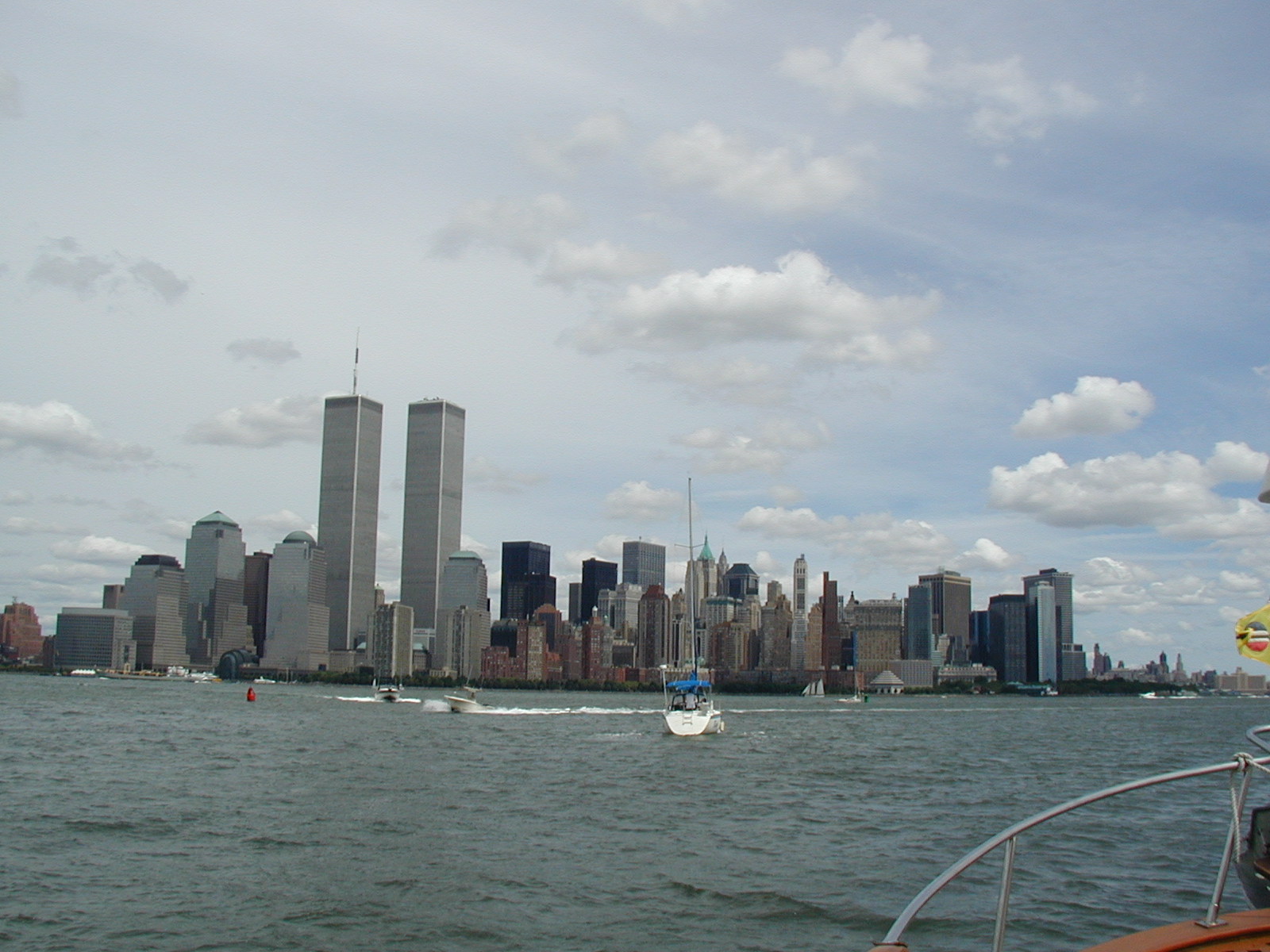
We left the mooring as soon as it was light, about 0615, Thursday, November 6, and by about 0645 were passing under the Throgs Neck Bridge and into the East River. Due to the lateness of the season, there was very little pleasure boat traffic, and not even much commercial traffic. We made the initial part of the transit at slack tide, and arrived at Hells’Gate (a notoriously bad area for tidal currents) just after slack. We did pass a couple of tugs and tows headed up river, and a lot of commuter traffic once we reached the lower portion of the river around Brooklyn. There were a number of hydrofoil ferry boats speeding around, and the large ferries that operate in the area. After sailing past the United Nations building, and just before the Brooklyn Bridge, we were able to see the Statue of Liberty ahead of us in New York Harbor, past the Battery and the South Street Seaport Museum.
When we exited the East River, we turned south and proceeded through the Verrazano Narrows heading toward Sandy Hook. The marine weather forecasts had indicated that a low pressure area was building, and that by mid-day the north-easterly would be generating winds up to 35 knots and 8 to 10 foot seas along the Atlantic Coast, so we knew we wouldn’t be able to continue south until the storm passed. Tom was familiar with a municipal marina at Atlantic Highlands, and knew that they had some mooring we might be able to pick up, or if we were lucky, would be able to find a slip. We travelled through some fairly rough seas getting in, but we found the entrance to the break water and were in the marina by about 1200. We then found the fuel pier where we topped off the diesel fuel and also arranged for a slip on the leeward side of a pier where we wouldn’t be pushed against the pilings by the north-easterly winds. We made the Sanderling fast to the pier with double bow and stern lines, and two mid-ship spring lines, just to provide some insurance against the high winds we were anticipating. We also had to leave enough slack in the lines to anticipate the 5-6 foot tidal range, and the increased high tide which was being forecast because of the storm. As it turned out, Sanderling has handled the winds and tide well.
Tom’s entry in the Deck Log for passage from Osterville to Atlantic Highlands reads:
Total time: 1D-04H-25M (minus 1H-05M detention at City Island)
Running time: 1D-03H-20M
Total Distance 208.4 miles
Burned 4.47 gallons per hour running at 2000 RPM
Average speed: 7.6 knots @ 2000 RPM
Made 1.7 miles per gallon fuel consumed
The “main street” of the town is just a few short blocks from the boat. There is a lot of activity at the marina, but not much going on in town. Most of the boats have already been hauled for the winter, although the marina is still working to get boats out of the water.
Last night (Thursday) we ate at an Italian restaurant in town just a few blocks from the marina, and then went to the local small movie theater to see “Kiss the Girls” – a poor imitation of “Silence of the Lambs,” in my opinion. With a good night’s sleep, we’re all feeling much rested today. Winds are still fairly high, and the tide higher than normal – the walkway on the marina docks were almost submerged. After breakfast, Andrew and I went into town to the library while Vic and Tom remained behind. Andrew is taking a pre-GRE exam, and we’re using the quiet of the very small town library to give him the timed practice exams. I tried without success at virtually every store in town to find a spare phone line which I could use to access my internet account, but nobody was willing to let me use their lines. No phone booth in town has a telephone jack available. I asked a local telephone repairman if he knew of any place I could use, and he said “I’m just the man on the street – I don’t know about that stuff.” Consequently, I may not be able to send this along until I get home!! If we come back to the library tomorrow, I may try to talk the librarian into letting me use her ONE telephone line for a few minutes. Guess I’m going to have to buy an acoustic coupler!
This morning’s marine forecast indicates that the slow-moving low pressure area will still be with us tomorrow (Saturday), so we will be delayed at least another day. It’s disappointing to have to wait like this, but we can’t do anything about the weather and certainly don’t want to jeopardize our safety with the current sea state. We have about a 60 mile run before we can get into the inside ICW, south of Atlantic City, New Jersey. Once we get inside, we won’t be so vulnerable to the Atlantic storms, and can continue to Cape May, then through the canal to the Delaware. We have to have fairly good weather for the Delaware Bay, but wouldn’t have to worry as much about a “nor’easter” as we do on the open Atlantic
So here we are at the small town of Atlantic Highlands, New Jersey, waiting out a storm. Andrew is taking an exam, I’m writing this, and Vic and Tom just walked in and have found the paper back section of the library and a few books. We’re having a good time together, and conversation is lively, mostly about boats and boating (I wonder why). We ate breakfast together this morning, and tried out the stove-top toaster for the first time. It worked fairly well, but we learned that when the heat of the burner is high, it doesn’t take long at all to turn out a well-done piece of toast (burned)! Vic and Tom are in the V-berth forward. When we were on watch underway, Andrew and I both used the master cabin aft, but in port he’s sleeping on the settee made up into a double berth in the main cabin.
Unless something really dramatic occurs, we’ll certainly be here until Sunday, but that depends entirely on the weather. With any luck, we will be able to depart Sandy Hook on Sunday.
===============================================================
Part II. Written in Annandale, Virginia
Weather was the critical factor in this trip from the very beginning. We had passed up several weeks in October when we would have been guaranteed good weather all the way down the coast, and now we were paying the price of starting too late in the season. After mid-October, storms develop more frequently along the Atlantic coast, creating winds which in turn create waves in the ocean which small boats are not able to deal safely with. When the wind is from the northeast, as was the case with the storm we were waiting out, the Atlantic ocean along the coast of New Jersey, Delaware and south is filled with big waves caused by the long distance the wind has to blow over open water thereby creating wind-blown waves. Add to the waves the fact that the shore is to the lee (the direction toward which the wind is blowing) and you can get into big trouble quickly.
Marine weather forecasts from the beginning of the trip indicated that a storm would be forming over the southern Atlantic coast and move northward, creating northeasterly winds. We were fortunate in getting to Sandy Hook and Atlantic Highlands, New Jersey, before we had to lay over. The forecast Thursday afternoon indicated that the storm was moving slowly up the coast, and may not pass until Saturday or Sunday, but that once the storm passed the winds would shift to the northwest. When that occurred, Tom felt we could get underway again for the open Atlantic part of our journey to Cape May, New Jersey. We would be in the lee of the shore and would be fairly well protected because the wind would not have a long fetch of water over which to build waves and the wind would “dampen” the waves which had been created by the preceding northeasterly.
Unfortunately, the nature of the low pressure area and its slow trip northward kept us in Atlantic Highlands through the weekend. The weather was nasty – windy and rainy most of the time. Andrew worked several afternoons in the small town library. Vic and Tom found the library’s books helped pass the time, and that there was a paperback table where one could simply take the books without having to check them out. Sanderling acquired a few adventure novels through that process. I spent time in the library as well as did some shopping for supplies for the boat. We all slept from time to time and read on the boat. It seemed to be a real luxury to be able to sleep in the morning. We saw two movies at the local theater, and ate a few meals ashore in the restaurants. At one movie which started at 9:30 PM, we were four of the six people in the theater! We all took showers at the marina.
We were surprised on Friday night after dinner by a knock on the door. When Tom answered, a man said he was looking for me. Turned out to be a couple who were friends of one of the recipients of my first email (the one sent from the library about the first part of the journey). The person who received the email lives in Quebec, Canada, had friends in Atlantic Highlands, called them and told them where we were, and the couple came to the marina and found us! What a coincidence. They invited us to their home up on the hill overlooking the bay, and we had a nice chat as well as a chance to warm up in a real house!
We were tied up port side to a pier near the end of one of the docks at the marina. Out bow was pointing toward the southeast, and there was a large sailboat (probably about 50 feet) tied up to the other side of the pier. Both the sailboat and the pier helped protect us a little from the winds coming from the northeast, as well as the waves which were coming across the marina from the breakwater which was about 1/4 mile away. The tidal range was 4-5 feet, so we sometimes had quite a step from Sanderling’s rail up to the dock. With the northeast winds came tides which were higher than normal, and one high tide nearly came up to the top of the dock. Being on the lee side of the dock meant that Sanderling was being blown away from the dock rather than into it, but we had our fenders and fenderboards out nonetheless.
By Sunday afternoon (November 15th) the marine forecast indicated that the storm would be passing to the north of Sandy Hook soon, and we anticipated getting underway at first light on Monday morning to continue our trip south. Andrew’s barometer watch indicated rising pressure, and we felt fairly certain that the low front was passing. We had filled our diesel tanks on Thursday when we entered Atlantic Highlands, so all we had to do was to ensure that gear was stowed away and check the engine oil and transmission fluid levels.
We were up at 5:30 Monday morning, ate a quick breakfast, and were underway by 6:15 heading out of the protected waters of the marina and into the bay to the west of Sandy Hook. We came abeam of Sandy Hook about 7:00 and were out into the Atlantic. Tom’s prediction was right on the money – the ocean was relatively smooth, even though there was a bit of a wind from the northwest and a moderate following sea. The sky was fairly clear and sunny. As we proceeded down the coast the following sea smoothed out and the ride was quite pleasant. We literally steered from buoy to buoy almost parallel with the coast, from one to two miles off the coast. We set the watch at 8:00 with the same watch teams as we had earlier in the voyage.
Since we were so close to the shore, we seldom saw any large ships of any kind, except on the horizon far to the east of us. There were a few pleasure and fishing boats running along the coast, and another trawler (Whispering Gull) behind us. That trawler had pulled into Atlantic Highlands on Sunday and tied up near us. The owner and one crewman were taking it to the Bahamas for the winter. They left Sandy Hook half an hour or so after we did, and we could see her for an hour or so before she disappeared from view behind us. We could hear her on the VHF radio from time to time for the remainder of the day. We also saw “head” boats with their fishing passengers from time to time.
We passed many small towns along the Atlantic coast of New Jersey, and the entire coast seemed to be lined with houses and other buildings. Vic and I had the watch when we passed Ocean City, New Jersey, and it’s obvious huge Ferris wheel (it must be at least as big as the one at the Prater in Vienna). Atlantic City was also very obvious, with its ostentatious buildings right on the ocean!
Andrew and Tom relieved Vic and me about 6:00 in the evening, and it was dark. Tom estimated we’d get into Cape May shortly after 8:00, and he was right, again. I awoke when I heard the engine RPM decrease. I looked out the windows of the aft cabin and saw several fishing boats (fishing trawlers) fairly close to us with all their lights on; some with nets out, others apparently heading back to port. We were obviously close to Cape May! Then I noticed one boat which seemed to be following us rather closely off our starboard quarter. It had it’s booms extended to the sides, and it looked rather ominous. Suddenly Sanderling started turning to port, and we did a complete 360 degree circle while the trawler took the lead. We then followed it into the breakwater for Cape May. Tom later told us he didn’t want the trawler overtaking us in the channel into Cape May, so elected to get behind it instead. At about the point where we had to bear off to the port to head toward the coast guard station and an anchorage Tom had in mind, another trawler passed us proceeding out to the ocean. It, too, had the booms extended, and we had to maneuver to avoid passing too closely to the booms. The crews of those boats must put the booms out as soon as they leave the dock – in doing so they create a real hazard for other boats.
Once inside the breakwater at Cape May, New Jersey, the channel zigs and zags a few times, and the day markers (triangular shapes on poles driven into the bottom) are not lighted for the most part. We broke out the search light in order to identify the markers, and made our way down the channel until we reached the coast guard pier. Then we went a short distance past the pier and into shallower water, lowered the anchor, turned off the engines and the running lights, and turned on the anchor light (at the top of the radar mast) to identify Sanderling as a boat which was anchored. The time was about 8:30 PM.
After making everything secure about the deck and upper steering station, we settled down to eat the beef stew which Helga had sent along with Vic (it was still frozen when we left Sandy Hook in the morning and put it in a pan on the stove to thaw during the day) and some biscuits baked in Sanderling’s oven. It wasn’t long before we were in bed reading and going to sleep.
On Tuesday, November 11th (Veteran’s Day), we were again up before dawn, brewing coffee and heating water for hot chocolate and oatmeal. Tom always found the first cup of coffee as soon as it was ready, and then went about reviewing the sailing plans for the day. Vic and I checked the oil and transmission levels, and Andrew turned his bed of the night into the settee for the day. Once the engine oil was topped off, Tom started the twin diesel engines to get them warmed up and ready for the work of the day.
We were underway at 6:25. This time we had to raise the anchor in the process, and discovered that the windlass had decided to quit working. So Andrew heaved on the anchor line while Tom nudged Sanderling ahead slowly. When the anchor line was straight up and down, Andrew secured it to the stanchion while Tom drove slowly ahead to loosen the anchor from the muddy bottom. Then Andrew hauled in the rest of the line and chain, and “washed” the anchor in the water to clean off the mud as the boat moved slowly back to the channel and headed toward the Cape May Canal and Delaware Bay.
Sanderling was one of a number of boats going through the canal that morning. There was quite a procession of power and sail boats ( mostly pleasure boats) heading to various places in the Delaware Bay. Our goal was the entrance to the Chesapeake and Delaware Canal (C&D Canal) just south of Wilmington, Delaware, about 50 nautical miles away (7 nautical miles equals 8 statute miles). We were proceeding up the Delaware Bay, and through the C&D Canal to within about 1 mile of the Chesapeake Bay to a small town of Chesapeake City. This was a milestone, of sorts, for several reasons: (1) we had to change to a different chart book; (2) we were going to be heading north for the first time in the voyage!
We cleared the Cape May Canal at 0700. The weather was scattered clouds with strong north wind and a rough northwesterly sea. We were pitching heavily at times while heading on a course of 321 degrees (magnetic).
The entrance of Delaware Bay is known for its stormy weather, tricky currents, and shoals. It’s also wide enough that it is difficult to see either side from the middle of the bay. When we left the canal and set on our course to the first buoy, we had to travel about 21 nm before we would get to the mark where we would change course to head more northerly in the main shipping channel. It was quite windy, with 2-3 foot waves bouncing Sanderling around. Vic and I took the watch at 8:00, and by 0920 we had passed Miah Maull Light House and were in the shipping channel heading up the bay. We only saw a few large freighters after entering the main channel, and a few pleasure boats, some fishing on the shoals, others heading up the bay with us. Sanderling is not a race horse, and that is what appealed to me about her. She keeps plugging along at a nice pace, hour after hour, and lets those of us onboard enjoy relative peace and quiet compared to her faster sisters.
On the way up the Delaware, we saw a moth-balled navy cruiser being towed down the bay, probably from the “moth-ball fleet” at the former Philadelphia Naval Shipyard on the Delaware River. One large tug was pulling, and another was made fast astern, to act as a rudder, I suppose! The hull number had been painted out, and no flag was flying.
Other than a few boats, and passing the nuclear power plant, the trip up the Delaware was uneventful. The sea was fairly calm once we got up a ways, and the sky clear, with light wind.
Andrew and Tom were on watch when we entered the C&D Canal. Tom pointed out the superstructure of a freighter which had sunk on the starboard side of the shipping channel just south of the entrance in the 60’s. From the area of the entrance to the canal, we could see the first several highway bridges over the canal, as well as the big bridges at Wilmington over the Delaware River which one takes in a car from I-95 to join the New Jersey Turnpike when heading north along the Atlantic seaboard.
The C&D Canal was longer than I had anticipated, about 10 nm in all. We passed under numerous bridges and power cables. Tom and Andrew heard a sailboat skipper on the VHF saying he was aground at the entrance to a marina on the north side of the canal near the Delaware entrance, with the marina operator telling him he must be out of the channel. About 3/4ths way through the canal we passed that sailboat and another motoring together through the canal to Chesapeake Bay. The boat which had been aground was a fairly large ketch, and after we passed them and told them where we were heading, told the smaller sailboat with them that they were going to follow us into the anchorage at Chesapeake City. Tom gave them very specific instructions about how to enter the anchorage on the south side of the canal, just opposite Shaeffer’s Dock and Restaurant – he told them specifically to stay wide to starboard, as the port side of the entrance had shoaled. They wanted to follow us, because our draft was about the same as theirs (4.5 feet) and we could “dig out” any muddy bottom.
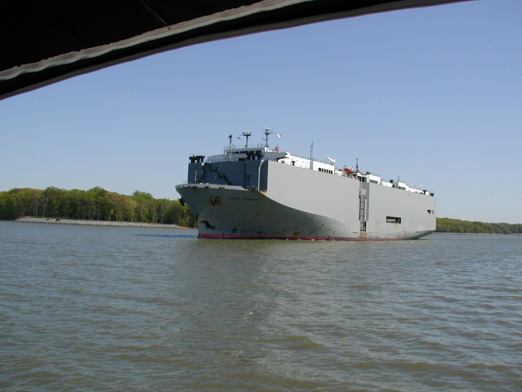
The trip through the canal was uneventful, with one exception. Just as we were approaching one of the curves to starboard in the canal, we noticed this thing ahead which seemed to be blocking the entire canal. The “thing” turned out to be a huge commercial freighter heading the toward Delaware Bay. I’d never seen anything like it – it seemed almost rectangular in every direction, with straight sides down to the waterline. I’ll have to wait until I get my pictures back to identify the line, but I remember that it was German. We passed port to port (normal passing situation) without difficulty, but I can’t imagine being the captain of a boat that size going through such a restricted area.
About 4:30PM (still in daylight for a change) we came to the anchorage at Chesapeake City on the south side of the canal. We entered without difficulty, and tied up starboard side to the wall on the west end of the anchorage provided by the city free of charge. We moved forward to allow enough space along the wall for the sailboat we knew would be arriving shortly. About 10 minutes later, we saw the masts over the north wall, and knew our “partner” would be arriving shortly. We watched, as the man at the helm cut directly into the port side of the entrance (just what Tom had told them not to do), and then make way toward the space behind Sanderling (fortunately for them, they didn’t go aground). When it was obvious they weren’t going to get into the space behind us, they circled, to try again. On the way around, I heard someone telling the person at the helm how to approach the wall behind us. When they headed toward the large sailboat behind the space we had saved for them, Tom and I knew they were in trouble. We looked at each other and we both opined that perhaps we shouldn’t have left room for them! The other boat already on the wall had some protruding davits astern, and sure enough, the “partner” almost hit the davits while avoiding the hull of the other boat. Luckily for them we were there to help them get into the space we had saved for them after someone onboard tossed lines to us. The smaller sailboat which at one point was accompanying our “partner” came in about 15 minutes later and had to anchor out in the anchorage for the night.
I later learned that the boat had had a number of difficulties. There were only two people aboard, the owner and one crewman. After going aground trying to get to the earlier marina on the north side of the canal, the crewman aboard had called for a towboat using his cell phone. When he was put on hold by the towing company, the batteries of his cell phone went dead. They eventually got themselves off their grounding point. Prior to that, wherever they were staying the night before (along the New Jersey coast, I think), the boat’s batteries were dead and they couldn’t start the engine in the morning. The owner had to call his son to come to the boat with a car battery to get the engine going using jumper cables to the engine. Seems that everything that could go wrong, had gone wrong! They were using candles that night at Chesapeake City in order to conserve their battery’s power.
The next morning (Wednesday) as we were about to get underway, they asked if we had jumper cables, which we didn’t. Although the owner’s son had left a car battery aboard as a backup, he hadn’t left the jumper cables so there was no way to get the boat’s engine going. I know they eventually got going, because two days after we arrived at Patuxent River, I heard them on the VHF talking with another boat after leaving Solomon’s Island, heading south! I hope they make it to wherever they’re going.
My friend from Baltimore (the same one who had taken me to the airport the previous Tuesday) met us at Chesapeake City with a delicious meal she had made the night before. Andrew’s friends from Bowie, Maryland, came to the boat later in the evening, and they left to take him to BWI Wednesday morning so he could catch a flight back to Salt Lake City in time to go to his class at the University Wednesday afternoon. Andrew was disappointed that he couldn’t complete the trip with the rest of us. After our meal, and everyone’s departure, the three remaining crew members turned in to get a good night’s sleep.
—————————————————————–
Part III Written in Annandale, Virginia
The Deck Log shows the following information for the passage from Atlantic Highlands to Cape May:
Total time: 14H-12M dock to anchor
Steaming time: 13H-32M breakwater to breakwater
Distance: 114 miles dock to anchor
Steam/Distance: 111 miles breakwater to breakwater
Average speed: 8.22 knots at 2000 RPM
The Deck Log shows the following information for the passage from Cape May to Chesapeake City:
Total time anchor to dock: 10H-15M
Total distance: 63.2 miles
Average speed 6.2 knots (against tides)
(I have yet to compute the same info for the passage to Patuxent River.)
We got underway as soon as it was light in order to go across the canal to fill our fuel tanks. The day before was Veteran’s Day and Shaeffer’s Dock was closed, but we were told that they would be open for fuel at 6:00AM. We were at the dock at 6:30 and ready to take on fuel. Tom went looking for someone to operate the pump, and finally found a man whom we believe to be the owner of Shaeffer’s. He was unable to get the pump to work, blaming the problem on the computer. Eventually, he told us that he had called the pump man and that he was on his way. About 8:00 the pump man arrived; he had no better luck getting the pump to work. Finally, at 8:30 we got underway for another marina. Our fuel supply was getting critically low, and we knew we wouldn’t make it too far. Tom knew of a marina on the Chesapeake about 10 miles away, and that’s where we headed, hoping we wouldn’t run out of fuel on the way!
We had lost two hours waiting for fuel at Shaeffer’s Dock. We knew then that we wouldn’t complete the trip south until well after dark.
As I checked several books I had brought along dealing with cruising the ICW, I noticed that there were several other marinas closer which might have fuel. I called Shaeffer’s on the cell phone, and they confirmed that a marina just beyond the canal in the Chesapeake would have fuel. We made our way into that marina through some extremely shallow water marked by buoys. We tried to raise someone on the VHF radio, and when that failed we blew our horn and yelled toward the fuel pier. Suddenly, a person stood up right on the dock – he had been there all along. He told us they didn’t have any diesel fuel, but the next marina just over the hill (around the bend in the Chesapeake) did.
We motored back out to the Chesapeake, turned south for a few miles, and went into the Bohemia River where the marina was located. That marina answered up right away on the VHF to our request for information about fuel, and confirmed that they had fuel and would send someone down to help us as soon as we were at the fuel dock. The person on the radio also gave us directions on how to find the entrance to the marina and then to the fuel dock. He was extremely helpful and a much welcome relief. We were all fast at the Bohemia Bay Yacht Harbor fuel dock at 9:54, topped off with 142 gallons of diesel fuel (tanks only hold about 150 gallons, we think), filled the water tanks, washed the salt spray off the windows, and were underway at 10:15 and back in the Chesapeake at 10:33 heading south.
The wind was still from the northwest. The far upper Chesapeake is fairly narrow, and consequently somewhat sheltered from northerly winds. However, as one proceeds south, but Bay opens up and becomes quite wide, allowing the winds to build fairly high waves and rough seas from all directions. We had to fight a beam sea from the very beginning, causing the boat to yaw from side to side and to roll, a motion that is not very comfortable. As we headed south, the yaw and roll became more extreme and more uncomfortable.
With Andrew’s departure, we were down to a crew of three. Because of the rough conditions, we decided to conn the boat from the inside steering station, and that one person would take care of everything while the other two rested. Because it was our last day on the boat, all of us were up and helping navigate. Eventually the seas became so rough and the motion of the boat so uncomfortable, that it was almost impossible to get any rest laying down.
At one point in the upper bay we came upon an Army Corps of Engineer’s boat keeping station to the north of a very large dredge. We tried to raise it on the VHF to ask about a safe course around the dredge, but when they finally answered they just referred us to the dredge operator, who simply told us that we should avoid his rig! As we approached closer, we were aware of a long line of floats that seem to extend most of the way across the bay, certainly across the main channel blocking it off entirely. The floats ran from the dredge to the west. We changed course several times trying to find a way around the floats, through safe water. We finally went around to the west. We wondered what large boats were doing about the impediment. The floats were supporting the discharge tube, which ran into shallow water where the material the dredge was picking up from the bottom was dumped.
From the area of Poole Island south, the bay becomes quite wide, and that is when we began to encountered the roughest seas.
At 1:37PM, Tom recorded this weather information in the Deck Log: Northwesterly F-6 wind – Rough sea – Pitching and rolling heavily at times. Compass course 210 magnetic.
The person steering the boat had to more or less wedge himself into the wooden seat in order to keep from being thrown about. Anyone standing had to hang onto the overhead hand rails. We ate sandwiches, but soup wouldn’t have stayed in the bowls very long!
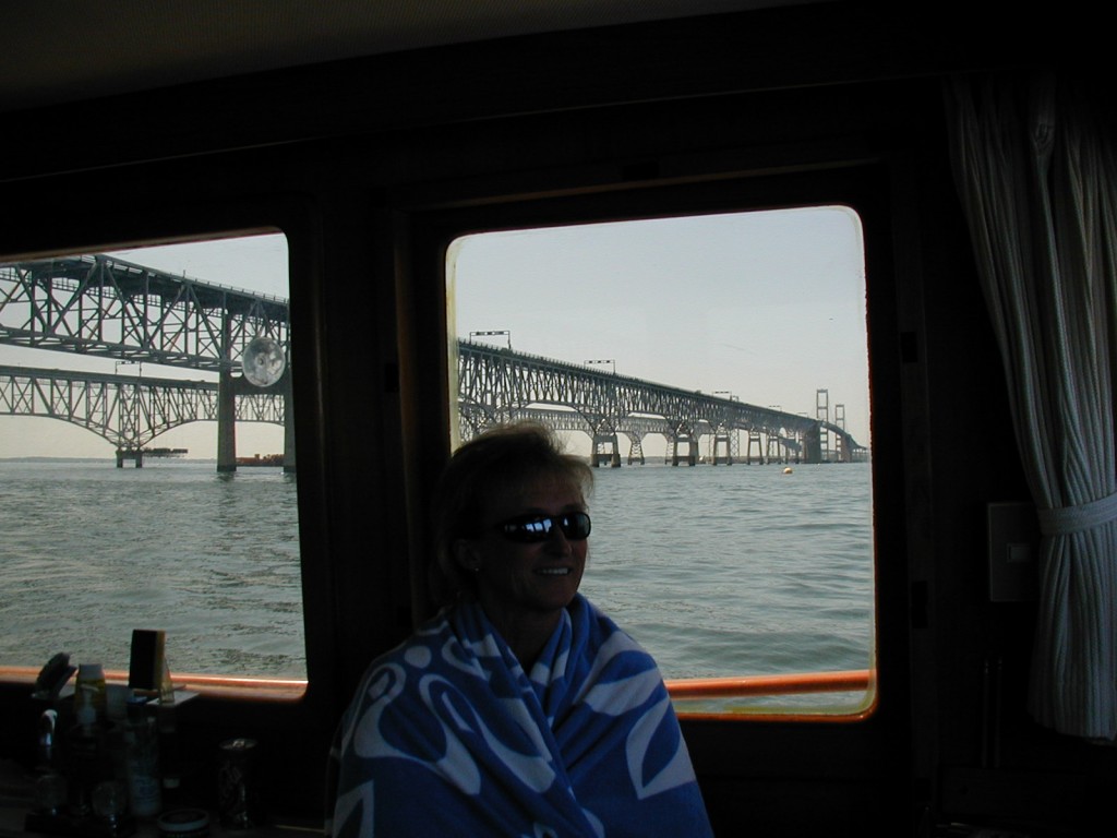
At 2:52 we passed under the William P. Lane Memorial Bridge from Annapolis to Kent Island. Tom noted in the log: Weather and sea moderating as we gain a lee under the west shore.
By the time we passed Annapolis, just south of the bridge, our course took us along the west side of the bay. Then we gained some protection from the wind which was still northwesterly and the waves.
There was nothing unusual about the journey down the Chesapeake Bay, except having to deal with the wind and beam seas in the upper stretches. Once we passed Annapolis, our passage became more routine. We did sight a submarine (presumably OUR navy’s) heading north about 1 mile off our port beam at 3:55, presumably on its way to Annapolis for an orientation for the midshipmen at the Naval Academy. The sub’s decks were awash, with the conning tower and upper tail fin sticking out of the water; the watch crew was in the conning tower.
Vic had programmed all the buoys along our course into the loran, and as we passed each buoy, we would bring up the next waypoint on the loran and be able to keep track of the course and distance to the new waypoint, and the course and speed over the ground. It proved to be reasonably accurate, usually within 1/2 mile of the actual location of the waypoint.
Sun set occurred while we were still several hours from our destination. We began the process of picking out the buoys which marked our course through their light characteristics and bearing. We also kept a sharp lookout for other boats and ships, particularly since we had passed a number of large vessels and tugs with tows during our trip down the Chesapeake. About the time we were off Calvert Cliffs, a tug with tow which we had been tracking on the radar and visually for over an hour and which was on a reciprocal course approached to within a mile. We changed course slightly to starboard in order to pass it port to port (the standard passing procedure). When it was about 1/2 mile away, we could still see the red and green running lights as well as the mast-head lights – meaning it was coming directly for us. We continued to alter course to starboard, and although the tug would initially appear to be passing to our port side, it would suddenly be heading right for us again. This continued several times. Finally Tom raised the tug captain on the VHF and suggested a port to port pass; the captain agreed. The tug swung to port, but then came back at us again. I began to have visions of something from “The Twilight Zone.” Eventually it swung back to our port. We passed within 1/4 of a mile of each other, and Tom speculated that the tug itself was probably yawing from side to side while pulling it’s tow and that’s why it would seem to head toward us while we were turning away. That’s the kind of excitement you don’t need.
After we passed Calvert Cliffs and the abandoned oil off-loading station just south of Calvert Cliffs, we started looking for the buoys which would take us into the Patuxent River and then to our marina at Patuxent River Naval Air Station. The buoys just inside the river all have similar light characteristics, but Tom eventually sorted them out and with Vic and I spotting them visually with the search light and binoculars. By this time we were all outside, with Tom steering from the upper station. We headed west until the Cove Point Light was off our starboard beam, then headed on course 230 magnetic toward the entrance to the marina. One of the lights marking the entrance to the marina wasn’t working, so it made the job a little more difficult, but Tom was able to spot the opening as we got closer. We pulled inside the marina, turned right and found a slip against the quay large enough to get into, and made Sanderling fast bow in to the slip.
The voyage was over! But not the fun!
We ate dinner in peace and quiet on the boat, rechecked the lines to ensure they were holding, and went to bed.
Thursday morning we talked with the marina manager about the slip Sanderling would be in, then checked it out to make sure it was wide enough. We then left the temporary slip of the night before, and moved Sanderling to her “permanent” slip. We gathered up our things, and I drove Tom and Vic to BWI where they caught flights back to their homes. I drove home to Annandale from BWI, took a quick shower and grabbed some clothes, stopped at a marine supply store to buy some new dock lines, and returned to Sanderling to spend the night and watch the lines during the high winds which had been forecast. On Friday I made a few adjustments to the lines to allow Sanderling to ride easier in her slip. On Friday morning, as I was checking the marine forecast, I heard a call on the VHF from our “partner” who had had all the difficulty at Chesapeake City – they had left Solomon’s Island and were in the Chesapeake heading south.
My friend from Baltimore and I decided we should get in some practice leaving and returning to the slip, so on both Saturday and Sunday we took Sanderling out for a two hour cruise around the Solomon’s Island area. The wind was still from the northwest, but it had moderated considerably. To my great surprise, we were able to cast off lines and back out of the slip without difficulty, turn Sanderling to starboard using the two engines in opposition, and head out of the marina. The first day we went up the Patuxent River under the bridge connecting Lexington Park and Solomon’s Island, and then took a quick turn around the small island inside the harbor at Solomon’s Island. Sunday we cruised slowly up all the inlets that form the harbor area at Solomon’s, looking at the beautiful homes and boats. We also saw six swans fly past Sanderling – I don’t think I’d ever seen swans in flight before. Most surprisingly to me, we got Sanderling back into the slip both days without causing any structural damage to the hull or the slip! Both cruises were good confidence builders.
Sanderling is going to be my home on the water, something I’ve always hoped for. I often think how fortuitous it was that I walked onto the dock at the Crosby Boat Yard last June and ran into Bob Gill working on Sanderling. As we talked, I told him that I wanted to buy a trawler, and he told me that he was planning on selling Sanderling at the end of the summer. We agreed to keep in touch, and we did. Bob Gill got a lot of enjoyment from sailing Sanderling, and took several long trips with her. I hope my relationship with Sanderling will be as good.
The name Sanderling, by the way, refers to a small starling-sized bird whose habitat is ocean beaches, sandbars, occasionally mud flats and is found on linland lakes and river shores, as well. It is a member of the Sandpiper family. It’s range is worldwide. The Audubon Society Field Guide to North American Birds (Eastern Region) describes sanderlings as follows:
Practically every day of the year these birds may be found on any ocean beach. As a wave comes roaring in, the birds run up on the beach just ahead of the breaker, then rush after the retreating surf to feed on the tiny crustaceans and mollusks stranded by the outgoing water.

