Catching up / In Norfolk area

We’ve been cruising long days and I’ve been too tired most nights to work on this blog, but tonight’s the night to catch up at least part way. I’ll start where I left off in the last blog.

May 6, 2011 Ft. McAllister Marina on the Ogeechee River

We watched Bailee’s softball game last night and then returned to the marina with the Hill family for a late dinner. Had a great time discussing Bailee’s athletic accomplishments.

We departed the marina about 1045 in the rain, and at 1150 rejoined the ICW, passing through Hell Gate (a notoriously shoaled area), crossed the Savannah River into South Carolina, and anchored in Bull Creek for the evening. As we were relaxing topside, a dinner-moonlight cruise passed by presumably out of one of the marinas on Hilton Head Island. They went up the river several miles while the sun was setting, then returned passing us on their way back. We’ve never experienced a dinner cruise up close and personal before!

Day: 7H05M – 47.8SM
Trip: 52H55M – 324.7SM

Saturday, May 7, 2011 Bull Creek, South Carolina

We were underway at 0805 in clear and sunny weather, crossed Port Royal Sound and passed Beaufort, South Carolina. We anchored for the night in Toogoodoo Creek after trying twice to get the anchor to hold. We’ve been here several times; the last time we experienced a tremendous thunder storm with winds up to 55 knots (and the anchor still held firmly). This time the weather was great – but the chart plotter stopped working while we were eating dinner (we leave it on for a few hours to ensure that we aren’t dragging the anchor). Nothing we could do would bring it back to life.

Day: 10H00M – 71.0SM
Trip: 62H55M – 444.1SM

Sunday, May 8, 2011 Toogoodoo Creek

We were underway at 0715 under clear skies. I did some checking online and on the boat and concluded that the fault with the chart plotter was with the unit and it would need to be sent in to Garmin for repair. In the meantime, we’d need another chart plotter, and while we were at it we might as well replace the topside VHF radio that was having some problems. I called West Marine in Charleston and Judy called a marina a few miles from West Marina. Between the two of us we arranged to buy a new chart plotter and VHF radio, and have them delivered to Ashley Marina where we could stop for an hour or so at no charge while we met the West Marine delivery person! Not bad for a morning’s work! We pulled in to Ashley’s at 1120, and by 1220 we had the new equipment and were on our way (it would have taken 1/2 the time but they charged me the non-sale price for the chart plotter so the person had to return to the store to straighten out the charge, and then return to get my signature).

We continued on for another few ours and anchored in Graham Creek about four hours north of Charleston on the ICW.

Day: 8H20M – 58.9SM
Trip: 71H15M – 531.0SM

May 9, 2011 Graham Creek Anchorage

We were underway at 0730 and I finished the installation of the new chart plotter and VHF while Judy was at the helm. Got everything connected (NMEA circuit feeding the laptop, radar, and auto-pilot) except the hailer (think I need a different one to work with the new VHF).

We passed through Winyah Bay near Georgetown, NC, and entered the Wacamaw River, anchoring for the night in an ox-bow named the Wacamaw River Anchorage.

Day: 8H45M – 64.lSM
Trip:80H00M – 595.1SM

Tuesday, May 10, 2011 Wacamaw River Anchorage

We were underway at 0720 and crossed into North Carolina at 1202. We caught a favorable tidal current for most of the afternoon, and tied our lines to the free dock at the Provision Company (a restaurant) in Southport, North Carolina, at the mouth of the Cape Fear River, at 1625. We had dinner at the restaurant, and helped several other boats tie up in the swift current.

Day: 9H00M – 66.9SM
Trip: 89H05M – 662.0SM

Wednesday, May 11, 2011 The Provision Company, Southport, NC

Lines off and underway at 0810 and headed up the Cape Fear River. We kept a good lookout but never did see either Robert Mitchum or Robert DeNiro! The tide was near slack, but the river current kept our speed to about 5.5 MPH the entire way up the river and into Snow’s Cut where the current was running about 3.0 MPH against us. We then had to wait about 30 minutes for the bridge at Wrightsville Beach (the bridge tender claimed she got distracted and forgot about us at the 1300 opening) and in less than 30 minutes I was taking the mast down in order to clear a 20 foot bridge a little further along; didn’t save much time, but at least I found all the pieces necessary to lower the mast and now have them stowed in a more accessible location.

We anchored for the night in Mile Hammock Bay at Camp LeJeune, North Carolina, along with 11 sailboats.

Day: 10H15M – 65.4SM
Trip: 99H20M – 727.4SM

Thursday, May 12, 2011 Mile Hammock Bay

After getting underway at 0725 we encountered a sailboat with an engine problem and towed it back to Mile Hammock Bay where the captain was going to try to fix the problem. Poor guy, he had just spent a week in a marina not too far away having a transmission replaced, and now there’s an engine problem. We were back on the way north about 0815 and continued on through Moorhead City and anchored for the evening at Oriental, North Carolina, in Smith Creek. We took the dinghy to the town dock, and had a nice meal ashore.

Day: 10H20M – 69.9SM
Trip: 121H40M – 797.3SM

Friday, May 13, 2011 Oriental

We were underway at 0715 down the Neuse River and then the Pamlico River. At 1420 we stopped at Dowry Creek Marina for fuel and took on 200 gallons to fill the tanks. Our fuel burn figured out to 1.65 gallons per hour. We also filled the water tanks, disposed of trash, and bought a T-shirt and some Klondike bars for desert!

When we prepared to leave the dock the bow thruster didn’t work, although it was working when we pulled into the dock. That’s not a big deal on a single engine boat, but it makes maneuvering a bit more difficult. Repairs had to wait until I gathered some information about what to do!

We anchored for the night at 1900 at Tuckahoe Point on the Alligator River after transiting the Pungo River-Alligator River Canal.

Day: 10H55M – 80.6SM
Trip: 133H25M – 878.2SM

May 5, 2011 Ft. McAllister Marina

Monday, May 2, 2011 Daytona Beach, Seabreeze Bridge

Anchored under a heavily-used city bridge can hardly be described as “peaceful” but the boat traffic died down in the late afternoon (after having to put up with all the go-fast boats returning from the beach on our way north into Daytona on a Sunday) and other than the fact that every vehicle in Daytona uses the bridge and has loud exhaust noises, the night was peaceful!

We departed at 0825 and had a most unusual day – the tidal current followed us the entire day. Through Palm Coast and Matanzas Inlet and into St. Augustine (where the tide was at low slack, then a flood tide following us the entire 15 miles north of St. Augustine to Pine Island where we anchored for the night. It isn’t very often that we can average over 7.5 MPH for an entire day! There were only two other boats in the anchorage when we arrived, and two more came after we anchored – plenty of room for all.

The day was warm and sunny, with a little breeze to keep the temperature moderated.

Day: 8 hours 35 minutes – 64.5 statute miles
Trip: 21 hours 00 minutes – 152.8 statute miles

Tuesday, May 3, 2011 Pine Island

The anchor was up and we were underway at 0715, crossed the St. Johns River at 1150, thru Fernandina Beach and into the St. Mary’s River, past the submarine base at King’s Bay, Georgia, and anchored at Little Cumberland Island with winds gusting to 20 MPH at 1720. We had hoped to see a few wild ponies, but they chose not to show up that evening. The evening was a little rocky due to the wind out of the northwest, but the anchor held through the night.

The wind was blowing at 20 MPH from the NW when we awoke, and we had to cross the long expanse of St. Andrew’s Sound. We couldn’t tell from the NOAA forcast what conditions would be like on the sound, so we waited until several other boats passed and asked them for a report of the conditions – not so bad was the report; so we shipped anchor and were underway about 0945. We crossed St. Andrew’s Sound without a problem – actually relatively benign given the wind. Then we crossed St. Simons Sound, and arrived at the Little Mud River at near dead low tide and dragged our keel through the mud without getting “stuck,” and anchored for the night in 13 feet of water in Crescent River (8 foot tide). We let out 150 feet of anchor chain which weighs one pound a foot, so along with the anchor we had a lot of weight on the bottom to keep us in position in 20 feet of water at high tide and winds blowing 15-20 out of the north.

Day: 8 hours 00 minutes – 53.8 statute miles
Trip: 39 hours 05 minutes underway – 279.2 statute miles

Thursday, May 5, 2011 Crescent River

We were underway at 0710 this morning. The anchor held us in almost the exact same position throughout the night despite the changing tidal current and wind. Must have been all the weight of the chain. By the time we reach Sapello Sound the wind had picked up considerably, and as we reached the point near the ocean where the InterCoastal Waterway (ICW) turns north, we had wind of 18-20 mph from the north with a flood tide opposing the river current – seas were very confused and as the water got shallow the waves increased to the point where we took some spray over the bow that reached the windows of the bimini (the window “smiles” were down because of the wind). Not a bad ride, but we were glad when we got a few miles north of the sound into a river where the water was fairly calm.

At 1245 we turned upstream into the Ogeechee River and followed the recently placed red and green floating markers to Ft. McAllister Marina about 6 miles upstream from the ICW where we are staying for the night in order to see Judy’s daughter, her husband, and two children. Nice, quiet place with a good restaurant, not too far from Lori and Joe’s house and just a short distance from where their oldest daughter will be playing baseball tonight (we’re all attending the game)!

Day: 6H45M – 46.1SM
Trip: 45H50M – 325.3SM

Underway

We departed Manatee Cove Marina Saturday afternoon, May 30th, mid afternoon. We got as far as the barge canal on the Banana River near Port Canaveral where we anchored for the night. It was a beautiful clear, quiet night!

We were up early this morning, shipped anchor, and were underway by 0725 so we could be the first boat at the fuel dock at Harbortown Marina – and we were. While we were filling up, our friend Mike Thompson strolled over from his DeFever to say hello. We took only 202.7 gallons of diesel although I had estimated we’d need about 300 gallons – a nice surprise!

We’ve anchored in Daytona Beach tonight by the Seabreeze Bridge.

Trip to date: 86 miles.

Getting ready!

Less than a month before departing for Canada and our list of things to accomplish before leaving is getting shorter (but still exists).

We hope to leave Merritt Island around April 27th, weather permitting. We have made some major improvements since last year: a mechanism to allow us to lower the mast to bring our air draft down from 22 1/2 feet to 15 1/2 feet (we’ll need the lower clearance in order to transit some of the canals in New York state and Canada), have purchased a new 10 foot Achilles dinghy which will be much more stable and comfortable, replaced both holding tanks and all the sanitation hose, replaced the entire house bank of batteries (10 Trojan T-105 6 volt batteries providing 1100 amps of 12 volt power), replaced all the interior incandescent 12 volt bulbs with LEDs, replaced the running and anchor light bulbs with LEDs, added additional shelving in storage spaces, and added removable side awnings, along with a lot of smaller additions and changes.

Our cruise this year will take us north on the IntraCoastal Waterway (ICW) from Florida to Norfolk, Virginia; up Chesapeake Bay, through the Chesapeake and Delaware Canal and down Delaware Bay to Cape May, New Jersey; up the New Jersey coast into the Hudson River at New York City; up the Hudson River as far as it’s junction with the Erie Canal north of Troy, New York; into the Erie Canal to the Finger Lakes west of Syracuse, then into Lake Ontario via the Oswego Canal; through the Trent-Severn Waterway to Georgian Bay and return; the Thousand Islands area at the mouth of the St. Lawrence River; the Rideau Canal to Ottawa and down the Ottawa River into the St. Lawrence Seaway to Montreal; to Sorel and the beginning of the Richelieu Canal to Lake Champlain; finally returning to the Hudson River and retracing our track to Florida! We’re estimating the total distance to be about 8,000 statute miles. Along the way we’ll be joined by family and friends who will be aboard for various lengths of time; Andrew and his family will be joining us for a month for part of the Canadian portion of the cruise.

The cats haven’t yet been told that they’ll need to put on their sea legs in a few weeks!

You can check out our blogs from previous years here:
2008 at 2008 Cruise to Bay of Fundy
2009 at 2009 Cruise to Chesapeake Bay
2010 at 2010 Cruise on the St. Johns River

Sanford to Naval Air Station, Jacksonville

While we were at Sanford, Judy rented a car and drove home to take care of some business, then returned on the morning of Thursday, June 10th. We did a little quick shopping, turned in the rental car, and then departed Monroe Harbor Marina to head downstream toward the ICW.

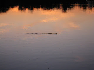
We stopped a few hours later at Hontoon Island State Park (where we had spent three nights on the way upstream) since we enjoyed that area so much. We had thought we might stop at Blue Springs Park on the way, but when we looked at the only two anchorages available we decided to bypass that park this trip. The stop at Hontoon Island State Park turned out to be an interesting one. Late in the afternoon as we were sitting topside reading we saw a strange looking bird swimming toward the island; it took a while to realize it was a juvenile sand hill crane apparently not yet able to fly swimming through the alligator-infested waters to join its parents on the island! We see sand hill cranes almost daily at our home, but had never seen one swimming. Quite an unusual site. Then, shortly after sunset, the alligators began appearing. One was obviously much larger than the others and cruised both sides of the river and then entered the area around the docks at the island where it apparently threatened a smaller ‘gator which quickly swam away. Good thing the sand hill crane had made it to shore well before the ‘gators started their nightly patrol.

The next day we continued downstream (north) to the southern end of Lake George and then turned left off the main channel to anchor near the entrance to Crystal Glen Spring Run, one of the many fresh water springs in central Florida. The afternoon was hot, and we didn’t waste much time after anchoring getting the dinghy into the water and motoring into the spring. As soon as we got near the spring’s mouth the water got clear and cooler, and after actually entering the spring we could easily see the bottom, fish swimming around, and aquatic plants of various kinds.

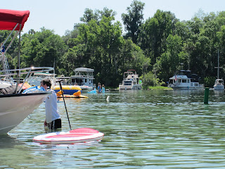
The spring originates about 3/4 of a mile to the west of Lake George’s shoreline, and near the actual spring the body of water gets a little wider with a roped-off state park at the far end. Boats of all descriptions were anchored in the very shallow area just before the source while others were pulled up on the sandy shoreline. There were a number of small house boats, kayaks, canoes, small runabouts, and various types of pontoon boats – even a guy selling hot dogs and sodas from a pontoon boat which he would frequently motor around the other boats. People were in the water talking and swimming and generally enjoying the cool spring water. As we were leaving we saw one large gar perhaps 3 feet long as well as other fish of unknown types.

That evening the wind suddenly picked up from less than 5 mph to around 15-17 mph from the south-east as we began hearing thunder in the distance. Eventually we could see the lightning in the clouds as the sun was still setting, and soon it became obvious that we were on the edge of a large thunderstorm. NOAA weather radio indicated that a severe storm was heading south – and it did as it skirted just to the west of the lake. Eventually the storm passed and the wind calmed down to nearly nothing.

Saturday morning we departed Silver Glen Springs Run and ran 37 miles to Porters Cove, about three miles south of Palatka, where we anchored for the night. We dinghied downstream 1.5 miles to the free restaurant dock at Corky Bell’s Restaurant where we met friends for dinner, and were back on Sanderling (again via dinghy) before sunset. The air was still and hot enough that we ran the generator and both air conditioning units until about 0100 the next morning in order to keep cool enough to sleep comfortably.

On Sunday we had planed to travel as far as the free restaurant dock on Six Mile Creek, just south of Green Cove Springs, to spend the night; however, due to the hot weather with temps approaching 95 we decided to stop for a late lunch at the Outback Crab Shack restaurant and continue north to Naval Air Station Jacksonville where we could be in an inexpensive marina with electricity for air conditioning. We’re glad we made that choice. The temps have been in the mid to high 90s with humidity to match, making a heat index near 105 for the past several days!

Judy is driving home Tuesday evening to work in her hospital on Wednesday.  While she’s away, Bob is going to try to fix, at least temporarily, the aft cabin air conditioner which seems to have it’s own rules about the best time to run and rest. When Judy returns on Thursday morning we’ll depart for a Jacksonville and a few nights at the Landing so we can do some more sight-seeing for a day. Then we’ll head into the ICW and south toward Merritt Island and home.

Palatka to Sanford

After Palatka the St. Johns River changes its character. Where downstream (north) of Palatka is is broad and lake-like, upstream (south) of Palatka is is a meandering stream connecting a series of lakes.

We departed Palatka and the crab festival on Sunday, May 30, and immediately experienced a different river than we had been seeing before. We cruised a few miles upstream to Murphy Creek (forms Murphy Island with the St. Johns River) and entered the creek looking for an anchorage for a few days. Murphy Creek winds around in a narrow necklace on the south side of Murphy Island with deep water and cypress swamps on either side. Since it was a holiday weekend there were a number of small boats speeding through the creek, and a few pulled up near the shore in clumps of water hyacinths fishing. We couldn’t find any spot we felt was suitable for an anchorage for several days, particularly with the small boats zipping around in the relatively narrow ribbon of deep water.

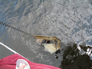
We completed the circuit on Murphy Creek, exiting back into the St. Johns River near Rat Island, and proceeded into an anchorage on the right bank ascending at the Palatka Yacht Club houseboat. We had difficulty getting the anchor to hold when we backed down, and decided to haul in the anchor and try another location. As we raised the anchor, we discovered that we had hooked a cinder block and small line (probably part of an old crab trap). Judy was able to raise the anchor to the bow pulpit and dislodge the cinder block with a boat hook. We then moved a bit further upstream and anchored in a large cove on the north side of Murphy Island about 300 yards downstream from a submerged sand bar that was being used the the small boat crowd for a holiday party – having a great time with kids and adults in the water throwing footballs, swimming, jumping off of boats, and talking.

The next day, Monday – Memorial Day – the small boats were showing up at the sand bar by the time we were up and about at 0800! More boats kept arriving throughout the morning, and by noon the submerged beach was crowded. The boats ran the gamut from PWCs, 14 foot uncovered pontoon boats, and ski boats, to larger covered pontoon boats and 26-28 foot SeaRay type boats, even a large house boat. A few hours later the clouds started getting darker and darker. Some of the small boats started leaving – others stayed. By the time the rain and wind picked up, most of the boats had departed, but a few remained. Those that left early might have gotten “home” before the bad wind and rain; those that remained got soaked and blown around. We could see a few people on some of the smaller boats huddling under blue tarps! At least the rain was warm. One of the boats, in the middle of the storms, left the sandbar and went behind one of the small islands for some protection from the wind. Later, after the storms had passed, the remaining boats headed for home – a soggy conclusion to Memorial Day.

On Tuesday, June 1st, we shipped anchor about 1120 and headed upstream to Welaka where we were able to tie up to one of the dolphins at the end of the town dock. A sign indicated that there was no charge for use of the dock, but didn’t say whether there was a limit on how long a boat could stay or if overnight tie-ups were permitted. We walked the few blocks into town and stopped at the town hall where we asked, and were told that overnights were OK as long as we stayed with the boat. We also located the local wooden boat museum, but it was closed for the day, so we decided to tour the museum the next day when it opened at 10:00 AM.

The next day we appeared at the museum shortly after it opened, and were glad that we had spent the night and waited to tour the museum. The museum contained, among other things, 13 boats built by Richard Speas, who built all of the boats displayed from small blocks of butternut epoxied together using a technique he developed in the 1970s; all of the boats were built in the 15 years between 1990 and 2005 using his unusual technique and restored parts from older, abandoned, boats. Propulsion included steam and early gasoline engines. Other items in the museum included vases made by a nephew using the same technique, a display of old gasoline engines, and various family photographs.

 After visiting the museum, we departed Welaka and a few hours later anchored south of Black’s Point off Georgetown, Florida, for the remainder of the day and the night.

Thursday, June 3rd, was to be our longest days run on the river – 40.3 statute miles and 6 hours 5 minutes underway. We departed Black’s Point at 0750 and crossed Lake George, seven feet deep everywhere except in the straight-as-an-arrow, 10 mile long, 10-12 foot deep channel running down it’s center to the river at the southern (upstream) end. At it’s southern end we entered another totally different river experience on the same St. Johns River. This one was even narrower and more twisting, with a few sections hugging the edge of very shallow lakes only to twist back into a small river and continue it’s twisting and turning meandering. We saw more alligators along this stretch of the river than we’d seen during all our other cruising experiences; most were small, around 4-5 feet, but once in awhile there would be a larger one crossing the river or moving along its bank.

At about 1400 we tied our lines to the upstream dock at Hontoon Island State Park, a gem along the St. Johns River, with 40 slips for small boats as well as two larger outer docks, water and electricity, campgrounds, picnic and play areas, and nature trails leading to a large shell mound at the southwest corner of the island-park from the period when the island was the home of Timucuan Indians. The island is accessible only by private boat or free ferry operated by the park staff. We liked the park so well that we stayed for three nights!

The second day at the park we dingied into the Dead River along the north edge of the park. The cypress swamp along either side was incredible, with knees growing thickly between the older trees. Spanish moss covers most of the branches. 


In the morning of our last day at the park, prior to the now daily afternoon thunderstorms (and hot, humid weather) we hiked the nature trail to the Indian mound. As the trail headed toward the Dead River along the north side of the park, we spotted two adult deer and a fawn grazing on plants along the edge of the river. The fawn disappeared into the dense undergrowth and trees, but we could hear it bleating and one of the does responding as they slowly moved through the brush and onto a trail leading away from the area.

We then continued along the trail to the Indian mound and ascended a rather unusual hill and in another 30 yards came to a seat with a sign reading “End of the Trail.” We looked around and there was no mound to be seen, but we were standing on shells – we were on the mound and had been since the trail started rising. There was a huge tree growing at the “end of the trail” and other trees and bushes growing on the mound itself. Off to one side was a truly “dismal” swamp – standing water covered with green growth amidst huge cypress trees and knees. Interestingly, cooler air was rising out of the swamp beside the Indian mound.

We departed Hontoon Island State Park on Sunday, June 6th and headed further upstream to Sanford, about 20 miles distance. Since this was a weekend, we encountered many kayhaks, small outboard and fishing boats, and PWCs as we cruised past Blue Springs State Park (swim in crystal clear water) and many small marinas and boat launch ramps. Again, even with many alligators in the water, people were swimming from sandy beaches along the river, their boats run up on the beach. We crossed under the rail road bridge at the Port of Sanford, on the north end of Lake Monroe, and we could see Sanford and the Monroe Harbor Marina a few miles across the lake. As we entered the lake we counted 14 PWCs zooming northward heading toward the narrow part of the St. Johns River we had just left.

Ahead was the city of Sanford and the Monroe Harbor Marina. After some confusing non-directions from a marina employee who probably had never been in a boat on the water around the marina, we finally found our slip and tied up for a few days in the marina’s east basin.

Sanford has a beautiful riverwalk and downtown area. There’s quite a history to the region which was once the commercial center of Florida (back in the steamboat days).

St. Johns River to Palatka


From Wikipedia: The St. Johns River is the longest river in the U.S. state of Florida and its most significant for commercial and recreational use. At 310 miles (500 km) long, it winds through or borders twelve counties, three of which are the state’s largest. The drop in elevation from the headwaters to the mouth is less than 30 feet (9.1 m); like most Florida waterways, the St. Johns has a very slow flow rate at a third of a mile an hour (0.2 km/h), and is often described as “lazy”. It is one of a small number of rivers in the United States to run north. Numerous lakes are formed by the river or flow into it, but as a river its widest point is 3 miles (4.8 km) across, spanning several miles between Palatka and Jacksonville, the latter being the largest urban area on the river. The narrowest point is in the headwaters, an unnavigable marsh in Indian River County, Florida. In all, 3.5 million people live within the various watersheds that feed into the St. Johns River.

As we entered the St. Johns River, the first site is a commercial shipyard on the northern bank laying alongside the entrance to the continuation of the ICW heading north. The shipyard is always busy with megayachts and commercial vessels in various stages of construction and repair.
Turning upstream toward Jacksonville (westward, at this point), we cruise past industrial areas with container ships being loaded and unloaded, and other port facilities catering to ocean going ships of all types and sizes. There are also beautiful homes on bluffs overlooking the broad river as it twists and turns it’s way northward from it’s swampy beginnings 300 miles upstream.

About 20 miles upstream of the ICW, downtown Jacksonville comes into view. We take a spot at the free dock at Jacksonville Landing, and enjoy the busy downtown area for a day.

Jacksonville Landing is a great spot to spend a night or two and take in the attractions of downtown Jacksonville. Those include a library, art museum, free trolley, monorail to the other side and the Science Museum and more restaurants.

We depart Jacksonville Landing the next day, Wednesday, May 19th, pass under the I-95 highway bridge and the CSX railway bridge and onto one of the large “lakes” that form various parts of the St. Johns River. This is where the St. Johns River curves 90 degrees and becomes essentially a north-south river the rest of the way to it’s origins. At this point the river is 3-5 miles wide at various places, so there’s not much to see on the shore line. There are also very few cruising boats, but quite a few smaller fishing boats heading upstream to their favorite fishing grounds.

We stop at Mulberry Cove Marina at Naval Air Station Jacksonville for a few nights, and then cruise a short distance further to Doctors Lake, a nice anchorage on the western side of the river where we spend a few nights enjoying the sunshine and mild (not hot – yet) temperatures. Judy even goes for a swim in the lake. We’re the only boat anchored in the Mill Cove on the southern shore of Doctors Lake, but there is a boat launching ramp about 1/2 mile distance with many PWCs and small fishing craft being launched throughout the day.


We returned to Mulberry Cove Marina for a few more days while Judy drove home for a few days, then departed southbound on Thursday, May 27th heading upstream again. That day we departed the St. Johns River for a side-trip up Black Creek just north of Green Cove Springs. The creek is a narrow throwback to the Florida of yesterday, meandering through thick cypress swamp on both sides. We turned around a short distance before a 20 foot high bridge that would prevent us from going further, worked our way back

downstream seeing an occasional bass boat flying by on its way to a favorite fishing spot at 60 plus miles an hour, then re-entered the St. Johns River and anchored for the rest of the day at Hallowes Cove (approximately statute mile 45 from the mouth of the St. John River). We took this opportunity of an early afternoon anchorage to put the dinghy in the water and make a short dinghy trip around the cove, and to take a few pictures of Sanderling at anchor.

The next day (Friday, May 28th) we move further upstream to the small town of Palatka at approximately statute mile 77 where we tied up to the town dock in one of the two locations on that dock which can accommodate a boat the size of Sanderling. Most of the dock, on both sides, is taken up with short slips that can be used by boats of up to perhaps 24 feet in length. Unknown to us when we arrived, the Memorial Day Crab Festival was taking place, and the dock was in the park at the south end of the area where the festival was located. Helicopter rides were a hot item, and the small helicopter landed in a parking lot at the land-side of the dock about 100 yards from Sanderling every 2 minutes and 15 seconds – cost $10.00 per person! The flights started at 10:00 AM and continued until 10:30 PM – needless to say, the noise never stopped, but it was fun watching the bird load and unload its passengers (two at a time) and observing the small boats coming and going to the small slips throughout the day. A boat launching ramp alongside the dock added additional viewing enjoyment! We walked the streets of the festival one hot afternoon and sampled some of the food being offered. After two days, it was time to depart even though the festival still had a day and half to go!

Charleston to Manatee Cove Marina

While Bob stayed in Charleston with Sanderling, Julie and Khepera, Judy rented a car and drove back to Florida to work two days in her hospital and to attend some meetings. Cruising friends of ours live in Charleston, and they invited Bob to attend the Charleston Symphony one night, and for dinner at their house another. One of the men who worked at the marina (Ashley Marina) helped Bob turn the boat so it would be facing “out” when it came time to leave. Bob continued to take care of minor things on Sanderling, and the day Judy arrived did some last minute grocery shopping.

October 20, 2009

We departed Charleston (Ashley Marina) at 0800 when the tide was nearing slack. We made good time with the tide in our favor most of the day, and arrived at an anchorage across the river in Beaufort, South Carolina, at 1700 while it was still light.

Day: 68.5SM – 9H05M
Trip: 2264.7SM – 326H19M

October 21, 2009

We wanted to make a few extra miles so departed the anchorage while it was still dark at 0630 (with Judy steering while Bob raised the anchor), crossed Port Royal Sound (south of Beaufort), and by noon had crossed the Savannah River and were in Georgia. From there we continued south past Isle of Hope (a suburb of Savannah), through Hell Gate, and then departed the ICW to go further up the Ogeechee River to Ft. McAllister Marina, about seven miles beyond where the ICW turns. Navigating the river beyond the ICW was a little tricky as the charts were obviously not up-to-date; when we were within about a mile or so of the marina we called them to get directions, after discovering water that was only about 3.5 feet deep (not deep enough for us). The people at the marina gave us directions over the phone to cross to the south side, then along the bank in deep water until we reached the marina at about 1645.

This was a two-night stop while Judy borrowed her daughter’s car (they live about 10 miles from the marina) and drove back to Merritt Island for the day, returning in time for dinner at the marina restaurant that evening. While Judy was gone, Bob walked to Ft. McAllister and walked the earthen-ware ramparts and enjoyed the exhibits of the Civil War era fortification which was involved in the battle for Savannah and the site of shelling by some of the Union forces’ ironclads.

Day: 74.3SM – 10H15M
Trip: 2339.0SM – 336H34M

October 23, 2009

We departed Ft. McAllister Marina at slack ebb tide, despite the shallow water we encountered on the way up river, relying on information provided by a tow boat operator at the marina and the track of our upstream trip on the GPS – we never saw water less than about 8 feet deep in the shallowest areas.

After rejoining the ICW, we crossed St. Catherine Sound and Sapello Sound, eventually anchoring in the Frederica River to the east of Brunswick, Georgia. There were several boats already in the anchorage, and it was almost dark by the time we selected our spot and got the anchor down.

Day: 74.7SM – 10H05M
Trip: 2413.7SM – 346H39M

October 24 & 25, 2009

We had a lazy start from the Frederica River anchorage at 0720, but again had favorable current most of the day, and crossed into Florida about 1245 as we came down Cumberland Sound and past the huge submarine base where we saw three submarines undergoing repairs and replenishment.

We stayed that night in Palm Cove Marina after trying to find a good anchorage just south of the St. Johns River (there aren’t any).

The next day (October 25) we departed the marina at 0755 since we only had to get as far as the Palm Coast Marina (less than 60 miles) where friends from Merritt Island were going to meet us. Judy had to be home to work at her hospital on Monday, and Melissa would drive her back to Merritt Island while Mike stayed on Sanderling with me to complete the trip home over the next several days.

We arrived at the Palm Coast Marina at 1450; Mike and Melissa showed up about an hour later. We had a nice reunion with them, ate dinner at a nearby restaurant, then Judy and Melissa departed to drive to Merritt Island while Mike and Bob (with Julie and Khepera) stayed aboard.

Day: 56.1SM – 6H55M
Trip: 2545.9SM – 363H24M

October 26, 2009

Mike and Bob were underway and heading south by 0715. We ran the engines at 1800 rpm most of the day with a fair current until Mike mentioned that if we kept up the good speed we could anchor about 20 miles from our marina that night. We discussed it a bit, and decided that we could just as well run later into the evening and get all the way to our marina without having to spend another night on board. We boosted the rpms to 2000, and were making about 8.1 mph over the ground. By 1840 we turned off the ICW into the Canaveral Barge Canal heading toward the Banana River. We passed Melissa at their marina, waiving from the dock. Within half an hour it was dark and we were relying on radar, GPS and a little light reflecting from the clouds and sky to see the water surface as best we could. The remainder of the trip was made interesting by the fact that after it got dark about 7:15 it was apparent that the water was full of luminescent “stuff” (whatever creates a blue luminescence) and the entire transom, swim platform and dinghy were lighted in an eerie blue glow from the water which was light enough to read by. Then after we turned south on the Banana River near the Canaveral Locks (which connect Port Canaveral with the Banana River), when we were about an hour and a half away from the marina Mike noticed two “blue” dolphins swimming alongside Sanderling’s port flank, entirely visible underwater and bathed in a blue glow that made them more visible than they ever would have been in daylight – so visible that we could clearly see their mouths, eyes, breathing hole, fins etc. – and they were big ones, about 7-8 feet long. They stayed alongside about 8-10 minutes until the water started getting shallow. We continued on to the marina, relying on the GPS and radar to keep us on our track.

Judy and some marina friends met us on the dock to help get our lines tied at the dock near the marina office to make it easier to offload all of the things that were coming home; we turned off the engines, took Julie and Khepera (the cats) off in their cages, locked up, and left for home! We tied up at 2120.

Day: 112SM – 14H 05M
Trip: 2657.9SM – 382H49M
Judy and I moved Sanderling from the office dock to our slip on Friday October 30, 2009. We were finally “home.”

Elizabeth City, NC to Charleston, SC

October 8, 2009

The forecast was good and we departed Elizabeth City at 0645 (as soon as we could clearly see the surface of the water). On the way down the Pasquatank River we passed the large wooden structure where most of the blimps in the US are built – the photo shows two blimps tethered outside. A number of other boats departed at about the same time, and by the time we had crossed the calm Albermarle Sound there was quite a parade of boats crossing the shallow area entering the Alligator River from both Elizabeth City and Coinjock (the main ICW route). The Alligator River stretches interminably to the south, then takes a dog-leg to the west, and finally connects with the Alligator-Pungo Canal. We frequently stop at an anchorage after passing through the Canal, in the headwaters of the Pungo River, but this time kept going another 15 miles or so to Pungo Creek, just south of Belhaven, NC – what a beautiful spot, and we could see the Milky Way that evening as there wasn’t a city within miles to lighten the sky.

Day:87.4sm – 11H45M
Trip: 1854.1sm – 271H15M

October 9-10, 2009 (Pungo Creek to Mile Hammock Bay)

We departed Pungo Creek with winds forecast for 15-20 gusting to 25 in the afternoon. By the time we traversed the Neuse River and made the turn toward Beaufort/Morehead City, NC, the winds had picked up. We passed Cedar Creek (a familiar anchorage) to get to Morehead City and possibly Swansboro at the western end of Bogue Sound, but decided the higher winds would make Bogue Sound (totally unprotected from the south and we couldn’t get a forecast specific to the sound) too rough, and were concerned that the winds would also make Morehead City waters rough, so turned around and anchored in Cedar Creek for the rest of the afternoon and night. It was a short day.

Day:56.3sm – 7H30M
Trip: 1910.4sm – 278H45M

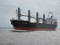
The next day (October 10) winds had slacked off slightly, and we still couldn’t get a good forecast for Bogue Sound itself, so we decided that we’d give it a try and turn around again and find a spot in Morehead City, if necessary. As we turned the corner at Morehead City, we passed alongside this freighter unloading at the dock.

Turned out the sound was not a problem, and we made it to Mile Hammock Bay (Marine base Camp Lejeune, NC) by late afternoon. We tried to arrange dinner with retired Marine Corps friends there, but they had prior commitments – one of these trips we’ll get together, again.

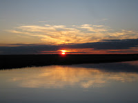
Several of the boats anchored in Mile Hammock Bay at sunset

Day: 58.7sm – 7H55M
Trip: 1969.1sm – 286H40M

October 11-14, 2009 Mile Hammock Bay to Charleston, SC

The next four days were relatively uneventful – no winds to be concerned about, plenty of places to anchor – other than the low bridges with fixed opening schedules that we had to have opened for us (as well as other boats, doing the same) before we could pass. As it turned out, we made all of the scheduled openings without having to wait more than a few minutes, so we made good time.


Freighter heading up the Cape Fear River

Anchorage about 20 miles north of Charleston harbor

Judy had to return to Florida for some scheduled American Heart Association meetings and to work the upcoming weekend at her hospital in Sebastian. The issue became how far could we get before she had to rent a car and drive home. We first looked at Georgetown, SC, but they had a wooden boat show over the weekend and we couldn’t get a slip, and it would have meant that we would have needed to stop earlier than necessary. We didn’t have enough time before her departure to get as far as Beaufort, SC (closer to home for the final push). So Charleston came up as the logical place to stop while Judy made the trip back to Florida.

Sanderling, Julie, Khepera and I are now in Ashley Marina in Charleston, SC. As soon as we arrived late Wednesday morning Judy got a rental car and drove back to Florida. She will return on Monday and we’ll depart Tuesday morning (early) to get as far south as we can before she has to return to Florida again for more scheduled meetings. We’ve both had to reschedule some appointments or miss some meetings, but that’s the way it is when you’re cruising.

I’ve been working on some minor boat-related projects, reading, and meeting up with some crujising friends who live in Charleston. Last night (Friday) we went to the Charleston Symphony to hear a Beethoven concerto and symphony; tonight I’ve been invited to their lovely home in the heart of old Charleston for dinner. I also need to do some grocery shopping before departing, and will do that today or tomorrow via the marina’s courtesy van.

We depart Tuesday. Our planned itinerary will take us to Beaufort, SC; Savannah; Frederica River; Fernandina Beach; St. Augustine; New Smyrna Beach; and finally to Manatee Cove Marina.

Trip: 2196.2sm – 317H14M