Palatka to Sanford

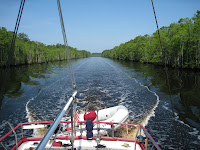
After Palatka the St. Johns River changes its character. Where downstream (north) of Palatka is is broad and lake-like, upstream (south) of Palatka is is a meandering stream connecting a series of lakes.

We departed Palatka and the crab festival on Sunday, May 30, and immediately experienced a different river than we had been seeing before. We cruised a few miles upstream to Murphy Creek (forms Murphy Island with the St. Johns River) and entered the creek looking for an anchorage for a few days. Murphy Creek winds around in a narrow necklace on the south side of Murphy Island with deep water and cypress swamps on either side. Since it was a holiday weekend there were a number of small boats speeding through the creek, and a few pulled up near the shore in clumps of water hyacinths fishing. We couldn’t find any spot we felt was suitable for an anchorage for several days, particularly with the small boats zipping around in the relatively narrow ribbon of deep water.

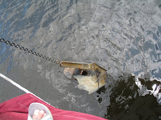
We completed the circuit on Murphy Creek, exiting back into the St. Johns River near Rat Island, and proceeded into an anchorage on the right bank ascending at the Palatka Yacht Club houseboat. We had difficulty getting the anchor to hold when we backed down, and decided to haul in the anchor and try another location. As we raised the anchor, we discovered that we had hooked a cinder block and small line (probably part of an old crab trap). Judy was able to raise the anchor to the bow pulpit and dislodge the cinder block with a boat hook. We then moved a bit further upstream and anchored in a large cove on the north side of Murphy Island about 300 yards downstream from a submerged sand bar that was being used the the small boat crowd for a holiday party – having a great time with kids and adults in the water throwing footballs, swimming, jumping off of boats, and talking.

The next day, Monday – Memorial Day – the small boats were showing up at the sand bar by the time we were up and about at 0800! More boats kept arriving throughout the morning, and by noon the submerged beach was crowded. The boats ran the gamut from PWCs, 14 foot uncovered pontoon boats, and ski boats, to larger covered pontoon boats and 26-28 foot SeaRay type boats, even a large house boat. A few hours later the clouds started getting darker and darker. Some of the small boats started leaving – others stayed. By the time the rain and wind picked up, most of the boats had departed, but a few remained. Those that left early might have gotten “home” before the bad wind and rain; those that remained got soaked and blown around. We could see a few people on some of the smaller boats huddling under blue tarps! At least the rain was warm. One of the boats, in the middle of the storms, left the sandbar and went behind one of the small islands for some protection from the wind. Later, after the storms had passed, the remaining boats headed for home – a soggy conclusion to Memorial Day.

On Tuesday, June 1st, we shipped anchor about 1120 and headed upstream to Welaka where we were able to tie up to one of the dolphins at the end of the town dock. A sign indicated that there was no charge for use of the dock, but didn’t say whether there was a limit on how long a boat could stay or if overnight tie-ups were permitted. We walked the few blocks into town and stopped at the town hall where we asked, and were told that overnights were OK as long as we stayed with the boat. We also located the local wooden boat museum, but it was closed for the day, so we decided to tour the museum the next day when it opened at 10:00 AM.

The next day we appeared at the museum shortly after it opened, and were glad that we had spent the night and waited to tour the museum. The museum contained, among other things, 13 boats built by Richard Speas, who built all of the boats displayed from small blocks of butternut epoxied together using a technique he developed in the 1970s; all of the boats were built in the 15 years between 1990 and 2005 using his unusual technique and restored parts from older, abandoned, boats. Propulsion included steam and early gasoline engines. Other items in the museum included vases made by a nephew using the same technique, a display of old gasoline engines, and various family photographs.

 After visiting the museum, we departed Welaka and a few hours later anchored south of Black’s Point off Georgetown, Florida, for the remainder of the day and the night.

Thursday, June 3rd, was to be our longest days run on the river – 40.3 statute miles and 6 hours 5 minutes underway. We departed Black’s Point at 0750 and crossed Lake George, seven feet deep everywhere except in the straight-as-an-arrow, 10 mile long, 10-12 foot deep channel running down it’s center to the river at the southern (upstream) end. At it’s southern end we entered another totally different river experience on the same St. Johns River. This one was even narrower and more twisting, with a few sections hugging the edge of very shallow lakes only to twist back into a small river and continue it’s twisting and turning meandering. We saw more alligators along this stretch of the river than we’d seen during all our other cruising experiences; most were small, around 4-5 feet, but once in awhile there would be a larger one crossing the river or moving along its bank.

At about 1400 we tied our lines to the upstream dock at Hontoon Island State Park, a gem along the St. Johns River, with 40 slips for small boats as well as two larger outer docks, water and electricity, campgrounds, picnic and play areas, and nature trails leading to a large shell mound at the southwest corner of the island-park from the period when the island was the home of Timucuan Indians. The island is accessible only by private boat or free ferry operated by the park staff. We liked the park so well that we stayed for three nights!

The second day at the park we dingied into the Dead River along the north edge of the park. The cypress swamp along either side was incredible, with knees growing thickly between the older trees. Spanish moss covers most of the branches. 


In the morning of our last day at the park, prior to the now daily afternoon thunderstorms (and hot, humid weather) we hiked the nature trail to the Indian mound. As the trail headed toward the Dead River along the north side of the park, we spotted two adult deer and a fawn grazing on plants along the edge of the river. The fawn disappeared into the dense undergrowth and trees, but we could hear it bleating and one of the does responding as they slowly moved through the brush and onto a trail leading away from the area.

We then continued along the trail to the Indian mound and ascended a rather unusual hill and in another 30 yards came to a seat with a sign reading “End of the Trail.” We looked around and there was no mound to be seen, but we were standing on shells – we were on the mound and had been since the trail started rising. There was a huge tree growing at the “end of the trail” and other trees and bushes growing on the mound itself. Off to one side was a truly “dismal” swamp – standing water covered with green growth amidst huge cypress trees and knees. Interestingly, cooler air was rising out of the swamp beside the Indian mound.

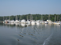
We departed Hontoon Island State Park on Sunday, June 6th and headed further upstream to Sanford, about 20 miles distance. Since this was a weekend, we encountered many kayhaks, small outboard and fishing boats, and PWCs as we cruised past Blue Springs State Park (swim in crystal clear water) and many small marinas and boat launch ramps. Again, even with many alligators in the water, people were swimming from sandy beaches along the river, their boats run up on the beach. We crossed under the rail road bridge at the Port of Sanford, on the north end of Lake Monroe, and we could see Sanford and the Monroe Harbor Marina a few miles across the lake. As we entered the lake we counted 14 PWCs zooming northward heading toward the narrow part of the St. Johns River we had just left.

Ahead was the city of Sanford and the Monroe Harbor Marina. After some confusing non-directions from a marina employee who probably had never been in a boat on the water around the marina, we finally found our slip and tied up for a few days in the marina’s east basin.

Sanford has a beautiful riverwalk and downtown area. There’s quite a history to the region which was once the commercial center of Florida (back in the steamboat days).

St. Johns River to Palatka


From Wikipedia: The St. Johns River is the longest river in the U.S. state of Florida and its most significant for commercial and recreational use. At 310 miles (500 km) long, it winds through or borders twelve counties, three of which are the state’s largest. The drop in elevation from the headwaters to the mouth is less than 30 feet (9.1 m); like most Florida waterways, the St. Johns has a very slow flow rate at a third of a mile an hour (0.2 km/h), and is often described as “lazy”. It is one of a small number of rivers in the United States to run north. Numerous lakes are formed by the river or flow into it, but as a river its widest point is 3 miles (4.8 km) across, spanning several miles between Palatka and Jacksonville, the latter being the largest urban area on the river. The narrowest point is in the headwaters, an unnavigable marsh in Indian River County, Florida. In all, 3.5 million people live within the various watersheds that feed into the St. Johns River.

As we entered the St. Johns River, the first site is a commercial shipyard on the northern bank laying alongside the entrance to the continuation of the ICW heading north. The shipyard is always busy with megayachts and commercial vessels in various stages of construction and repair.
Turning upstream toward Jacksonville (westward, at this point), we cruise past industrial areas with container ships being loaded and unloaded, and other port facilities catering to ocean going ships of all types and sizes. There are also beautiful homes on bluffs overlooking the broad river as it twists and turns it’s way northward from it’s swampy beginnings 300 miles upstream.

About 20 miles upstream of the ICW, downtown Jacksonville comes into view. We take a spot at the free dock at Jacksonville Landing, and enjoy the busy downtown area for a day.

Jacksonville Landing is a great spot to spend a night or two and take in the attractions of downtown Jacksonville. Those include a library, art museum, free trolley, monorail to the other side and the Science Museum and more restaurants.

We depart Jacksonville Landing the next day, Wednesday, May 19th, pass under the I-95 highway bridge and the CSX railway bridge and onto one of the large “lakes” that form various parts of the St. Johns River. This is where the St. Johns River curves 90 degrees and becomes essentially a north-south river the rest of the way to it’s origins. At this point the river is 3-5 miles wide at various places, so there’s not much to see on the shore line. There are also very few cruising boats, but quite a few smaller fishing boats heading upstream to their favorite fishing grounds.

We stop at Mulberry Cove Marina at Naval Air Station Jacksonville for a few nights, and then cruise a short distance further to Doctors Lake, a nice anchorage on the western side of the river where we spend a few nights enjoying the sunshine and mild (not hot – yet) temperatures. Judy even goes for a swim in the lake. We’re the only boat anchored in the Mill Cove on the southern shore of Doctors Lake, but there is a boat launching ramp about 1/2 mile distance with many PWCs and small fishing craft being launched throughout the day.


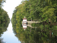
We returned to Mulberry Cove Marina for a few more days while Judy drove home for a few days, then departed southbound on Thursday, May 27th heading upstream again. That day we departed the St. Johns River for a side-trip up Black Creek just north of Green Cove Springs. The creek is a narrow throwback to the Florida of yesterday, meandering through thick cypress swamp on both sides. We turned around a short distance before a 20 foot high bridge that would prevent us from going further, worked our way back

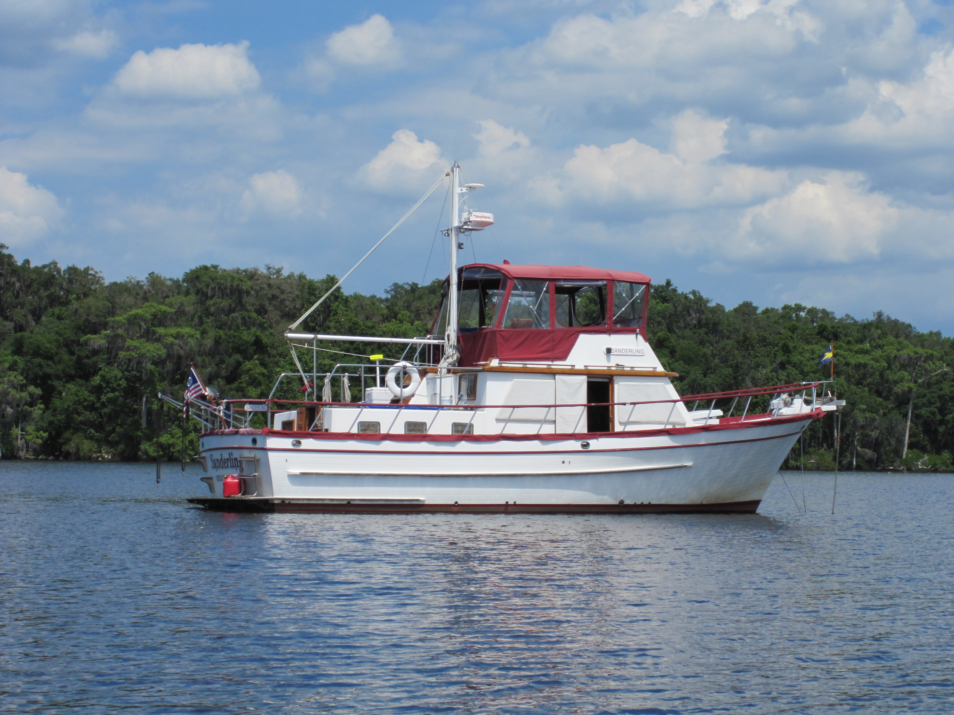
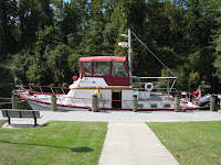
downstream seeing an occasional bass boat flying by on its way to a favorite fishing spot at 60 plus miles an hour, then re-entered the St. Johns River and anchored for the rest of the day at Hallowes Cove (approximately statute mile 45 from the mouth of the St. John River). We took this opportunity of an early afternoon anchorage to put the dinghy in the water and make a short dinghy trip around the cove, and to take a few pictures of Sanderling at anchor.

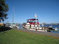
The next day (Friday, May 28th) we move further upstream to the small town of Palatka at approximately statute mile 77 where we tied up to the town dock in one of the two locations on that dock which can accommodate a boat the size of Sanderling. Most of the dock, on both sides, is taken up with short slips that can be used by boats of up to perhaps 24 feet in length. Unknown to us when we arrived, the Memorial Day Crab Festival was taking place, and the dock was in the park at the south end of the area where the festival was located. Helicopter rides were a hot item, and the small helicopter landed in a parking lot at the land-side of the dock about 100 yards from Sanderling every 2 minutes and 15 seconds – cost $10.00 per person! The flights started at 10:00 AM and continued until 10:30 PM – needless to say, the noise never stopped, but it was fun watching the bird load and unload its passengers (two at a time) and observing the small boats coming and going to the small slips throughout the day. A boat launching ramp alongside the dock added additional viewing enjoyment! We walked the streets of the festival one hot afternoon and sampled some of the food being offered. After two days, it was time to depart even though the festival still had a day and half to go!

Sanderling – DeFever 41 trawler

Sanderling is a DeFever 41 motor vessel, built in 1987 in Taiwan by BLUEWATER YACHT BUILDERS LTD, and formerly named China Pearl and Walkabout.

Sanderling measures 40.6 feet in overall length (34.6 feet waterline), with a beam of 14.5 feet, a draft of 4.0 feet, and displaces about 19 tons when fully loaded. Approximate air-draft measurements are as follows: 22’3″ to the top of the radar mast and anchor light; 15’3″ with the radar mast laid down; 10.0 feet with the bimini totally down (radar mast laid down).

Sanderling is powered by a Ford-Lehman 135 horse power, naturally aspirated diesel engine, connected to a Borg-Warner Velvet Drive transmission with a 2.47:1 ratio. Burning 1.7 gallons of diesel fuel per hour at 1600 RPM (6.5 knots or 7.5 MPH) she has a cruising range, before refueling, of around 1200 nautical miles.

Sanderling has three main compartments inside: the main saloon, a forward V-berth with separate head/shower (for guests), and an aft cabin with separate head/shower/tub and walk-in cedar hanging locker. Outside she has walk-around decks, an aft deck above the aft cabin, and an enclosed upper deck and topside steering station above the saloon.

Sanderling is equipped with radar, GPS, and a depth sounder and fish finder for navigation; two heat pumps for heat and air conditioning for climate control; a 5 gallon water heater which operates on 120 volts and is also heated by the engine cooling system when underway; an Onan 8KW diesel generator for 120 volt electricity; a 110 volt refrigerator with separate freezer; and a Force 10 three-burner propane stove with oven and broiler. She’s also equipped with two VHF radios, plus a hand held VHF radio, a five person Achilles dinghy (with oars and a Mercury 15 HP 2-stroke outboard), a Heart/Xantrex combination 100 amp 3-stage charger/2000 watt inverter, AM/FM/CD stereo, 12 volt lighting, pressurized water, and a combination washer/dryer, and a West Marine party sized propane grill. She has two separate battery banks: 10 T-105 (golf cart) batteries are combined into a house-bank for 12 volt needs producing 550 usable amps (1100 amps total); and one group 27 battery for starting the generator. While underway, the main battery bank is charged by a Balmar 110 amp alternator. Battery status is monitored by a Link 1000 monitor. Fresh water capacity is 160 gallons; fuel capacity is 400 gallons divided between two tanks. Fuel is filtered through one 30 micron Racor 500 filter, one 2 micron Racor 500 filter (set in a lever selected two-filter manifold), and two on-engine 10 micron filters. Primary ground tackle consists of 260 feet of 5/16″ HT” chain attached to a 55 pound SuperMax adjustable anchor, and 300 feet of 5/8 inch three strand nylon line with 10 feet of chain attached to a CQR anchor as secondary ground tackle. The anchor windlass is a Lofrans Tigress 12 volt model, which can raise as well as lower the anchor and chain from controls at both the topside steering station and a tethered remote at the windlass itself. Each head is equiped with a holding tank and a separate electrically operated Lectrasan unit for processing waste.

Charleston to Manatee Cove Marina

While Bob stayed in Charleston with Sanderling, Julie and Khepera, Judy rented a car and drove back to Florida to work two days in her hospital and to attend some meetings. Cruising friends of ours live in Charleston, and they invited Bob to attend the Charleston Symphony one night, and for dinner at their house another. One of the men who worked at the marina (Ashley Marina) helped Bob turn the boat so it would be facing “out” when it came time to leave. Bob continued to take care of minor things on Sanderling, and the day Judy arrived did some last minute grocery shopping.

October 20, 2009

We departed Charleston (Ashley Marina) at 0800 when the tide was nearing slack. We made good time with the tide in our favor most of the day, and arrived at an anchorage across the river in Beaufort, South Carolina, at 1700 while it was still light.

Day: 68.5SM – 9H05M
Trip: 2264.7SM – 326H19M

October 21, 2009

We wanted to make a few extra miles so departed the anchorage while it was still dark at 0630 (with Judy steering while Bob raised the anchor), crossed Port Royal Sound (south of Beaufort), and by noon had crossed the Savannah River and were in Georgia. From there we continued south past Isle of Hope (a suburb of Savannah), through Hell Gate, and then departed the ICW to go further up the Ogeechee River to Ft. McAllister Marina, about seven miles beyond where the ICW turns. Navigating the river beyond the ICW was a little tricky as the charts were obviously not up-to-date; when we were within about a mile or so of the marina we called them to get directions, after discovering water that was only about 3.5 feet deep (not deep enough for us). The people at the marina gave us directions over the phone to cross to the south side, then along the bank in deep water until we reached the marina at about 1645.
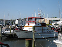
This was a two-night stop while Judy borrowed her daughter’s car (they live about 10 miles from the marina) and drove back to Merritt Island for the day, returning in time for dinner at the marina restaurant that evening. While Judy was gone, Bob walked to Ft. McAllister and walked the earthen-ware ramparts and enjoyed the exhibits of the Civil War era fortification which was involved in the battle for Savannah and the site of shelling by some of the Union forces’ ironclads.

Day: 74.3SM – 10H15M
Trip: 2339.0SM – 336H34M

October 23, 2009

We departed Ft. McAllister Marina at slack ebb tide, despite the shallow water we encountered on the way up river, relying on information provided by a tow boat operator at the marina and the track of our upstream trip on the GPS – we never saw water less than about 8 feet deep in the shallowest areas.

After rejoining the ICW, we crossed St. Catherine Sound and Sapello Sound, eventually anchoring in the Frederica River to the east of Brunswick, Georgia. There were several boats already in the anchorage, and it was almost dark by the time we selected our spot and got the anchor down.

Day: 74.7SM – 10H05M
Trip: 2413.7SM – 346H39M

October 24 & 25, 2009

We had a lazy start from the Frederica River anchorage at 0720, but again had favorable current most of the day, and crossed into Florida about 1245 as we came down Cumberland Sound and past the huge submarine base where we saw three submarines undergoing repairs and replenishment.

We stayed that night in Palm Cove Marina after trying to find a good anchorage just south of the St. Johns River (there aren’t any).
The next day (October 25) we departed the marina at 0755 since we only had to get as far as the Palm Coast Marina (less than 60 miles) where friends from Merritt Island were going to meet us. Judy had to be home to work at her hospital on Monday, and Melissa would drive her back to Merritt Island while Mike stayed on Sanderling with me to complete the trip home over the next several days.
We arrived at the Palm Coast Marina at 1450; Mike and Melissa showed up about an hour later. We had a nice reunion with them, ate dinner at a nearby restaurant, then Judy and Melissa departed to drive to Merritt Island while Mike and Bob (with Julie and Khepera) stayed aboard.

Day: 56.1SM – 6H55M
Trip: 2545.9SM – 363H24M

October 26, 2009

Mike and Bob were underway and heading south by 0715. We ran the engines at 1800 rpm most of the day with a fair current until Mike mentioned that if we kept up the good speed we could anchor about 20 miles from our marina that night. We discussed it a bit, and decided that we could just as well run later into the evening and get all the way to our marina without having to spend another night on board. We boosted the rpms to 2000, and were making about 8.1 mph over the ground. By 1840 we turned off the ICW into the Canaveral Barge Canal heading toward the Banana River. We passed Melissa at their marina, waiving from the dock. Within half an hour it was dark and we were relying on radar, GPS and a little light reflecting from the clouds and sky to see the water surface as best we could. The remainder of the trip was made interesting by the fact that after it got dark about 7:15 it was apparent that the water was full of luminescent “stuff” (whatever creates a blue luminescence) and the entire transom, swim platform and dinghy were lighted in an eerie blue glow from the water which was light enough to read by. Then after we turned south on the Banana River near the Canaveral Locks (which connect Port Canaveral with the Banana River), when we were about an hour and a half away from the marina Mike noticed two “blue” dolphins swimming alongside Sanderling’s port flank, entirely visible underwater and bathed in a blue glow that made them more visible than they ever would have been in daylight – so visible that we could clearly see their mouths, eyes, breathing hole, fins etc. – and they were big ones, about 7-8 feet long. They stayed alongside about 8-10 minutes until the water started getting shallow. We continued on to the marina, relying on the GPS and radar to keep us on our track.

Judy and some marina friends met us on the dock to help get our lines tied at the dock near the marina office to make it easier to offload all of the things that were coming home; we turned off the engines, took Julie and Khepera (the cats) off in their cages, locked up, and left for home! We tied up at 2120.

Day: 112SM – 14H 05M
Trip: 2657.9SM – 382H49M

Judy and I moved Sanderling from the office dock to our slip on Friday October 30, 2009. We were finally “home.”

Elizabeth City, NC to Charleston, SC

October 8, 2009

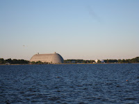
The forecast was good and we departed Elizabeth City at 0645 (as soon as we could clearly see the surface of the water). On the way down the Pasquatank River we passed the large wooden structure where most of the blimps in the US are built – the photo shows two blimps tethered outside. A number of other boats departed at about the same time, and by the time we had crossed the calm Albermarle Sound there was quite a parade of boats crossing the shallow area entering the Alligator River from both Elizabeth City and Coinjock (the main ICW route). The Alligator River stretches interminably to the south, then takes a dog-leg to the west, and finally connects with the Alligator-Pungo Canal. We frequently stop at an anchorage after passing through the Canal, in the headwaters of the Pungo River, but this time kept going another 15 miles or so to Pungo Creek, just south of Belhaven, NC – what a beautiful spot, and we could see the Milky Way that evening as there wasn’t a city within miles to lighten the sky.

Day:87.4sm – 11H45M
Trip: 1854.1sm – 271H15M

October 9-10, 2009 (Pungo Creek to Mile Hammock Bay)

We departed Pungo Creek with winds forecast for 15-20 gusting to 25 in the afternoon. By the time we traversed the Neuse River and made the turn toward Beaufort/Morehead City, NC, the winds had picked up. We passed Cedar Creek (a familiar anchorage) to get to Morehead City and possibly Swansboro at the western end of Bogue Sound, but decided the higher winds would make Bogue Sound (totally unprotected from the south and we couldn’t get a forecast specific to the sound) too rough, and were concerned that the winds would also make Morehead City waters rough, so turned around and anchored in Cedar Creek for the rest of the afternoon and night. It was a short day.

Day:56.3sm – 7H30M
Trip: 1910.4sm – 278H45M

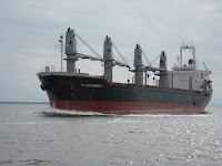
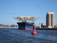
The next day (October 10) winds had slacked off slightly, and we still couldn’t get a good forecast for Bogue Sound itself, so we decided that we’d give it a try and turn around again and find a spot in Morehead City, if necessary. As we turned the corner at Morehead City, we passed alongside this freighter unloading at the dock.

Turned out the sound was not a problem, and we made it to Mile Hammock Bay (Marine base Camp Lejeune, NC) by late afternoon. We tried to arrange dinner with retired Marine Corps friends there, but they had prior commitments – one of these trips we’ll get together, again.

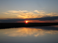
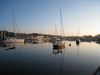
Several of the boats anchored in Mile Hammock Bay at sunset

Day: 58.7sm – 7H55M
Trip: 1969.1sm – 286H40M

October 11-14, 2009 Mile Hammock Bay to Charleston, SC

The next four days were relatively uneventful – no winds to be concerned about, plenty of places to anchor – other than the low bridges with fixed opening schedules that we had to have opened for us (as well as other boats, doing the same) before we could pass. As it turned out, we made all of the scheduled openings without having to wait more than a few minutes, so we made good time.


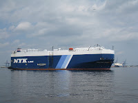
Freighter heading up the Cape Fear River

Anchorage about 20 miles north of Charleston harbor

Judy had to return to Florida for some scheduled American Heart Association meetings and to work the upcoming weekend at her hospital in Sebastian. The issue became how far could we get before she had to rent a car and drive home. We first looked at Georgetown, SC, but they had a wooden boat show over the weekend and we couldn’t get a slip, and it would have meant that we would have needed to stop earlier than necessary. We didn’t have enough time before her departure to get as far as Beaufort, SC (closer to home for the final push). So Charleston came up as the logical place to stop while Judy made the trip back to Florida.

Sanderling, Julie, Khepera and I are now in Ashley Marina in Charleston, SC. As soon as we arrived late Wednesday morning Judy got a rental car and drove back to Florida. She will return on Monday and we’ll depart Tuesday morning (early) to get as far south as we can before she has to return to Florida again for more scheduled meetings. We’ve both had to reschedule some appointments or miss some meetings, but that’s the way it is when you’re cruising.

I’ve been working on some minor boat-related projects, reading, and meeting up with some crujising friends who live in Charleston. Last night (Friday) we went to the Charleston Symphony to hear a Beethoven concerto and symphony; tonight I’ve been invited to their lovely home in the heart of old Charleston for dinner. I also need to do some grocery shopping before departing, and will do that today or tomorrow via the marina’s courtesy van.

We depart Tuesday. Our planned itinerary will take us to Beaufort, SC; Savannah; Frederica River; Fernandina Beach; St. Augustine; New Smyrna Beach; and finally to Manatee Cove Marina.

Trip: 2196.2sm – 317H14M

Goodbye Baltimore – Hello ICW

September 30, 2009

After delaying a day for uncomfortably high wind on the Chesapeake, we departed Baltimore and Henderson’s Wharf Marina today to head south to Florida. Chesapeake Bay was delightfully calm, and we made it to Solomons by 1645 and into took a mooring at Zahnizer’s Marina. There were several boats anchored out, apparently waiting for Trawler Fest to start on Friday. A HUGE boat at Zahnizer’s dock was the Argyll at 150 feet and 4 decks above the waterline. She is huge, and our stern was about 40 feet off her port side. I’m sure other boats in the harbor would have had difficulty seeing “little” Sanderling against the backdrop of this monstrosity! Check out “Argyll luxury yacht charter” to see it for yourself.

Day: 65.7nm – 9H35M
Trip: 1390.8nm – 234H00M

October 1, 2 & 3, 2009

Departed Solomons at first light (about 0645) immediately after Argyll left her dock. There were a number of other trawlers (as well as other types of boats) departing and all headed south. We were hoping for another good day on Chesapeake Bay, but hoped to at least get south of the Potomac River before encountering some predicted head seas in the lower part of the Bay. As it turns out we had another beautiful day cruising down Chesapeake Bay – at one point in the mid afternoon the water was like glass, something that is very unusual on the bay. We anchored for the night a little after sundown in the Phoebus Channel immediately north of Norfolk. The wind came up a little during the night to give us a little rocking, but nothing like we’d experienced in this location on prior occasions.

The next morning (Octobe 2nd) we took the dinghy 1/4 mile or so to the Army-operated marina at Old Point Comfort to go ashore and tour historic Fort Monroe and see where Jefferson Davis was imprisoned for several years after the Civil War.

In the early afternoon we made a short cruise back around the I-64 tunnel entrance and up the Hampton River to an anchorage just north of a number of large marinas and under a bridge with 29 feet clearance. We had no sooner dropped anchor when we saw Argyll (the luxury yacht from Solomons) pulling up to the town docks. She didn’t dominate the waterfront like she did in Solomons, but it was still hard to miss! We checked out the free dinghy dock at the town docks, walked around a little, then went back to Sanderling for the rest of the afternoon and evening.

On October 3rd friends Norm and Nancy came aboard around noon. We caught up with each others’ goings on since we saw them last February in Florida, got them settled in to their quarters in the V-berth, and then went ashore for dinner at a local restaurant.

Day: 3.3nm – 0H35M
Trip:

October 4, 5 & 6, 2009 – The Great Dismal Swamp

October 4th began our trip into the IntraCoastal Waterway (ICW) which will take us all the way to our home in Florida. We started at 0830 after breakfast and cruised across Hampton Roads and past the sprawling Navy base at the northern end of the Elizabeth River. There were a number of aircraft carriers, cruisers and submarines docked at the base, in addition to several Military Sealift Command (MSC) ships taking on cargo. We then passed mile zero of the ICW and continued up the Elizabeth River. We stopped for fuel (260 gallons) at the Ocean Marine Center (known for it’s good fuel prices) where we also filled our water tanks. We then continued up the Elizabeth River through Norfolk and Portsmouth, Virginia, with their very active waterfronts. Even though it was Sunday there were a few tugs and other boats out performing their day’s work. We seemed to be one of a few pleasure boats heading south. The bridges were all open, although we did have to wait 10-15 minutes at one highway bridge for a tug to position some work barges against the fenders where they were working.


We arrived at Deep Creek Lock leading into the Great Dismal Swamp at 1305, and were let into the lock at 1325; by 1400 we had been raised eight feet to the level of the canal and had our lines tied to Elizabeth’s Dock just inside the northern lock in the Great Dismal Swamp.

We walked around the park adjacent to Elizabeth’s Dock, walked to the small town and purchased a few groceries, then walked back to Sanderling where we just took it easy for the rest of the afternoon. We then walked back into town in the evening for dinner at a Mexican restaurant.

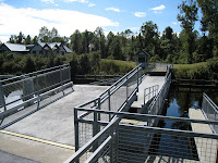
On October 5th we departed Elizabeth’s Dock in order to go through the bridge about a mile from the lock at 0830 when it opened for a northbound boat departing the canal. We continued 15 miles through the straight and narrow canal, with mostly swamp land and a few farm fields on the west (right/starboard) side, and a few trees and highway 17 on the east (left/port) side. We arrived at the North Carolina Visitors’ Center and tied to their free dock at 1125. We had a very enjoyable day there, exploring the area around the Visitors’ Center and the nearby North Carolina Dismal Swamp Park. A floating swing bridge leads from the visitors’ center across the canal to the park and an extremely well-presented display of the history and other things related to the canal and the Great Dismal Swamp. We walked the boardwalk out into the swamp, and talked with the park rangers.

On Tuesday, October 6th, we departed the visitors’ center at 0950 and arrived at the South Mills Bridge and Lock at 1035 where we tied to the bridge fender to wait the opening of the bridge at 1100. By 1055 we were through the bridge and into the lock. By 1120 we had been lowered eight feet to the level of the Pasquotank River on the south end of the canal and were heading out of the canal to Elizabeth City, about 16 miles down the river from the South Mills Lock. By 1400 we had lines to the free bulkhead at Elizabeth City – the City of Hospitality. Believe me, this city lives up to its motto. We had no sooner tied up than a lady from the Welcome Center had come to the boat and was telling us about the area, it’s many restaurants, art gallery, museum, and the wine and cheese party they throw for boaters at 1630 in the afternoon. We had plenty of time to walk through the museum just across the street from where we are located, and still attend the wine and cheese event where we met a number of other boaters who had arrived recently. Then we went to dinner at a local restaurant where we’ve eaten when we’ve been here before.

Unfortunately, the weather forecast for Wednesday for Albermarle Sound, which we must pass across on our way south, was not good for comfortable cruising. Another complication was the fact that the Alligator River Bridge, across the northern end of the Alligator River, was being worked on and wouldn’t be opening until 1700 on Wednesday. We checked the forecast several times throughout the day and into the evening, and it didn’t get any better, so we decided to remain in Elizabeth City for another day until weather improved on Albermarle Sound and the bridge repairs had been completed. As it turns out, only one boat left on Wednesday heading south.

Day: 23,6sm – 3H10M
Trip: 1714.6sm – 259H30M

Upper Chesapeake Bay Cruise

September 13, 2009

Departed the marina at Baltimore at 0900 on our way further up Chesapeake Bay and then the Susquehanna River to Havre de Grace, Maryland. The forecast was for good weather for a three day period, so we were going to take advantage of it rather than sit around the marina since Judy didn’t have any work scheduled.

Departing Baltimore harbor, we again passed Fort McHenry; this was a beautiful day for a good photo of the historic fortification

and one of the many ships unloading at the port.

The trip north was delightful, and we arrived at Havre de Grace about 1530 that afternoon. We went into a marina, since the only anchorage is about a mile away and the current flowing down the Susquehanna River is fairly strong at times.

Havre de Grace is a nice little town for walking – mostly antique shops, and lot of vacant buildings, and some good restaurants. After an early dinner at an Italian restaurant (Judy had what she claims is the best Italian seafood pasta she’s had anywhere and I had some great pizza) we returned to the marina and walked along the extensive docks checking out the boats. In the process we discovered that the piers and slips were infested with spiders that liked to spin their webs between the pilings supporting the docks and the finger piers, and even the boats (those that were not used frequently) were covered with the little creatures and their webs! However, the bathrooms and showers were as clean as we’d seen anywhere.

Day: 45.0nm – 6H30M
Trip: 1237.2nm – 202H00M

September 14, 2009

We departed the marina at Havre de Grace about 0955 and cruised a few miles upriver on the Susquehanna under the Amtrak and highway #1 bridges – there are two more bridges (freight train and I-95) which we didn’t go under, but we could see the high dam that is the end of navigation on the Susquehanna. Interesting to think about how much of our country’s early history involved the Susquehanna as a means of transportation inland.

We turn turned back south through the sometimes narrow and winding channel down to the main ship channel in Chesapeake Bay, and after a couple of miles back on the Chesapeake turned east into the Sassafras River with Georgetown, Maryland, as our destination. The cruise up the Sassafras River was beautiful in full sun – wide, winding river, groups of modest and bigger homes, and – best of all – no crab traps after we left the mouth of the river.

Georgetown is not a town, it turns out, but just an area with 5-6 large marinas, associated restaurants and boating supply stores. Essentially it is a boating center; many boats both sail and power of all sizes. A small town is 2-3 miles away along the two-lane highway that cuts across the low bridge at the end of the main river. The marina where we stayed had moorings, so we took a mooring and dinghied ashore to do some walking before returning to Sanderling for a quiet meal aboard as the sun set and the air started cooling down to make a beautiful evening.

Day: 22.0nm – 3H30M
Trip: 1259.2nm – 205H30M

September 15, 2009

We dropped the mooring at 0755 and headed back down the Sassafras River. A slight current was behind us on the river, and when we reached the Chesapeake Bay we had about 1.4 knots of current pushing us along for about half the distance back to the Patabsco River. Consequently, the trip back to Baltimore (even with the setting current we encountered when we entered the Patabsco River) was a quick six hours for the 40.2 miles.

Day: 40.2 nm – 6H00M
Trip: 1299.5nm – 211H30M

September 20, 2009

Today is the perfect day for a cruise around Baltimore Harbor, and we took advantage of it. We invited friends and family aboard, and all enjoyed a six hour cruise into the Inner Harbor, then down the Patabsco River to Curtis Bay and into Curtis Creek where we anchored for an early afternoon lunch, then back to the marina. We enjoyed the time together catching up on recent events.

Day: 25.7nm – 5H45M

Mid-August in Baltimore

August 16, 2009

We’ve been in Baltimore for a little over a month. Judy is now working in the ICU at Anne Arrundel Medical Center (near Annapolis), Jennifer and I have been getting small projects checked off on her house, and Judy and I have been working on Sanderling.

Since arriving on the 11th of July, we have taken two short cruises: one with Ed and Ro to Chestertown, Maryland, up the Chester River – a beautiful little town settled in the 1700s on the eastern shore; and just these past few days Judy and I cruised to St. Michaels, Maryland, also on the eastern shore but a little further south (down Chesapeake Bay) than Chestertown.

The trip to Chestertown involved anchoring for the night in a small stream off the Chester River (Langford Creek) and then proceeding to Chestertown the next day. On the way up and back we saw log canoes racing on the river; these boats, indigenous to the Chesapeake Bay, are made from hollowed-out logs fastened together, carrying a lot of sail, with the crews hiking out to windward on hiking boards. We spent the night in a small marina in Chestertown, and just as we were about to go topside and enjoy a beautiful sunset overlooking the river and the hills beyond, a 110 foot yacht tied up on the outside of the pier and totally obliterated our view of anything but the marina! Judy was fit to be tied. Had we known we were going to be dock-mates with a 110 foot gargantuan we would have anchored out ourselves and taken the dinghy ashore for a tour of the town and dinner! As it was, the “ship” blocked part of the fairway leading to the river and the crew had to stand by to make sure that we didn’t put a scratch in their yacht as we exited our slip and entered the river (we didn’t).

Day: 45nm – 6H45M
Trip: 1108.8nm – 181H55M

Our trip to St. Michaels was enjoyable, but getting there took about two hours longer than I had estimated (should have looked at the charts more closely). We anchored in a small creek opposite the town of St. Michaels and took the dinghy ashore on Friday to walk about the town, do some window shopping, and have lunch at the Crab Claw Restaurant.

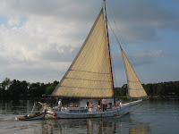
Leeds Creek has some spectacular homes, and we anchored in an area where we had panoramic views of three of them. Each morning watermen came to the area, set a few crab traps, and ran their trot lines. We also took the dinghy up to the head of the river past more nicely modest homes, and saw a Chesapeake Bay Skipjack taking a few paying customers on a trip up the river past Sanderling. We returned to Baltimore via Kent Narrows, saving 10 nautical miles and over an hour underway, but the day was hot and humid, and we couldn’t wait to get to the dock and turn on the air conditioning!

Day: 36.9nm – 6H15M
Trip: 1192.2nm – 195H30M

Judy has her first day of non-orientation work at Anne Arrundel Medical Center today, so I’ve been working on a few projects on Sanderling – seems like every day brings more work, but this is a good place to get it done.

In Chesapeake Bay

June 26-July 11, 2009

We departed Mill Creek on the morning of June 26th and less than an hour later were in a slip at Point Patience Marina (Navy Recreation Center, Solomons, Maryland). We enjoyed renewing our acquaintance with old friends who have their sailboat in the marina (and happened to be in the slip next to us) and then started getting things together for our family reunion. We rented a car so we could do some shopping, and checked out the locations we would be using for the reunion.

Andrew and family (Rebecca, Alyssa and Avery) arrived in their rental car on Saturday morning, and he and I drove separate cars to Baltimore where he needed to drop off his rental car before noon. After dropping of his car, we had lunch with Jennifer (who lives in Baltimore) and then drove back to Solomons. They stayed on Sanderling with us that night.

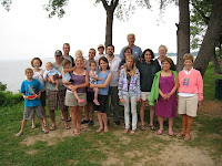
Sunday was the reunion attended by Jennifer, Andrew and family, and in-laws, nieces and nephews who live in the area or came in for the reunion from South Carolina and Minnesota. Although it was cloudy and a little windy, we had a great time at a gazebo overlooking the Patuxent River, talking, laughing and taking lots of pictures. Later in the afternoon we checked into the bungalow where Jennifer, Andrew and his family would be staying for the rest of the week. We had a great time that week with everyone from Alyssa and Avery to the adults finding plenty of activities to keep as occupied as desired.

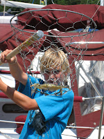
For the rest of the week, Avery and Alyssa elected to spend a lot of their time at Sanderling and on the docks hunting for Chesapeake Blue Crabs with a crab net along the piers. We also enjoyed the beach and swimming pool, miniature golf, and reading for relaxation. Friday was checkout day and everyone moved aboard Sanderling for the night. Rebecca and Alyssa departed on Saturday (July 4th) for Salt Lake City by plane, Jennifer drove back to Baltimore early in the evening, and then the rest of us walked over to Solomons to watch the 4th of July fireworks – a very nice display.

Andrew and Avery departed on Monday – I drove them to Union Station in Washington, DC, for their Amtrak adventure, and then went to Annapolis on my way back to Solomons to check out a used inflatable that we thought we might be interested in as a replacement for our dinghy that had started to come apart. For the next few days Judy and I searched for other used inflatables for sale, and Judy looked at hospitals in the Annapolis and Baltimore areas as potential employers. On Thursday we decided on an inflatable dinghy located on the Magothy River (north of Annapolis) and picked it up. Friday morning Judy got a call from a hospital in Annapolis asking her to come up for an interview. With the probability that she would have a job there, we decided it was time to move to Baltimore where she would be closer to the hospital for her commute, so we prepared to depart Solomons early Saturday morning heading to Baltimore.

The trip from Solomons to Baltimore was the longest distance we have covered in a day, so far – 67.2 nautical miles – and it took almost 10 hours underway. The marina where we would be staying at Fells Point closed at 5:00PM, so we departed Solomons at 0600 knowing that the tidal current would be against us most of the way – and it was! We ran the engine at 200 rpms faster than we normally do to keep our speed up with the opposing tidal current. About mid-day the wind started picking up from the south, and Chesapeake Bay became a little rough. We heard several calls to the Coast Guard regarding overturned small boats, and southbound boats were really having a tough time of it beating into the 2-3 foot seas. Sanderling’s weight, and the fact that the wind-generated waves were overtaking us, allowed us to have a fairly decent trip.

We’re now at Henderson’s Wharf Marina at Fell’s Point in Baltimore – a really happening place. The dockmaster gave us a very favorable rate since we’ll be staying here for at least a month, and Judy has landed a job in the ICU at Anne Arrundel Medical Center just outside of Annapolis. Judy has also completed replacing the failed solenoid on our new windlass with two heavy-duty solenoids – she is the only one aboard who could squeeze into the chain/rope locker and work on on the electrical cables.

Friends are coming aboard on Friday (July 17) and we’ll have a three day cruise across the Bay to the Chester River and to Chestertown, a beautiful little town on the eastern shore and the home of Washington College. Then we’ll be back in the marina until our next mini-cruise. We plan to base our cruises for the next month or so out of this marina when Judy isn’t working at the hospital.

Day: 67.2nm – 9H50M
Trip: 1011.3nm (1162sm) – 166H25M

On the road again!

June 10, 2009

Departed Isle of Hope Marina southeast of Savannah this morning at 0900 at slack high tide, and had another uneventful day, crossing the Savannah River into South Carolina, then past Daufuskie Island (setting for the movie “The Water is Wide”), Hilton Head Island and through the Calibogue Sound and Port Royal Sound to Beaufort, South Carolina, where we anchored on the east side of the Beaufort River in about 10 feet of water at low tide.Had a relatively uneventful day with the tidal current playing its usual game of sometimes pushing faster and sometimes holding us back, until we reached a nice anchorage in Beaufort, SC, where we stopped for the day about 1630.

Last night at the marina while we were reading about 2100, we heard a rumbling engine sound that could easily have been a lumbering freight train – if there were train tracks anywhere close by. Instead, it was a tug pulling the dredge that had been working at Hell Gate and its attendant barges and pipes – all in all a 1800 foot long parade through the water attended by a couple of small tugs to help keep things lined up around bends and thru bridges. We passed it today as it was working it’s way from the north end of Callobogue Sound out Skull Creek into Port Royal Sound.

As we were coming out of the Calibogue Sound into Skull Creek we passed the tug Maverick towing a dredge, several smaller barges, and dredging pipe. This same 1800 foot rig had passed us about 2100 at the Isle of Hope. There are three smaller “helper tugs” accompanying the rig in order to help keep everything lined up when rounding bends in the ICW and going through bridges.

Tonight, as we were preparing dinner (filet mignon wrapped in bacon) the dredge train passed and stopped to wait for the tidal current to slack before proceeding under the Ladys Island Bridge in Beaufort.

Day: 52.1sm – 7H40M
Trip: 392.3sm – 56H20M

June 11, 2009

We weighed anchor at 0935 and were underway. Today we passed through many small rivers and land cuts (man made cuts connecting rivers) in the South Carolina low country south of Charleston. We anchored for the night at Toogoodoo Creek, about 25 miles south of Charleston.

During the late afternoon and into the early evening we watched as thunder heads built up in the west, and lightning flashed around the sky. It soon became apparent that we were not going to escape a major storm, so we made preparations by closing up the topside area, removing various items from around the boat, covering the flag and pennant and tieing the cover, and turning on the GPS so we could keep track of our position. Judy made this log entry for 2100: “Big thunderstorm came through – sever lightening – cloud to ground – Judy clocked wind at 56 knots (65mph) with hand held wind meter. Waves in the creek were substantial! Storm lasted about 20 minutes followed by cool air.”

Day: 44.4sm – 5H15M
Trip: 436sm – 61H35M

June 12, 2009

Underway at 0845. Passed through Elliot Cut (on the west side of Charleston harbor) at 1230, and then toured the mega dock at the Charleston City Marina. By 1325 we had crossed Charleston Harbor and were back on the ICW channel heading northward.

We passed tug Maverick and her 1800 foot tow again this afternoon just north of Charleston.

We intended to anchor in Graham Creek (one of the places we seem to return to frequently), but with more storms predicted and two other boats already anchored in the small stream, we decided we’d go a little further north to another broad anchorage in Awendaw Creek. We had that creek to ourselves; although it is totally exposed to wind from any direction, it is at least 1/4 mile in any direction with 12-14 feet of water at low tide – perfect as far as we are concerned without regard to any winds the storm may throw at us. We let out 100 feet of chain, dug in the anchor, and then let out another 50 feet – all in anticipation of high winds again.

We had a little rain, some wind gusting to perhaps 20 knots, nothing more, but we were prepared!

Day: 64.2sm – 9H10M
Trip: 500.9sm – 70H45M

June 13, 2009

Underway at 09:15 and subsequently passed the North and South Santee Rivers, into Winyah Bay past Georgetown, SC, and the mouth of the Pee Dee River (the river about which Stephen Foster was writing – not the Suanee River) and into the Waccamaw River and its cyprus swamp. The river is lined on either side with cyprus trees so thick you cannot see more than 20-30 feet back into the swamp in most places. This continues until the river gets within 10 miles or so south of the Myrtle Beach area, where the land rises and development takes over for nature’s beaufy. The trees, for the most part, are draped in Spanish moss (neither Spanish, nor a moss – actually a member of the pineapple family).

We passed tug Maverick and her tow again this afternoon. Learned that she and her 1800 foot train are heading to Norfolk. We probably won’t see them again, as they run 24 hours a day (for the most part) while we stop at night, and are going to stop for two nights in Myrtle Beach.

We anchored for the night about 1.5 miles up Buck Creek, thick in the cyprus swamp. When we anchored the “tide” was flowing downstream at about 1.25 mph; the current never changed direction the entire night, but undoubtedly increased as the tide lowered and raised in the Waccamaw River (2.5 feet). We checked the chart plotter several times during the night, and the anchor was holding us in the same spot.

Day: 56.2sm – 7H30M
Trip: 557.1sm – 78H15M

June 14, 2009

The anchor was up at 0855 – it hadn’t caught on any trees or limbs that floated by during the night, and the trip line float was visible just below the surface when we were over the anchor itself. We were soon out of the beautiful cyprus swamp and into Myrtle Beach golf courses and ostentatious homes. We stopped at Barefoot Landing Marina, right behind a discount shopping mall, so Judy could rent a car and drive back to Savannah to attend her daughter’s “white coat” ceremony at pharmacy school on Monday afternoon. In the meantime, I’m going to find someone to check out the forward air conditioning unit which is acting up.

Note: the next day I located a tech who came to the boat and diagnosed the AC problem as a bad fresh water pump. He’ll order a new one and meet us in Carolina Beach to install it.

Day: 30.0sm – 4H05M
Trip: 587.1sm – 82H20M

June 15, 2009

Departed Barefoot Landing at 1010 after Judy returned the rental car, and at 1020 entered a stretch of the ICW called “The Rock Pile” because it is very narrow and is lined with the rock outcroppings from where the canal was blasted through the bedrock – it is an area where it is difficult to pass because of the width. At 1615 we entered the Cape Fear River at Southport, and had a good passage on the river despite threatening rain. By 1830 we had transited the river (without seeing Robert DeNero) and up Snow’s Cut into the anchorage at Carolina Beach. It took us three tries to get the anchor to hold, and in the process the anchor windlass stuck in the “up” position (fortunately, after we had dropped the anchor for the final try).

Day: 59.8sm – 8H20M
Trip: 646.9sm – 90H40M

June 17, 2009

Called the air conditioning guy who came to the boat at Barefoot Landing, and he was ready to meet us at a dock on our way out of the anchorage. By 0945 a new water pump had been installed and we were on our way. We were delayed at Wrightsville Beach by a bridge that only opened on the hour to begin with, then had to delay for over 40 minutes waiting for an ambulance. That resulted in a late arrival at Mile Hammock Bay (Camp LeJeune, NC) where we were going to meet friends for dinner. As we turned into the bay from the ICW it was hard not to notice the group of Army LCMs parked at the head of the bay on the dock where we would have to land to go ashore to meet our friends; as soon as we anchored we put the dinghy in the water and I went over to check with the Army to see if it was OK if we stayed – it wasn’t! So we called our friends to cancel dinner, and had to find another place to spend the night. By this time it was starting to get dark, and we decided the easiest thing to do would be to backtrack a few miles and stay at a marina (where we could also buy fuel at a good price). Turned out to be a good decision, but we missed dinner with our friends whom we had been looking forward to seeing. We’ll get together on our trip south.

Day: 58.9sm – 9H40M
Trip: 705.8sm – 100H20M

June 18, 2009

When the marina opened at 0700 we let them know that we were the extra boat – we had come in well after the marina closed for the day – and that we needed fuel and ice. We took on 200.1 gallons of diesel at the lowest price per gallon we’d seen on the waterway; we had travelled 132 hours since our last fill-up, so we could calculate that we were burning 1.5 gallons per hour and averaging 4.5 miles per gallon – every bit as good as I had hoped for after having the injectors tuned and adjusting the valves before we left home.

We got underway at 0820, went through Moorehead City/Beaufort, NC, at 1520, and anchored in Cedar Creek at mile 190 at 1710 along with several other boats.

Day: 60.9sm – 8H50M
Trip: 766.7sm – 109H10M

June 19-20, 2009

We left Cedar Creek at 0750 on Friday, anchored in the Pungo River that evening, and on Saturday transited the Alligator River-Pungo River Canal and the length of the Alligator River. When we got to the mouth of the Alligator River it was mid-afternoon, and we had Albermarle Sound and another four hours of running ahead of us, so we anchored on the western side of Alligator River at Sandy Point for the evening. Albermarle Sound is a notoriously rough body of water when the wind is blowing more than 10-15 knots from either west or east, so we were hopeful that an early start the next morning would result in a calmer passage. We planned to be underway by 0600.

Trip 874.7sm – 124H20M

June 21, 2009

We were underway at 0610 and Albermarle Sound had already started acting up. Our course was to the mouth of the Pasquatank River and to Elizabeth City – a good 4-5 hours away on a good day! We “battened down the hatches” so to speak and tied everything down that was moveable, bolted the saloon table to the floor, laid down the lamp and books, and closed the doors and windows to prevent spray from entering the boat. The passage wasn’t too bad – we encountered 2 foot seas off the port bow, and a little spray, but it was still “bumpy.”

We passed through the Elizabeth City Bridge at 1100, and by 1330 we were into the South Mills Lock at the south end of the Dismal Swamp Canal. There were four other boats in the lock with us, and we were the last ones, so we decided we’d just spend the night on the bridge fenders after going through the lock and the bridge. Places to tie up in the canal are limited, and with other boats ahead of us we were concerned that we wouldn’t be able to find a place.

We had a really good pizza for dinner (purchased at the gas station next to the bridge) and stocked up on ice.

Day: 54.7sm – 8H00M
Trip: 929.4sm – 132H20M

June 22, 2009

We departed the South Mills bridge at 0730 on our way to a small dock near a Mexican Restaurant at Deep Creek (near the north end of the canal and about 21 miles from the south end). We had allowed plenty of time for the trip at 6 mph, but when we started off I thought I’d push up the rpms a bit to make sure we could cover the distance a little faster than we had planned. When I increased the rpms, the boat speed did not increase commensurately. We began worrying that there was something wrong with the transmission. Increasing the rpms more didn’t help – the speed stayed about 6.4 mph, and fluctuated between 6..0 and 6.9 mph. We considered that the gps was acting up, but two different gps units showed identical information – perhaps it was the gps satellites – perhaps we were under attack and the gps constellation had failed? I consulted the Trawlers-and-Trawlering list, and the one theme that made the most senst (hoped for solution) was that the hydrodynamics of the boat moving through the shallow and confined width of the canal was restricting the boat’s speed through the water – several people came up with this explanation based on their past experience. The more we thought about it, the more sense it made. On our previous passages through the canal we had never tried to go faster than about 6mph, so we had never experienced the problem.

Without a definitive solution to the problem we were experiencing, we were able to tie up to the little dock by the Mexican Restaurant at Deep Creek, did some shopping, and waited for the next passage through Deep Creek Bridge and Lock at 1330. When we got through the lock about 1400, I increased the rpms and Sanderling’s speed picked right up to where it should be! The problem was the hydrodynamics of the canal. Whew!

We passed through Norfolk with it’s busy port and the Navy base, and anchored in the Phoebus Channel next to Old Point Comfort.

When we passed Hospital Point we passed mile zero of the ICW, so we are now switching to nautical miles instead of statute miles, since statute miles are used only on man-made canals and some rivers whereas nautical miles are used on the ocean and other major bodies of water.

Day: 44.4sm – 6H45M
Trip” 973.8sm – 139H05M

June 23-24, 2009

We left Phoebus Channel and anchored inside Sandy Point on the Great Wicomico River (just south of the Potomac River) for the night, then the next day crossed the mouth of the Potomac (it takes forever) and into the Patuxent River (Solomons) with the tidal current (and river currents) running against us the entire way. We anchored in Mill Creek just above Solomons and across the river in California, Maryland (at least that’s the town/city where we think we’re located – it’s a little difficult to tell from a map). We’ll stay here until Friday when we’re heading into the marina at the Navy Recreation Center Solomons for our family reunion and will stay there for a week or more.

Trip: 941nm(1081.8sm) – 155H50M