May 29, 2009
We finished loading clothes, food, and cats (as well as ourselves) aboard Sanderling. We spent the night aboard at the marina so we could get a fairly early start the next morning. We didn’t actually get aboard for the evening until almost 2200, had time to put a few things away, and then went to bed.
May 30, 2009
Underway about 0745 after filling the water tanks and getting a last minute supply of ice for the ice chest where we decided to keep our cold drinks rather than opening the refrigerator every time we wanted something.
Weather was beautiful. Two other boats that were heading for the St. Johns River departed a short time ahead of us, but we were more or less together heading up the Banana River and across the Canaveral Barge Canal, until they stopped at Harbortown Marina for fuel. We arrived at the planned anchorage on Mosquito River Lagoon about two hours ahead of them – they were delayed at the marina waiting for a pump-out to be fixed (it never was). Unfortunately the wind died down after sunset and the lagoon lived up to its name – mosquitoes swarmed aboard before we had a chance to put up our screens, so we spend the rest of the evening trying to kill them with our electric zapper and finally retreating under a sheet. The night was short!
Day: 53.3sm – 7H45M underway
May 31, 2009
Anchored on the north side of the Sea Breeze Bridge in Daytona, Florida, after an uneventful day underway.
Day: 33.1sm – 4H45M
Trip: 86.4sm – 12H30M underway
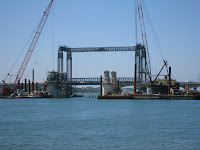
About 1500 we passed under the Bridge of Lions in St. Augustine, Florida, which is undergoing repairs. During the repairs, a second, temporary, bridge was built on the north side of the original bridge so as not to disrupt auto traffic. This picture shows the construction in progress.
We had hoped to spend the night in a small anchorage on the ocean side of St. Augustine (Salt River) but after checking it out and seeing that there was no space available among the moorings, we proceeded another hour and a half to Pine Island where we anchored for the night.
Day: 68.4sm – 9H35M
Trip: 154.8sm – 22H05M underway
June 2, 2009
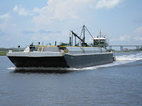
At 1215 we crossed the St. Johns River and passed under Sisters Creek Bridge on our way to Fernandina Beach for the night. Shortly before arriving at Fernandina Beach we met this tug and barge in the Crane Island Range.
We took a mooring at the Fernandina Harbor Marina and dinghied ashore for dinner and a walk around the quaint downtown area.
Day: 48.7sm – 6H40M
Trip: 203.5sm – 28H45M underway
June 3, 2009
Judy needed to do some online work so we stayed at the mooring for a second day. Judy worked while Bob played (and did a few things to improve Sanderling).
We again dinghied ashore for dinner.
June 4, 2009
Before heading north today we tied up at the marina’s dock for water and ice, and were underway by 0740 after taking on only 40 gallons of water. We crossed both the St. Andrews and St. Simons Sounds on the way to the Frederica River in southern Georgia. We had hoped to tour the National Park Service’s Ft. Frederica (originally built by the Spanish) but after calling the office we were told that we couldn’t land by dinghy because the dinghy dock had sunk and the ladder up to the walkway was in disrepair. It was still a beautiful spot; we’ll try on the way south – hopefully the dock will be repaired by then.
Day: 47.9sm – 5H35M
Trip: 251.4sm – 36H00M underway
June 5, 2009 – Frederica River
We cruised thru the beautiful salt-grass “plains” of southern Georgia today; very remote areas with only a few houses to be seen from time to time. The high tides (around 8 feet) make for an interesting change in the scenery as the water rises to cover the grass, then falls six hours later to expose large expanses of mud flats topped with dark green salt grass.
Anchored in the Wahoo River several miles off of the ICW. The only other time we were here was on our trip south in 2002 when we first brought our boat from Maryland to Florida. As we set anchor we noticed large numbers of dolphins plying the water in pairs and sometimes threes – breeding season!
Day: 42.7sm – 5H35M
Trip: 294.1 sm – 41H35M underway
June 6, 2009 – Wahoo River
We were underway at 0840, rejoined the ICW at mile marker 630 at 0915, passed through Hell Gate (always a very shallow spot in the past, but now it has been dredged and the depths were 13 feet at low tide) at 1325, and had our anchor down in the north Vernon River at 1425. The depth of the water on the shallow where we anchored is 10 feet at low tide, with a total tidal range of 8 feet (typical of Georgia), so we have deployed 150 feet of chain to hold us in the current which will reverse twice while we’re here.
Tomorrow we’re only traveling about eight miles to the Isle of Hope Marina where we’ll spend two nights while Judy helps her daughter, Lori, and family move into their new home in the Savannah area while Lori attends pharmacy school.
Day: 35.0 sm – 5H45M
Trip: 332.1sm – 47H20M underway
June 7, 2009 – north Vernon River
Had a very peaceful and quiet night at the anchorage on the Vernon River. Several other larger boats arrived in late afternoon and anchored up river from us. They had both left by the time we got underway this morning.
We’re now in Isle of Hope, Georgia, at the Isle of Hope Marina – a very well run marina where we’ve stayed before. We’re going to use their courtesy car for a couple of hours to do some shopping and drop Judy at her daughter’s new house so she can help them unpack.
The cats are doing fine!
Day: 8.1sm – 1H20M
Trip: 340.2sm – 48H40M

