This is a bit late, but I’ll get it in sequence. I now have some time to catch up and throw in some photos we took while transiting these inland rivers.
The wind on Lake Michigan cooperated for once and we were able to move from Muskegon (where Bob stayed with Sanderling and the cats while Judy flew to Kansas for her mother’s 92nd birthday celebration) to Holland (Michigan, that is) to St. Joseph, and then across the bottom of Lake Michigan to Chicago.
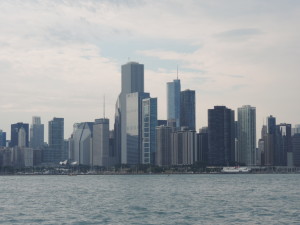
This is our view of the Chicago skyline as we approached on Saturday, September 7th about mid-afternoon. We arranged for a mooring in Monroe Harbor, which is dead center in the photo. Our mooring was located directly in front of Buckingham Fountain in Grant Park. We were meeting Caroline and Melissa for dinner in the evening, and since we both have visited Chicago a number of times we were not going to stay longer than one night there – we wanted to get on with the inland rivers! We took the launch to the marina office where we registered and met up with Caroline and Melissa. We walked to Miller’s Pub for dinner, then into the nearby Millennium Park where we enjoyed seeing “The Bean” (not it’s official name) and listening to the Chicago Lyric Opera perform various arias on the nearby stage. By the time we returned to Sanderling on her mooring the wind had shifted to the east and waves were blowing in the entrance to the mooring field through the breakwater, directly at Sanderling. It was a fitful night – even the cats were hunkered down!
Sunday morning we had to lower the radar mast in order to get below the 17 foot minimum clearance on the Chicago Sanitary Canal route through downtown Chicago, but the waves were still tossing us about and there was no way we could lower the mast (it weights about 150 pounds and we use a 4-part rope fall to assist) under those conditions. A helpful launch driver who happened by suggested that we pull further into the harbor to a free pumpout dock and while there pumping out our holding tanks we could lower the mast and be on our way. It worked our perfected; while Judy took care of the holding tanks and gave them a thorough rinsing, Bob rigged the gin-pole and rope fall, then the two of us lowered the mast into the mast/boom crutch and we were off to our next adventure – transiting downtown Chicago into the inland rivers.
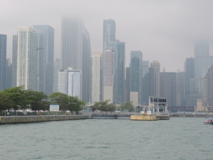
The photo shows the Chicago skyline in the high fog on Sunday morning (September 9th) as we were waiting for the Chicago Lock to lock us down a few feet into the Chicago Sanitary Canal. Once in the canal we passed right through downtown Chicago and across all the well-known streets that we had walked on earlier visits, including Michigan Avenue and through the heart of the “Miracle Mile.” Quite a thrill to see the windy city from that perspective.
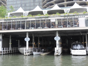
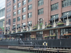
This is how it looked shortly after entering the canal. The second bridge in the photo is the Michigan Avenue DuSable Bridge. Tour boats abounded throughout this stretch, as well as water taxis and private boats out for a Sunday morning cruise.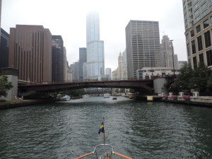
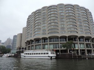
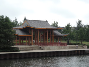
Other photos of Chicago via the Canal:
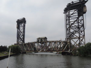
Once through downtown Chicago with the minimum bridge clearance of 17 feet, there is one last impediment to a hastle-free transit: the Amtrak railway bridge with a clearance of less than 10 feet (on a good day). If the bridge is down (as it is in the above photo) one must call by phone some mysterious place and ask that the bridge be raised. We called twice with no results; we called the bridge via VHF radio with no results. On the third phone call the bridge was raised and we went our merry, if delayed, way. Shortly after this bridge the Chicago Sanitary Canal joins forces with the Cal-Sag Canal (higher clearances for boats that cannot get lower than 17 feet) and enters the Illinois River.
Later in the afternoon we went through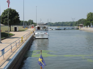 our first lock on the Illinois River at Lockport with another pleasure trawler which had transited the Chicago area via the Cal-Sag Canal, Tie A Knot with Jann and Gary aboard. Unbeknownst to us at the time, we were going to be traveling companions for the next month. We both tied to the outside of the lower lock wall bullnose for the night.
Day: 40.1SM/34.9NM – 6H25M Trip: 2782.4NM/3197.1SM – 481H05M
For the next six days we cruised down the Illinois River, transiting the remaining six locks and dams along the way.
| Lock/Dam Name | Location | River Miles Above Mississippi |
Pool Level (above sea level) |
Geo Coordinates |
|---|---|---|---|---|
| T.J. O’Brien L&D | Chicago | 326 | 577 feet (176 m) |  41°39′7.45″N 87°34′1.24″W 41°39′7.45″N 87°34′1.24″W |
| Lockport L&D | Lockport | 291 | 577 feet (176 m) |  41°34′8.61″N 88°4′39.29″W 41°34′8.61″N 88°4′39.29″W |
| Brandon Road L&D | Joliet | 286 | 539 feet (164 m) |  41°30′12.12″N 88°6′11.04″W 41°30′12.12″N 88°6′11.04″W |
| Dresden Island L&D | Morris | 271 | 505 feet (154 m) |  41°23′52.66″N 88°16′56.42″W 41°23′52.66″N 88°16′56.42″W |
| Marseille L&D | Marseilles | 245 | 483 feet (147 m) |  41°19′39.77″N 88°45′4.5″W 41°19′39.77″N 88°45′4.5″W |
| Starved Rock L&D | North Utica | 231 | 458 feet (140 m) |  41°19′27.93″N 88°59′10.82″W 41°19′27.93″N 88°59′10.82″W |
| Peoria L&D | Peoria | 157 | 440 feet (134 m) |  40°37′54.84″N 89°37′29.52″W 40°37′54.84″N 89°37′29.52″W |
| La Grange L&D | Beardstown | 80 | 430 feet (131 m) |  39°56′21.21″N 90°32′0.69″W 39°56′21.21″N 90°32′0.69″W |
Most inland rivers are numbered in statute miles starting at their mouth; there are a few exceptions which we’ll encounter later. On the Illinois the mouth of the river is at Grafton, Illinois, a few miles upstream from St. Louis, Missouri. The Illinois River and waterway (includes the Chicago Sanitary Canal and the Cal-Sag Canal) drops from 578 feet at Lake Michigan to 419 feet (above mean sea level) at Grafton. The locks and dams make it possible for commercial tow traffic to use the river to transport goods and makes it possible for us pleasure boaters to access the remaining inland rivers and circumnavigate the eastern United States in what has become known as the “Great Loop.”
After Lockport, we stopped for the night at Ottawa (mile 239) on a free town dock and stayed there for two nights during some very hot weather so we could take advantage of free electricity for our air conditioners; at Hamm’s “marina” near Rome (mile 178), Illinois; at Tall Timbers Marina at Havana, Illinois (mile 120); at Buckhorn Island (mile 46.1), and at Mortland Island near the small town of Hardin, Illinois (mile 18.7).
The two night stop at Ottawa provided an opportunity to do a little food shopping and eat out, to say nothing of being able to run our generators for two days while the heat soared into the 90s – all at no cost! We ate out with Jann and Gary and found Ben & Jerry’s ice cream at the local grocery store.
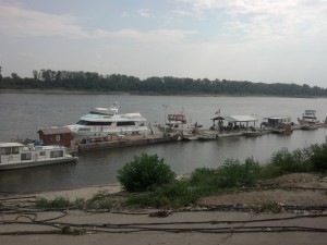
Of all the places we stopped along the Illinois River, Hamms “marina” was the most interesting, by far. It obviously was a very active marina at one time, and the owner operated several tugs along the river. Now it has become a storage for “marina queens” – boats that are seldom used and appear to have all of their better days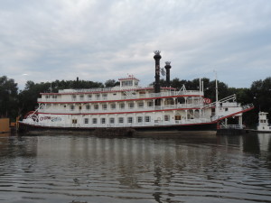 behind them – of all shapes, sizes and lineages. There is even an old riverboat being stored for the time the owner wants it back. The owner is a congenial fellow who was happy to collect our $1.00 per foot overnight fee in return for which he offered a spider filled dock, an electrical hookup that worked all the time we were there, and water (if one were brave enough to actually drink it from the ancient and stagnant lines). Nonetheless, it was an interesting place to spend the night.
The river level was down several feet from the time that some of our cruising guides was written, so the entrance to Tall Timbers Marina was barely passable for us with our four-foot draft. Tie A Knot (at 4.5 foot draft) decided not to plow through the entrance mud, and anchored for the night above a tow staging area just upstream from the marina. While there we were impressed with the cleanliness of the marina and the attentiveness of the husband and wife owners. All the docks and small buildings in the marina were floating so they were able to reopen shortly after the spring floods. The marina also had the cleanest Port-A-Lets we have ever seen – just like walking into a head in an upscale marina!
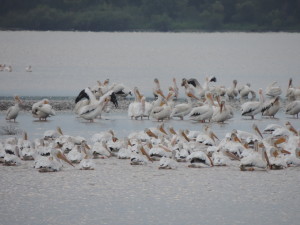 One of the things that surprised us while on the Illinois River was the abundance of white pelicans – something we’d never even seen in Florida. At first we thought they were egrets, but it soon became apparent that the clouds of birds soaring overhead were white pelicans; undoubtedly we were in the mid-western flyway and they were heading to warmer climes ahead of the approaching winter snow.
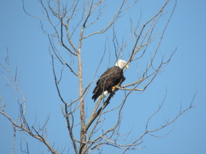 And eagles – we saw several along the river.
 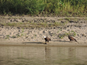 The bald eagle in the tree appeared to be alone, but the eagles eating a dead fish (undoubtedly one of the Asian carp) included an immature bald eagle waiting its turn at the table!
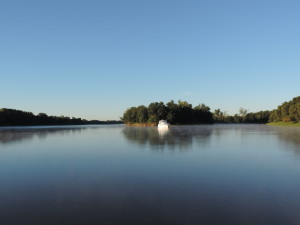
We shared many beautiful anchorages with Tie A Knot. Here’s a photo of Tie A Knot in the early morning at Buckhorn Island.
On Sunday, September 15th, we departed Mortland Island at 0825 and a few hours later entered the Mississippi River at Grafton (Illinois River mile 0; Mississippi River mile 219) and turned UPSTREAM to get to a marina at St. Charles, Missouri, where we planned to spend a few days. Both boats needed to resupply before departing for the roughly 200 miles of the Mississippi River we’d be traveling, and we (Bob and Judy) were going to rent a car and drive to Bob’s home town, Mt. Pleasant, Iowa, so Judy could see the growing metropolis and meet some of his friends. We are now at mile 221 of the Upper Mississippi – that is 221 miles from where the Ohio River joins the Mississippi at Cairo, Illinois. The Mississippi River above Cairo is called the Upper Mississippi; the river below Cairo is the Lower Mississippi and the two segments are numbered separately – the numbering of the Lower Mississippi starts at the Gulf of Mexico.
Day: 25.6SM/22.3NM – 3H40M Trip: 3044.1NM/3497.9SM – 522H35M
Monday, September 16, 2013 – Road trip to Mt. Pleasant, Iowa
We arranged to get an Enterprise rental car as early as possible on Monday morning after getting to the Port Charles Harbor Marina at St. Charles, Missouri, the day before, along with Tie A Knot and crew. We were finally underway by car about 1030 after being picked up at the marina and taken to the closest Enterprise office about 20 miles away. We had our overnight bags with us so immediately headed north on the Avenue of the Saints (linking St. Louis and Minneapolis/St. Paul and going right through Bob’s hometown of Mt. Pleasant, Iowa).
After arriving in Mt. Pleasant we did a quick tour of all the interesting sites of significance in Bob’s formative years (took about an hour) including the house where he lived until he left for law school and the Iowa Wesleyan College campus then got a room in a local motel, changed clothes, and headed to Burlington, Iowa (on the Mississippi) to have dinner with one of Bob’s high school and college buddies and his wife, Arnie and Lois Sperfslage. Bob hadn’t seen them in a number of years so there was a lot to catch up on before and during dinner. We had a very enjoyable evening with Arnie and Lois, seeing their lovely home and the additions that Arnie had built and getting ice cream for desert at a mom and pop ice cream store near their home after dinner on the waterfront at Big Muddy’s!
The next morning we visited with Bob’s broker, met with the attorneys who bought Bob’s father’s law firm, drove through the Midwest Old Settler’s and Thresher’s park and drove to Oakland Mills to get a fried pork tenderloin at Butch’s River Rock Cafe. From there we continued east to rejoin the Avenue of the Saints and get back to Sanderling.
Throughout the visit Bob regaled Judy with many humorous tales of growing up in (and leaving) small town Iowa. (Bob isn’t sure that Judy would confirm this characterization.)
On the way back to Sanderling we stopped at a small grocery store and bought a few groceries that would get us down the Upper Mississippi, through the short stretch of the Ohio, and into the Cumberland River.
On Wednesday, September 18, 2013, we took on 200 gallons of diesel fuel, pumped out the holding tanks, and were on our way down the Mighty Mississippi at 1110. We knew we were only going a few miles to Alton, Illinois, so didn’t try to get an early start. Two and a half hours later we were at the Alton Marina, just upstream of the first lock and dam we would be transiting on the Mississippi. Along the way we passed and met several large tows, but they were nothing in size to the ones we would be seeing the next day.
This information is from Wikipedia:
Above St. Louis on the Upper Mississippi River and on other rivers such as the Illinois, Ohio, Arkansas, Tennessee and Cumberland, boats can handle only up to 15 barges due the size of lock chambers. These boats tend to be limited to 5,000 horsepower (3,728 kW).
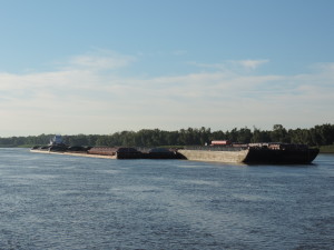
South of the Chain of Rocks Lock across from St. Louis on the Mississippi River, the river is open with no locks or impediments other than channel size and depth. Larger boats can run this segment of the river with the maximum tow size of 42 barges southbound and 40+ northbound. A typical River tow might be 35 to 42 barges, each about 200 feet (61 m) long by 35 feet (11 m) wide, configured in a rectangular shape 6 to 7 barges long and 5 to 6 barges wide, depending on the number of barges in tow. The whole tow, excluding the towboat, can easily be over 1,200 feet (370 m) long and 200 feet (61 m) wide, covering over 6 acres (2.4 ha) and holding thousands of tons of cargo. [The towboats pushing these large tows can be as much as 200 feet long and 56 feet wide with up to 11,100 horsepower (8,277 kW).]
The Alton Marina is a large, floating marina, with everything built on floating docks anchored to shore to rise with the periodic flooding of the Mississippi (at least a couple of times a year). Even the pool and store were part of the floating structure. All the slips except a few for transient boaters (like us) were covered. It’s quite a place.
Bob changed the engine oil and filters after the engine room had cooled down a bit after our arrival (something that he does every 250-275 hours of engine run-time). Later in the afternoon we attended a “loopers briefing” conducted by the America’s Great Loop Cruisers Association harbor hosts for Alton, Bob and Patty Mitchell. Their up-to-date information on the Mississippi and Ohio Rivers provided good information to assist us for the next 250 miles of our trip. They then drove all of us attending the briefing (about 12 people) to Mac’s Time-Out Lounge for dinner. Lots of fun.
Day: 21SM/18.3NM – 2H40M Trip: 3062.4NM/3518.9SM – 525H15M
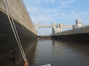 Shortly after departing the Alton Marina on Thursday, September 19, 2013, we passed through our first Mississippi River lock at mile 200, the Melvin Price Locks and Dam – it was substantially larger than the locks we had encountered on the Illinois River, at least it seemed so. It had two separate chambers, one large (the newer chamber) and one smaller (essentially the original chamber). We called the lockmaster before departing the marina and were told that the main (big) lock would be waiting for us when we arrived, and it was. We went right in and took a floating bollard about half-way down the starboard side of the chamber. The floating bollards make locking through easy for us and requires only one line at the mid-ship hawse cleated at one end to Sanderling and then single-looped around the bollard. As the water in the lock rises or lowers, the bollard floats up or down with the water level. Large round ball fenders near Sanderling’s bow and stern keep the boat from scraping the lock walls. We were the only boat in this huge lock; locking through these locks operated by the Army Corps of Engineers costs us nothing. Thank you, taxpayers!
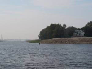 This lock was the northern end of a man-made canal which bypasses the confluence of the Missouri River with the Mississippi and some shallow rapids in that area.
The next lock was only 10 miles further downstream, the Chain of Rocks Lock and Dam, near Granite City, Illinois. This lock is the end of a man-made canal and is the last lock and dam on the Mississippi River when southbound.
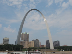 As we passed St. Louis we started encountering staging areas for the large tows that are put together to transit the remainder of the Mississippi to New Orleans. We were constantly on the lookout for small towboats moving one or two barges into position and joining them together to create the huge tows that we would be seeing on this part of the river.
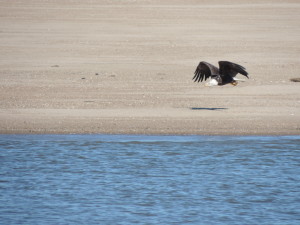 Further downstream we saw several eagles at separate locations; this one flying along a sandy area probably looking for some “found” lunch!
We stopped for the day at Hoppies, a well-known and must-experience stop south of St. Louis at mile 158. Hoppies consists of some old barges anchored along the RDB (Right Descending Bank) at the town of Kimmswick, Missouri. Not much to look at, but it’s the only game in town for the next 158 miles of the Mississippi River and a place that sells both diesel and gasoline fuel for boats needing to top off. Electricity and water are available, but no heads or showers. We walked into town for lunch and then joined other boaters spending the night to listen to Fern’s briefing about things we should know for the rest of our transit of the Mississippi and Ohio Rivers. Fern has been boating on the Mississippi for years and has a lot of good advice for us newcomers. One of her tid-bits that we put to good use was to always meet a tow on a straight-away or inside of the curve on the river to avoid their very strong and long-lasting prop wash when upbound; never take the outside of a tow on a curve.
One of the things you soon learn on any confined body of water is that it is important to contact the tow captain to arrange a passing well in advance of actually overtaking or meeting. This becomes even more important on the narrow stretch of the inland rivers where the tows are very restricted in their ability to maneuver and the channels are sometimes barely wide enough for them to swing their sterns to make the turn. More than once on the Mississippi we waited for a tow to come around a bend in the channel before proceeding through the bend ourselves. The tow captains have their own language to arrange meeting and passing situations with other boats. The Inland Rules provide that the primary means of arranging a meeting/passing is by VHF radio and in the alternative to sound your horn to alert the other boat of your intentions (one whistle to indicate you intend to pass on your port side and two whistles to indicate you intend to pass on your starboard side – this is at least the easy-to-understand interpretation of the rules even though it isn’t the exact language of the rules themselves). On the rivers the tow captains have incorporated the horn signals into the language used on the VHF. So they talk of a one whistle pass and a two whistle pass. Anyone boating on the inland rivers had best understand what it means: it’s not about sides of a boat – it’s about the maneuver, and it’s not my one-whistle side or my two-whistle side, or your one-whistle side or your two-whistle side. If you initiate the VHF call and want to indicate your intention to pass or meet the other boat on YOUR PORT SIDE, then you would refer to a one-whistle pass; this is true whether you’re passing or meeting the other boat. The corollary is also true: if the caller intends to meet or pass the other boat on the caller’s starboard side, then the caller would indicate a two-whistle pass. Of course, the clearest and simplest was to arrange a passing/meeting is simply to indicate in plain English that you would like to pas the other boat on it’s port or starboard side. Tow captains understand, either way, and the whole idea is to leave no doubt in either mind so there is no danger of a collision. With our AIS system, the tow captains frequently contact us in advance to arrange a meeting (they seldom pass us as even at our slow speeds we are generally going faster than the tows).
Day: 46.5SM/40.5 NM – 5H30M Trip: 3102.9NM/3565.4SM – 530H45M
We departed Hoppies dock at 0730 on Friday, September 20, 2013 heading a short distance to Kaskaskia Lock where we hoped to be able to tie to the river side of the bull nose on the downstream side of the lock. This lock is not a lock on the Mississippi River, but rather on a river that joins the Mississippi at mile 117. When we arrived about 1150 we were in luck – no other boaters had arrived so we took the first position along the wall. It had started to rain by the time we arrived and continued to rain throughout the afternoon, so we were happy to be off the river and cozy in our warm, dry boat. There were no amenities here, just a place to tie up that was out of the way. Later in the day a sailboat came in and tied up behind us.
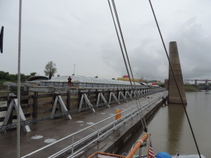 Shortly after we arrived a tow locked down from the Kaskaskia River and made an interesting maneuver. The tow was two barges wide and 3 barges long. It exited the lock on the opposite side from us (the wall was low so we could see the whole thing), the towboat unfastened from the barges while the barges were still moving slightly downstream toward the Mississippi (about 1/2 mile away),
 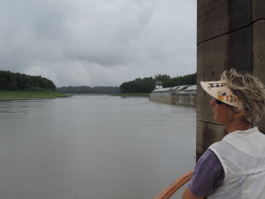 passed the barges, turned around, and reattached itself to the formerly forward end of the string of barges. After a large tow passed the mouth of the river in the Mississippi, it backed out into the Mississippi, turned and proceeded upstream. A crew member who was on the forward edge of the tow told us that this was the only way the towboat cold get the tow turned to head upstream in the Mississippi. If the tow proceeded to push the barges into the Mississippi the current would sweep the leading end downstream and the towboat could never get the two turned around 180 degrees to head upstream. By backing into the Mississippi the two captain could back downstream with the current and by the time it cleared the side river the entire tow wold be headed upstream. Pretty darned clever! The whole turn-around maneuver took all of about 10 minutes including unleashing and refastening the towboat.
Day: 42.1SM/36.6NM – 4H20M Trip: 3139.5NM/3607SM – 535H05M
The next length of the Mississippi would be the longest and provide the fewest opportunities to find a good anchorage (there would be no marinas or docks until we were in the Ohio River). Consequently, we set out as soon as we could see to safely navigate, about 0645 on September 21, 2013. The rain had stopped and it was going to be a clear and sunny day. We were hoping to find an anchorage behind one of the many wing dams which have been constructed by the Army Corps of Engineers to help mother nature control the flow of current in the rivers, but the unintended (who knows) consequences are that the formerly deep water downstream of the wing dams have silted in and the lower water level of the river when we passed through eliminated most of the anchorages discussed in the cruising guides. We passed up several potential anchorages at around mile 40-45 but that was too early in the day and would have resulted in a long day the next day when we would be going upstream on the Ohio River where there were even fewer anchorages. By late afternoon we started checking anchorages which had formerly been good for boats our size at around mile 20, but all were silted in and too shallow. We were running out of time so turned back upstream and proceeded against the 2.5 MPH current to an extensive shallow area at about mile 24.5 on the inside of a sharp curve in the river about 200 yards off the main channel on the LDB (Left Descending Bank). We looked at several places there behind wing dams (and out of the current) but they, too, were silted in and unavailable. At 1730 ended up anchoring in the river in about 9 feet of water with good holding in sand. Even if the river 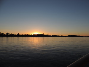 level dropped a few feet overnight we would still have enough depth to get back into the main channel. We checked with a passing tow captain to confirm that we would be out of the way of all river traffic; the only thing we had to be concerned about was “run-away” barges – barges that had broken loose from tows and were drifting downstream on their own with the current. After we had anchored Bob measured the current – it was flying past at 3 MPH – we let out 150 feet of chain (at 1 pound per foot) to keep us steady during the night. Throughout the night we were awakened from time to time by the sound of tows backing down and accelerating their huge diesel engines to maneuver the sharp bend in the river. We did have a nice sunset that evening!
Day: 104.0SM/90.5NM – 11H00M Trip: 3230.0NM/3711.5SM – 546H05M
Sunday, September 22, 2013 – Into the Ohio River
We had the anchor up (and 150 feet of chain) and were underway at 0650. We hoped to get to Lock 52 at mile 939 on the Ohio River before nightfall. The fast current of the Mississippi River pushed us along at over 9 MPH and by 1015 we were departing the Mississippi River and turning into the Ohio River at mile 981 (mile 0 of the Upper Mississippi River) at Cairo, Illinois. The character of the water changed almost immediately from a relatively narrow and turbulent body of water on the Upper Mississippi to a broad and fairly calm body of water on the Ohio River. The tow traffic picked up considerably, however, as the lower Ohio River is a major staging area for tows transitioning between the Ohio and the Mississippi. Many small towboats were moving barges around to break up large tows for their trip up the Ohio, or addition additional barges to tows heading down the Mississippi.
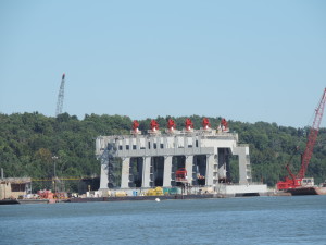
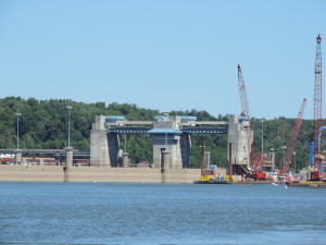
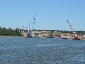
We soon passed a major Army Corps of Engineers Construction site for the Olmstead Locks and Dam at mile 964 that is projected to cost (with over-runs) upwards of a BILLION dollars. This single dam will replace existing dams number 52 and 53. Some people we met who were involved in the operation of other dams referred to it as a major boondoggle and a pit of corruption and payoffs; some even questioned whether it would be completed at all.
There was an incredible amount of construction traffic connected with the project – land-based vehicles as well as towboats large and small.
The lock structure appears to be completed and the dam itself is being constructed in modules fabricated ashore than placed into position in the prepared riverbed. The technique was developed in Europe where it has been used successfully in a number of projects, but has never been used before in the United States.
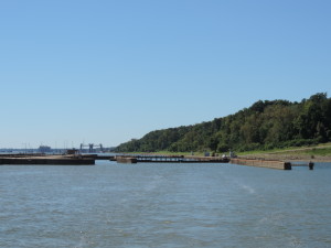 Shortly after passing the construction zone we were able to enter Lock #53 at mile 962. This photo shows Lock #53 from the upstream side after we exited the chamber looking back with the new dam construction site in the background.
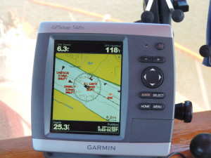
We continued to pass several staging areas as we moved up the Ohio approaching Lock #52. Here is a view of our chart plotter (GPS) showing a number of other vessels (all tows or solitary tow boats). The chartplotter shows our speed as 6.3 MPH, our heading as 118 degrees true, and the water depth as 25.3 feet. In the lower right corner is our lattitude/longitude.
We arrived at lock #52 too late in the afternoon to proceed any further upstream – there are no anchorages within range for the remaining daylight – so we anchored on the Kentucky side of the river about 1/2 mile below the dam. Like the previous night, the current was flowing at about 3 MPH (we learned the next morning that the dam was releasing extra water to lower the pool above the dam so some needed repairs could be made to the dam’s wickets. The dam operator told us to call them early the next morning to let them know we wanted to lock through and to get an approximation of when we would be able to go through. We set the alarm for 0530 so we would be ready to go and call them at 0600.
About a hour after we arrived a smaller 36 foot trawler anchored about 100 yards off our port side where the current from the dam was creating more waves than where we were anchored closer to shore and with a little protection from a jetty of land that directed the main flow of water away from us (toward their anchoring area). About an hour later they moved to directly behind us and hopefully had a less “rocky” night.
Day: 67.3SM/58.6NM – 10H05M Trip: 3288.6NM/3778.8SM – 556H10M
On Monday, September 23, 2013 we were up and at-em by 0530. We had done everything to get ready to get underway except raise the anchor. At about 0600 we heard the other trawler call the lock and let them know that there were two of us who wanted to lock through at their earliest convenience. We confirmed our status with the lock operator. The lock replied that it would be at least six hours before we could lock through since they were currently in the process of locking through one tow and another was on its way. Both of us let them know that we’d be standing by for further instructions and would be ready to go whenever the lock was available.
About 15 minutes later a different voice contacted us via the VHF and told us he had figured out a way to get us through early, and that we should immediately proceed to the lock chamber, but hurry as he was putting us in ahead of a tow that was approaching upbound (we could see the tow about a mile below the lock. We both immediately got our anchors up and headed for the chamber which was slowly opening for us to enter.
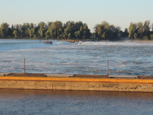
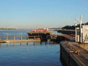
View across the dam with the far wickets lowered to allow more water to escape. We had anchored well downstream of the lock and away from the strongest rushing water.
Once we got into the chamber and had the opportunity to talk with one of the lock hands who directed us to the pins he wanted us to take, we learned that between the time the lock was originally contacted and the return call the shift had changed; the current shift supervisor realized that both of us had been anchored overnight and did everything he could to get us through ahead of the tow that was slowly approaching. While we were being raised in the chamber the approaching tow actually tied off to the wall below the dam and waited for our departure and for the lock to be “turned around” so he could enter after we exited.
We then continued up the Ohio River, past Paducah (where the Tennessee River enters the Ohio at mile 932) to the mouth of the Cumberland River at Ohio River mile 920 and turned up the Cumberland River heading to Lake Barkley and the Barkley Lock and Dam, another 30 miles upriver. The other trawler had gotten ahead of us at the mouth of the Cumberland because we waited for a downbound tow before negotiating a blind hairpin curve in the river, but by th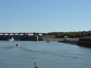 e time we arrived at the Barkley Lock and Dam we were back together again (they had to wait for a tow locking through). As we approached and called the lock operator we were told that the lock was ready for all of us (there was also a small fishing boat waiting to lock through) and to enter the chamber as soon as a tow had cleared the gate area.
A short distance later and we were heading to our assigned slip at Green Turtle Bay Marina on Lake Barkley at Cumberland River mile 30.8, where we would be the next two nights and would catch up with Tie A Knot and our friends Jann and Gary.
Day: 50.9SM/44.3NM – 9H30M Trip: 3332.9NM/3829.7SM – 565H40M

Lots of great information, thanks and well done…!