Posted on August 17, 2013
Sunday, August 11, 2013 Little Current
We departed Little Current at 1200 and after a short 15.2 statute miles anchored in Logan Bay on Clapperton Island. The cruise was uneventful, with a few boat departing Little Current about the same time, and other boats coming in to Little Current to spend a few hours at the town docks (free unless spending the night) or to go through Little Current to the east on the hour when the bridge spanning the channel opens for boat traffic. Little Current is located at a narrow channel which more or less divides the eastern section of the North Channel cruising grounds from the western areas and the main North Channel body of water. Although there are no lunar/solar tides in North Channel, there are wind driven water level fluctuations called seiches which can create quite a current in some locations, particularly at a restriction like Little Current. During the short time we were there the wind was blowing out of the west, causing water to move in an easterly direction through the confined channel. The low bridge across the channel opens only on the hour, so boats wanting to proceed to the east had to stop well in advance of the bridge and keep well off until the bridge opened; boats westbound have to keep in forward gear dead slow in order to keep close to the bridge in order to get through when it opens. It makes for quite a pile-up of boats on either side of the bridge depending on the amount of bigger boat traffic at any given time (small boats can go under the bridge when it is closed so don’t have to wait for the opening.
You can read an excellent explanation of seiches at http://web2.geo.msu.edu/geogmich/seiches. That article states in part:
A seiche has to occur in an enclosed body of water such as a lake, bay or gulf. A seiche, a French word meaning “to sway back and forth”, is a standing wave that oscillates in a lake as a result of seismic or atmospheric disturbances creating huge fluctuations of water levels in just moments. The standing waves slosh back and forth between shores of the lake basin, often referred as tide-like changes of the Great Lakes, by many. Most seiches on the Great Lakes are results of atmospheric disturbances and a cease in wind, not seismic activity or huge tidal forces.
Logan Bay was a nice stop after departing around noon and provided good protection for the westerly winds that were forecast to gust up to 25 MPH later in the evening and into the night. There were only two other boats there (one sail and one LUFF) during our stay.
Day: 12SM5./13.2NM – 2H20M Trip: 2245.8NM/2580.5SM – 395H05M
Monday, August 12, 2013 Logan Bay to Eagle Island
We departed Logan Bay at 0930 and headed to another island that would provide good protection for winds forecast to be from the west and northwest gusting to 25 for the afternoon and the day – Eagle Island. It proved to be a good choice and although there were as many as six boats there at one time, there was plenty of room for everything even as the wind gusts shifted from southwest to west to northwest through the afternoon and next day.
One thing I haven’t mentioned that is common to all the bodies of water in this area – loons. We see them constantly, and hear their mournful calls as the sun sets and rises each day. Eagle Bay was no exception and it seemed that there was always at least a pair of loons present on the bay, fishing or preening.
Day: 11.2SM/9.7NM – 1H35M Trip: 2255.5NM/2591.7SM
Wednesday, August 14, 2013 Eagle Island to Moiles Harbour (John Island)
We stayed in the protected bay at Eagle Island for two days waiting for the wind gusts to subside so we could move a little further west. By Wednesday morning the time had come to move a little further, so we departed Eagle Island at 0845 and anchored at 1125 at Moiles Harbour (really just a bay) at the eastern end of John Island. There were several other boats in this small but very protected anchorage and we found a good spot in about 20 feet of water. Winds picked up again, so instead of moving on to Beardrop Harbor we stayed for an extra day. We originally intended to move to Beardrop for our last night before heading 60 miles to the west in the main bay of North Channel, but because we needed a calm day for the long-distance and because Beardrop was only four miles away, we just stayed put in Moiles Harbour for an additional night rather than moving and anchoring in an area that was not as well protected from the southwesterly wind. The forecast for the next day was very good for the entire 60 mile route, so we planned an early departure.
Day: 18.1SM/15.8NM – 2H40M Trip: 2271.3NM/2609.8SM – 399H20M
Friday, August 16, 2013 Moiles Harbour to Witney Bay via Drummond Island U.S. Customs
We were up at underway at 0630 as the sun rose and the wind had died to less than 6 MPH as forecast. The water was like glass as the sun rose over the mountains to the east – the first time in a week when the wind hadn’t been blowing at 12 MPH or more.
Once we cleared the few small islands to the west of Moiles Harbour we set a course that was almost due west for the next 40 miles, then crossed the boarder into the US, raised our yellow quarantine flag, and shortly afterwards turned south at the northern tip of Drummond Island to head to Yacht Haven Marina and the US Customs where we were required to check in to reenter the US legally. We had no plans to stop at the marina other than to clear Customs and we were glad we didn’t – it was in terrible shape and the marina had virtually nothing to offer other than access to Customs. The young Customs officer came aboard and examined our boat documentation and passports, did a cursory inspection of the interior (looking for smuggled aliens?), and checked through their computer system (as far as we know), we were given a Customs Log number and our passports were returned.
As we were heading back to Sanderling to get underway we overheard a radio call from a boat that had hit a rock and was sinking about a mile north of the marina. The marina staff scrambled and one of them jumped in a boat to go to the rescue. The radio call indicated the boat was a Tiara and we could see it from the marina sitting stern down in an area with about 15 feet of water. Apparently the driver had failed to notice that it was crossing a very shallow area out of the channel leading into the marina and at its high rate of speed had struck a rock and somehow damaged the bottom to such an extent that the onboard pumps could not keep up with the incoming water. Just like the Titanic, the women and children aboard got in a dinghy and were helped ashore by nearby boat. The marina’s boat took the Tiara in tow and as we were leaving the Customs dock the Tiara, with two men aboard, was being towed to a travel lift where we assume they were going to place the sinking craft while it was still afloat and lift it out of the water. We don’t know the outcome.
Since it was still fairly early (1600) we got underway and continued on around the west side of Drummond Island (in the main shipping channel from Lake Superior and Soo St. Marie) to Whitney Bay at the southwest corner of Drummond Island. We anchored at 1805 in about 10 feet of water so clear we could see every detail on the bottom, including our anchor and chain. We immediately fired up the grill and had hamburgers for dinner as the sun was setting.
Day: 78.5SM/
Saturday, August 17, 2013 Whitney Bay, Michigan to St. Ignace, Michigan
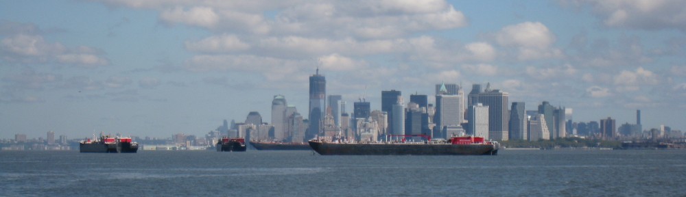
We were underway at 0705 on our way westward along the south shore of Michigan’s upper peninsula to St. Ignace. Again, the wind was fairly calm and the sun was shining to help warm the cool (to us) air. We saw a few Great Lakes ships enroute toward Lake Michigan, and a few heading east into Lake Huron. Since it was a weekend there were quite a few pleasure boats (both power and sail) out and about. As we rounded the northern tip of Mackinac Island we saw a number of high speed ferries plying back and forth between St. Ignace and Mackinac Island and their wakes actually created quite a chop in the narrows between the two locations.
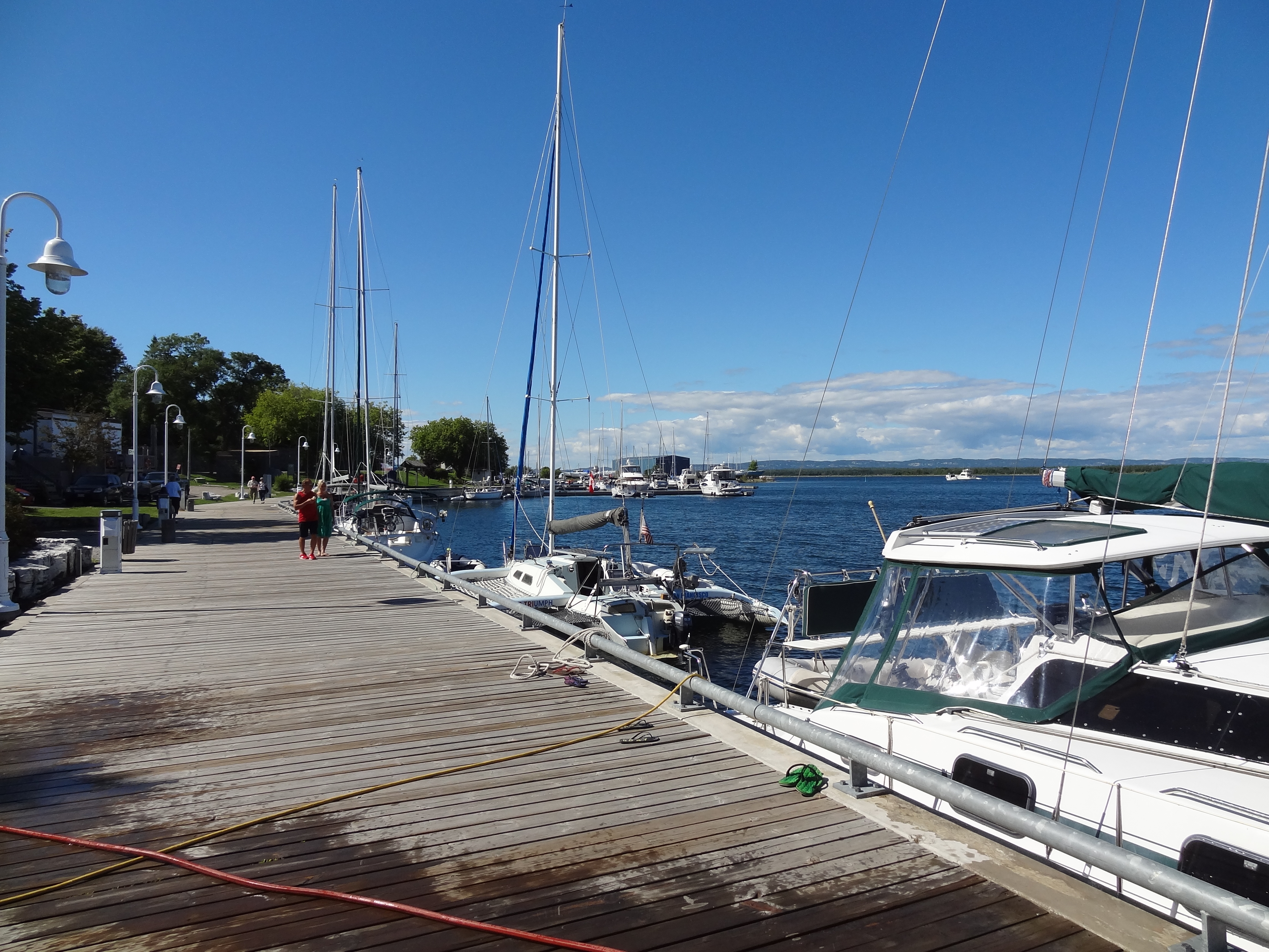
When we stopped at the St. Ignace Municipal Marina we pulled into the fuel dock and took on 200 gallons of diesel fuel and pumped out the forward holding tank before proceeding to our slip.
We’re going to Mackiinac Island tomorrow for the day, and if the weather cooperates we’ll depart Monday for the western shore of mainland Michigan.
Day: 43.8SM/
——————————————————————————-
Monday, August 5, 2013 – Killarney to Covered Portage
Day: 5.4SM/4.7NM – 0H45M Trip: 2183.7NM/2509.2SM – 384H20M
Thursday, August 8, 2013 – Covered Portage to Baie Fine
25.0SM/21.8NM – 3H30M 2205.5NM/253.2SM – 387H50M
Friday, August 9, 2013 – Baie Fine to Beaver Island Anchorage (Strawberry Island)
21.2SM/18.4NM – 3H05M 2223.9NM/2555.4SM – 390H55<M
Saturday, August 10, 2013 – Beaver Island Anchorage (Strawberry Island) to Little Current
 to Little Current (Town Docks)
Day: 9.9SM/
Sunday, August 11, 2013 – Little Current to Logan Bay (Clapperton Island)
Roy’s cruiser’s net broadcast on Saturday mornings
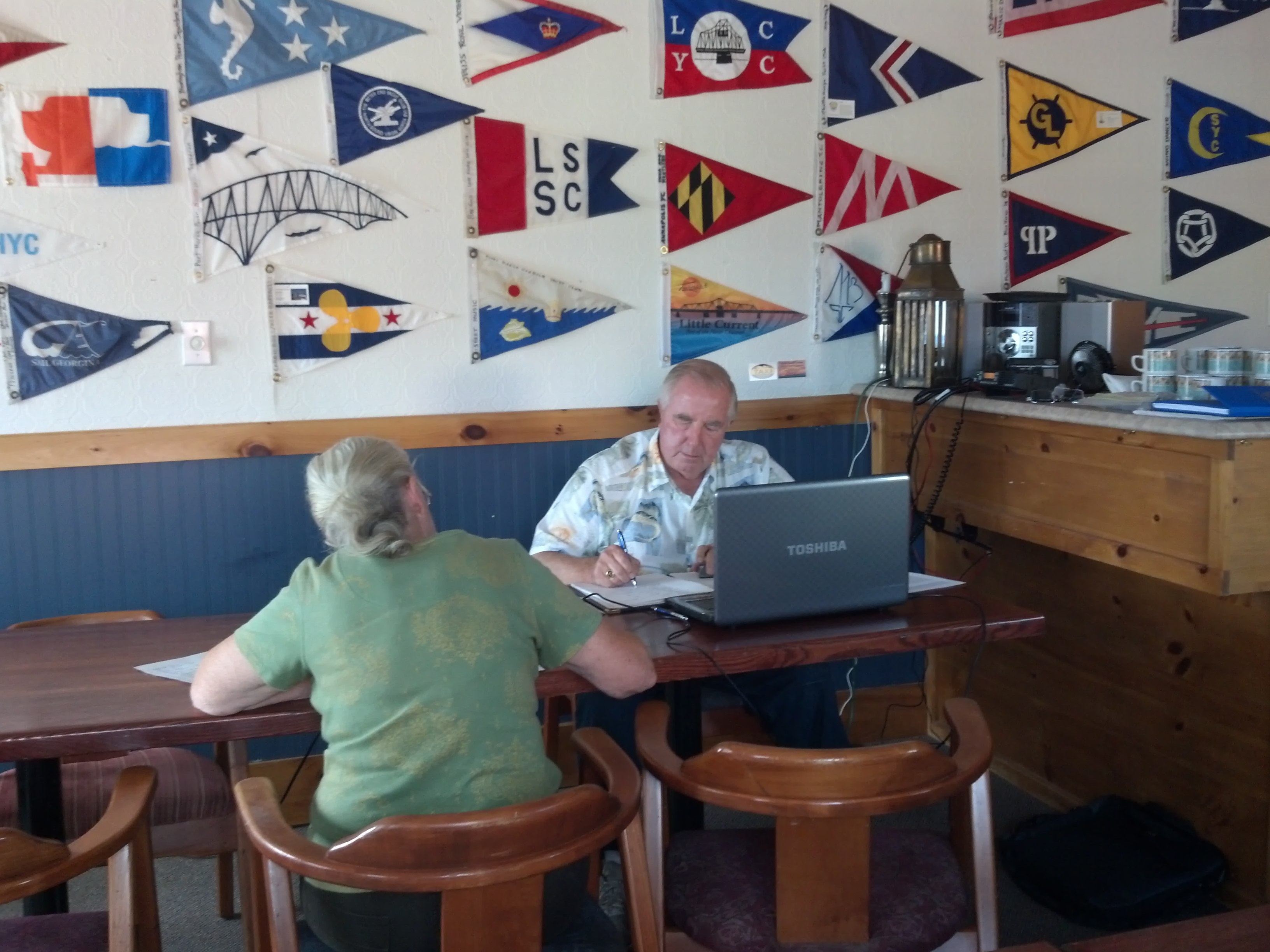
We’re about to depart Little Current. I attended Roy’s Cruisers’ Net broadcast on VHF-71 this morning and there were around 140 boats that called in (Roy thought it was probably a record number for this time of year). His all-time high was around 175 on July 27th this year – who says people aren’t cruising!
You can listen to Roy’s broadcasts (and read his newsletters) at http://www.lcyc.ca/index.php/cruisers-net
We’ll be heading to one of the anchorages at Clapperton Island today, then Eagle island, then perhaps to Beardrop Bay. Weather will be the big factor beyond Clapperton. From Beardrop Bay we’re going to head to Drummond Island (Michigan) to check back into the US, and from there to St. Ignace where we’ll spend a couple of nights and take a day-trip by ferry to Mackinac Island to see what the hoopla is all about. From there we’ll head over to the Michigan coast and make our way down the eastern side of Lake Michigan.
Will provide more info to this blog and fill in all the blanks as WiFi permits.